Warmer today, snow this evening

temps early Friday
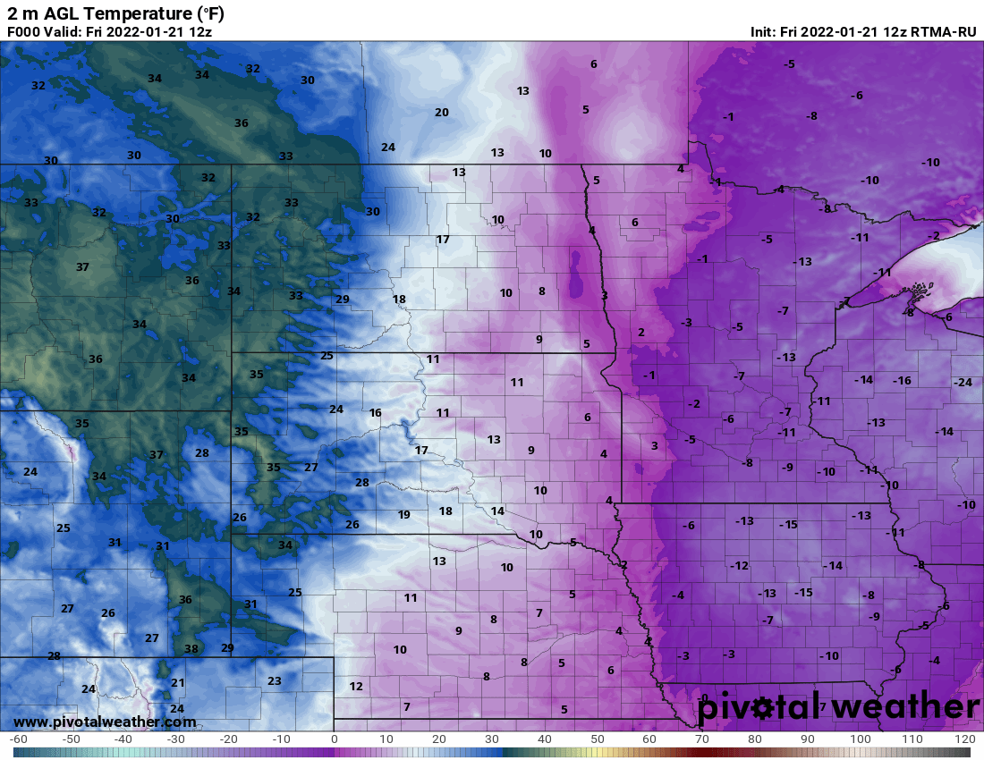
Temperatures early Friday morning
Pivotal Weather

It’s another cold start.

Temps are in the single digits in the Twin Cities and most of east central and southeast Minnesota to start. We’ve held pretty steady since midnight, but western Minnesota has seen their temperatures go up. It’s above zero all across the western quarter of the state.

A wind chill advisory is still in effect until 10 a.m. for eastern portions (including the Twin Cities) of Minnesota. Wind chills are still in the minus teens and minus twenties for many.

With the return of some warmer air, the jet stream is again going to be roaring through our area, bringing three different systems like a train of snow over the next few days.

Jet stream
Jet stream over the next few days
College of DuPage Weather
Snow train
National Oceanic and Atmospheric Administration's Global Forecast System computer model Friday through Monday
College of DuPage

The first round of snow starts Friday evening for most of us. It will be a quick shot of several hours of snow through about midnight dropping about one inch or so.

snow start
Timing of the start of snow Friday evening
National Weather Service
snowfall Friday night
NOAA Rapid Refresh model snowfall Friday night
College of DuPage Weather

We’ll see temperatures stay largely in the teens for highs all weekend with yet another shot of snow Saturday night and then again Sunday night.

The Sunday night into Monday morning system has a little more moisture and the potential for more than 1 or 2 inches of snowfall. Beyond that, temperatures once again plummet Tuesday and Wednesday.

Create a More Connected Minnesota

MPR News is your trusted resource for the news you need. With your support, MPR News brings accessible, courageous journalism and authentic conversation to everyone - free of paywalls and barriers. Your gift makes a difference.