Dangerously cold wind chills: Arctic blast persists through Wednesday morning
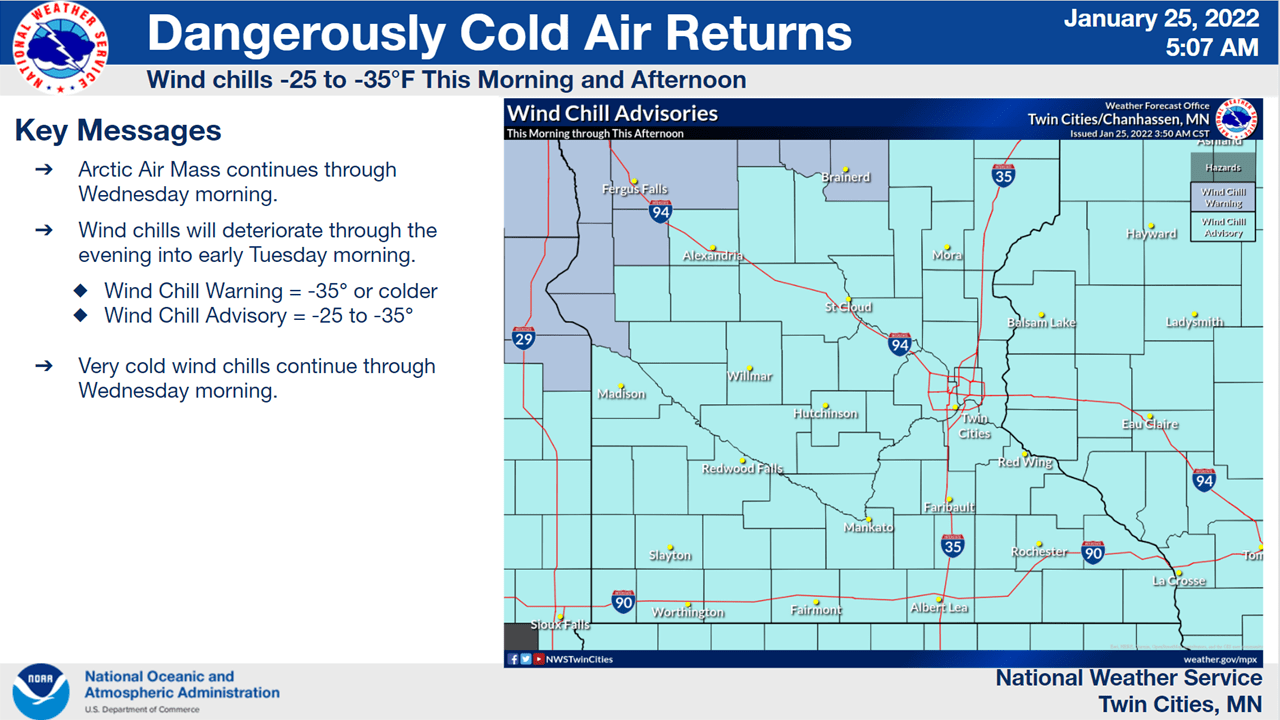
It’s a bitter cold morning early Tuesday. Temperatures are in the teens below zero across southern Minnesota and twenties below zero to even near minus 30 across northern Minnesota.
Wind chills range from the minus 20s in the southeast to the minus 30s and even some 40s below zero in northern and western Minnesota. Wind speeds of just 4 to 9 mph are easily making the temperatures feel about 15 degrees colder than the temperature.

Don’t look for things to warm up a whole lot Tuesday. Most of us will remain below zero all day with arctic sunshine.

We can expect even colder temperatures and wind chills Tuesday night for most. Western Minnesota will see its coldest conditions earlier in the night as the arctic air slowly departs, but eastern Minnesota will see its worst conditions later tonight into early Wednesday before things improve.

A wind chill warning expands Tuesday night into the western Twin Cities metro suburbs (a rarity) down into south-central Minnesota through early Wednesday. Wind chills in these areas will reach the 30s below zero overnight.

We then see rapid improvement. By late Wednesday temps will be near 20 degrees in eastern Minnesota and maybe even near 30 in far western Minnesota. That milder air will stick around into Thursday morning before cooler air (not arctic air) slides in.
Grow the Future of Public Media
MPR News is Member supported public media. Show your support today, donate, and ensure access to local news and in-depth conversations for everyone.