
Subzero temps grip Minnesota through Wednesday morning

Go Deeper.
Create an account or log in to save stories.
Like this?
Thanks for liking this story! We have added it to a list of your favorite stories.


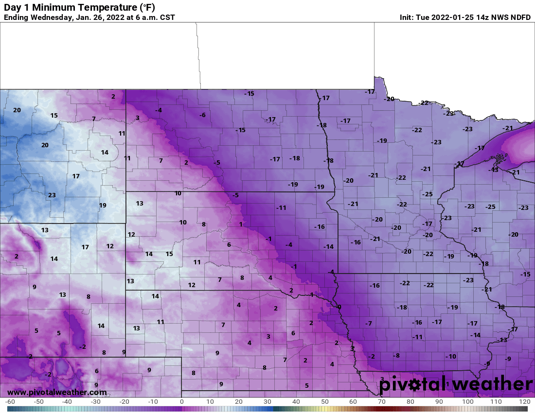
It’s really cold Tuesday morning but it will be even colder Tuesday night for the eastern half of Minnesota into western Wisconsin as the arctic air shifts east.
This means western Minnesota will see the coldest conditions earlier Tuesday night as the latest cold chunk retreats back into Canada.
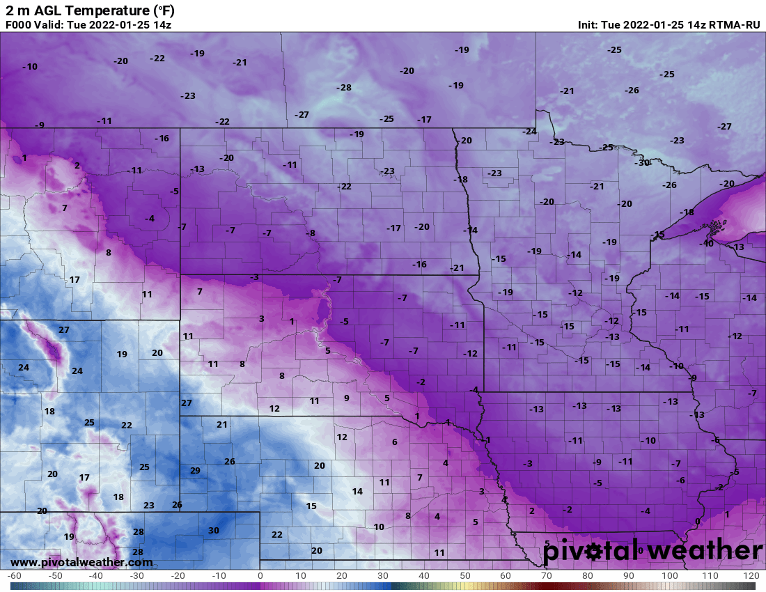
High temperatures Tuesday afternoon stay below zero for the vast majority of Minnesotans. In the urban heat island of the Twin Cities we could manage a high 1 or two 2 degrees above zero.

Tuesday night’s temperatures will initially dip in the west then hold steady and even go up. Eastern Minnesota will continue to see temperatures drop right up to sunrise (7:39 a.m.) Wednesday morning.
Turn Up Your Support
MPR News helps you turn down the noise and build shared understanding. Turn up your support for this public resource and keep trusted journalism accessible to all.
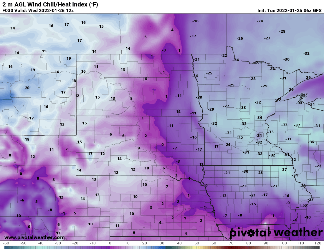
Wind chills will be dangerously cold for much of the state overnight Tuesday night into early Wednesday morning. In fact, the wind chill warning expands to include portions of the west and southwest Twin cities metro area.
Wind chills in the minus 30s will be widespread. Exposed skin can freeze in 10 to 15 minutes or less.
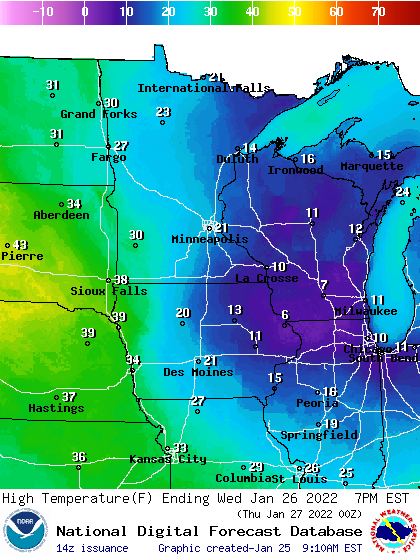
After Wednesday morning, temperatures begin a rapid increase from west to east. By Wednesday evening temperatures will be near 20 in the southeast and near 30 in far western Minnesota, while northeastern Minnesota lingers into the cooler teens (above zero).
We do see a brief shot of cooler air, brushing Minnesota and dropping temperatures from near 30 degrees Thursday morning back to just below zero early Friday, but this will not be a return to the arctic air overhead place Tuesday.
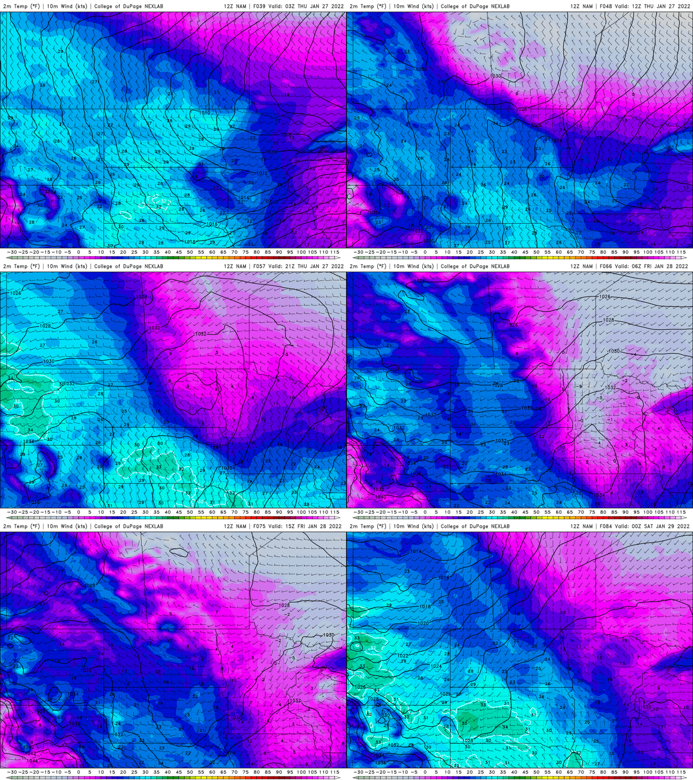
Friday’s high temperatures will be briefly cooler in the teens south, single digits north, but we return to teens and 20s Saturday and remain near normal or above into most of next week, a nice break!

