Get ready for more cold after a mild Monday

Go Deeper.
Create an account or log in to save stories.
Like this?
Thanks for liking this story! We have added it to a list of your favorite stories.


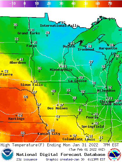
We have another 24 hours of milder weather to enjoy before a return of colder, windy conditions that will sweep across Minnesota. Highs Monday will be in the low 30s in the south.
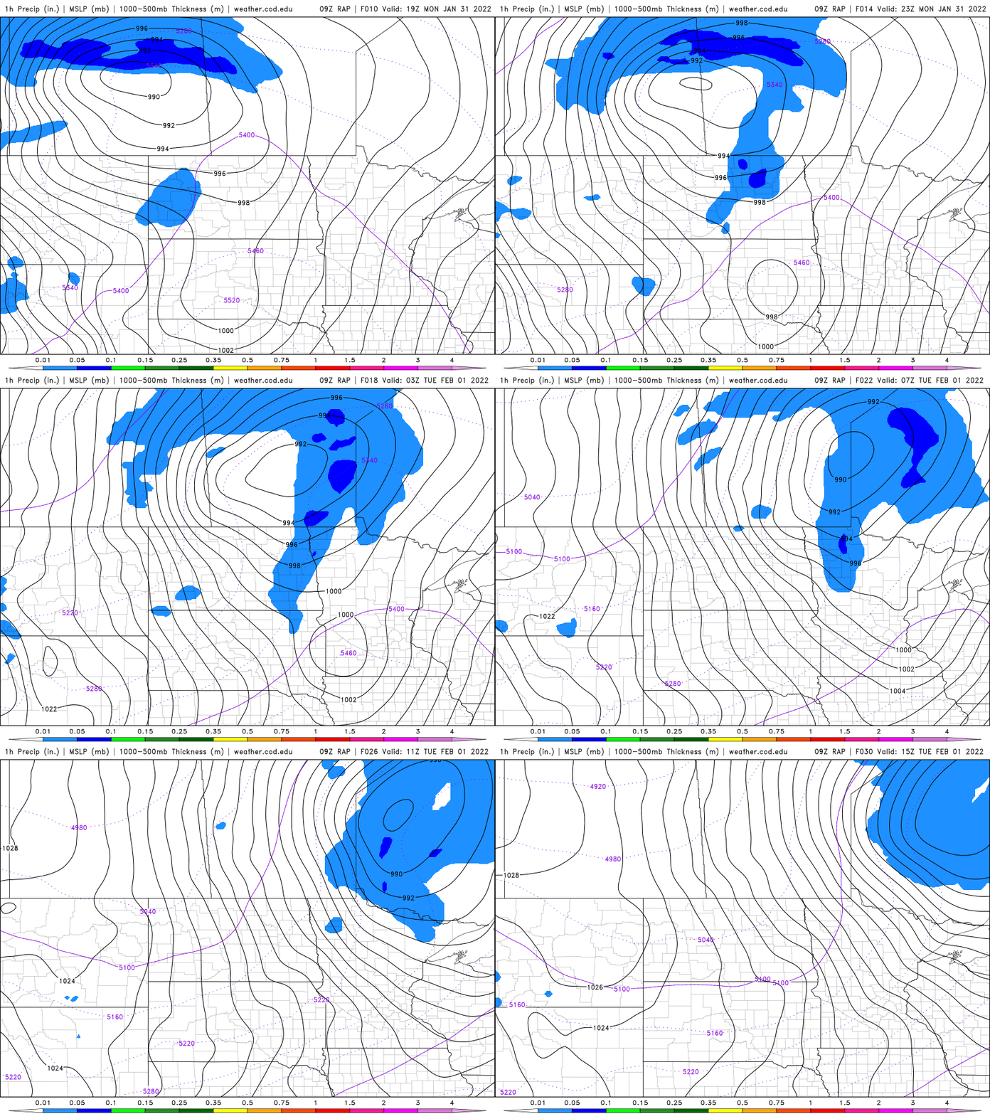
Cold slips into the northwestern corner of Minnesota Monday night, where snow will fall and blow into early Tuesday.
Early-week mildness, then subzero returns
The normal high temperature this last day of January in the Twin Cities is 24 degrees. We should be well above that Monday with high temperatures in the low 30s.
Even into far northern Minnesota highs will be in the mid-20s. We should have a decent amount of sunshine Monday, filtered through some high cirrus clouds.
Turn Up Your Support
MPR News helps you turn down the noise and build shared understanding. Turn up your support for this public resource and keep trusted journalism accessible to all.
Our next cold front reaches northwestern Minnesota overnight into Tuesday and will produce some snow and blowing snow ahead of it by Monday evening. Some spots in the northwestern corner of the state could see as much as 2 to 4 inches.
A winter storm watch is in effect in northwest Minnesota from 6 p.m. Monday to 3 p.m. Tuesday.

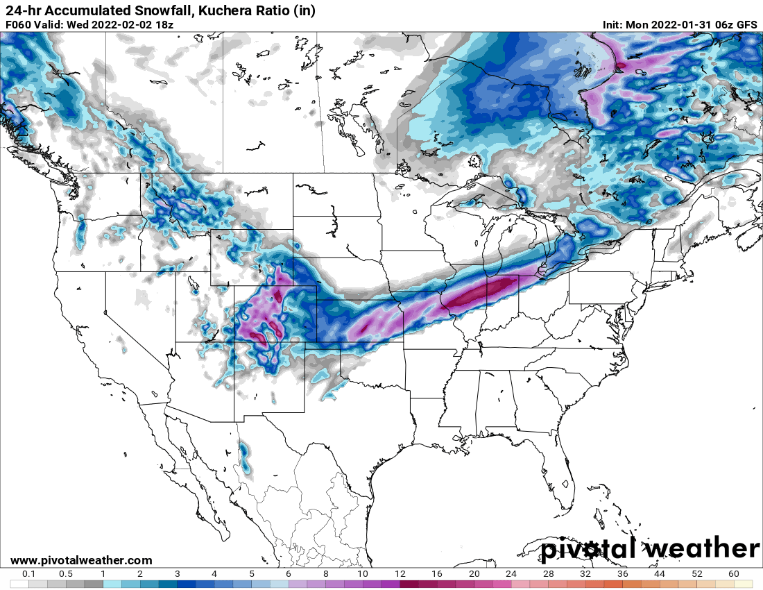
Our blast of cold air will continue south and meet up with significant moisture to produce a big snow for areas to our south and southeast. Up to a foot of snow could fall in parts of Illinois and Indiana.
Highs Tuesday will be in the morning for most of us. We’ll start the day near 30 degrees in the south and near 20 in the north.
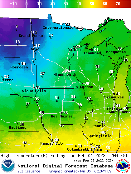
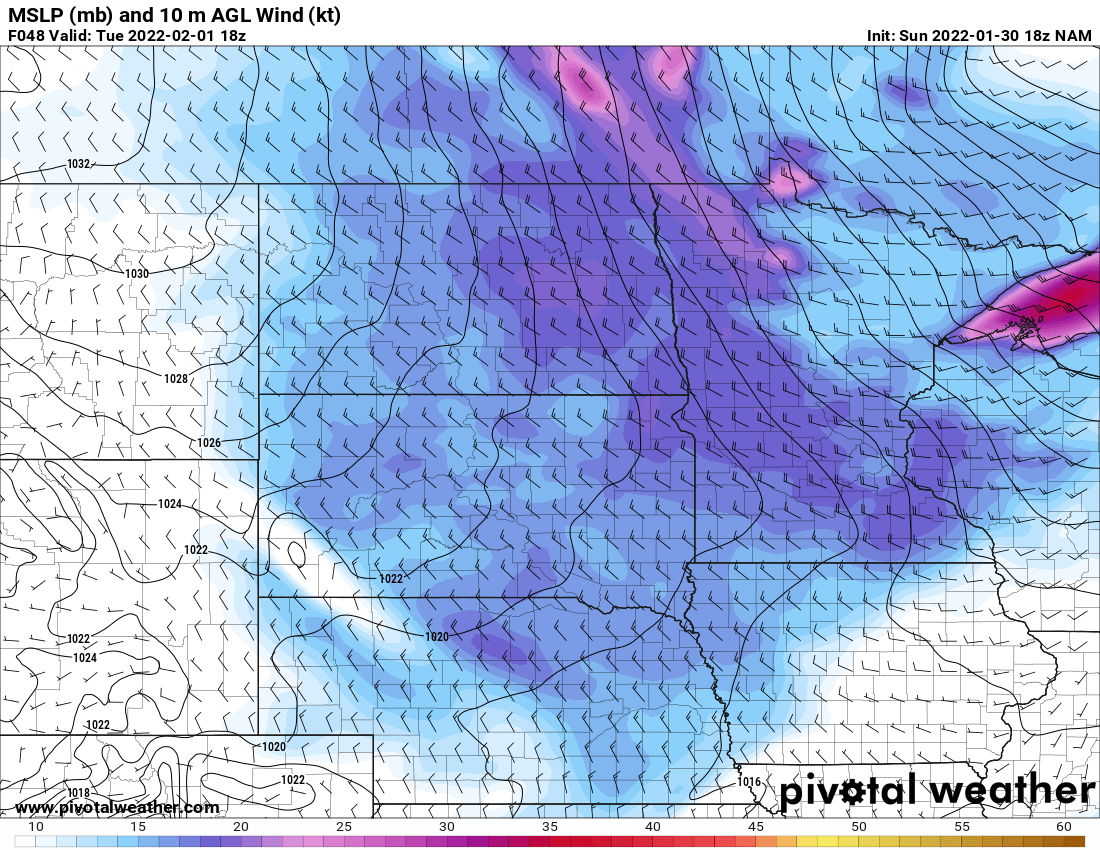
Not only will the temperatures fall but we’ll have gusty winds developing from the west and northwest. The highest wind gusts will be in the west, but even eastern Minnesota will see gusts near 40 mph.
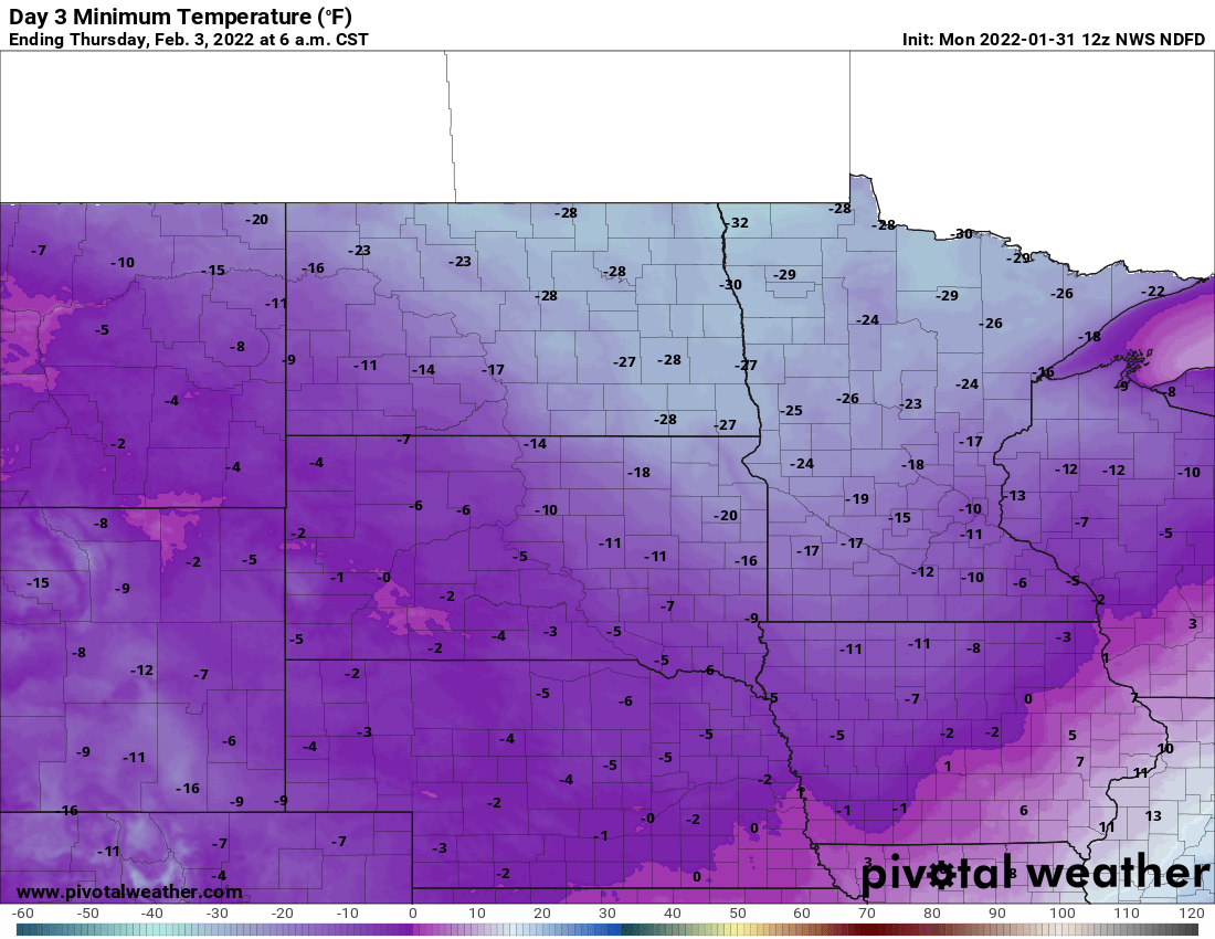
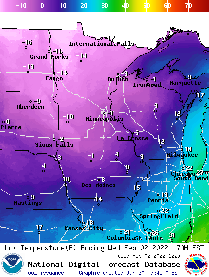
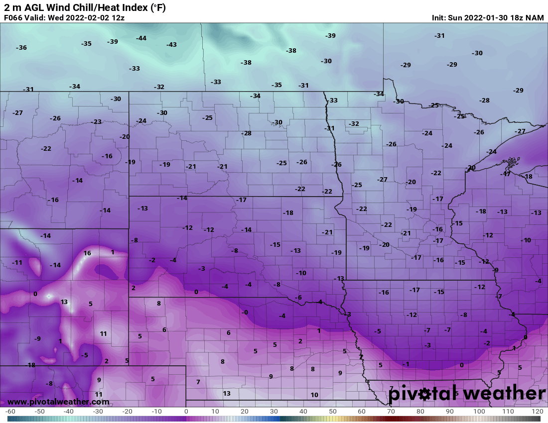
By early Wednesday, we’ll have temperatures below zero for most of Minnesota and frigid wind chill values.
Our coldest temperatures in this latest cold snap are likely to come Thursday and Friday early mornings. We’ll be near about 10 below zero in the Twin Cities with lows in the minus 20 to minus 30 range in the north.