
High winds set to blow subzero air back into Minnesota
Go Deeper.
Create an account or log in to save stories.
Like this?
Thanks for liking this story! We have added it to a list of your favorite stories.


After a balmy overnight with the high temperature reaching 37 degrees, temperatures will drop throughout Tuesday as yet another arctic blast blows through Minnesota. Temperatures will be even colder Wednesday night into early Thursday.
Cold, windy Tuesday
We had a high temperature of 37 degrees in the Twin Cities overnight, yet another overnight high temperature. That’s been happening more than usual this year, based on data from the La Crosse, Wis., National Weather Service office, likely a close approximation for the Twin Cities.
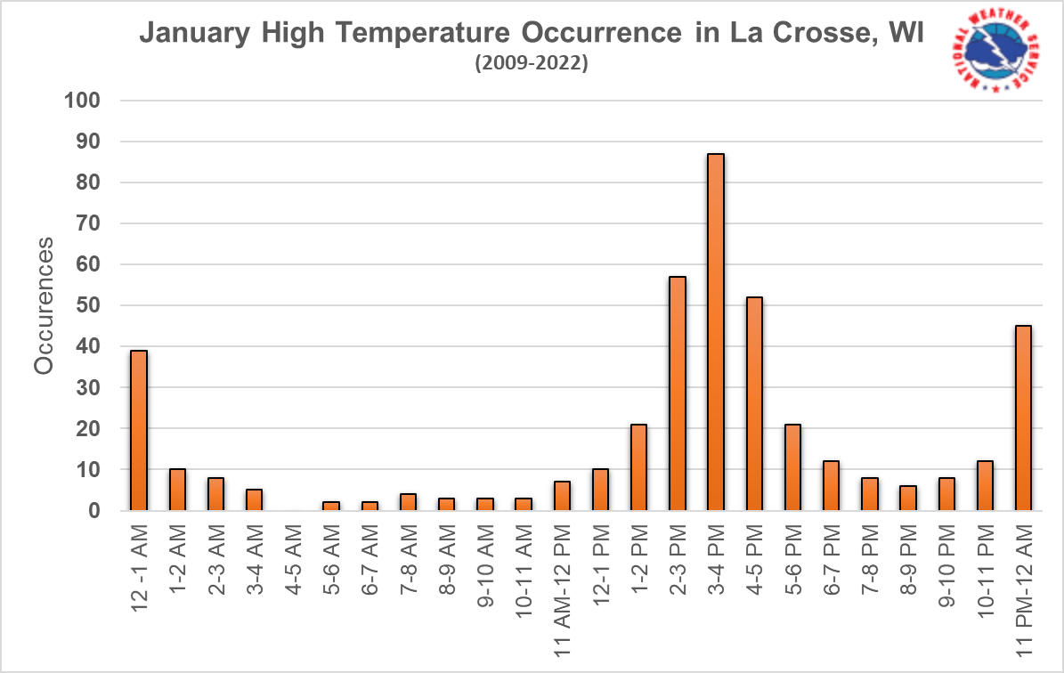
That’s because air mass changes are a bigger influence over our temperatures than the weak winter sunlight.
Based on that data, we average about seven overnight high temperatures in January, but this year we saw 10. This is a direct result of our constant fluctuations between short arctic cold snaps and quick warmups in between.
Turn Up Your Support
MPR News helps you turn down the noise and build shared understanding. Turn up your support for this public resource and keep trusted journalism accessible to all.
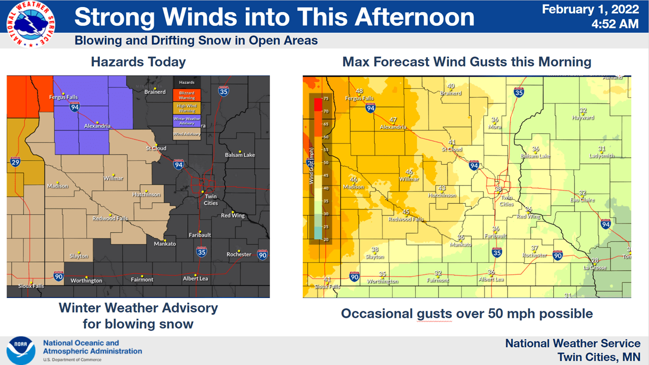
Gusty winds Tuesday of 40 mph and even 50 to 60 mph in the northwest are ushering in the change. Blowing snow is creating blizzard conditions in the northwest corner of the state.
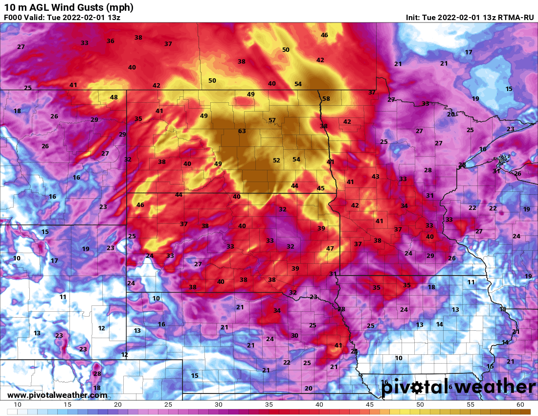
Light, blowing snow will be possible everywhere with flurries in the southern part of the state as well.
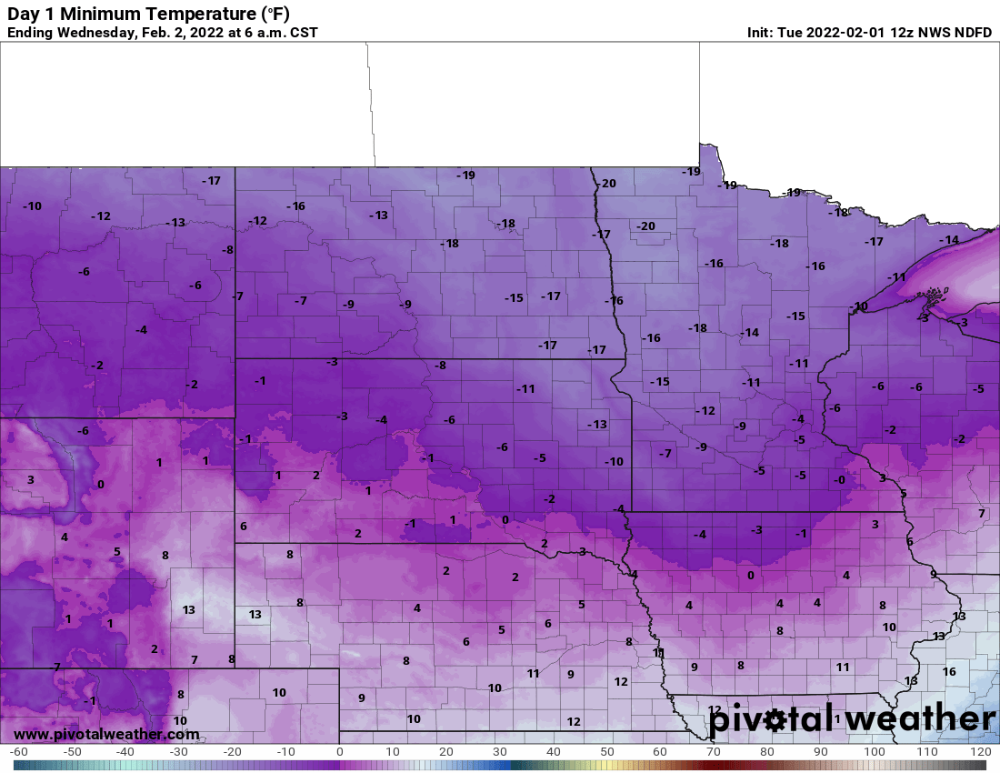
A wind chill advisory goes into effect Tuesday night into midday Wednesday across portions of west central and northern Minnesota. Wind chills there will be in the 20s below zero. We can expect wind chills in the teens below zero in the Twin Cities by early Wednesday.
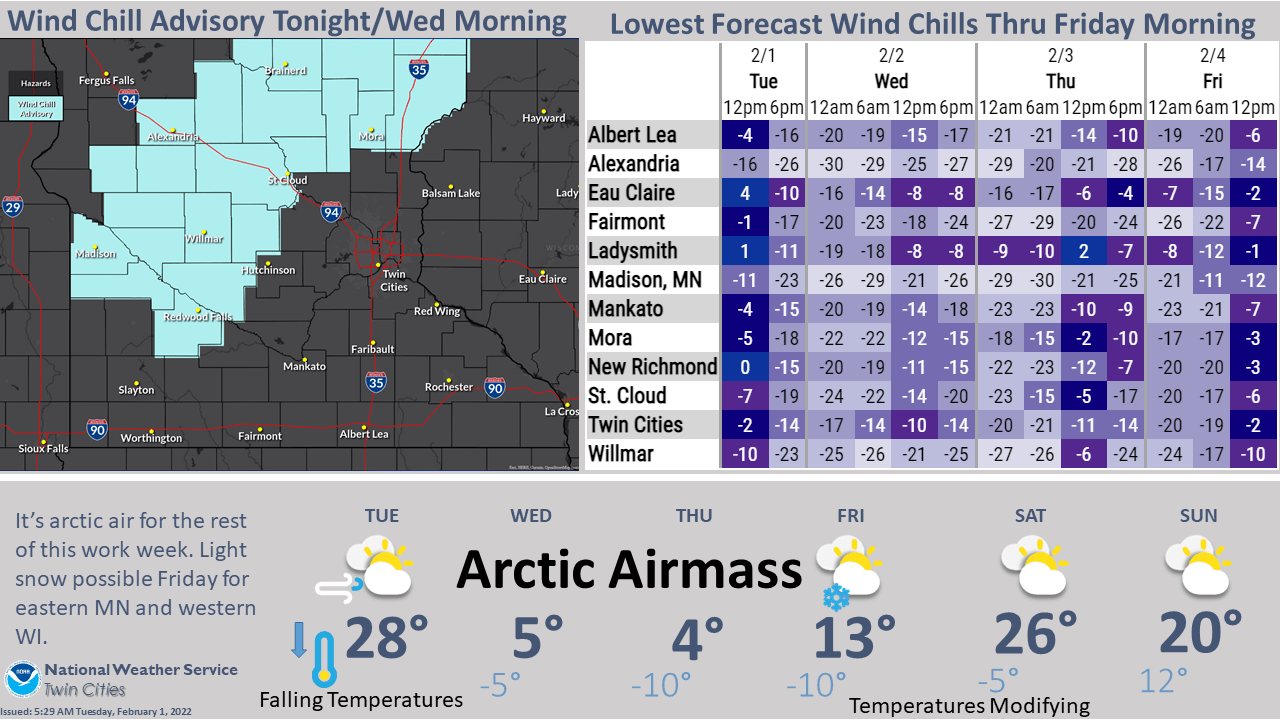
Actual air temperatures will bottom out in the single digits and teens below zero early Wednesday in southern Minnesota with teens and some 20s below zero in northwestern Minnesota.
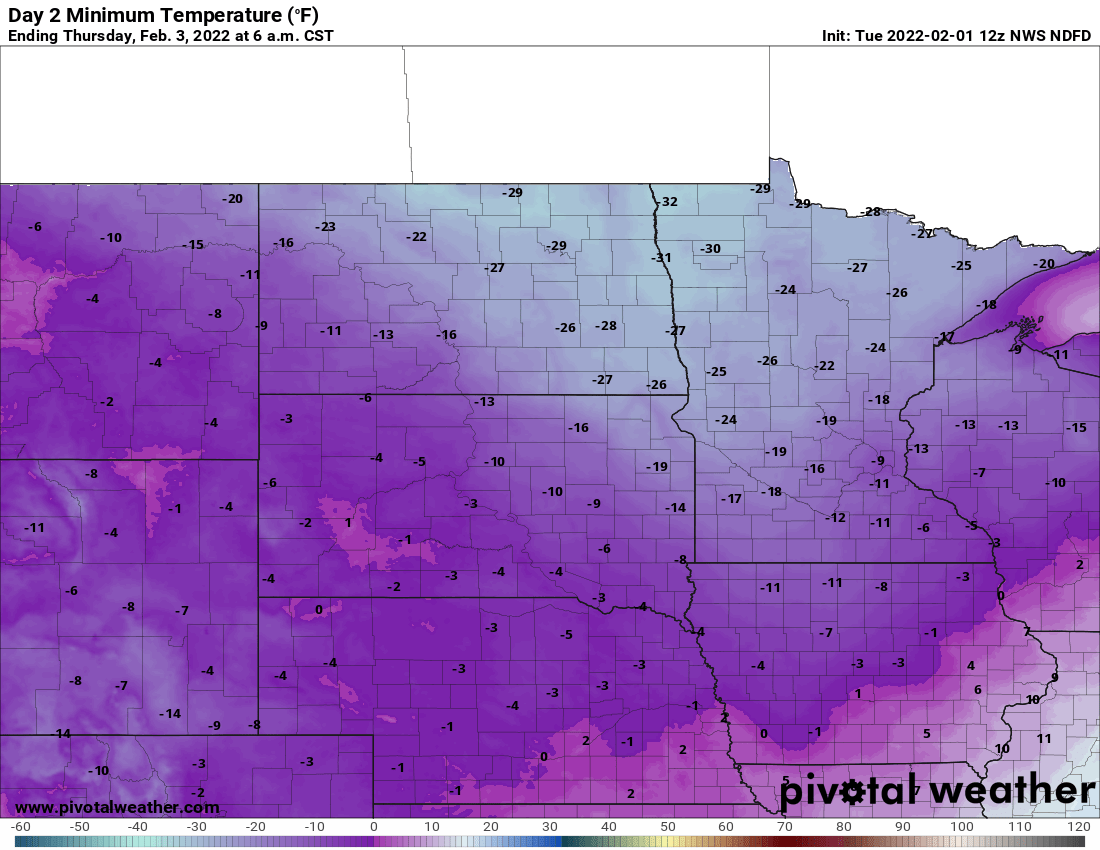
Temperatures will be even colder Wednesday night into early Thursday.
Just like much of January, we’ll only see a few days of cold. By Saturday high temperatures could be back well into the 20s, even close to 30 in southern Minnesota.
Cold Januarys becoming rarer
We just finished a cold January. Any cold winter month has become much less frequent in Minnesota’s warming winters. The month was 5.5 degrees below normal. It was the coldest January since 2014 and our third coldest January since the year 2000.
Even in a warmer world, we’ll still have ups and downs — that’s weather — but the trends are still undeniably upward.
So how cold was this January really?
Here’s some perspective: It was the 55th coldest in 149 years of record keeping; so, nowhere near a top 10 or 20 even. Cold Januarys will still happen, but the warming of our atmosphere will make them less frequent.
Based on 30-year normal and our most recent decade, a cold January like this is now just a once in a six- to nine-year occurrence. So, we can still expect a cold month like this once or twice a decade. Historically, this would have been a once in every two- or three- year frequency.
By warming January temperatures of about 3+ degrees over about 150 years, we’ve made cold months like this four times less likely. The average coldest winter temperature was about 27 below zero prior to 1905.
Now?
It’s just minus 15. As cold as this January was, the coldest temperature was just 17 below zero in the Twin Cities. Of course, outside of the Twin Cities temperatures were colder without the influence of the urban heat island, but temperature trends statewide are warmer, especially in the north.

