
Cold air pushes into Minnesota with gusty winds
Go Deeper.
Create an account or log in to save stories.
Like this?
Thanks for liking this story! We have added it to a list of your favorite stories.


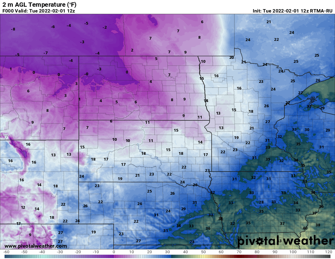
It’s another morning where our high temperature of the day was overnight into the early morning hours. The high reached 37 degrees between 1 and 2 a.m. early Tuesday. That will be far behind us in the rearview mirror by afternoon. Temperatures will drop through the day with gusty winds. Many of us will see wind gusts over 40 mph with even higher gusts in the northwest.
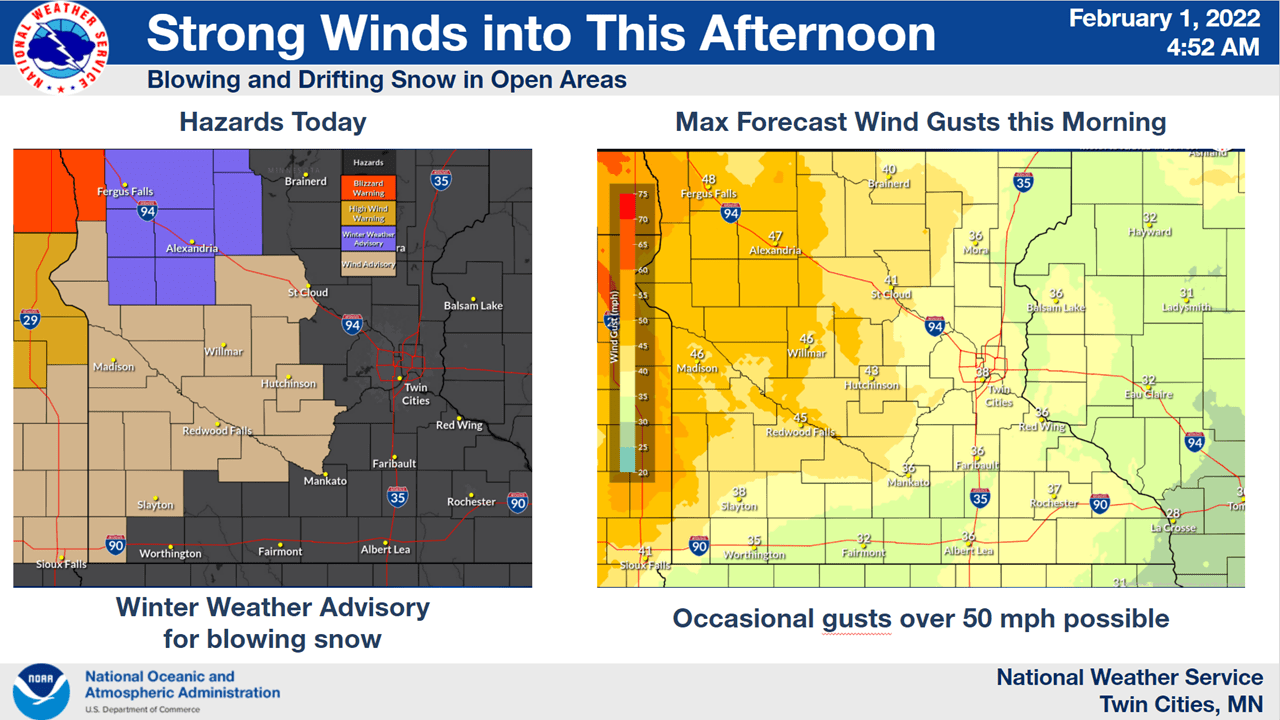
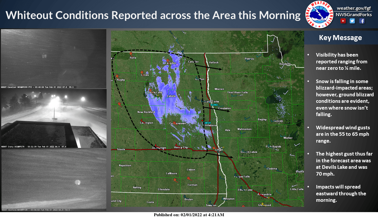
With fresh snow falling, white-out conditions are likely through the day in northwest Minnesota. Blizzard warnings are posted for the northwest most counties through 3 p.m. where wind gusts could reach a staggering 60 mph at times.
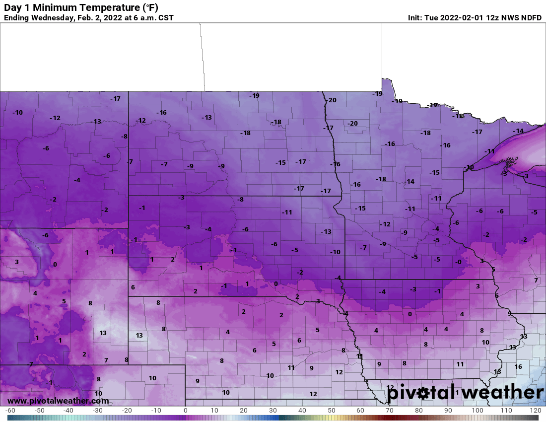
The reason for the wind is the return of arctic air. Overnight Tuesday temperatures will drop below zero pretty much statewide with frigid wind chills.
Winds will still be near 10 mph early Wednesday creating wind chills ranging from minus 15 to minus 35.
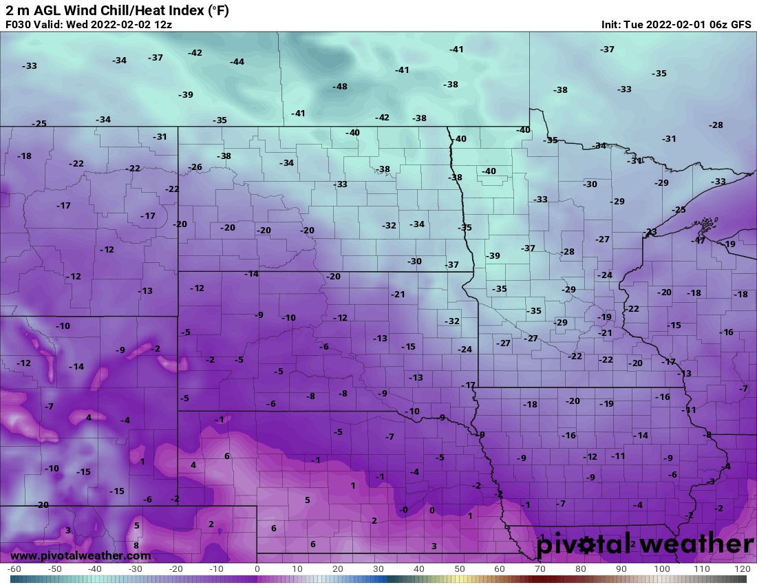
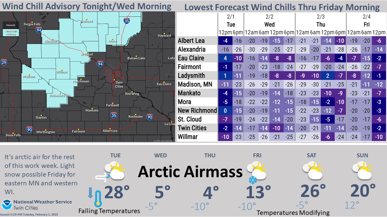
A wind chill advisory is in effect from 9 p.m. Tuesday night to 12 p.m. Wednesday.
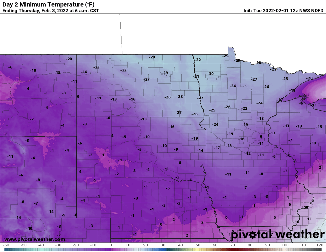
Temperatures will be colder Wednesday night into early Thursday. We will likely see temperatures in the single digits below zero to teens below zero in the south and 20s below zero with a few minus 30s in the north.
After another subzero morning Friday, we warm up. Highs should be in the 20s to even near 30 by the weekend. We could even see a stretch of thawing early next week!
Turn Up Your Support
MPR News helps you turn down the noise and build shared understanding. Turn up your support for this public resource and keep trusted journalism accessible to all.

