
A frigid couple days, then rapid weekend warming
One more real cold night before rebounding
Go Deeper.
Create an account or log in to save stories.
Like this?
Thanks for liking this story! We have added it to a list of your favorite stories.


Happy Groundhog Day! This is your annual reminder from meteorologists that a rodent is not better at forecasting. In fact, a coin flip is actually more accurate than Punxsutawney Phil’s predictions. Also, we know that in Minnesota, we are assured six more weeks of winter anyway.

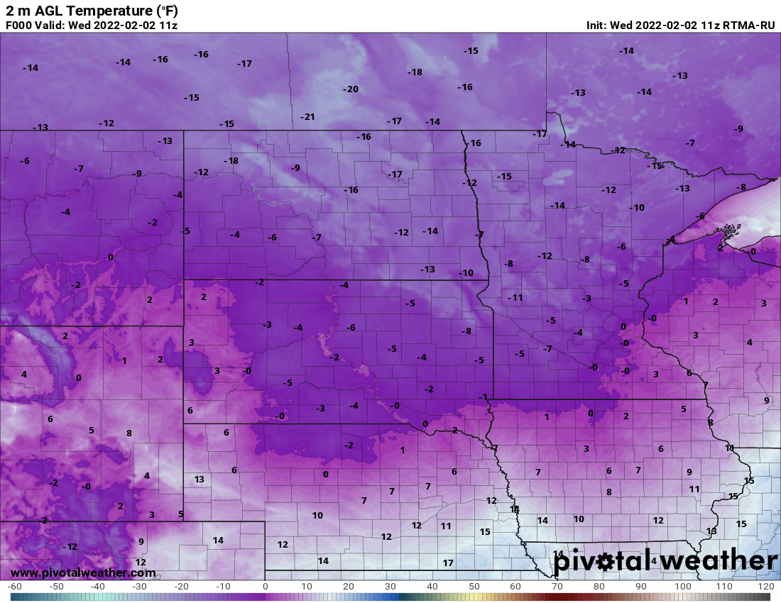
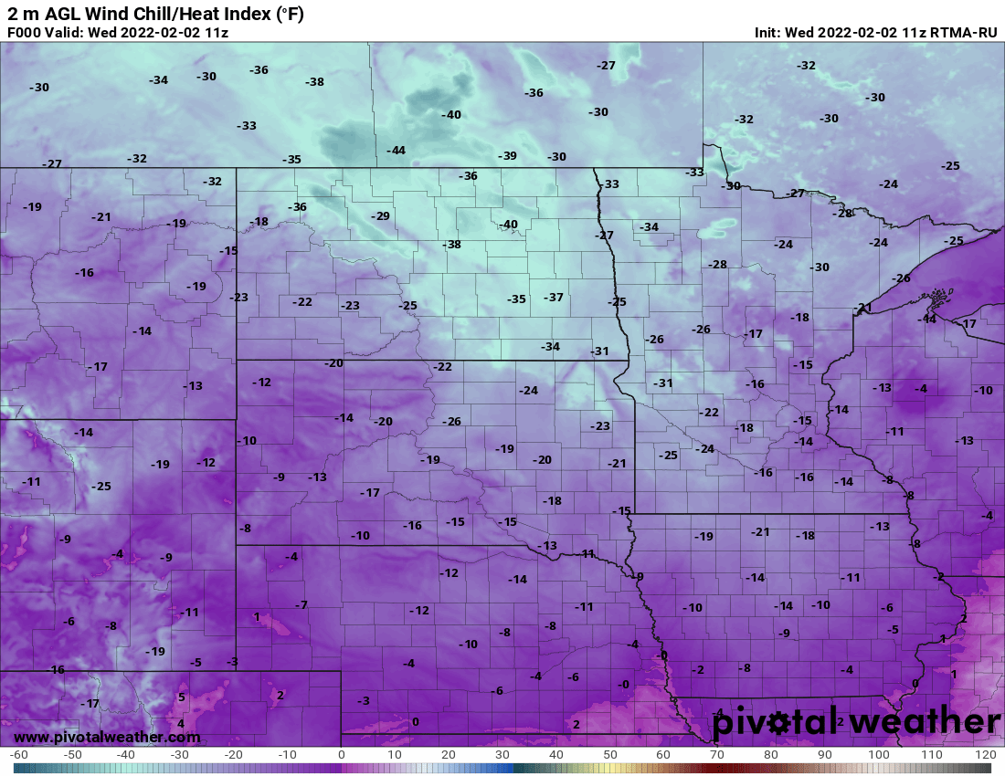
It’s déjà vu (just like in the Groundhog Day movie)! We are back below zero pretty much statewide early Wednesday. A breeze hovering at around 10 mph or more is creating wind chills in the teens, 20s, and 30s below zero.
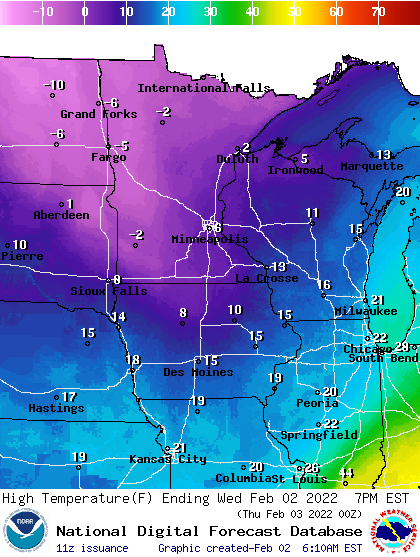
It will stay cold all day Wednesday, even with sunshine. Expect mainly single digits south and subzero highs in northern Minnesota.
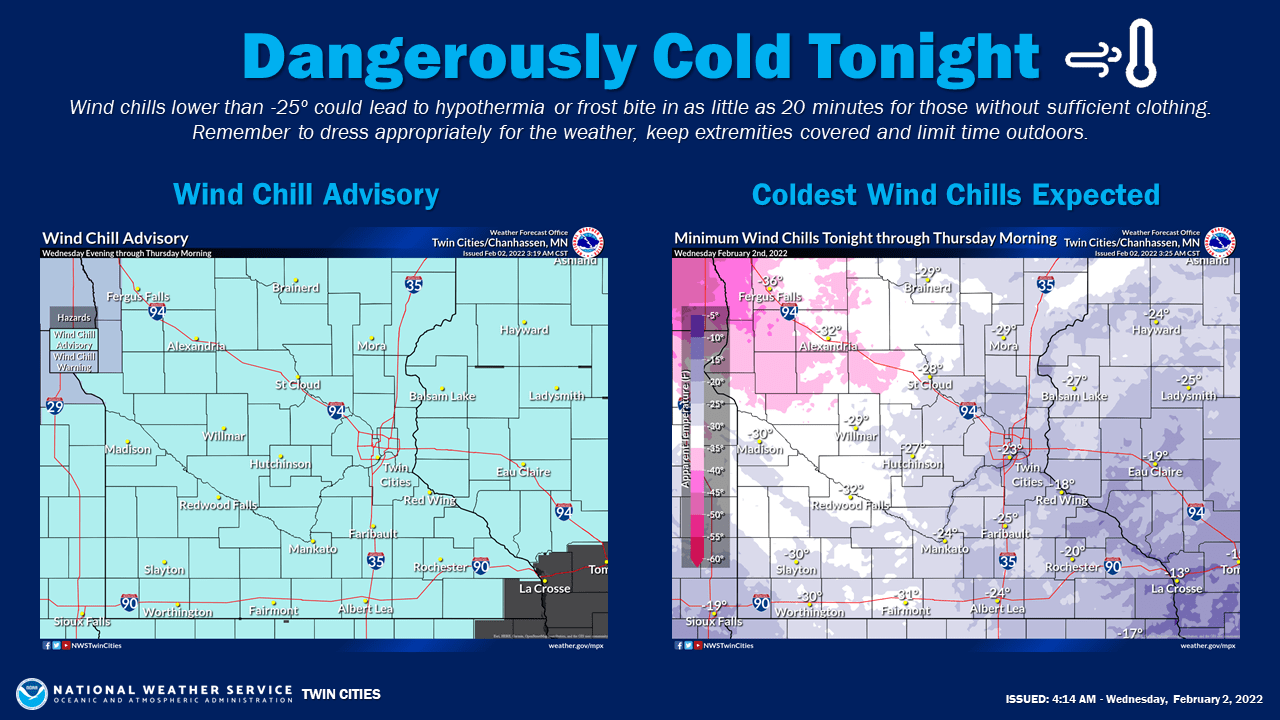
Our coldest readings of this latest cold snap will come late Wednesday night and early Thursday morning. Low temps will bottom out around 10 below zero in the Twin Cities with 20s to near 30 below zero in northern Minnesota. Wind chills will be even colder in the minus 20s to minus 40s in the north. A wind chill advisory is in effect Wednesday evening into Thursday morning.
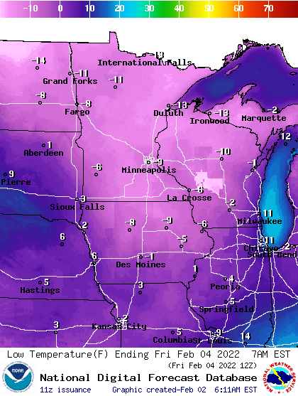
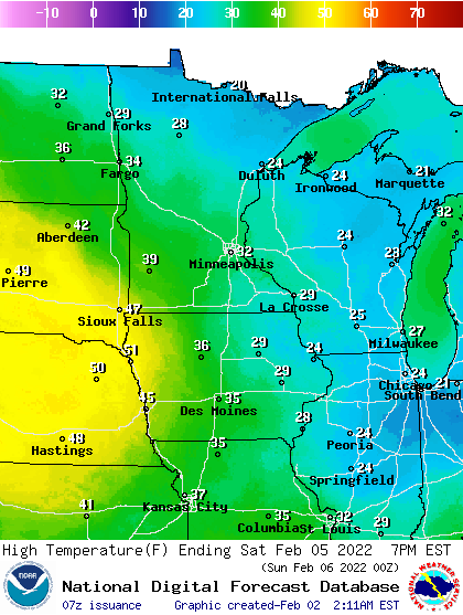
We will see another subzero night Thursday night but then teens return by Friday afternoon. By Saturday we’re looking at temperatures into the 20s to near 30 even for some.
The models are in agreement that next week will bring a nice thaw. We should see temperatures above freezing for several days! The Climate Prediction Center is forecasting likely odds of above normal temperatures next week.

Turn Up Your Support
MPR News helps you turn down the noise and build shared understanding. Turn up your support for this public resource and keep trusted journalism accessible to all.

