
Colder Wednesday night before warming up this weekend
Go Deeper.
Create an account or log in to save stories.
Like this?
Thanks for liking this story! We have added it to a list of your favorite stories.


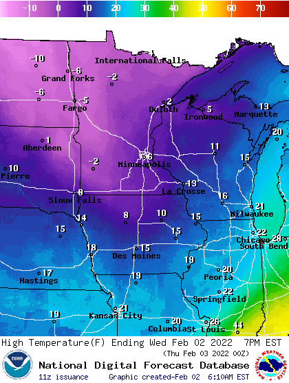
Highs Wednesday will only be in the single digits in the southeast part of the state, including the Twin Cities, but stay subzero for most of western and northern Minnesota.
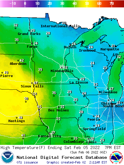
After another subzero night Thursday night, though considerably warmer, we’re back into the teens Friday and Saturday brings a return to 30s in southern Minnesota and 20s in northern Minnesota.
Cold enough
This latest cold air mass may not be quite as cold as the last couple visits, but it’s still just plain cold. Temperatures Wednesday will not get above zero for most of western, central, and northern Minnesota.
In the Twin Cities and areas southeast we should manage single digit above zero highs, but wind will chills will remain well below zero.
Turn Up Your Support
MPR News helps you turn down the noise and build shared understanding. Turn up your support for this public resource and keep trusted journalism accessible to all.
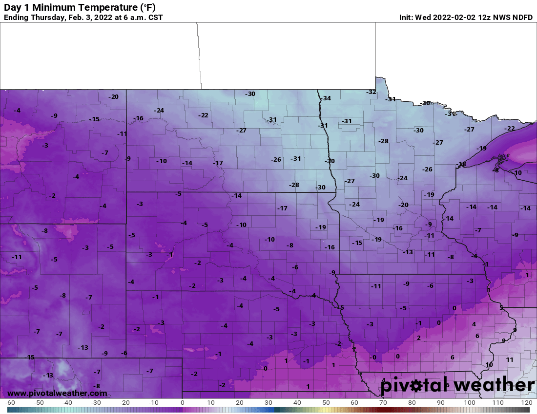
Back well behind the trenches of the leading edge of the arctic air in Minnesota, we’ll see our coldest night of the cold snap yet Wednesday night into early Thursday.
Lows will be in the low teens below zero in the Twin Cities but parts of northern and northwestern Minnesota will be in the low 30s below zero.
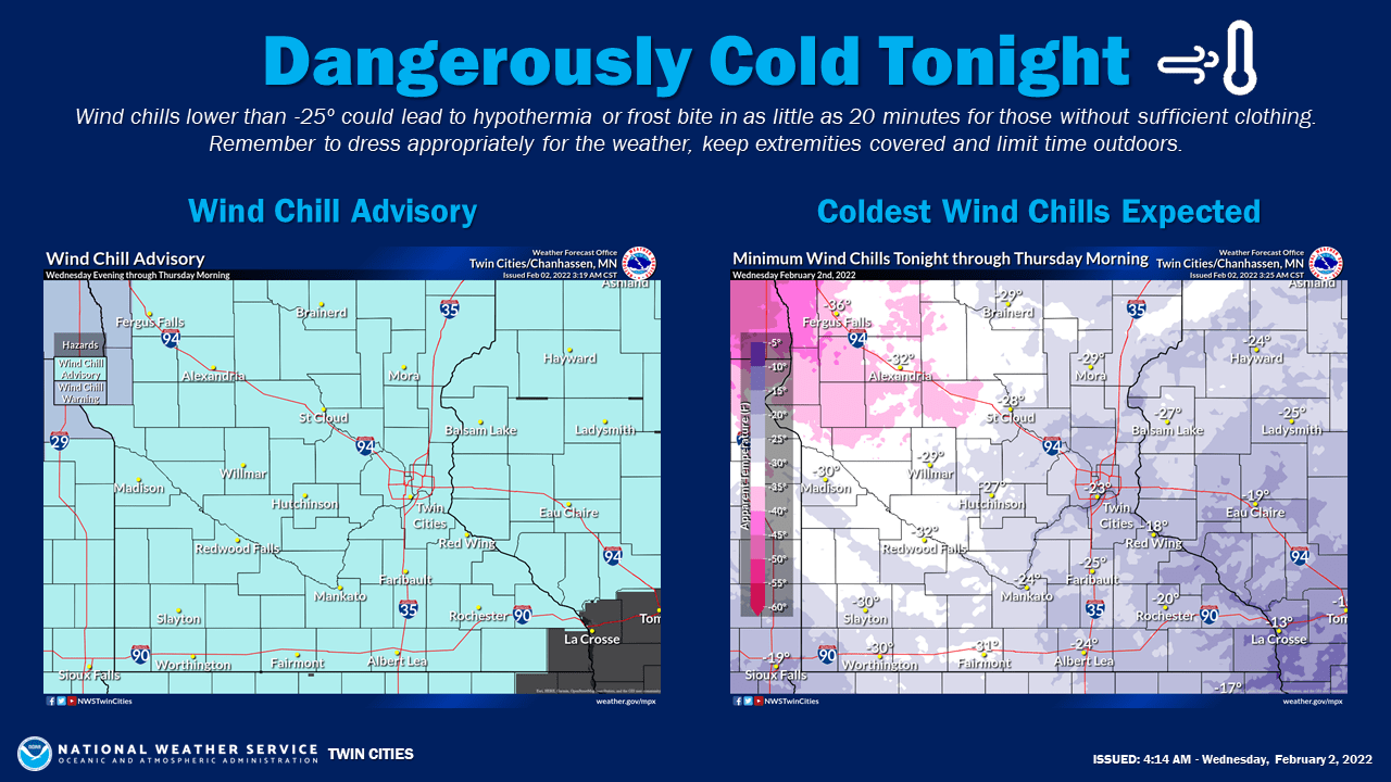
Wind chills of course will be even colder Wednesday night and Thursday morning. We can expect mainly teens and twenties below zero for southern Minnesota but wind chills in northern and northwest Minnesota will be much worse, in the 30s below zero.
Northwestern Minnesota could see wind chills of minus 50!
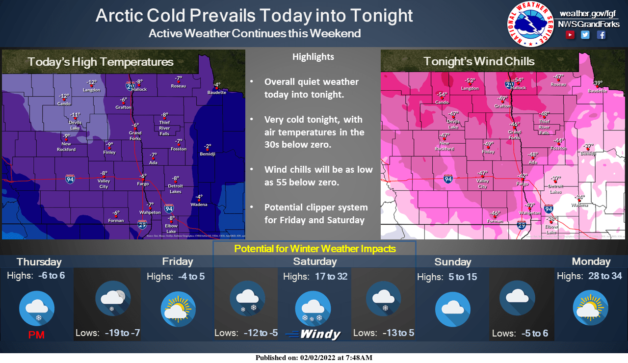
After another subzero night Thursday, though considerably warmer, we’re back into the teens Friday and Saturday brings a return to 30s in southern Minnesota and 20s in northern Minnesota.
Ice, snow grip the U.S. south of Minnesota
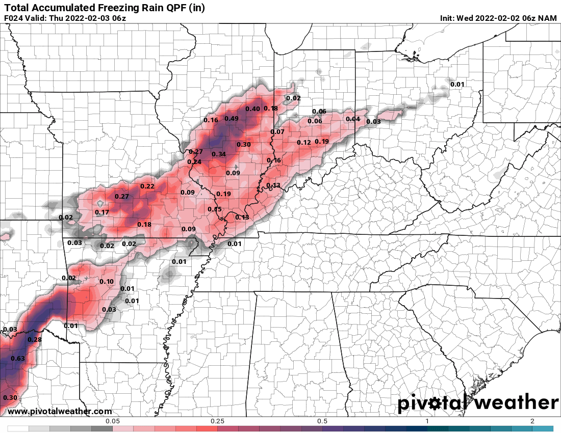
We may have the cold, but at least we’re not getting an ice storm. Snow lovers may want the heavy snow in Illinois and Indiana, but almost no one wants a thick ice accumulation. That’s what areas to the south are seeing with a large winter storm system.
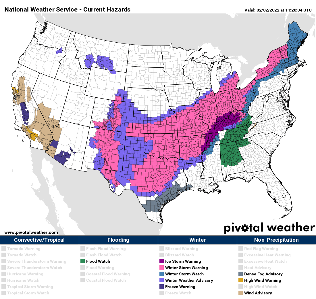
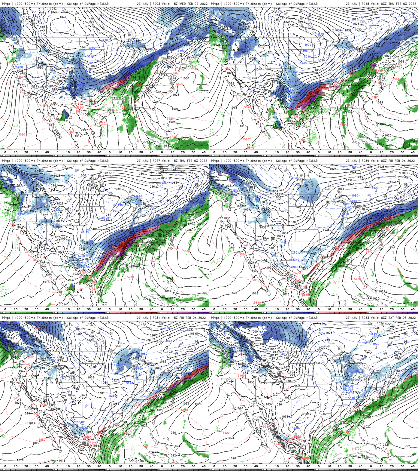
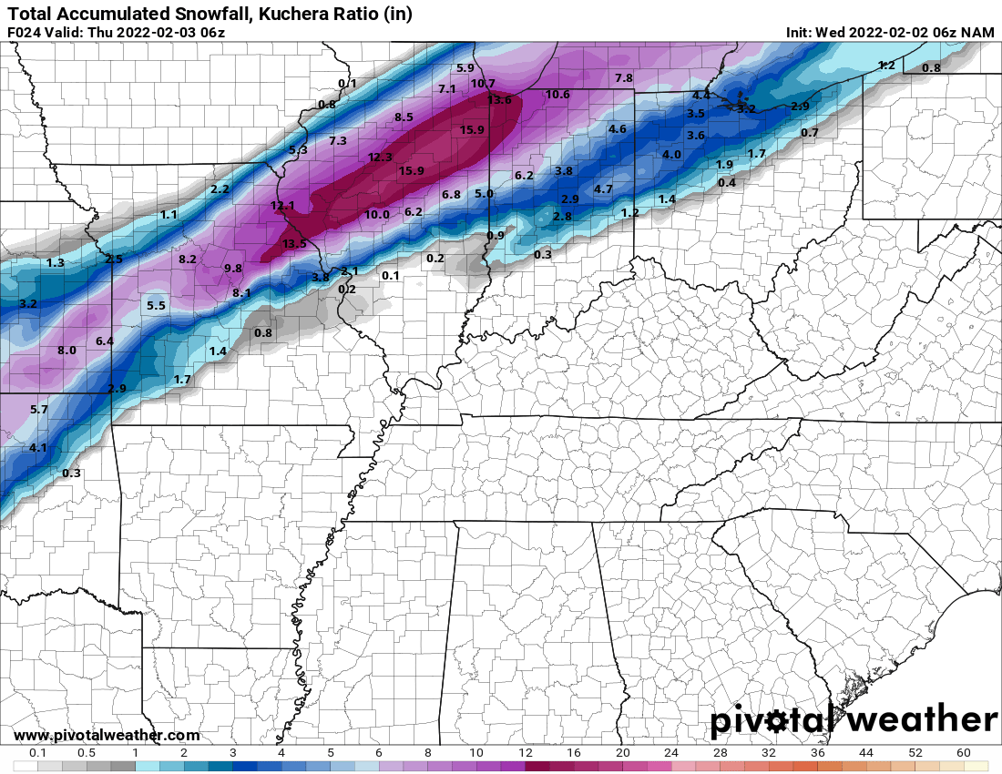
A heavy swath of snow will fall for a long swath along the edge of our arctic air from the plains all the way to the northeast. The heaviest will be south of Chicago where over a foot could fall.
The more treacherous aspect, the ice, will coat a large area from Texas into Illinois and Tennessee.
Thaw next week?
Beyond Saturday, we do cool off temporarily Sunday with highs back into the teens to around 20 degrees but next week we’re on track for a thaw.
Some models, such as the European Centre for Medium-Range Weather Forecasts computer model, brings in three days in the 40s.
The National Oceanic and Atmospheric Administration’s Climate Prediction Center gives us odds of above normal temperatures much of the middle and later part of next week. So if you’re sick of the cold, just hang on a little longer.


