Thursday stays arctic cold; warmer temps by Saturday

Go Deeper.
Create an account or log in to save stories.
Like this?
Thanks for liking this story! We have added it to a list of your favorite stories.


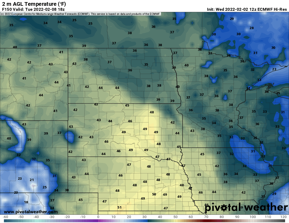
Subzero weather continues across much of Minnesota Thursday and overnight. Friday brings highs in the teens for most of Minnesota. Highs Saturday will be in the 30s in the south, 20s in the north. Highs by Tuesday could reach 40 degrees in the Twin Cities.
Bitter cold cracks a record
Temperatures were widespread in the 30s below zero in northern Minnesota. Wind chills in northwest Minnesota even reached 50 below zero at times. International Falls recorded a new record low temperature for Feb. 3, dipping to 42 below zero early Thursday, breaking the old record of 40 below zero set back in 1982.
The Canadian border town reaches somewhere between minus 37 and minus 41 once per winter on average, and that’s using the most recent decades of data.
Minnesota won’t see a lot of warming Thursday. Afternoon highs will stay below zero for most. From the Twin cities and southeast, we’ll see single digits above zero.
Turn Up Your Support
MPR News helps you turn down the noise and build shared understanding. Turn up your support for this public resource and keep trusted journalism accessible to all.
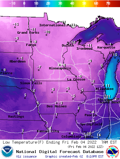
Temperatures will drop below zero again for most of us, but not as cold as early Thursday. In fact, temperatures will go up overnight in the western part of the state.
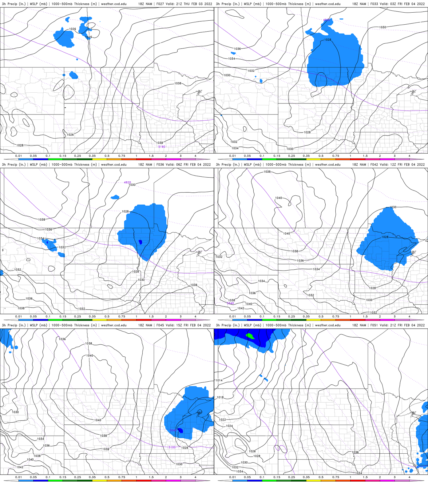
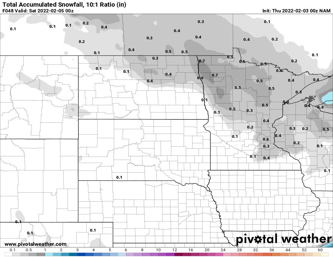
Friday will bring highs in the teens for most of Minnesota but we’ll have some light snow first early Friday morning. A clipper system combined with warmer air moving in will create a coating of snow for many spots.
The timing will not be great, starting in the middle of the morning commute in the Twin Cities from around 7 to 9 a.m.
Saturday is when we’ll really notice warmer temperatures. Highs will be in the 30s in the south and 20s in the north.
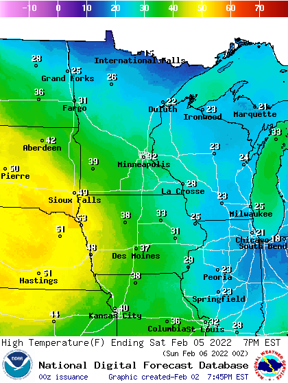
Temperatures will dip briefly Sunday behind a weak cool front, in the teens and low 20s, but we’re right back on track next week for a thaw. Highs by Tuesday could reach 40 degrees in the Twin Cities.
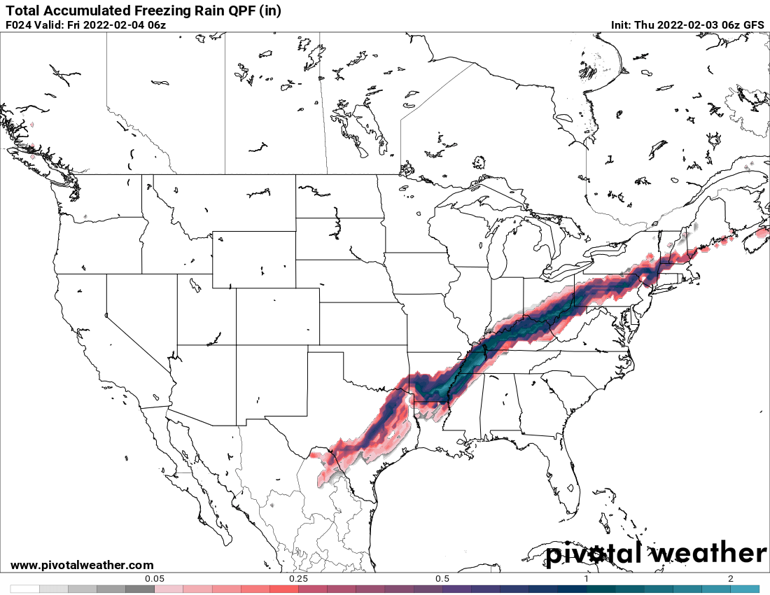
Our cold weather is wreaking havoc to the south and east. A major winter storm is dumping heavy snow and ice accumulations from Texas to Maine.
While the cold may be uncomfortable and dangerous in its own way, being in the core of a cold high pressure keeps us dry. On the leading edge of it is where we’re seeing a large swath of precipitation Thursday.
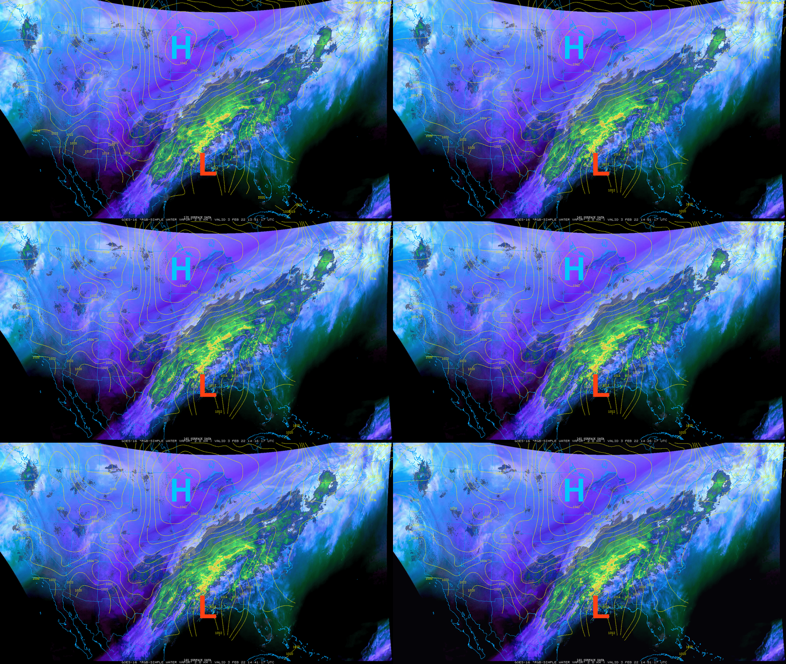
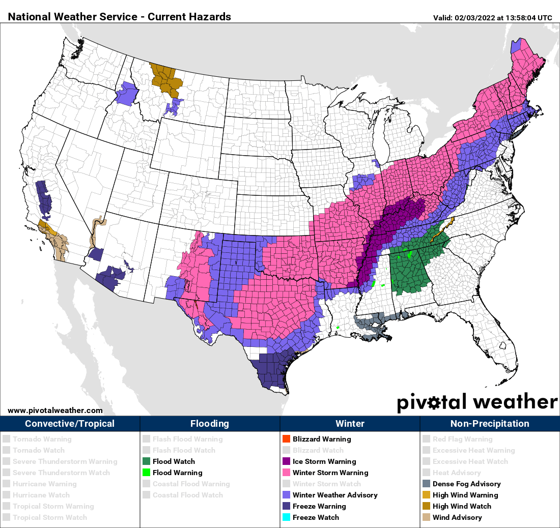
Many areas will see a large snowfall with over a foot in some spots.
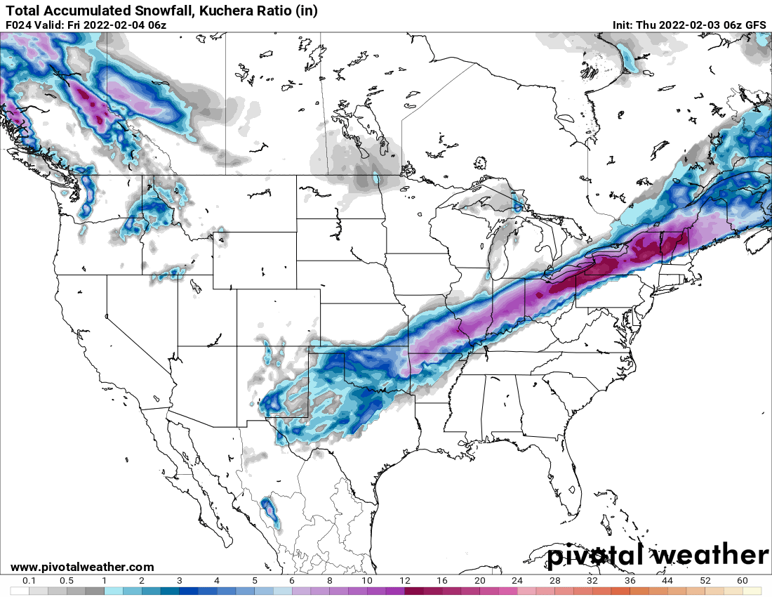
Some of the most treacherous weather will be caused by significant ice accumulations from Texas to Arkansas and Tennessee and Kentucky.