Our coldest morning of the week gives way to a warm up
Go Deeper.
Create an account or log in to save stories.
Like this?
Thanks for liking this story! We have added it to a list of your favorite stories.


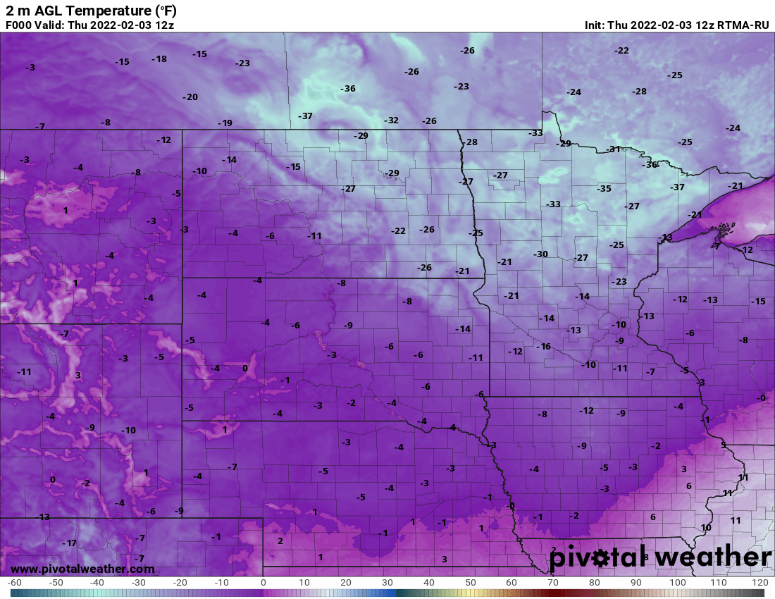
It’s almost a part of our weekly routine since the first of the year. We’ve averaged out to at least one night in the teens below zero in the Twin Cities since Jan. 1. In fact, each workweek has seen a reading of minus 10 or colder since the New Year — except one — the week of the Jan. 10-14, when the coldest reading was a mere 9 below zero. Close enough if you ask me.
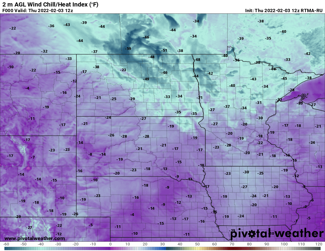
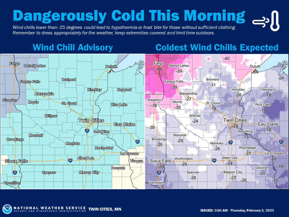
A wind chill advisory is out for most everyone until midday and western Minnesota is under a wind chill warning for those even more brutal conditions. The wind chills are worse northwest not just because it’s colder, but because there’s more wind and ironically that wind is already from the south far to the west.
The wind is from the south in the northwest because they’re on the backside of a cold high pressure parked right over Minnesota. Winds flow outward and clockwise from a high pressure center.
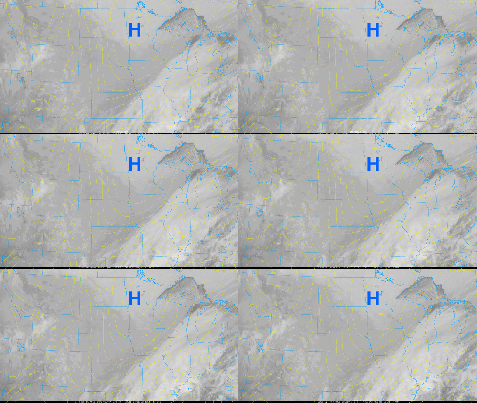
Those slowly developing south winds will bring in warmer air already over the next 24 hours as the cold high pressure retreats east. In yet another all to familiar pattern, temperatures will go up through the night Thursday night to the west. But first it’ll be yet another cold day.
Turn Up Your Support
MPR News helps you turn down the noise and build shared understanding. Turn up your support for this public resource and keep trusted journalism accessible to all.

Most us will still see another subzero night Thursday night (though not nearly as cold) before things really warm up noticeably.
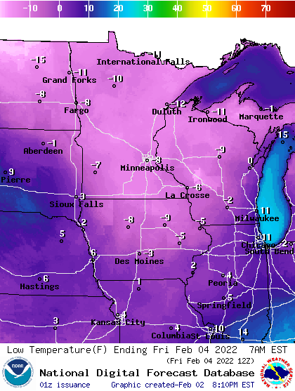
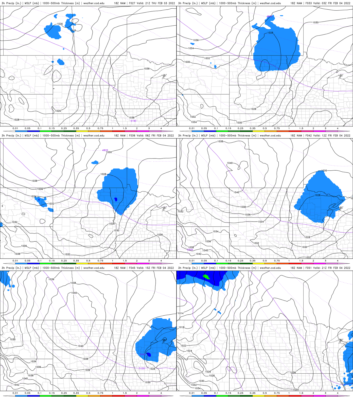
As warmer air moves in, we could see some light snow showers Friday morning given a boost by a quick moving clipper.
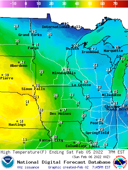
Saturday brings a return to above normal temperatures. Highs should reach the 30s in the south and 20s in the north.
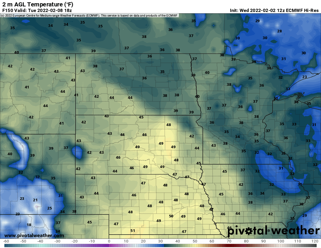
We’ll get a brief setback Sunday in the teens and low 20s before the bigger, sustained warm-up develops next week. It still appears likely we’re in for at least a few days above freezing and perhaps even 40 degrees.