
A cool Sunday, then temps rebound this coming week
Winter weather advisory Saturday evening northeastern Minnesota
Go Deeper.
Create an account or log in to save stories.
Like this?
Thanks for liking this story! We have added it to a list of your favorite stories.


After three consecutive days with single-digit high temps in the Twin Cities, it was good to see double-digit highs return on Saturday!
We had Saturday highs in the 20s in the Twin Cities metro area, reaching our warmest high temp since we notched 37 degrees on Tuesday, Feb. 1. You might remember that our Tuesday high temp was at about 1 a.m., with falling temps through much of that day.
Temperature trends
Our average Twin Cities high temp is 26 degrees on Feb. 6. We could see a daytime high close to 20 in the metro area on Sunday. Much of Minnesota will have Sunday highs in the teens, with a few single-digit highs in northwestern Minnesota:
Turn Up Your Support
MPR News helps you turn down the noise and build shared understanding. Turn up your support for this public resource and keep trusted journalism accessible to all.
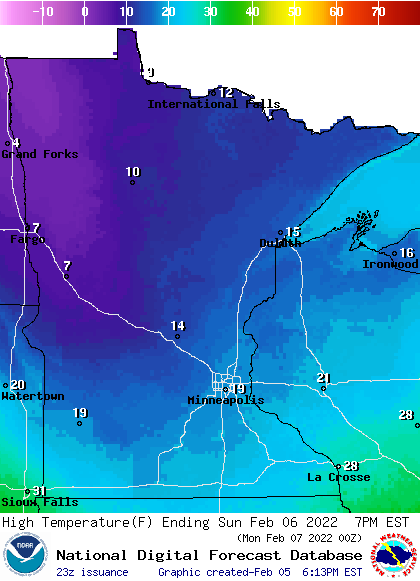
Western Wisconsin will have highs in the 20s.
Sunday wind gusts are expected to be in the 15-24 mph range:
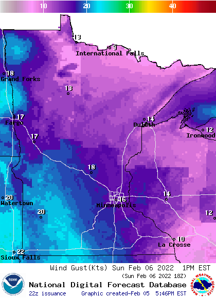
Forecast wind gusts are in knots, with 16 knots equal to 18.4 mph.
Back to temperatures, Twin Cities metro area highs are projected to be around 20 degrees on Monday, followed by lower 40s on Tuesday! Yes, a warm front moves through here on Tuesday. Twin Cities highs retreat to the mid 30s on Wednesday, followed by lower 30s Thursday and Friday.
Snow chances
Snow will continue to fall Saturday evening in portions of northeastern Minnesota, where some locations could pick up another inch or two of snow. A winter weather advisory continues until 9 p.m. this Saturday in Lake County and Cook County of northeastern Minnesota.
You can hear updated weather information for Minnesota and western Wisconsin on the Minnesota Public Radio News network, and you can see updated weather info on the MPR News live weather blog. Minnesota road conditions can be found here.
There’s a chance of occasional light snow showers in portions of southern Minnesota Sunday morning. The National Oceanic and Atmospheric Administration’s North American Mesoscale (NAM) forecast model shows the potential precipitation pattern from 5 a.m. Sunday to noon Sunday:
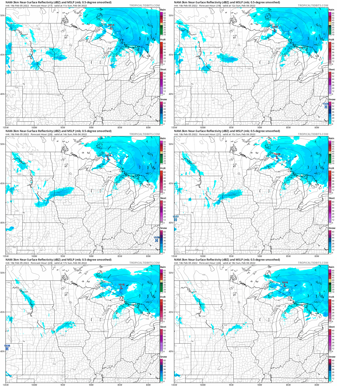
The Twin Cities metro area could see a passing flurry Sunday morning.
Weather nugget
For the current snow season (which began in the fall), our Twin Cities snowfall total is 33.4 inches. That’s 1.9 inches above normal for this point in our snow season.
Programming note
You can hear my live weather updates on MPR News at 7:35 a.m., 9:35 a.m. and 4:39 p.m. each Saturday and Sunday.

