
Areas of light snow Sunday a.m., temps retreat this afternoon
Some slick spots on roads Sunday morning
Go Deeper.
Create an account or log in to save stories.
Like this?
Thanks for liking this story! We have added it to a list of your favorite stories.


Light snow spread across much of Minnesota and western Wisconsin overnight.
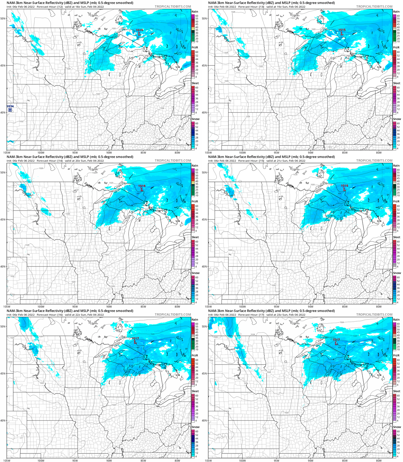
Periods of light snow linger in eastern Minnesota and western Wisconsin Sunday morning, with some patchy freezing drizzle also possible. The precipitation in Minnesota ends from west to east late Sunday morning.
Parts of western Wisconsin could see periods of light snow linger into early afternoon. The National Oceanic and Atmospheric Administration’s North American Mesoscale (NAM) forecast model shows the potential precipitation pattern from noon Sunday to 5 p.m. Sunday:
You can hear updated weather information for Minnesota and western Wisconsin on the Minnesota Public Radio News network, and you can see updated weather info on the MPR News live weather blog.
Turn Up Your Support
MPR News helps you turn down the noise and build shared understanding. Turn up your support for this public resource and keep trusted journalism accessible to all.
Minnesota road conditions can be found here. Wisconsin road conditions can be found here.
Sunday temps
The Twin Cities metro area and southern Minnesota have already seen early Sunday highs in the 20s. Temps retreat into the teens in most areas Sunday afternoon. Here are forecast noon temps:
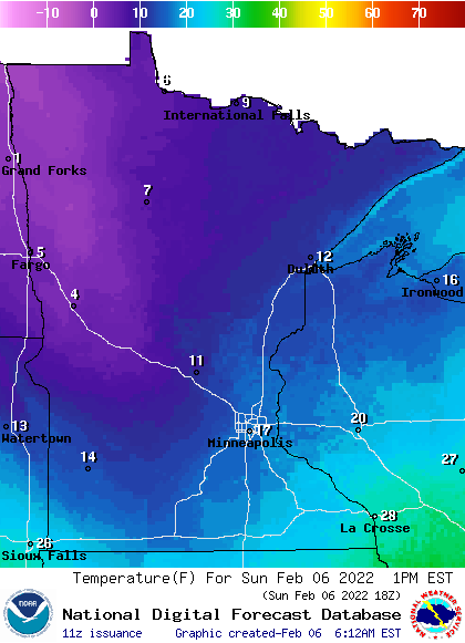
Northwestern Minnesota will have some single-digit highs.
Sunday wind gusts are expected to be in the 15-24 mph range:
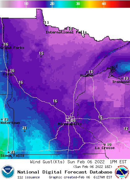
Forecast wind gusts are in knots, with 16 knots equal to 18.4 mph.
This Updraft blog will be updated by around 10:15 a.m., with a Sunday forecast update plus a look at the week ahead.
Programming note
You can hear my live weather updates on MPR News at 7:35 a.m., 9:35 a.m. and 4:39 p.m. each Saturday and Sunday.

