
A sustained warmup the remainder of the week
Go Deeper.
Create an account or log in to save stories.
Like this?
Thanks for liking this story! We have added it to a list of your favorite stories.


Temperatures will not plummet Monday night for a change. We’ll see most of us fall only about 5 to 10 degrees.
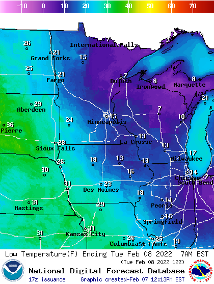
You don’t have to be outside at midnight this go around to enjoy milder temperatures. It seems much of January we had overnight high temperatures, and we did have more than normal.
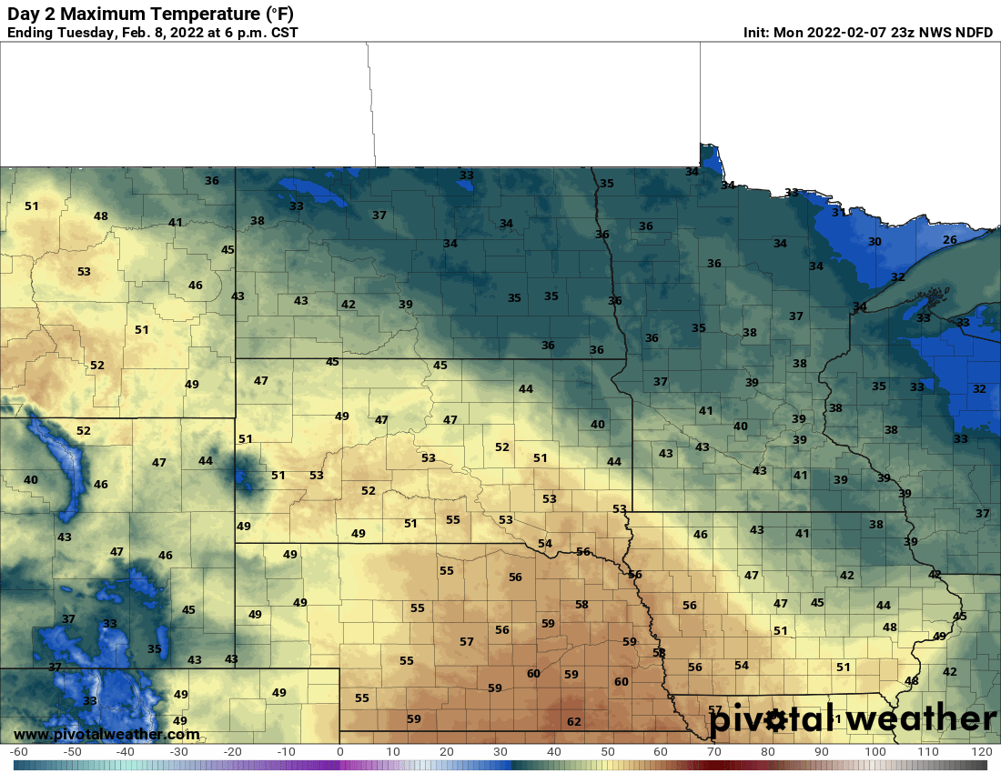
This time however, we’re going to see several days of mild weather stick around. The peak of that warmth will be Tuesday when temperatures across much of southern Minnesota will top out in the low 40s. Parts of southwest Minnesota could hit 50 Tuesday afternoon.
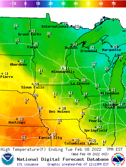
It may surprise you but we were last 40 degrees, or warmer just three weeks ago. Tuesday could be our third day in the 40s since the first of the year. It may also surprise you, that, despite a chilly January we’re on track with the normal amount of 40s to date (assuming we do reach it Tuesday).
Turn Up Your Support
MPR News helps you turn down the noise and build shared understanding. Turn up your support for this public resource and keep trusted journalism accessible to all.
The mild air sticks around through Friday, though in the 30s instead of 40 degrees. We do see a brief shot of colder air Saturday.
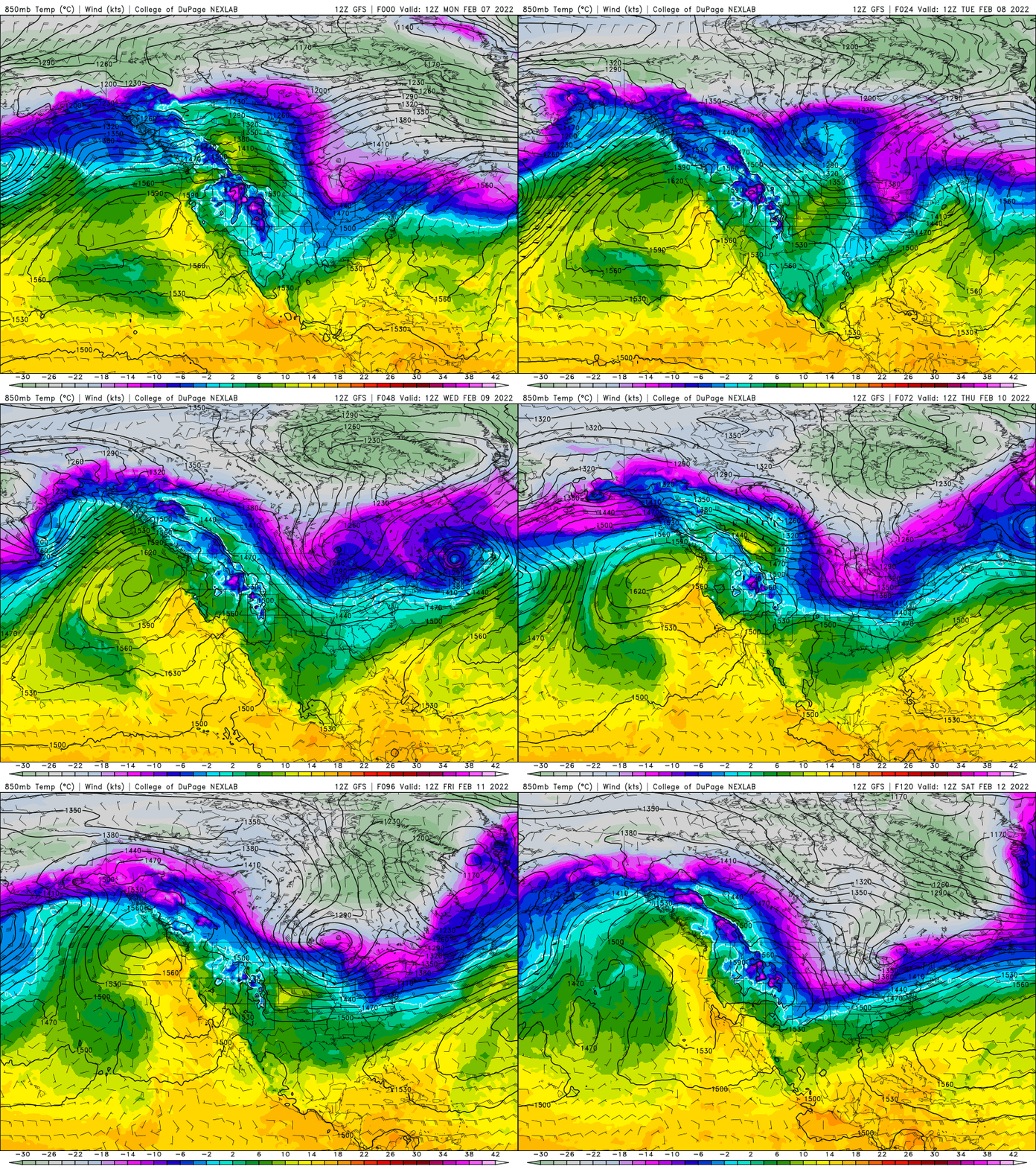
Temps will drop into the teens for highs Saturday and northern Minnesota will likely see a subzero morning.

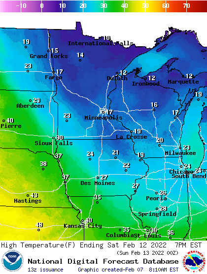
The pattern also will become more active with a quick moving clipper Wednesday bringing some flurries. The system that will bring in the chill for Saturday will be a more significant system moving through the region Thursday into Friday with the potential for significant snowfall in northeast Minnesota and northern Wisconsin.
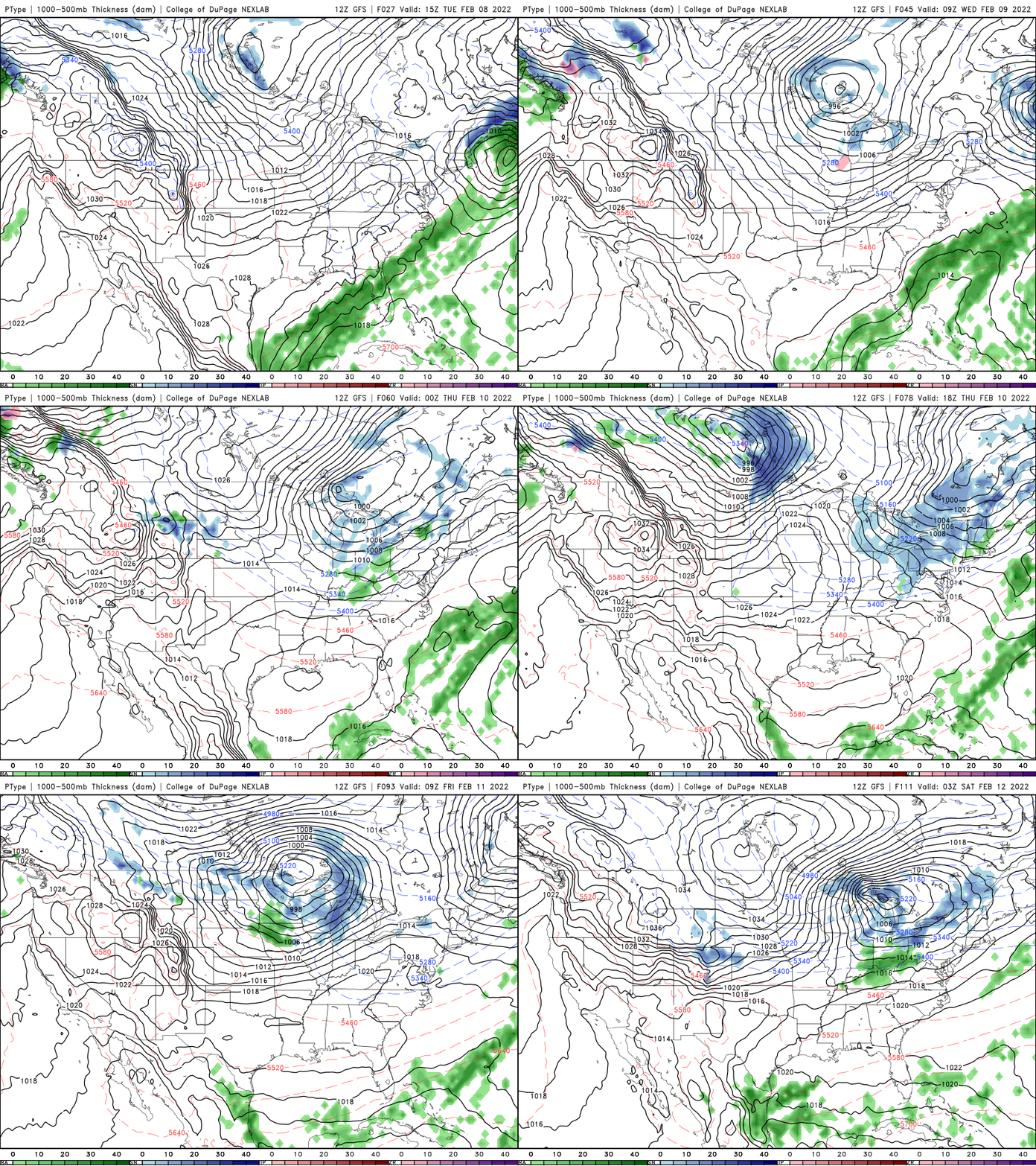
For the Twin Cities and much of southern Minnesota, not only will we be on the southwest edge of the current track of that system, but temperatures may be mild enough to see snow showers mixing with some rain showers. Stay tuned as the track could change depending on the timing of the colder air coming in behind it.

