
Weekend forecast: Cold, with a chance of flakes Saturday evening
Thursday snow amounts highest in northern Minnesota
Go Deeper.
Create an account or log in to save stories.
Like this?
Thanks for liking this story! We have added it to a list of your favorite stories.


I’ll get to the weekend forecast in a moment, but I’ll first give you an update on our Thursday snow outlook.
Snow is spreading across western and northern Minnesota Thursday morning. Through Thursday afternoon, the snow coverage will expand to cover most of Minnesota plus western Wisconsin.
Highest snow totals from this clipper system will be in northern Minnesota and parts of northwestern Wisconsin:
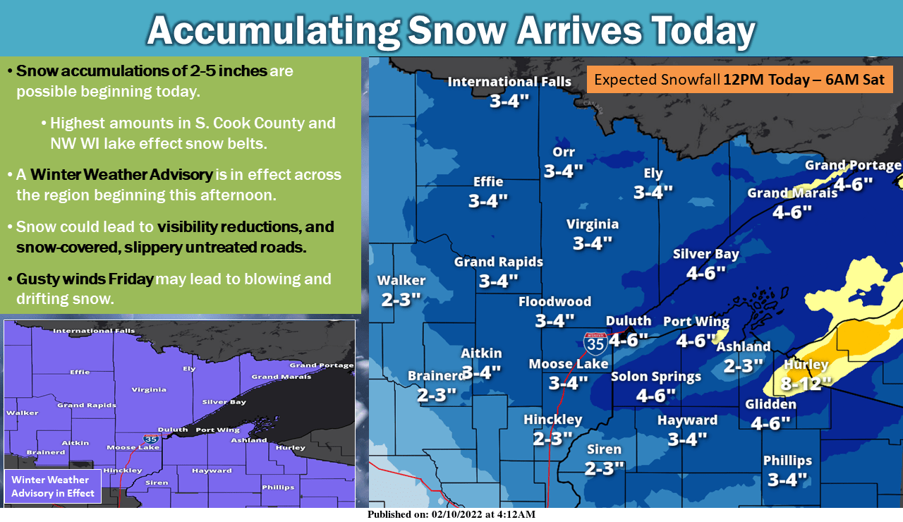
Winter weather advisories run from Thursday afternoon through Thursday night in much of northern Minnesota and northwestern Wisconsin. Here are details of the winter weather advisory in northeastern Minnesota:
Turn Up Your Support
MPR News helps you turn down the noise and build shared understanding. Turn up your support for this public resource and keep trusted journalism accessible to all.
URGENT - WINTER WEATHER MESSAGE National Weather Service Duluth MN 951 AM CST Thu Feb 10 2022 MNZ011-019-037-110400- /O.CON.KDLH.WW.Y.0006.220210T2000Z-220211T1000Z/ North St. Louis-Central St. Louis-Carlton and South St. Louis- Including the cities of Ely, Hibbing, and Duluth 951 AM CST Thu Feb 10 2022 ...WINTER WEATHER ADVISORY REMAINS IN EFFECT FROM 2 PM THIS AFTERNOON TO 4 AM CST FRIDAY... * WHAT...Snow and and some mixed precipitation expected. Total snow accumulations of 2 to 4 inches. A period of freezing drizzle also possible as the main area of snow moves away later this evening. * WHERE...North St. Louis, Central St. Louis and Carlton and South St. Louis Counties. This includes the Tribal Lands of the Fond du Lac Band and the Bois Forte Band, Lake Vermilion and, Nett Lake areas. * WHEN...From 2 PM this afternoon to 4 AM CST Friday. * IMPACTS...Plan on slippery road conditions. The hazardous conditions could impact the evening commute. PRECAUTIONARY/PREPAREDNESS ACTIONS... Slow down and use caution while traveling. The latest road conditions can be obtained by calling 5 1 1. Road conditions can also be found at 511mn.org for Minnesota or 511wi.gov for Wisconsin.
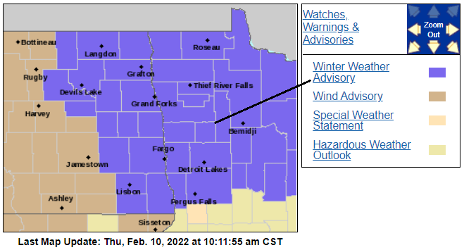
Winter weather advisories continue through Thursday evening in northwestern Minnesota:
You can hear updated weather information for Minnesota and western Wisconsin on the Minnesota Public Radio News network, and you can see updated weather info on the MPR News live weather blog.
Winter weather advisories extend as far south as Kanabec County and Pine County in Minnesota and Polk County and Barron County in Wisconsin:
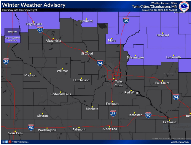
Those advisories run through Thursday evening.
Snow or a mix of snow and freezing drizzle will move into the Twin Cities metro area Thursday afternoon, then continue as snow or a mix of snow/light rain and drizzle Thursday evening. Metro area snow amounts are expected to be between 1 and 2 inches.
Some roads could be slippery during the afternoon and early evening commute. Minnesota road conditions can be found here. Wisconsin road conditions can be found here.
Weekend temps
Your warmest coat will be appropriate this weekend.
Low temperature early Saturday morning will be below zero:
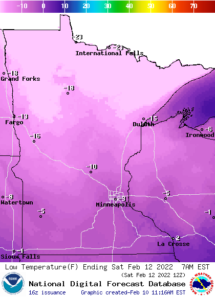
Saturday highs will only reach the single digits in most of Minnesota and western Wisconsin:
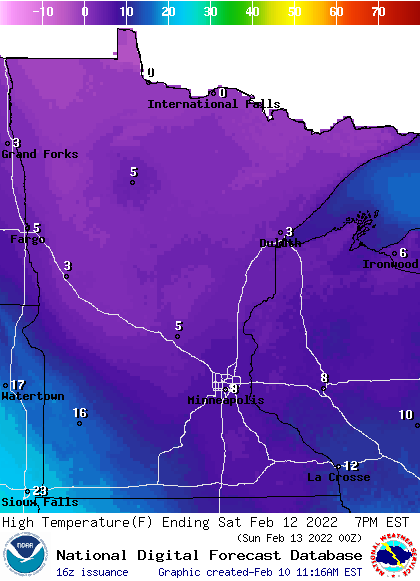
Southwestern Minnesota will reach the teens.
We may top out around 8 degrees in the Twin Cities on Saturday. For perspective, our average Feb. 12 Twin Cities high temp is 27 degrees.
Low temps early Sunday morning will be below zero in most areas, including the Twin Cities:
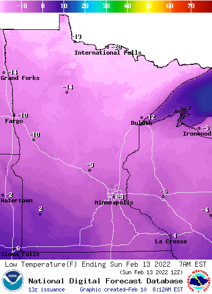
Sunday highs will be in the teens in many areas, with single digits in parts of far northern Minnesota:
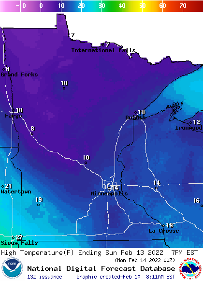
Saturday p.m. flake chances
Snow is expected to spread across northern Minnesota Saturday afternoon and into the Twin Cities metro area and southern Minnesota Saturday evening.
The National Oceanic and Atmospheric Administration’s North American Mesoscale (NAM) forecast model shows the potential precipitation pattern from noon Saturday to 6 a.m. on Sunday:
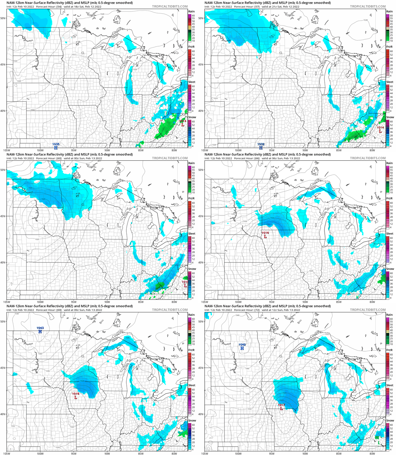
Snow amounts from the quick-moving system are expected to be fairly light, but check forecast updates this weekend.
Programming note
You can hear my live weather updates on MPR News at 7:35 a.m., 9:35 a.m. and 4:39 p.m. each Saturday and Sunday.

