
Sunday evening snow; cool and bright on Monday
Tuesday will be the warmest day this week
Go Deeper.
Create an account or log in to save stories.
Like this?
Thanks for liking this story! We have added it to a list of your favorite stories.


Snowflakes are in the forecast for much of Minnesota and parts of Wisconsin Sunday evening. Some roads could become slippery.
The National Oceanic and Atmospheric Administration’s North American Mesoscale (NAM) forecast model shows the potential precipitation pattern from 6 p.m. Sunday to 6 a.m. Monday:
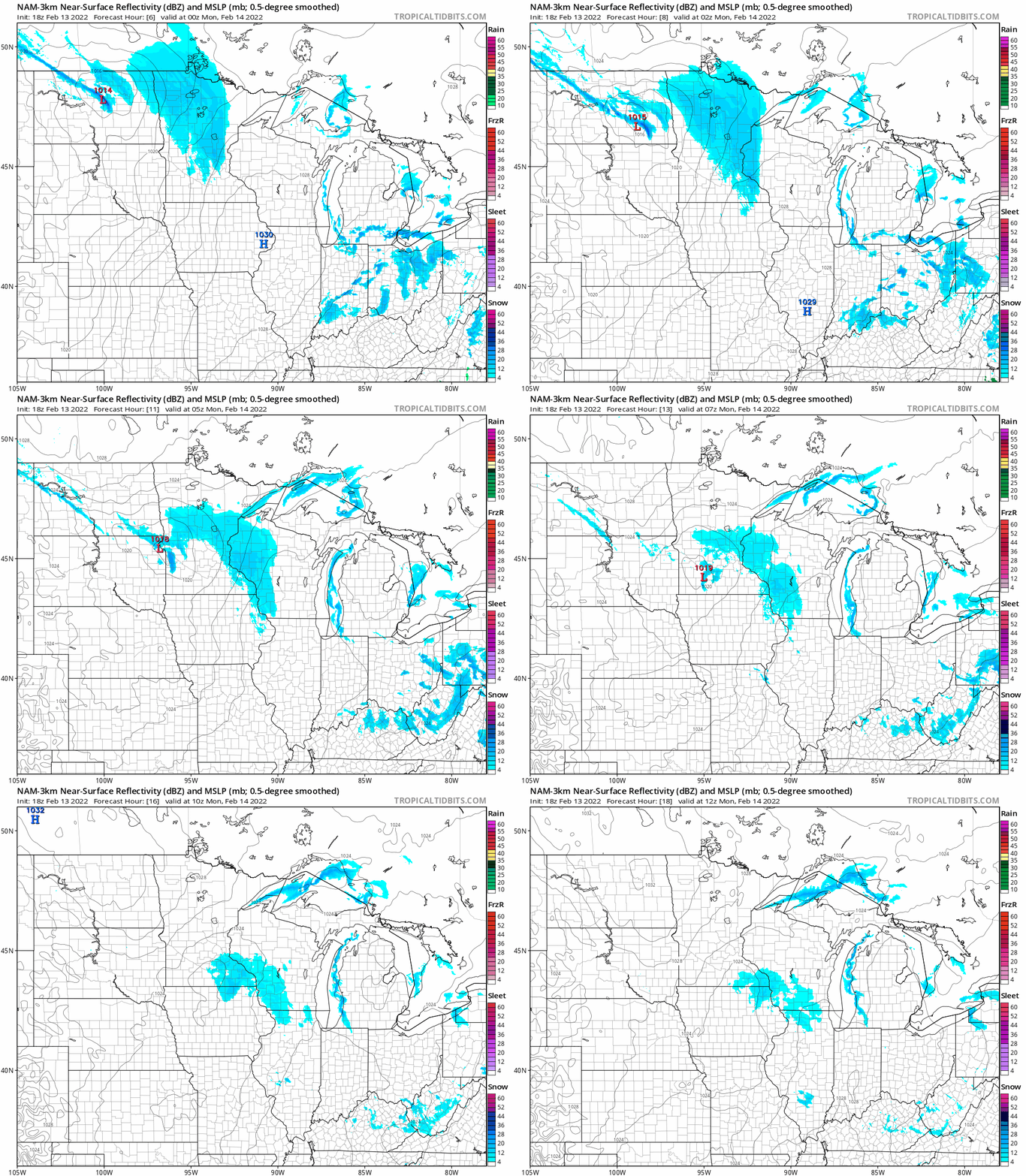
Many areas will see about one inch of snow, but there could be a few two-inch snow totals in central Minnesota. Much of the Twin Cities metro area will see snow totals of one inch or less.
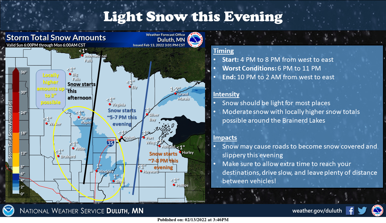
Here’s the NWS Sunday evening snow forecast for northeastern Minnesota:
Turn Up Your Support
MPR News helps you turn down the noise and build shared understanding. Turn up your support for this public resource and keep trusted journalism accessible to all.
Snow and blowing snow will cause travel problems in parts of eastern North Dakota and northwestern Minnesota Sunday evening. Winter weather advisories have been issued for those areas:

Here are details of the Sunday evening winter weather advisory:
URGENT - WINTER WEATHER MESSAGE National Weather Service Grand Forks ND 343 PM CST Sun Feb 13 2022 MNZ001-004-007-NDZ007-008-015-016-026-027-029-030-054-140600- /O.CON.KFGF.WW.Y.0018.000000T0000Z-220214T0600Z/ West Polk-Kittson-West Marshall-Cavalier-Pembina-Ramsey- Eastern Walsh-Nelson-Grand Forks-Steele-Traill-Western Walsh- Including the cities of Crookston, East Grand Forks, Hallock, Karlstad, Lancaster, Warren, Stephen, Argyle, Langdon, Cavalier, Walhalla, Drayton, Pembina, Neche, St. Thomas, Devils Lake, Grafton, Park River, Lakota, Mcville, Aneta, Tolna, Grand Forks, Finley, Hope, Mayville, Hillsboro, Hatton, Portland, Edinburg, Adams, and Lankin 343 PM CST Sun Feb 13 2022 ...WINTER WEATHER ADVISORY REMAINS IN EFFECT UNTIL MIDNIGHT CST TONIGHT... * WHAT...Snow and blowing snow creating reduced visibilities under a quarter mile at times especially in open country. Winds gusting as high as 40 mph. * WHERE...Portions of the central and northern Red River Valley. * WHEN...For the Winter Weather Advisory, until midnight CST tonight. * IMPACTS...Plan on slippery road conditions. Areas of blowing snow could significantly reduce visibility. The dangerously cold wind chills as low as 30 below zero could cause frostbite on exposed skin in as little as 10 minutes. PRECAUTIONARY/PREPAREDNESS ACTIONS... Slow down and use caution while traveling. The latest road conditions for North Dakota can be found at dot.nd.gov/travel and for Minnesota at 511mn.org, or by calling 5 1 1 in either state.
You can hear updated weather information for Minnesota and western Wisconsin on the Minnesota Public Radio News network, and you can see updated weather info on the MPR News live weather blog. Minnesota road conditions can be found here.
Temperature trends
Our average Twin Cities high temp is 28 degrees this time of year. Metro area highs will be in the upper teens on Monday. Much of Minnesota and western Wisconsin will top out in the teens Monday afternoon:
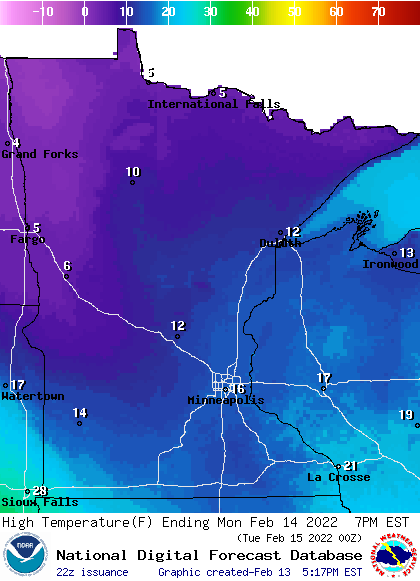
There will be some single-digit highs in far northern Minnesota on Monday.
Tuesday highs will range from 30s in far southern Minnesota to teens in the far north:
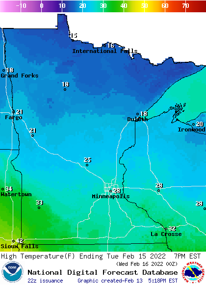
Some spots in the Twin Cities metro area will probably hit 30 degrees Tuesday afternoon.
Metro area temps could be close to 30 degrees at 1 or 2 in the morning on Wednesday, then temps will fall through the 20s during the daylight hours. Twin Cities metro area highs will then retreat to the lower teens on Thursday, before rebounding to the upper 20s on Friday.
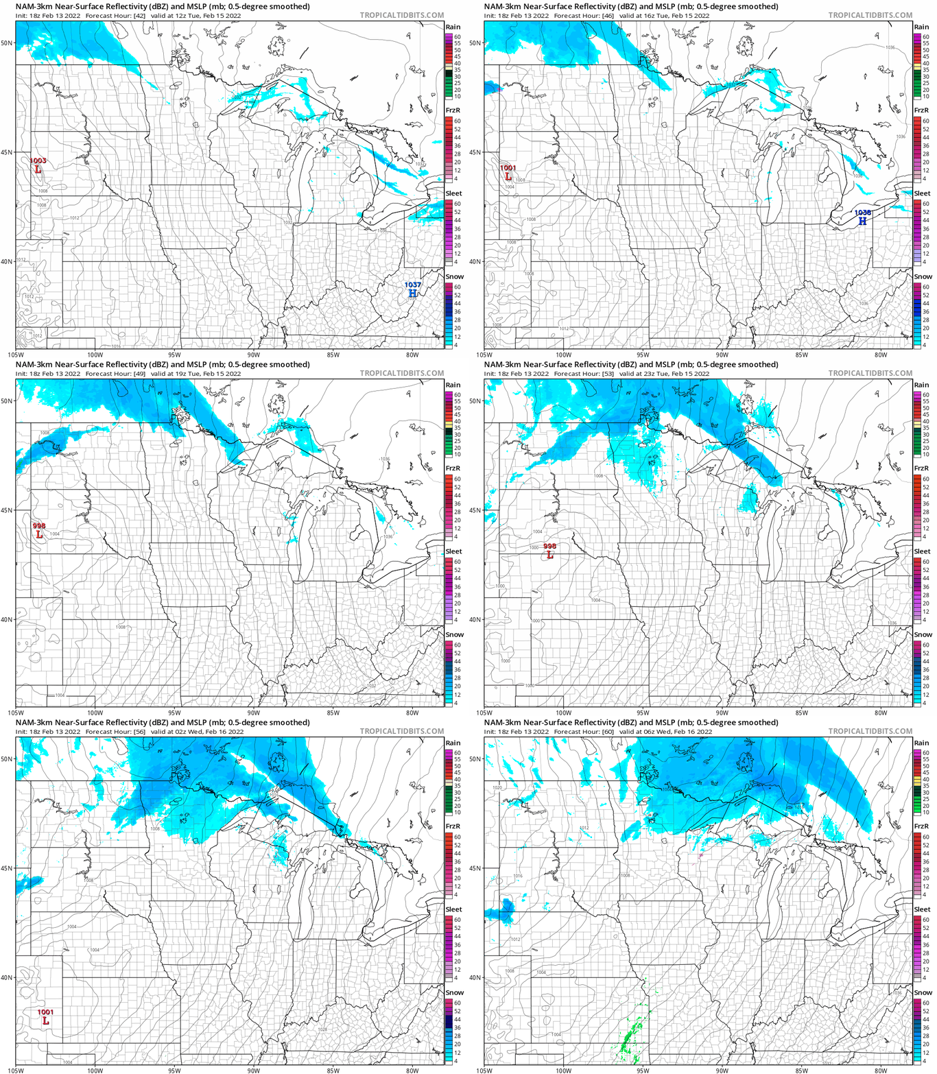
Tuesday snow north
Northern Minnesota will probably see some periods of snow Tuesday and Tuesday evening. NOAA’s NAM model shows the potential precipitation pattern for that period:
The Twin Cities metro area could see some light snow late on Friday.
Programming note
You can hear my live weather updates on MPR News at 7:35 a.m., 9:35 a.m. and 4:39 p.m. each Saturday and Sunday.

