
Cold Thursday, big warmup Sunday; snow potential early next week
Go Deeper.
Create an account or log in to save stories.
Like this?
Thanks for liking this story! We have added it to a list of your favorite stories.


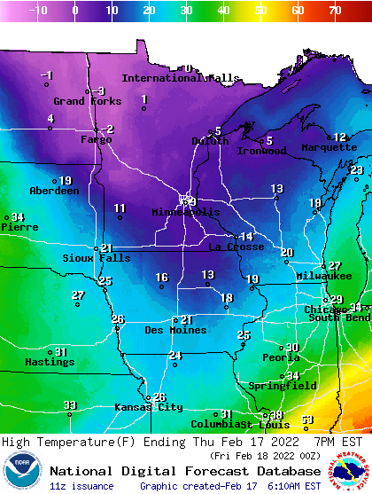
After a subzero start for most of the state Thursday, high temperatures will sit in the single digits. Expect snow showers Friday. Temps soar on Sunday, but significant snow may be on the horizon Monday and Tuesday.
Clipper sweeps in the cold
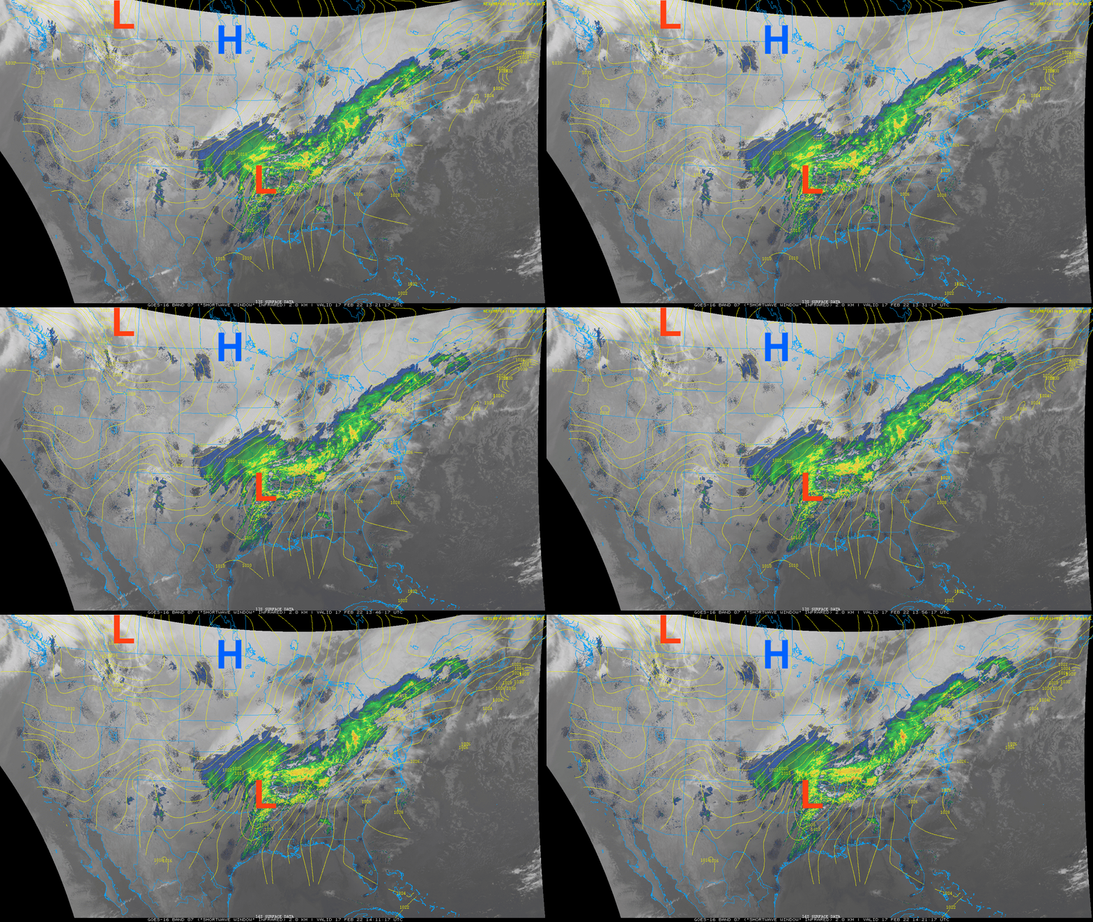
It’s a chilly Thursday, temperatures will only warm into the single digits for most of the state, even with sunshine. Portions of northwest Minnesota won’t get above zero even. Cold high pressure is giving us the sun and lighter winds.
While a big storm creates snow, ice and severe weather in the country southeast of Minnesota, we’re looking to the northwest for our next clipper system.
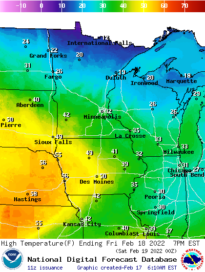
Temperatures Thursday night will initially drop below zero for most, then slowly rise overnight as that clipper system brings a wedge of warmer air for Friday.
Turn Up Your Support
MPR News helps you turn down the noise and build shared understanding. Turn up your support for this public resource and keep trusted journalism accessible to all.
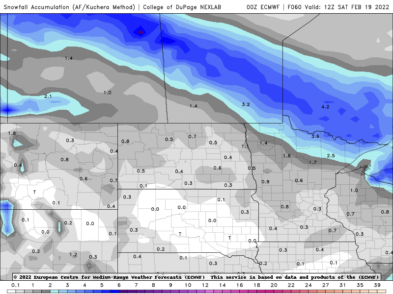
The fast-moving clipper will also bring snow showers with the bulk of the impacts in northern Minnesota as far as snow is concerned.
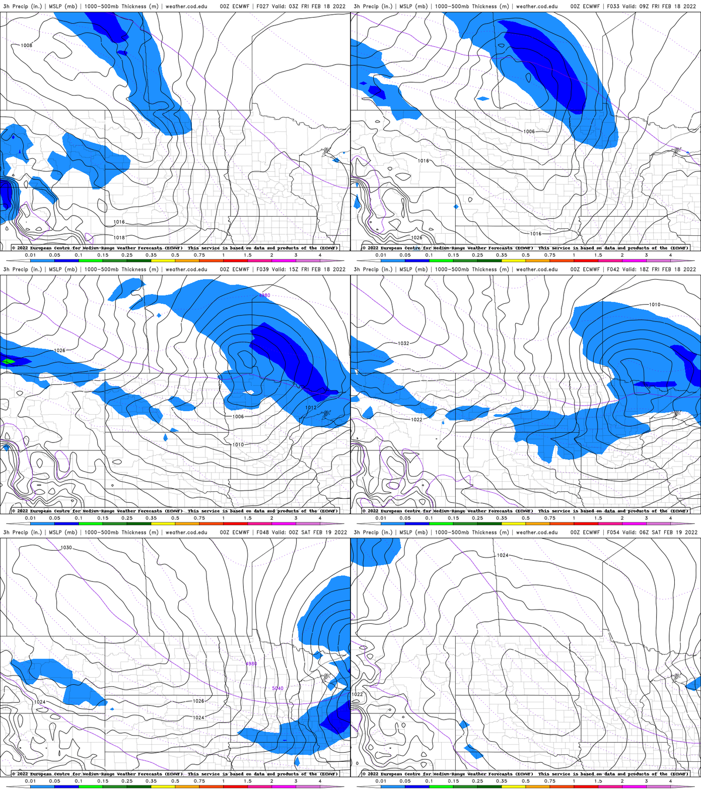
A few inches of snow will be possible mainly north of Duluth. Central and southern Minnesota can expect just a brief coating from a few snow showers early then perhaps late in the afternoon.
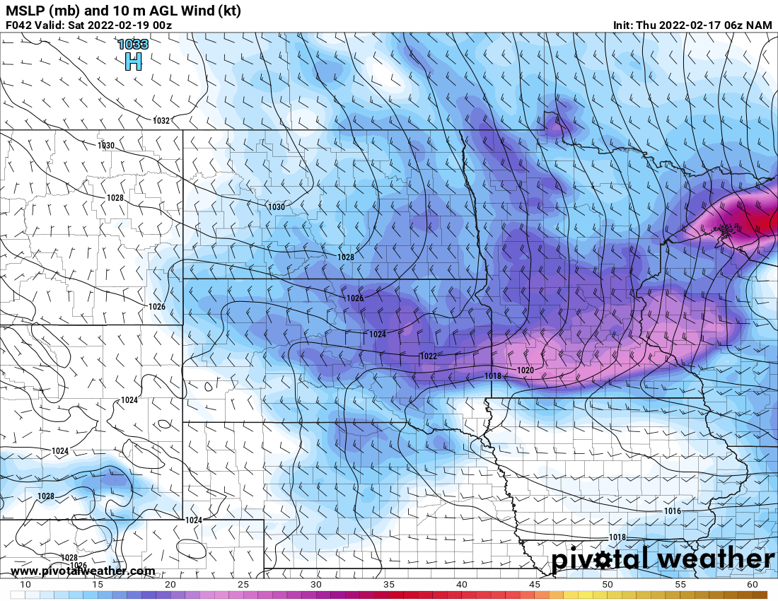
The other noticeable impact in the wake of the system will be some major wind. Wind speeds will pick up to 20-25 mph from the northwest but some areas could see gust of 45-55 mph.
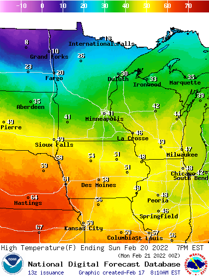
Saturday will be temporarily cooler, mainly in the 20s south and teens north but temperatures soar Sunday once again.
If you’re sick of winter, get out and enjoy Sunday because next week will be interesting. We’re really seeing a shift in the pattern the next several days that will set Minnesota up for some real snow potentially.
While there are no guarantees as of yet, the crucial ingredients for more significant snow (that has been focused south of us for several weeks) will finally move northward.
The first crucial element is the stronger southerly jet stream will be making its way farther north.
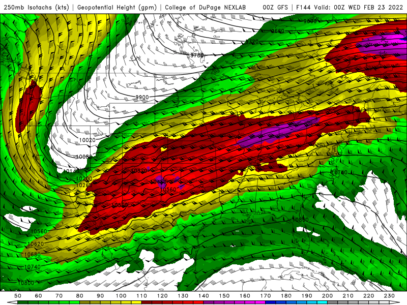
The jet stream is the main storm track but also allows us to ride the crucial cold-warm air boundary. At the same time, moisture will be surging north from the Gulf of Mexico early next week.
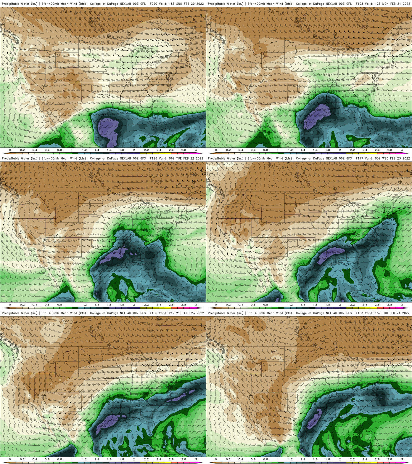
The combination of these factors, if timed just right, and if we’re in line with the storm track, will create significant snowfall, likely in a couple different waves Monday and Tuesday.
While we can’t pinpoint totals to specific places just yet, somewhere in the neighborhood will get some good snow. That moisture is much needed right now as well.
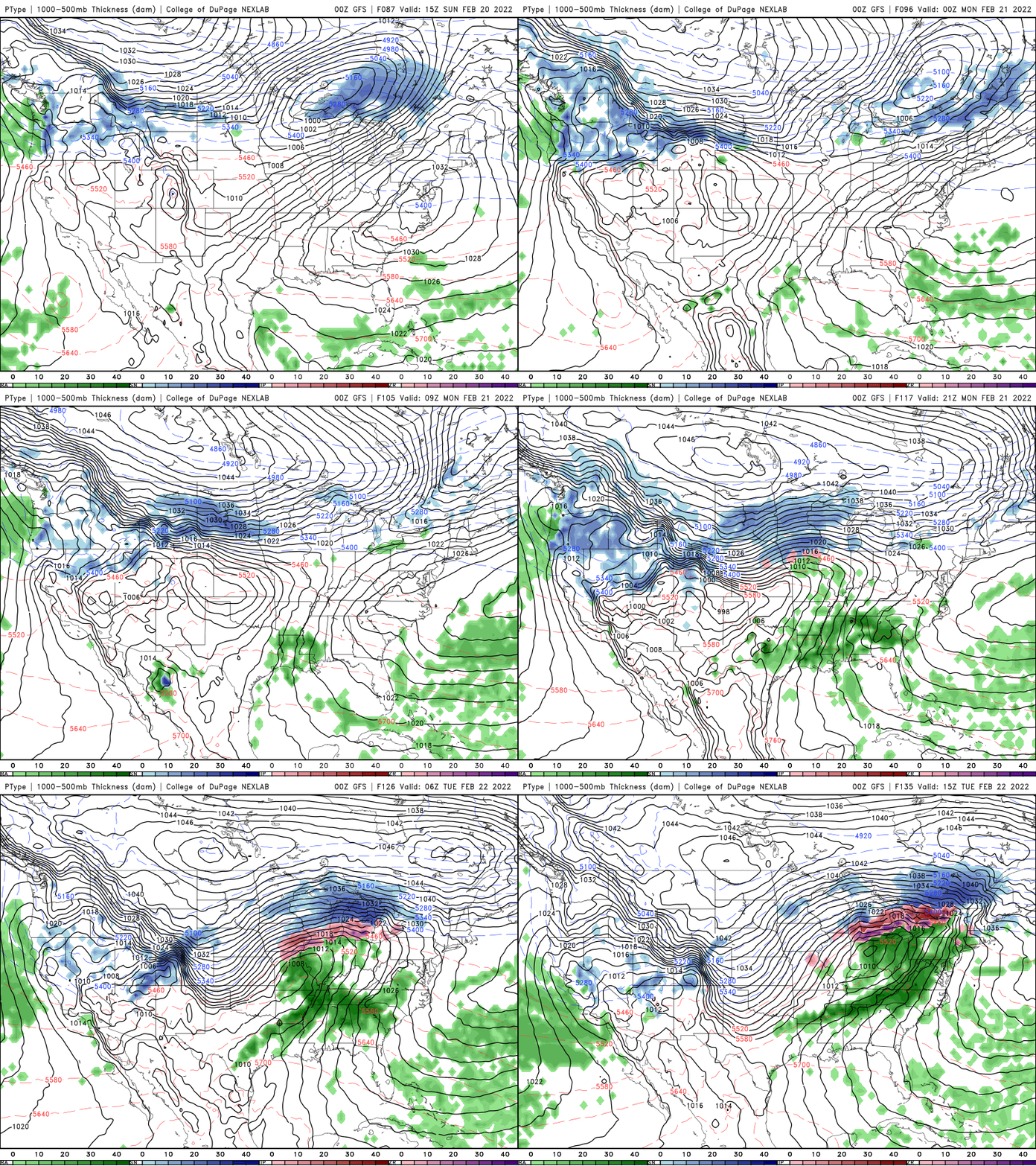
Stay tuned as this situation develops over the coming days we’ll have a much better idea of what to expect.

