
Weekend weather: 20s, 30s Saturday; 40s Sunday in southern Minnesota
Friday wind and snow
Go Deeper.
Create an account or log in to save stories.
Like this?
Thanks for liking this story! We have added it to a list of your favorite stories.


Twin Cities metro area highs are expected to reach the upper 20s Saturday. Our average Feb. 19 high temp in the Twin Cities is 30 degrees.
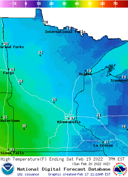
Many areas will have Saturday highs in the 20s, with some 30s in southwestern Minnesota and teens in far northeastern Minnesota:
Saturday wind gusts will be over 20 mph in western Minnesota, with lighter winds to the east:
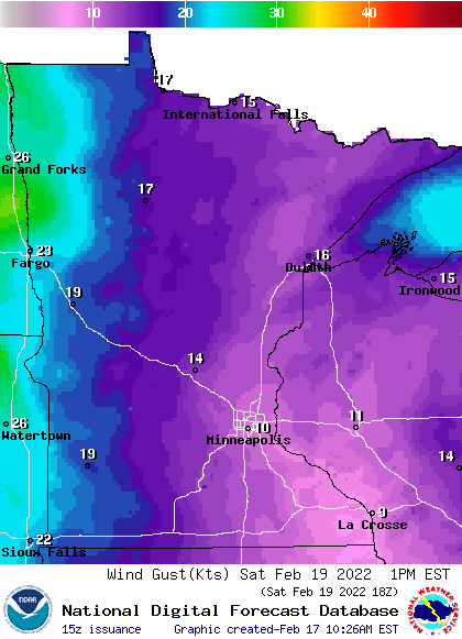
Forecast gusts are in knots, with 13 knots equal to 15 mph.
Turn Up Your Support
MPR News helps you turn down the noise and build shared understanding. Turn up your support for this public resource and keep trusted journalism accessible to all.
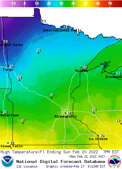
Sunday will be the warmest day of the weekend in most areas, with highs reaching the 30s in central Minnesota and lower 40s in the south:
Sunday wind gusts will be over 20 mph in western Minnesota, with gusts in the teens to the east.
Storm watch set for NW Minn. overnight into Friday
Northwestern Minnesota and eastern North Dakota could see blizzard conditions late Thursday night into Friday as a low-pressure system spreads snow and strong winds. A winter storm watch (shaded blue) runs from midnight Thursday to 6 p.m. Friday:

Here are details of the winter storm watch in northwestern Minnesota:
Block Quote
URGENT - WINTER WEATHER MESSAGE National Weather Service Grand Forks ND 1021 AM CST Thu Feb 17 2022 MNZ003-022-027-029-030-040-NDZ038-039-049-052-053-190000- /O.CON.KFGF.WS.A.0005.220218T0600Z-220219T0000Z/ Clay-Mahnomen-West Becker-Wilkin-West Otter Tail-Grant-Barnes- Cass-Ransom-Sargent-Richland- Including the cities of Moorhead, Mahnomen, Naytahwaush, Waubun, Detroit Lakes, Breckenridge, Fergus Falls, Elbow Lake, Hoffman, Ashby, Herman, Barrett, Valley City, Fargo, Lisbon, Enderlin, Gwinner, Milnor, Forman, Rutland, and Wahpeton 1021 AM CST Thu Feb 17 2022 ...WINTER STORM WATCH REMAINS IN EFFECT FROM LATE TONIGHT THROUGH FRIDAY AFTERNOON... * WHAT...Blizzard conditions possible. Total snow accumulations of up to one inch possible. Winds could gust as high as 60 mph. * WHERE...Portions of northwest and west central Minnesota and southeast North Dakota. * WHEN...From late tonight through Friday afternoon. * IMPACTS...Plan on slippery road conditions. Widespread blowing snow could significantly reduce the visibility. The hazardous conditions could impact the Friday morning and evening commutes.
Here are projected snow amounts and wind gusts for Friday:

You can hear updated weather information for Minnesota and western Wisconsin on the Minnesota Public Radio News network, and you can see updated weather info on the MPR News live weather blog. Minnesota road conditions can be found here.
Saturday night snow chance in the north
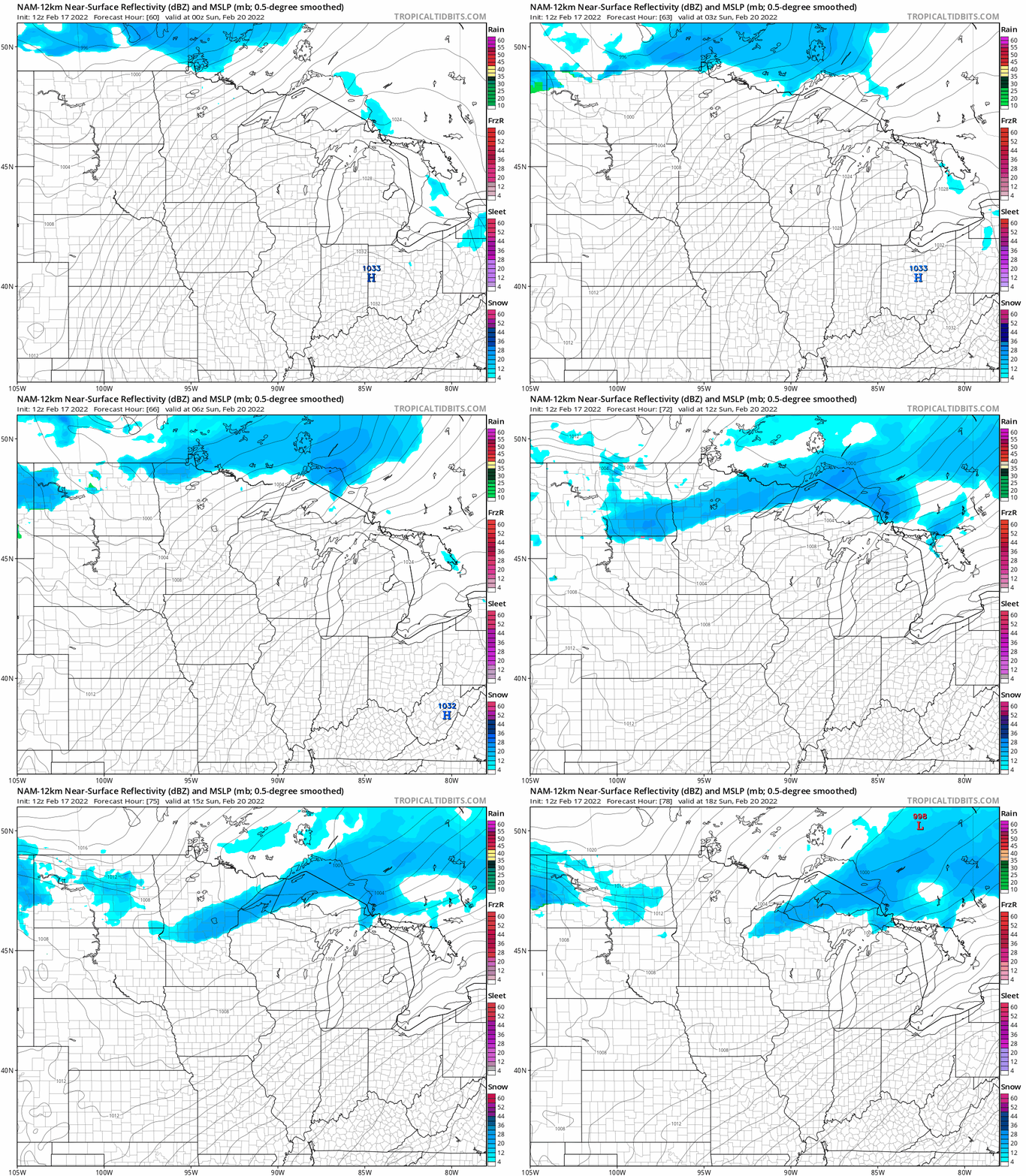
Northern Minnesota and parts of central Minnesota and northwestern Wisconsin could see some periods of snow Saturday night into early Sunday morning.
The National Oceanic and Atmospheric Administration’s North American Mesoscale (NAM) forecast model shows the potential precipitation pattern from 6 p.m. Saturday to noon on Sunday:
Programming note
You can hear my live weather updates on MPR News at 7:35 a.m., 9:35 a.m. and 4:39 p.m. each Saturday and Sunday.

