
First round of snow winds down, second round develops
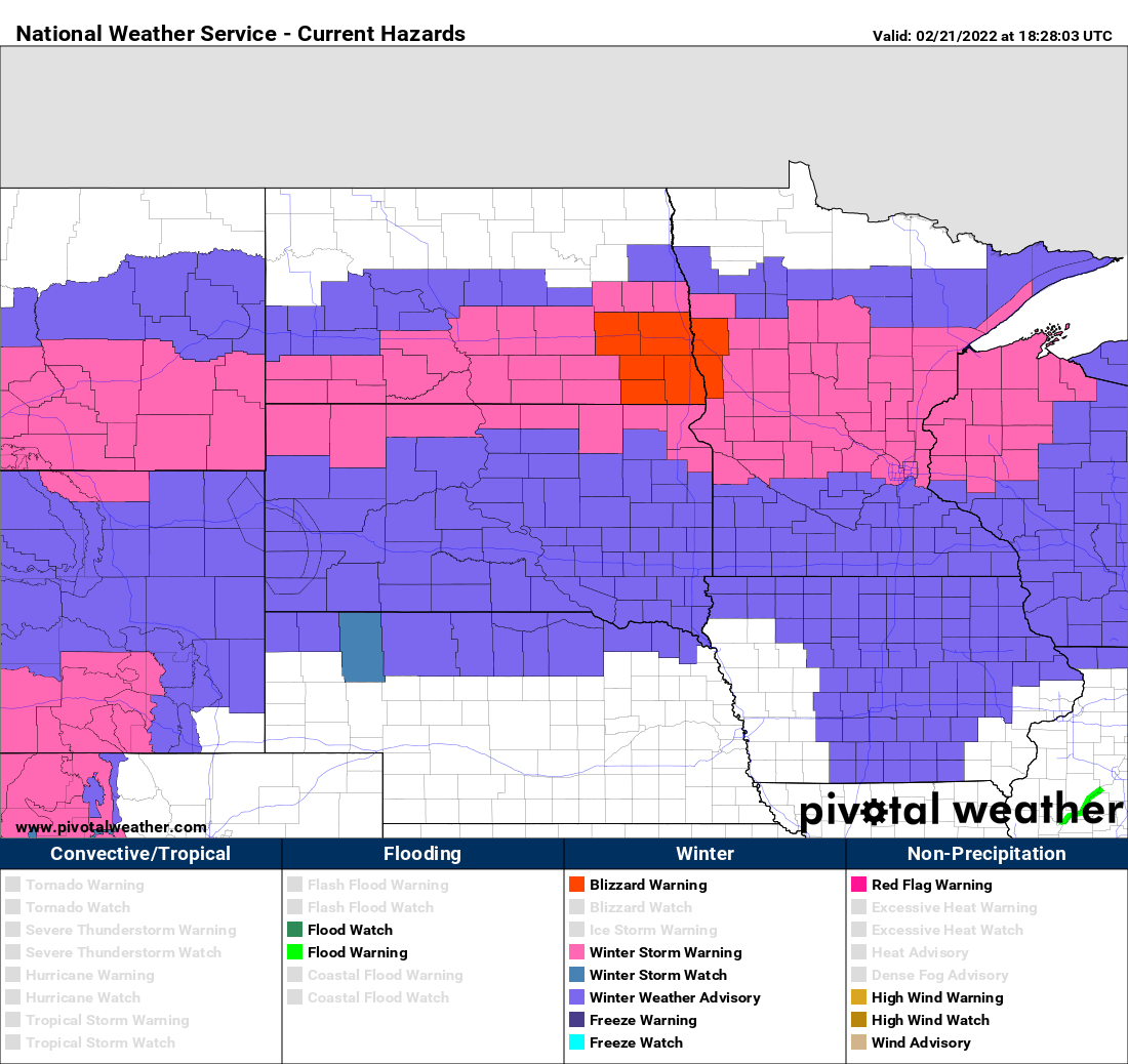
Go Deeper.
Create an account or log in to save stories.
Like this?
Thanks for liking this story! We have added it to a list of your favorite stories.


While the Twin Cities has had hardly a flake, snow fell through the day across central Minnesota and over Lake Superior. A few places have already reported 7 inches so far: Long Prairie, and McGrath. Over along the south shore in northern Wisconsin, Washburn has reported a staggering 19 inches thus far with the combination of the storm and major lake enhancement.
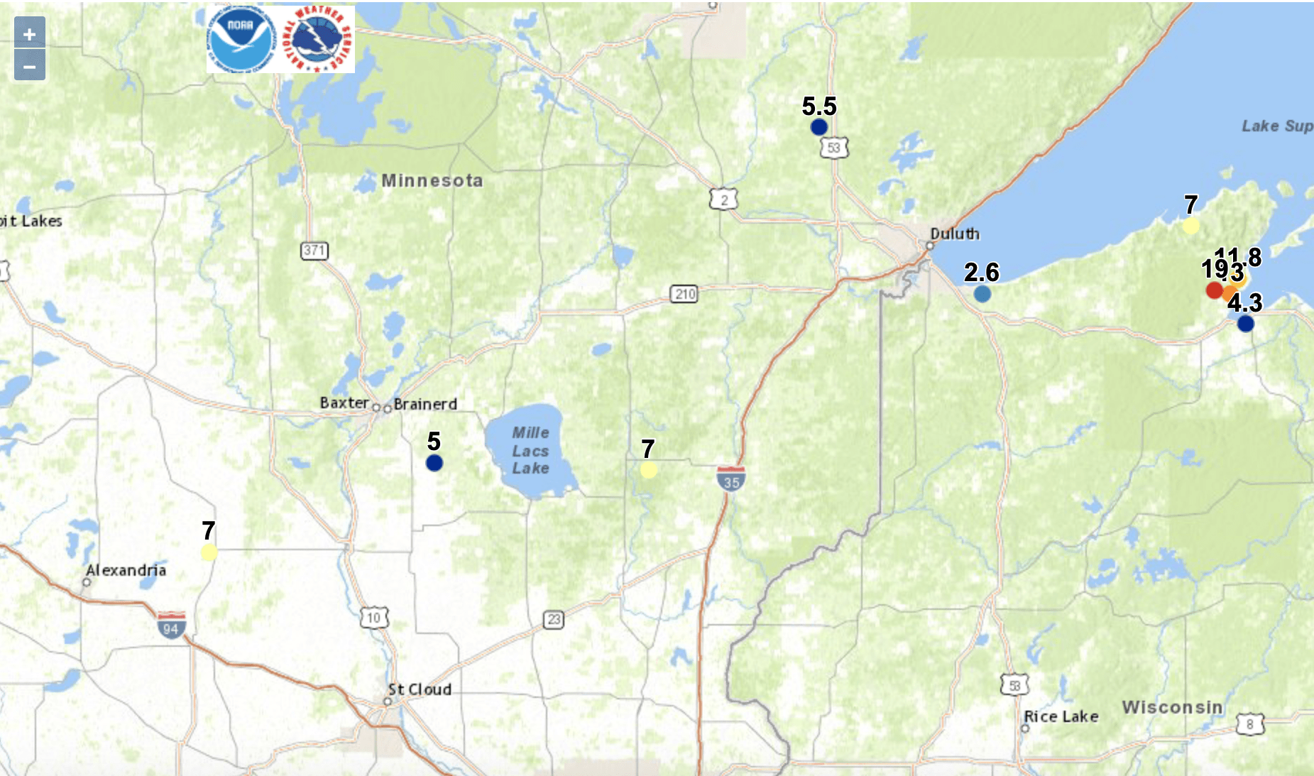
We’ll see the first round of snow lighten up, though near Lake Superior lake enhanced snow showers will continue.
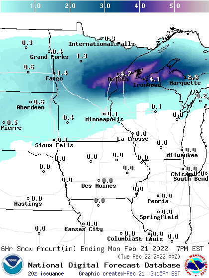
The second round of snow will move in late tonight/early Tuesday and cause more widespread snowfall accumulations Tuesday.

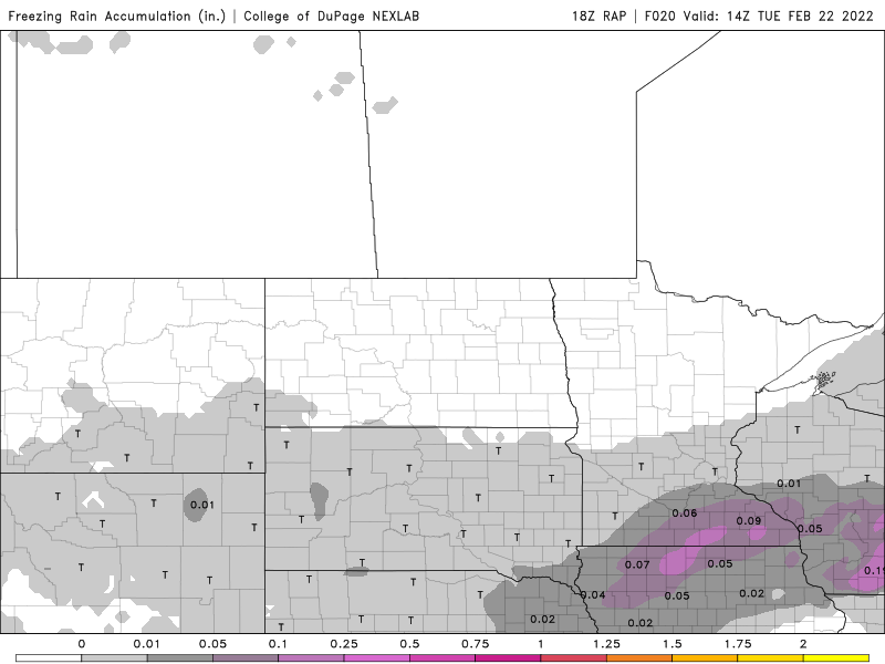
Light freezing rain/wintry mix is possible in southeastern Minnesota. Warmer air aloft is being pulled into the storm system over subfreezing temperatures at the surface.
Turn Up Your Support
MPR News helps you turn down the noise and build shared understanding. Turn up your support for this public resource and keep trusted journalism accessible to all.
We’ll see overnight lows drop as a tight temperature gradient tightens more as arctic air attempts to push farther south and east.
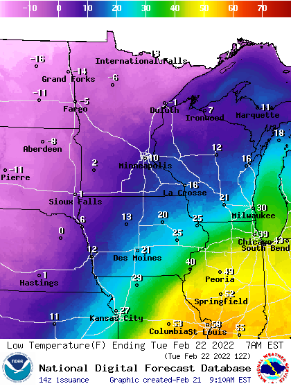
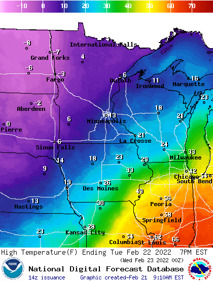
Snow will be heaviest during the morning and midday for most on Tuesday, tapering off late in the afternoon/evening slowly. The evening commute could be rough in the Twin Cities as temperatures will be just below the optimal temperature for salt to work.
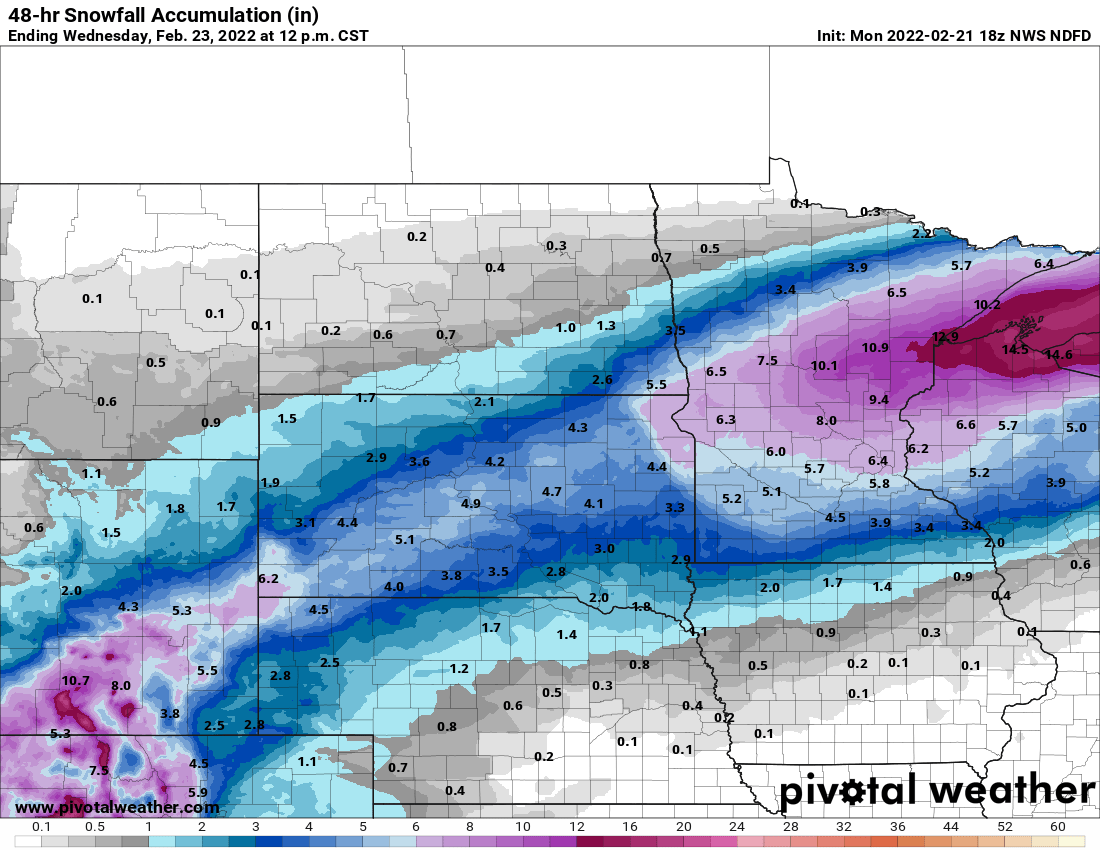
In total over the two days, we’re still looking at the most significant totals in north central Minnesota into northern Wisconsin. These are totals in addition to what they saw earlier Monday. Some places will end up with 12 to 18 inches. Most of the totals for southern Minnesota will come during the day Tuesday.
Beyond that, it’s a chilly week with temperatures of 10 to 25 degrees colder than the normal. We’ll be below zero most mornings Wednesday into Saturday.


