
Snow showers arrive early afternoon in Twin Cities; warming trend next week
Go Deeper.
Create an account or log in to save stories.
Like this?
Thanks for liking this story! We have added it to a list of your favorite stories.


Updated: 9:30 a.m.
Clear skies overnight led to another cold morning with most of Minnesota below zero. Now, clouds will quickly increase through the morning as we are clipped by a larger storm system to the south.
Expect snow showers to spread into southern Minnesota by mid to late morning Thursday, reaching the Twin Cities by around 1 p.m. to 2 pm.
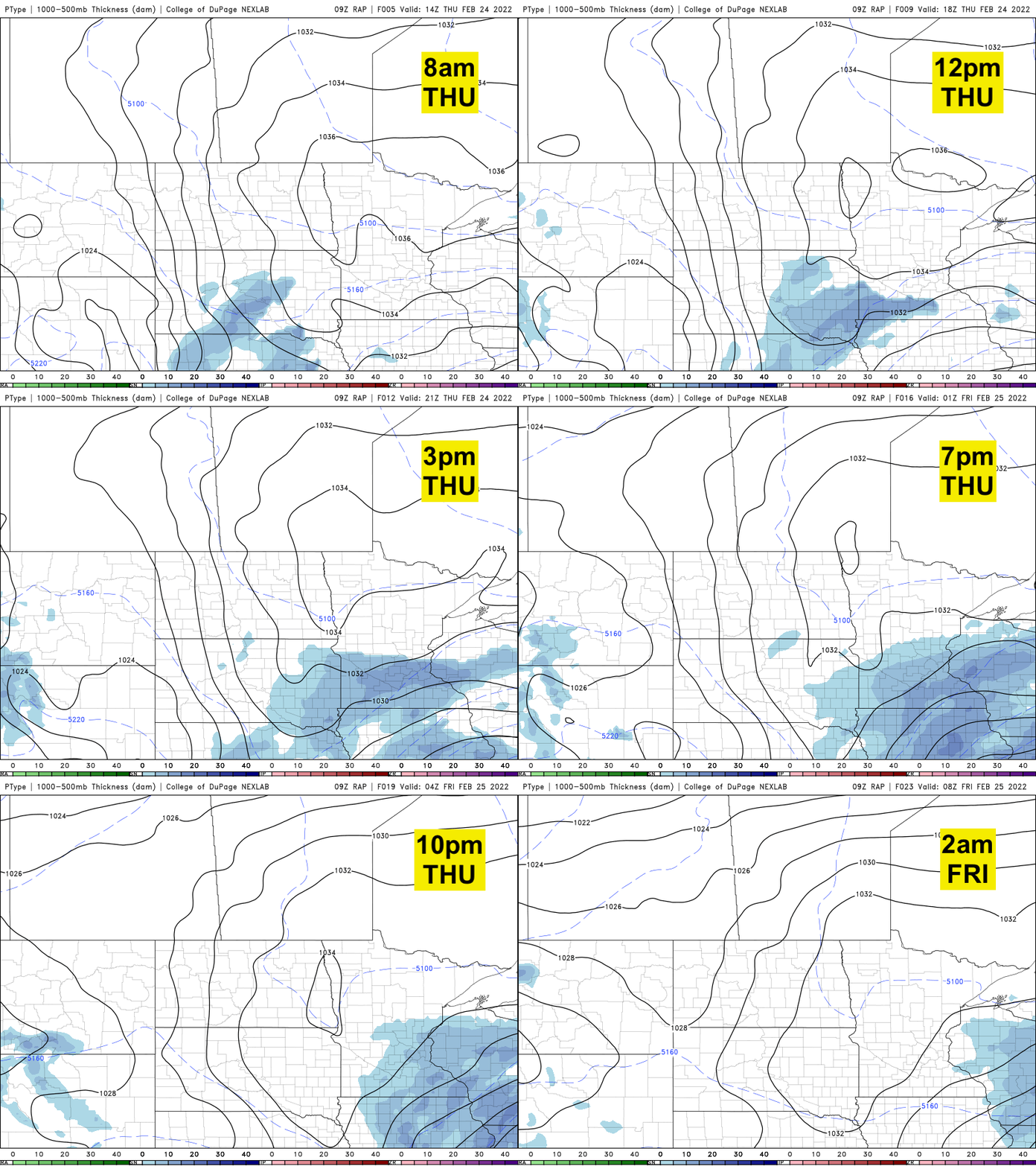
We’ll have snow showers through the evening with about 1-2 inches in the Twin Cities and parts of southeastern Minnesota receiving 3 to 4 inches.

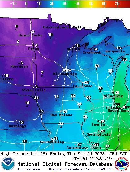
High temperatures Thursday afternoon will be nearly 20 degrees colder than normal once again, in the teens south and single digits north.
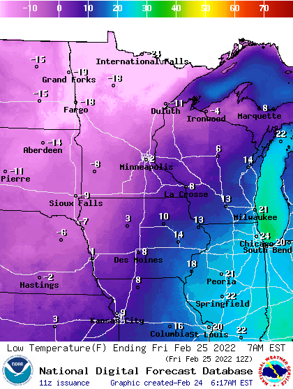
It’ll be another cold night Thursday night into early Friday, though the Twin Cities and much of southeast Minnesota will stay above zero while western and northern Minnesota again, drop below zero.
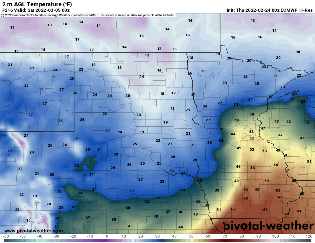
We’ll be back in the teens Friday but we warm up quickly in time for the weekend. Highs should be in the low to mid-30s both Saturday and Sunday making for a great weekend to enjoy that fresh snow because next week it will be messy as we warm up even more.
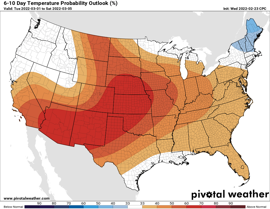
The Climate Prediction Center forecasts above normal temperatures for Minnesota in the six- to 10-day outlook. The European Centre for Medium-Range Weather Forecasts model expects our first 50 before next week’s end. The Canadian model also gets us very close.
Turn Up Your Support
MPR News helps you turn down the noise and build shared understanding. Turn up your support for this public resource and keep trusted journalism accessible to all.

