
Warmer temps this weekend; spring flooding outlook updated
Chilly overnight and Friday
Go Deeper.
Create an account or log in to save stories.
Like this?
Thanks for liking this story! We have added it to a list of your favorite stories.


Snow will linger Thursday evening in roughly the southern half of Minnesota, plus much of Wisconsin. Final accumulations of 1 to 2 inches are expected in the the Twin Cities metro area, with 2 to 3 inches in parts of southeastern Minnesota and southwestern Wisconsin.
Updated Minnesota road conditions can be found here. Wisconsin road conditions can be found here.
Temperature trends
Friday morning low temps are expected to range from 20s and 30s below zero in far northern Minnesota to single digits above zero in the Twin Cities and southeastern Minnesota. A wind chill advisory continues into Friday morning for most of the northern third of Minnesota.
You can hear updated weather information for Minnesota and western Wisconsin on the Minnesota Public Radio News network, and you can see updated weather info on the MPR News live weather blog. Minnesota road conditions can be found here.
Turn Up Your Support
MPR News helps you turn down the noise and build shared understanding. Turn up your support for this public resource and keep trusted journalism accessible to all.
Friday highs will be mainly in the teens:
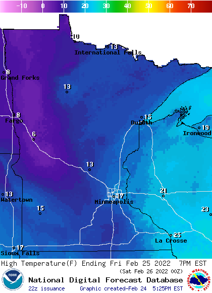
Some spots in far northwestern Minnesota will see highs in the single digits.
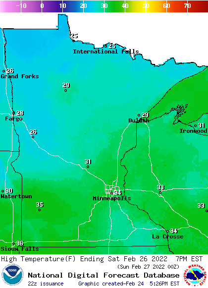
Saturday highs reach the 30s in central and southern Minnesota, with 20s to the north:
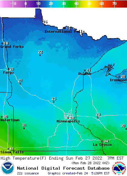
Sunday highs will be mainly in the 20s, with teens in far northern Minnesota and some 30s in the southwest:
Spring flood outlooks updated

The National Weather Service has updated the spring flood outlooks. Many locations along rivers in central and southern Minnesota have a near-normal chance of flooding due to spring snowmelt:
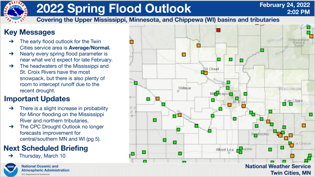
According to the NWS:
The 2022 spring flood outlook for the upper Mississippi, Minnesota and Chippewa (WI) river basins is generally average, or near normal. For a change, most known parameters leading to the snowmelt season are very close to what we would typically see in mid-February. Soil moisture is just slightly below normal, frost depth and snowpack are very close to normal. The lone exception is a slightly higher than normal snowpack in the Mississippi river headwaters, but not enough to warrant more than normal concern.
Chances for specific locations to exceed flood stages can be found here.
Here’s the updated spring flood outlook along the Red River in northwestern Minnesota and eastern North Dakota:

The NWS spring flood outlooks will be updated on March 10.
Programming note
You can hear my live weather updates on MPR News at 7:35 a.m., 9:35 a.m. and 4:39 p.m. each Saturday and Sunday.

