
A bright and breezy Saturday; mild weekend temps
Chance for flakes Saturday night in far northern Minnesota
Go Deeper.
Create an account or log in to save stories.
Like this?
Thanks for liking this story! We have added it to a list of your favorite stories.


Friday’s high temperature was just 18 degrees at Minneapolis-St. Paul International Airport. We’re shooting for metro area highs in the low to mid-30s Saturday afternoon.
Most of the southern half of Minnesota will have Saturday highs in the 30s, with mainly 20s to the north. A few spots near Duluth could touch 30. Winds could gust over 25 mph at times Saturday afternoon.
Flakes possible Saturday night in far north
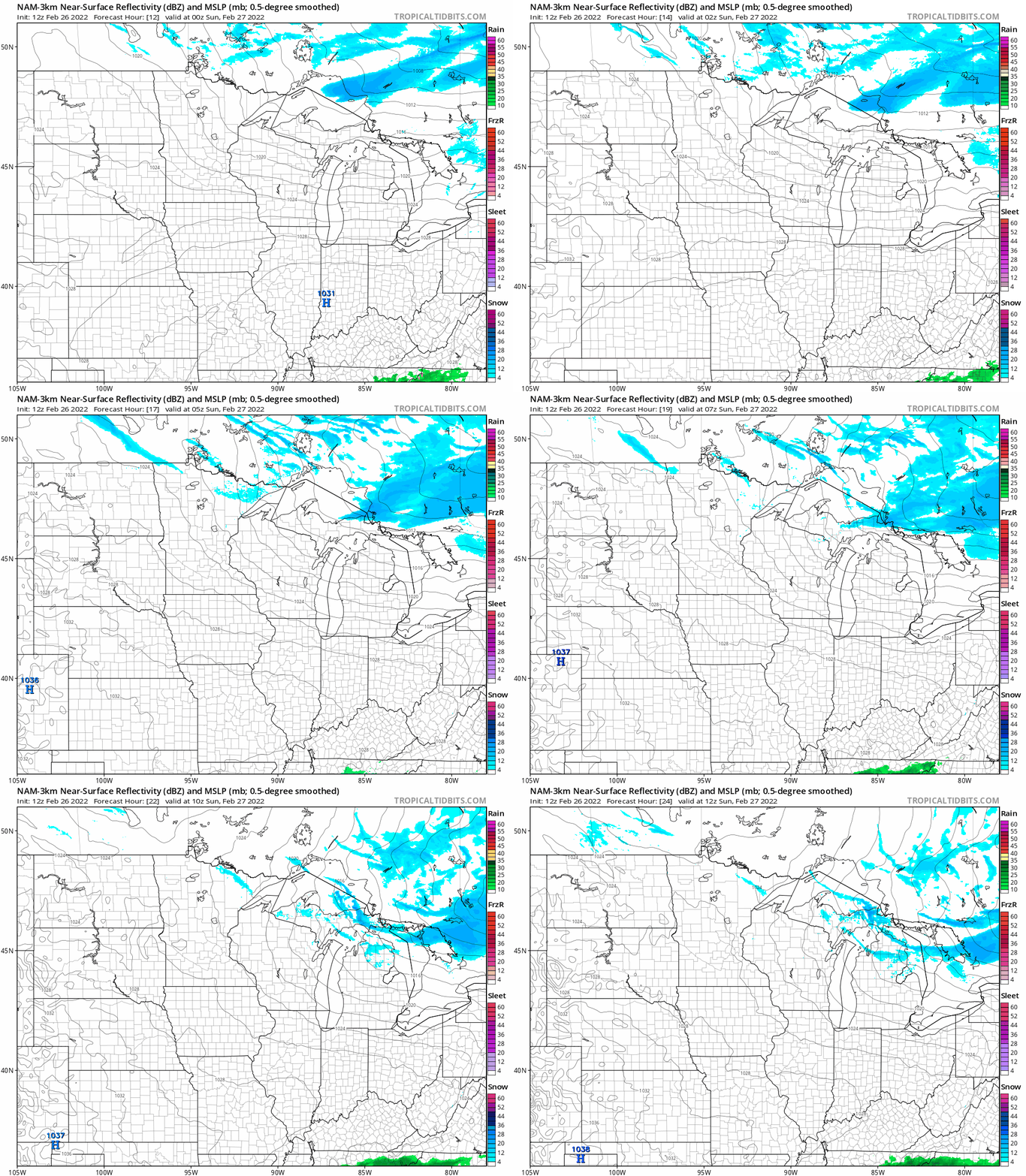
Far northwestern Minnesota could see a light snow shower late Saturday afternoon. The northern third or so of Minnesota will have a chance of scattered light snow showers Saturday evening and overnight.
The National Oceanic and Atmospheric Administration’s North American Mesoscale (NAM) forecast model shows the potential precipitation pattern from 6 p.m. Saturday to 6 a.m. Sunday:
Turn Up Your Support
MPR News helps you turn down the noise and build shared understanding. Turn up your support for this public resource and keep trusted journalism accessible to all.
You can hear updated weather information for Minnesota and western Wisconsin on the Minnesota Public Radio News network, and you can see updated weather info on the MPR News live weather blog.
Temperature trends
Sunday highs will be mainly in the 20s, with 30s in far southern Minnesota and some teens in the far north:
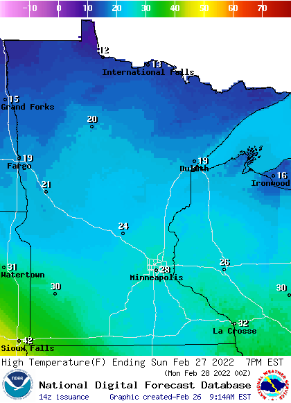
Some spots in the Twin Cities metro area could touch 30. Our average Twin Cities high is 33 degrees this time of year.
Twin Cities metro area highs are projected to reach the mid-30s Monday and Tuesday, followed by lower 30s Wednesday, upper 20s Thursday and lower 30s on Friday.
We could see some passing snow showers late Monday and also Tuesday afternoon and evening. One forecast model gives us a chance of a rain-snow mix Friday afternoon and evening, check forecast updates this week.
Snow update

If your weekend plans include cross-country skiing, sledding or snowboarding, there’s ample snow on the ground across most of Minnesota right now.
The latest snow depth map from the Minnesota State Climatology Office shows 12 inches or more of snow in roughly the northern half of Minnesota, with 2 feet or more of snow cover in much of north-central and northeastern Minnesota:

The map was compiled Thursday morning, so it does not include the inch or 2 of snow that fell in southern Minnesota Thursday afternoon and evening. Southwestern Minnesota now has some snow cover.
The official Twin Cities snow depth, measured at the Minneapolis-St. Paul International Airport, is 8 inches right now.
March snow?
The beginning of March is just a few days away. Our average snow total for the entire month of March is 8.2 inches in the Twin Cities.
Over the past eight years, we’ve seen more than 8.2 inches for the month of March just twice, in 2018 and 2019:

We had just 4 inches of snow in the Twin Cities last March, and just 1.3 inches in March of 2020.
Programming note
You can hear my live weather updates on MPR News at 7:35 a.m., 9:35 a.m. and 4:39 p.m. each Saturday and Sunday.

