
Lighter winds on Sunday; mild temps will linger several days
Go Deeper.
Create an account or log in to save stories.
Like this?
Thanks for liking this story! We have added it to a list of your favorite stories.


The Saturday high temp at Minneapolis-St. Paul International Airport was 36 degrees, which is 3 degrees warmer than our average Twin Cities high on Feb. 26. Much of Minnesota and western Wisconsin had Saturday highs in the 30s, with some 20s over northwestern and north-central Minnesota.
It was a breezy Saturday afternoon; the satellite loop even captured the movement of Lake Superior ice:
Our winds will be much lighter on Sunday.
Temperature trends
Turn Up Your Support
MPR News helps you turn down the noise and build shared understanding. Turn up your support for this public resource and keep trusted journalism accessible to all.
Sunday highs will reach the 30s across the Twin Cities, southern Minnesota and parts of western Wisconsin:
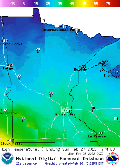
Northern Minnesota will have mainly 20s, with a few teens in the far north.
Monday highs will be in the 20s to the north, with mainly 30s south:
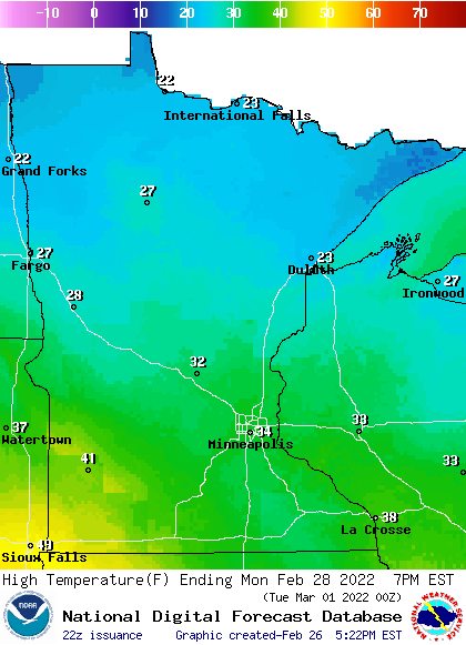
Some spots in southwestern Minnesota will reach the 40s Monday afternoon.
Twin Cities metro area highs are projected to reach the mid 30s on Monday and Tuesday, followed by lower 30s Wednesday, upper 20s Thursday and lower 30s on Friday.
Snow chances favor the north
Roughly the northern third of Minnesota will have a chance of scattered light snow showers or flurries overnight Saturday night.
A low pressure system could bring periods of light snow to northern Minnesota and parts of northwestern Wisconsin Monday and Monday night. The National Oceanic and Atmospheric Administration’s North American Mesoscale (NAM) forecast model shows the potential precipitation pattern from 3 a.m. Monday to 3 a.m. Tuesday:
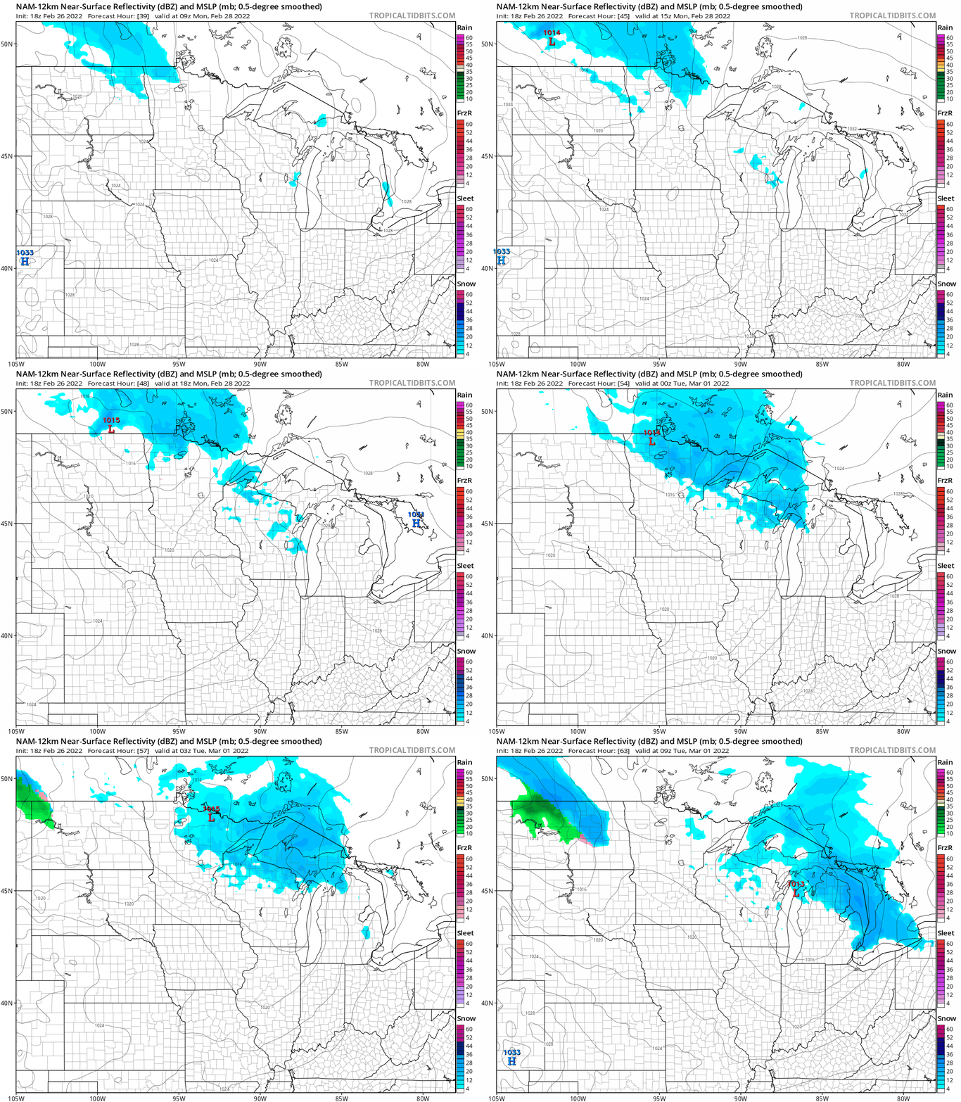
A second low pressure system may follow a similar track Tuesday afternoon into early Wednesday, with snow chances again favoring northern Minnesota.
You can hear updated weather information for Minnesota and western Wisconsin on the Minnesota Public Radio News network, and you can see updated weather info on the MPR News live weather blog.
Spring warmup timeline

Tuesday is March 1, which is the beginning of meteorological spring. Our temps take an impressive upward surge over the next few months. Let’s look at our average high temp in the Twin Cities:
At the end of February: 34 degrees
At the end of March: 49 Degrees
At the end of April: 63 degrees
At the end of May: 74 degrees
That’s a 40 degree change in our Twin Cities average high temp over the next three months!
Programming note
You can hear my live weather updates on MPR News at 7:35 a.m., 9:35 a.m. and 4:39 p.m. each Saturday and Sunday.

