
Mostly mild week; clippers set to sweep central, northern Minnesota
Go Deeper.
Create an account or log in to save stories.
Like this?
Thanks for liking this story! We have added it to a list of your favorite stories.


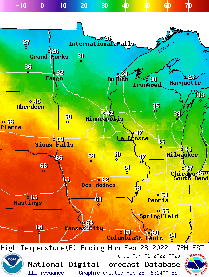
A mild Monday is on the way with highs in the low 40s in the Twin Cities and even 50s for portions of southwestern Minnesota. Northeastern Minnesota will be in the 20s as light snow showers move through. A Friday night snowstorm is possible but it’s still too soon to forecast.
Jet stream churns
It’s our last day of February and our last day of meteorological winter! February’s been another colder than normal month but we’re ending it on a rather mild note. We’ll see highs Monday in the low 40s in the Twin Cities and widespread 40s with even a few 50s in southern Minnesota.
The week overall will be rather mild as we’re in a zonal (west to east) Pacific flow. That also means the jet stream is roaring overhead, bringing every minor disturbance through every 24 to 36 hours.
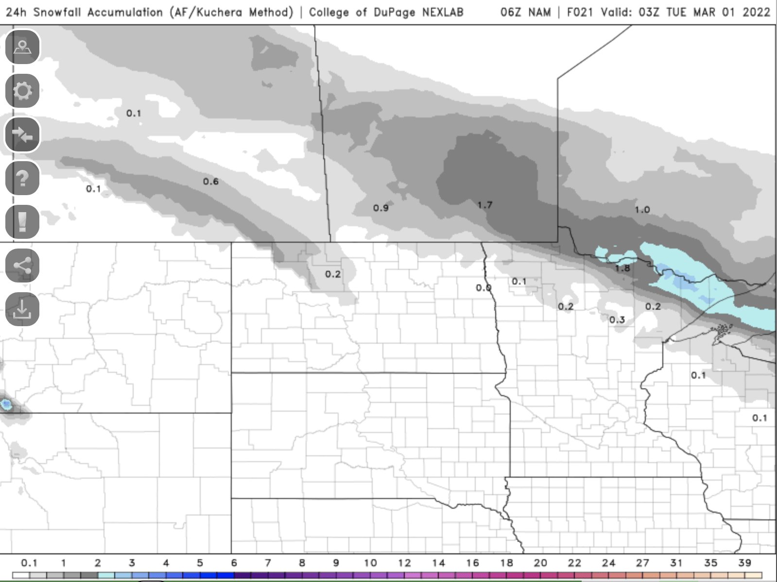
The first of three clippers moves through Minnesota Monday keeping northern Minnesota cooler and cloudier with a fresh coating of snow in northeastern Minnesota; up to 1 to 2 inches.
Turn Up Your Support
MPR News helps you turn down the noise and build shared understanding. Turn up your support for this public resource and keep trusted journalism accessible to all.
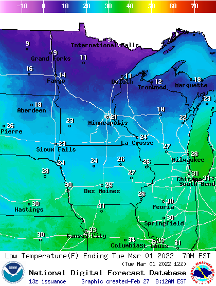
Overnight Monday night into early Tuesday, temperatures will dip below freezing again so watch out for refreeze.
Tuesday will be central Minnesota’s turn as the second clipper flies through. We’ll see the chance for some freezing drizzle and wintry mix in the hours before dawn and some morning snow showers.
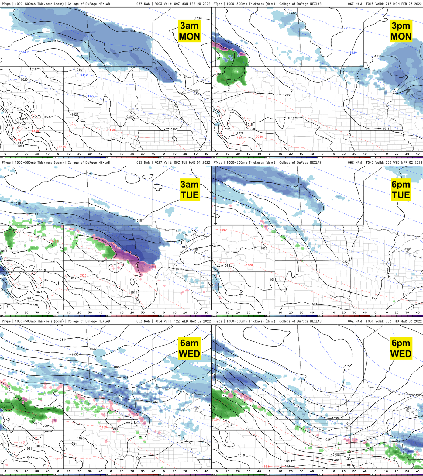
The models are mixed on just how much precipitation will fall Tuesday as it will be very narrow, and quick. There’s a potential for a coating of snow, especially farther west, up Interstate 94 west of St. Cloud.
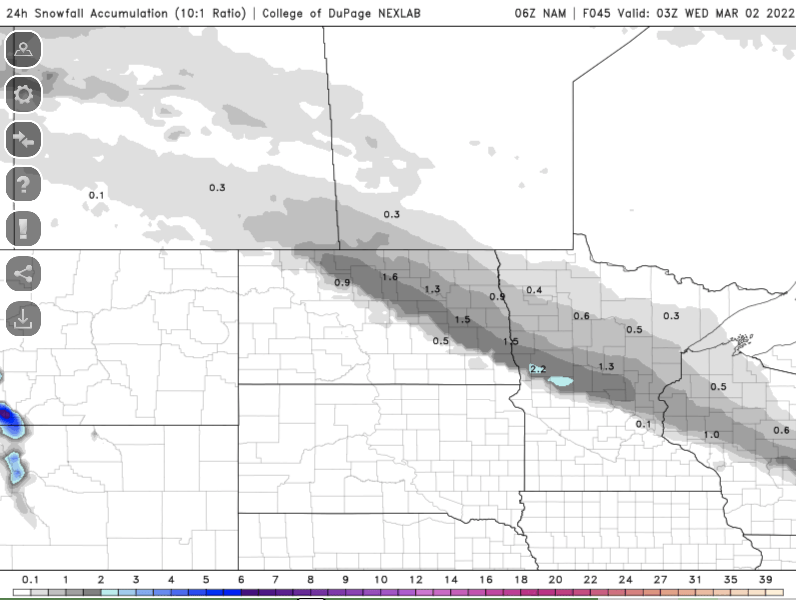
After that possibility of Tuesday morning precipitation, it will be another relatively mild afternoon.
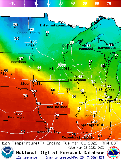
A third clipper comes through Wednesday bringing another possibility of a coating of snowfall but again, fairly minor.
The bigger focus this week will start to be a larger storm Friday night into Saturday. Significant moisture will surge north out of Texas and the Gulf of Mexico toward Minnesota late Friday.
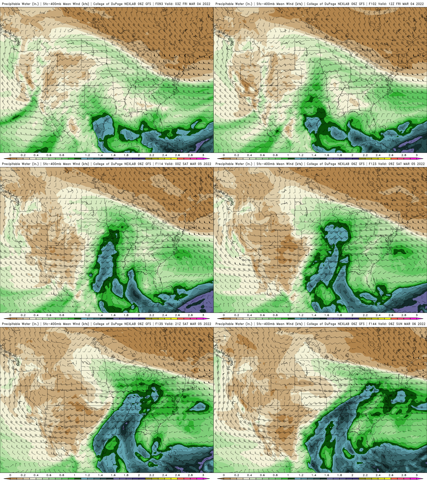
It’s way too early to try to decipher snow totals at this point since not only is the track set yet but also we’ll be dealing with lots of warm air. This means that southern Minnesota (including the Twin Cities) is likely to see a mix of sleet, rain and snow.
There will a lot of moisture however, and if precipitation turns to snow, there’s still the potential for very heavy snowfall.
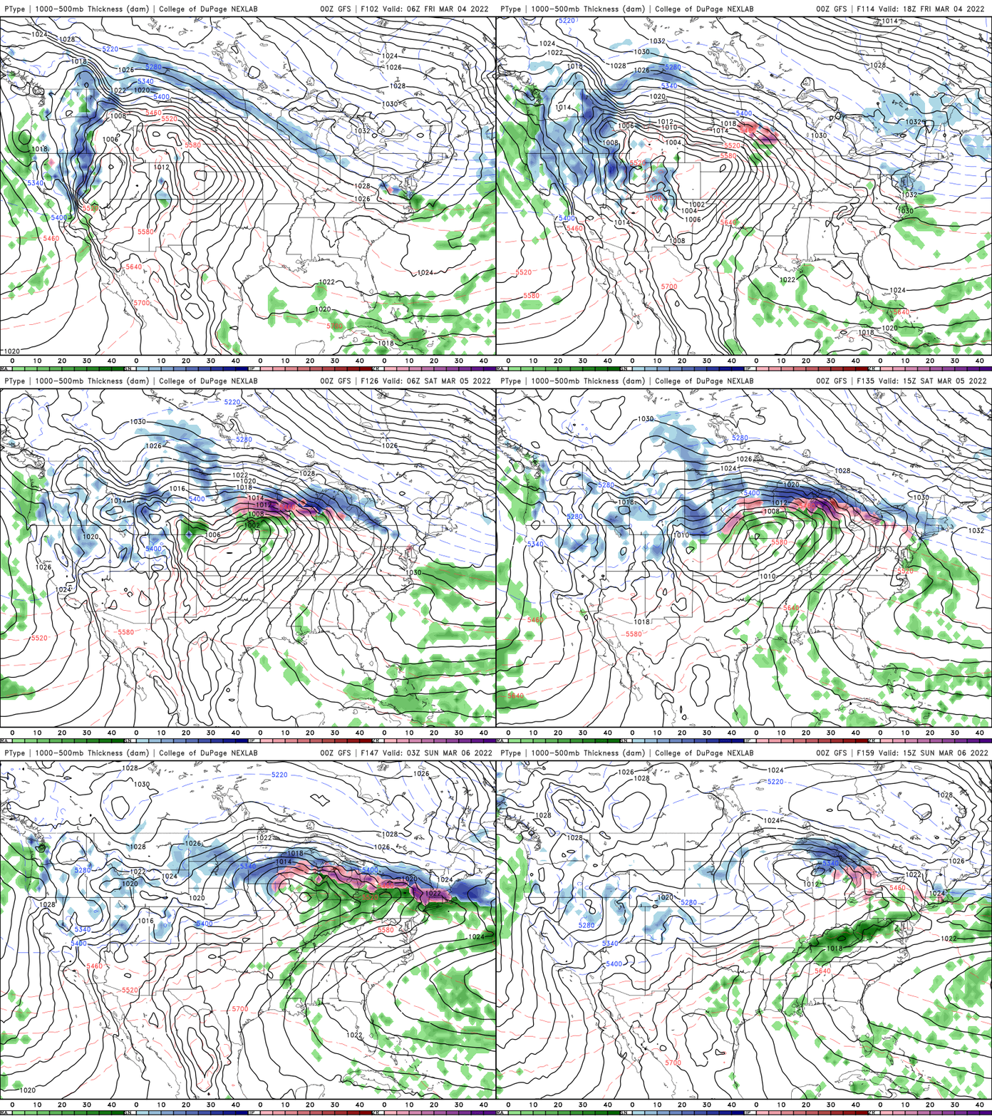
Stay tuned. This will be something to watch through the week as we get closer. There’s the potential for 1 to 2 inches of liquid water equivalent, much needed moisture for Minnesota potentially.

