
Chilly Thursday, mild Friday; snow, rain, freezing rain set for weekend

Go Deeper.
Create an account or log in to save stories.
Like this?
Thanks for liking this story! We have added it to a list of your favorite stories.


Temperatures will be on the cool side of normal all day Thursday in Minnesota, mainly 20s in the south and teens north. A chilly Thursday night gives way to a warmup Friday.
A mixed bag of sleet, freezing rain, rain and snow moves in late Friday night into the weekend. It’s still not certain yet where each type of participation will fall. The forecast is quite literally fluid.
Cold air curtain call
Winter gave us a gentle reminder that it’s not that far away yet early Thursday. Some colder air temporarily slid into Minnesota overnight Wednesday night.
Embarrass bottomed out at 27 degrees below zero early Thursday morning. International Falls had a low of 21 below zero and Ely also reached 20 below. Lows were mainly in the teens (above zero) across southern Minnesota.
Turn Up Your Support
MPR News helps you turn down the noise and build shared understanding. Turn up your support for this public resource and keep trusted journalism accessible to all.
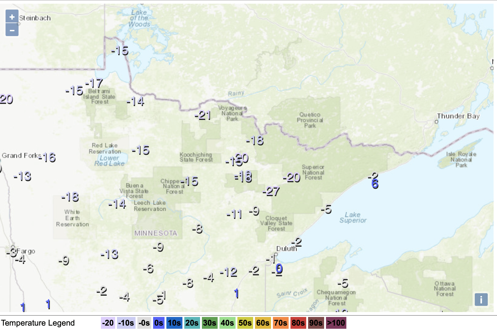
We’ll see highs Thursday afternoon in the 20s south and teens north. That’s about 5 to 10 degrees below normal for the date.

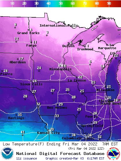
Expect another somewhat chilly night Thursday night with lows again subzero for portions of northern Minnesota to near 20 in the far southern portion of Minnesota.
Friday will already be milder with highs above freezing in the south, 20s north.
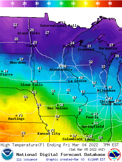
Temperatures will warm further Saturday as our weekend storm system draws warm air into it.

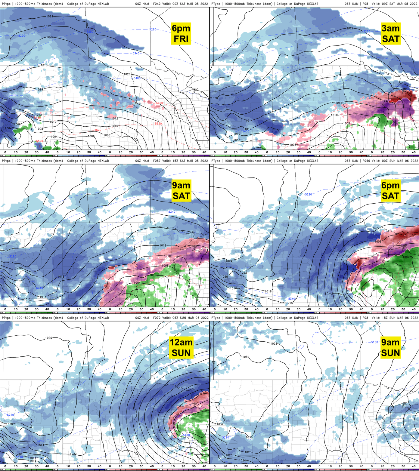
We can expect precipitation to reach Minnesota late Friday evening into the overnight. It will start as a wintry mix of sleet, freezing rain, rain and snow.
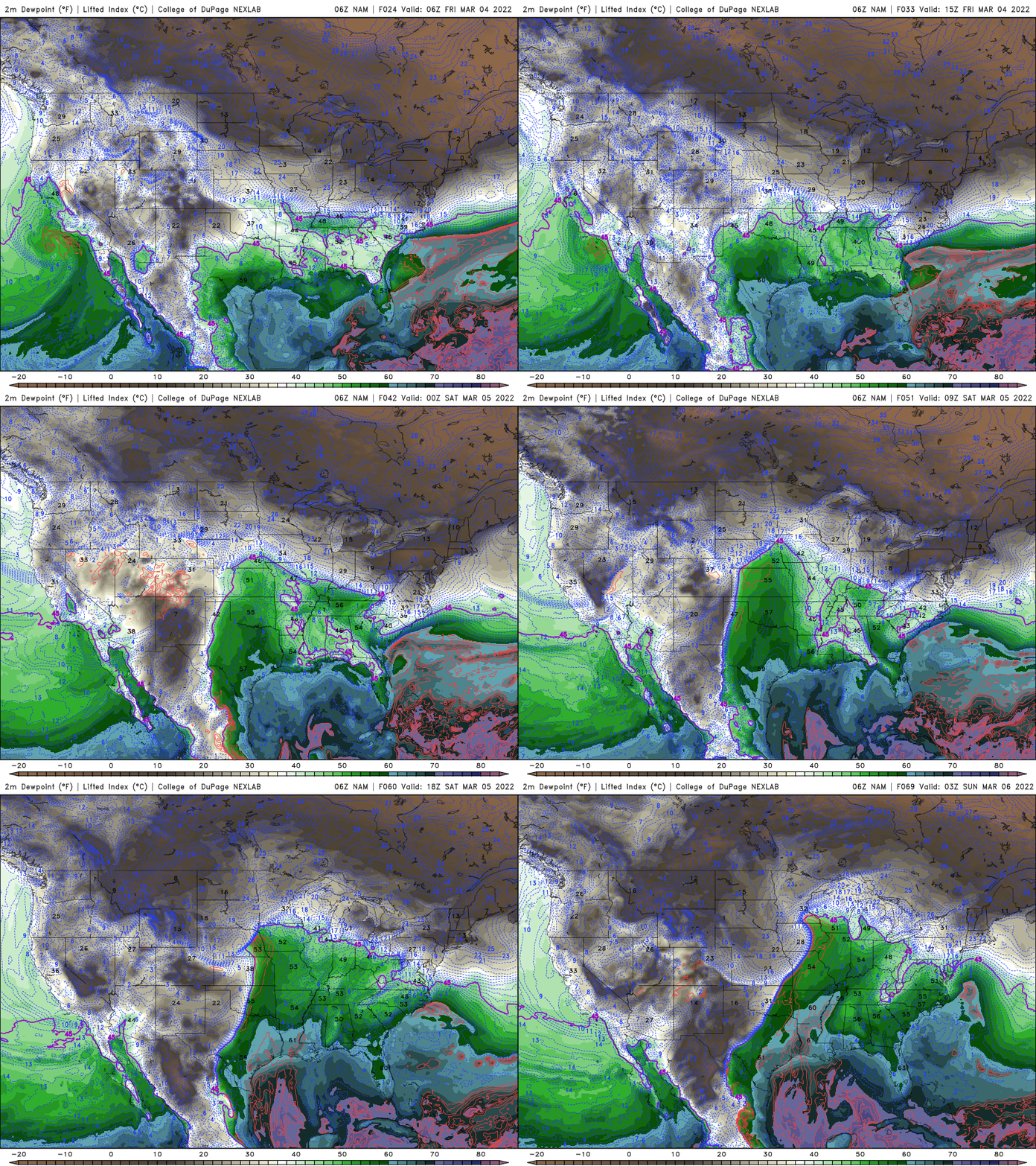
We’ll have a surge of moisture from the Gulf of Mexico with dew points potentially into the 50s Saturday in southeastern Minnesota.
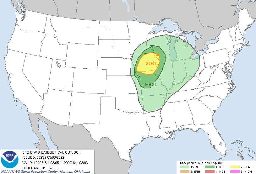
With the temperature contrast and ample moisture, there’s even a possibility of severe weather in eastern Iowa Saturday. The Storm Prediction Center’s area of general risk for thunderstorms includes southeastern Minnesota.
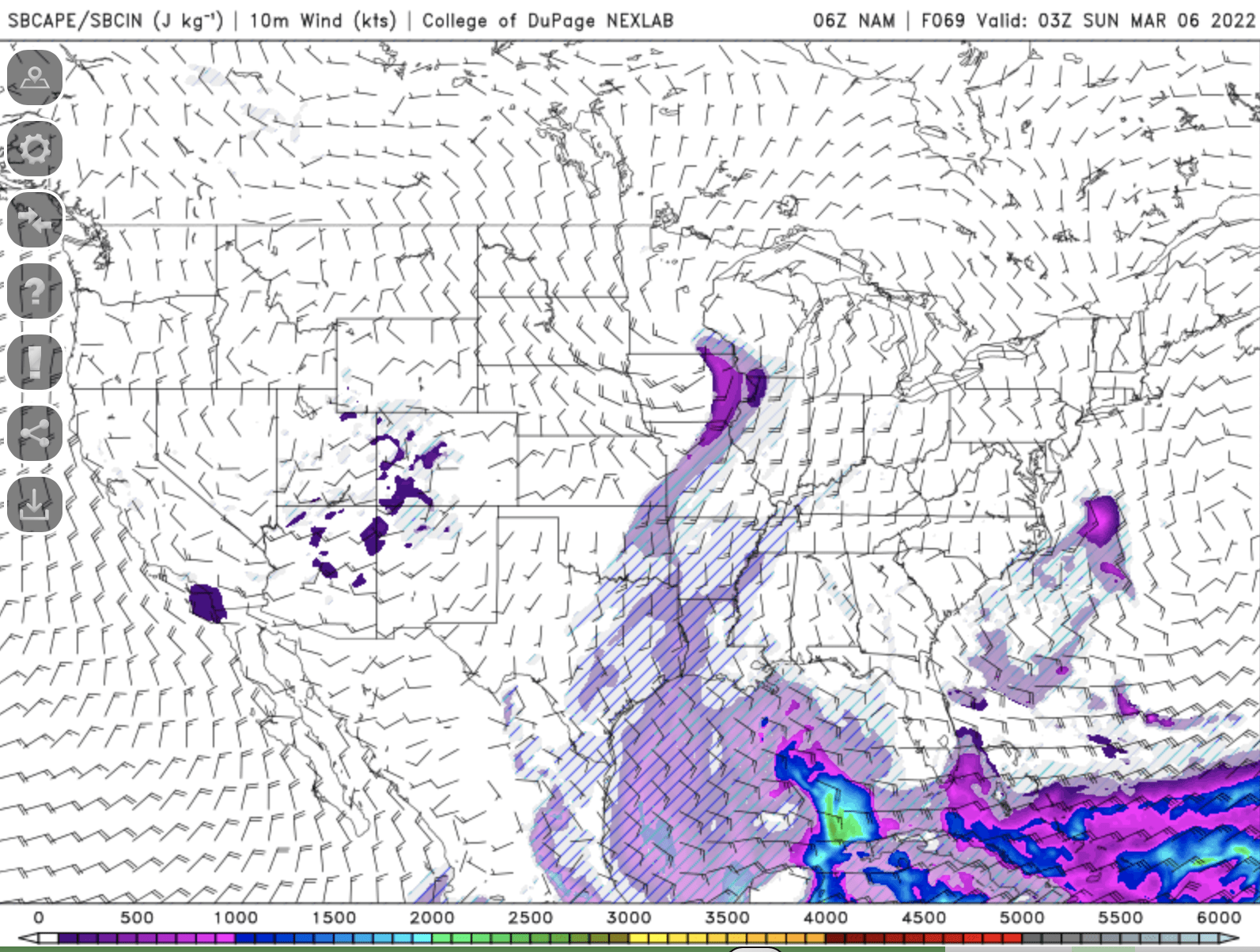
There will be just enough energy available for thunderstorms due to instability (“convective available potential energy") to create lightning and thunder throughout southeastern Minnesota with the rain on Saturday.
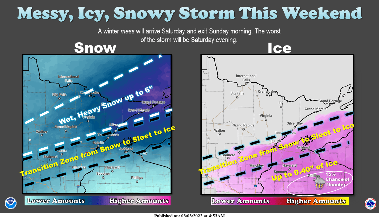
While southeastern Minnesota sees mainly rain during the day Saturday, central Minnesota will see a wintry mix and on the northern edge of precipitation it will be a very narrow area of heavy snow.
Pinpointing where this incredibly thin line of heavy snow will set up is still difficult two days out.
Here are three different computer model scenarios for snowfall over the weekend. Note that we do get some snow likely farther south Saturday night as rain turns back to snow on the tail end of the system.

This is somewhat of a shift over the last 12 to 24 hours, so there’s a still a lot of volatility in the forecast for snowfall over the weekend.
Regardless, many areas stand to see anywhere from one-half inch to as much as 1 or 2 inches of water out of this system. Stay tuned as the forecast is quite literally fluid.

