
Cold air returns; signs of spring next week
Frigid temperatures through Saturday, much warmer ahead
Go Deeper.
Create an account or log in to save stories.
Like this?
Thanks for liking this story! We have added it to a list of your favorite stories.


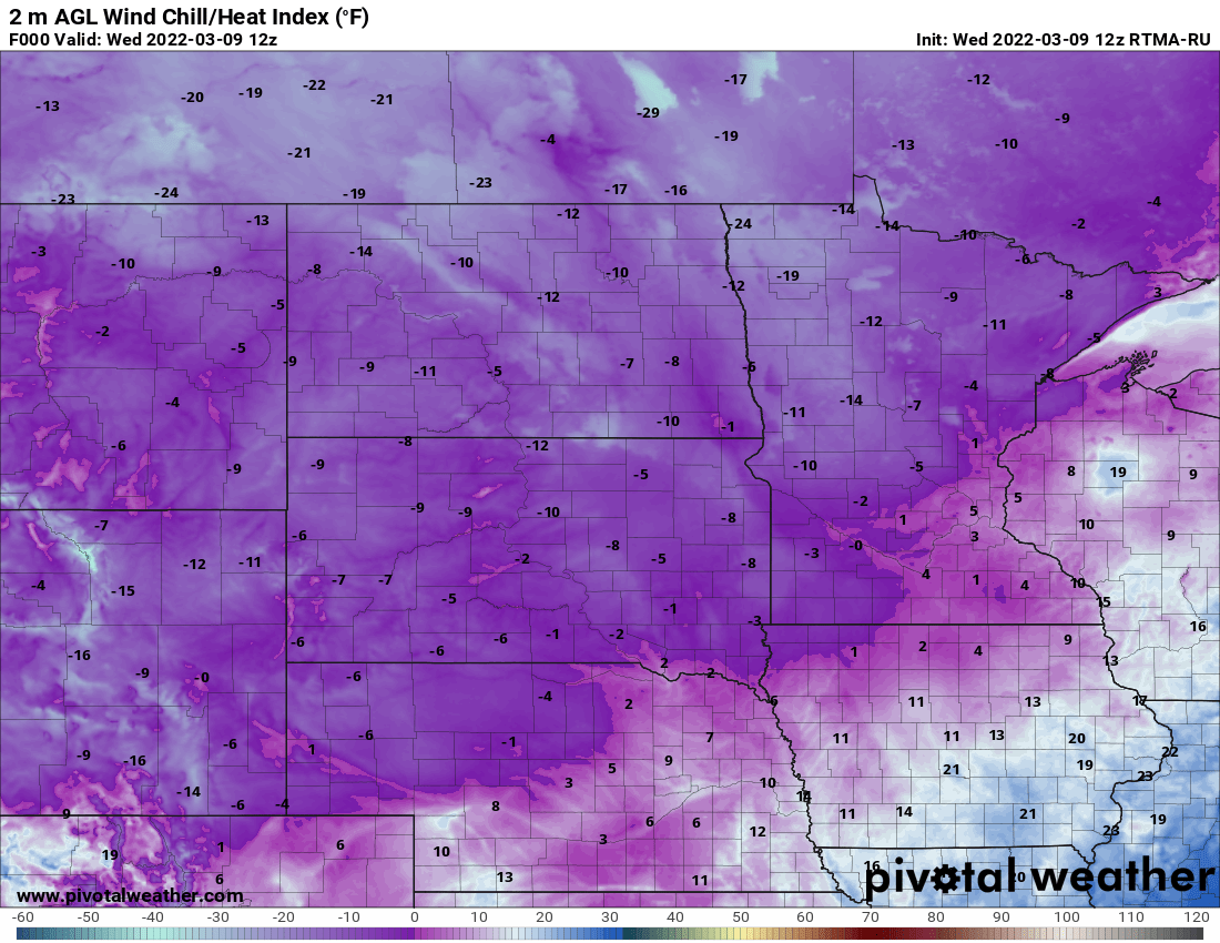
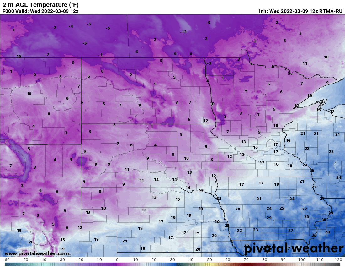
Here we go again. Winter is giving us (hopefully) once last real cold snap. Temperatures are above zero for most of Minnesota early Wednesday morning but wind chills are well below zero in the northern parts of the state.
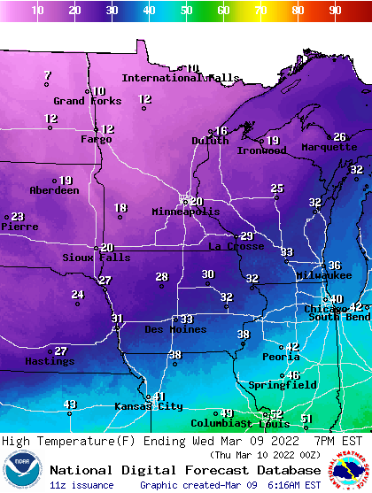
We’ll have sunshine, but high temperatures will be about 15 degrees below normal; ranging from the low 20s in the southeast to just single digits in the northwest.
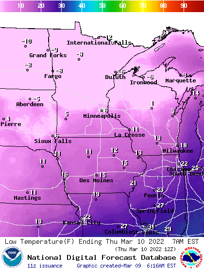
It’ll be even colder the next few days with lows in the single digits by early Thursday morning in the south and below zero north.
Highs will be around 20 yet Thursday and Friday in the Twin Cities, while northern Minnesota stays in the single digits and teens. Friday night into early Saturday looks to bring our coldest temperatures in this cold snap.
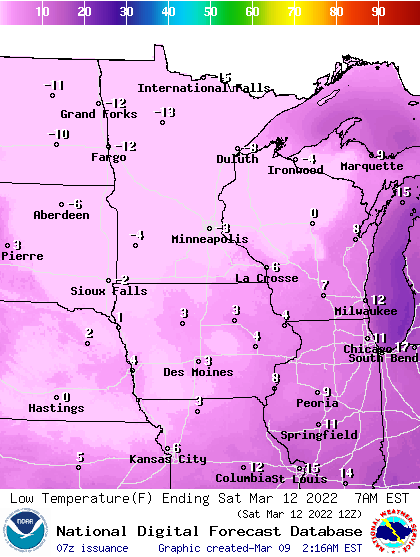
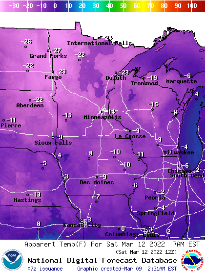
Temperatures will be below zero for most of Minnesota before sunrise Saturday. It could be our latest subzero reading in the season since 2009 in the Twin Cities. Wind chills will be even colder early Saturday in the teens and 20s below zero.
We rapidly warm up after that. Highs should be well into the 40s Sunday and our first 50s, even perhaps 60 look likely next week as a much warmer pattern shapes up.
Turn Up Your Support
MPR News helps you turn down the noise and build shared understanding. Turn up your support for this public resource and keep trusted journalism accessible to all.

