Bitter cold through Saturday; huge warmup starts Sunday
Cold through Saturday; first 50 and maybe 60 ahead
Go Deeper.
Create an account or log in to save stories.
Like this?
Thanks for liking this story! We have added it to a list of your favorite stories.


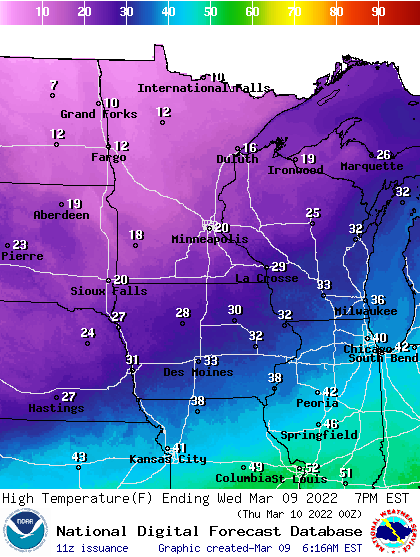
Highs Wednesday will range from the low 20s in the southeast to just single digits in the northwest. Expect subzero wind chills across the state Thursday and subzero temps overnight Friday into Saturday.
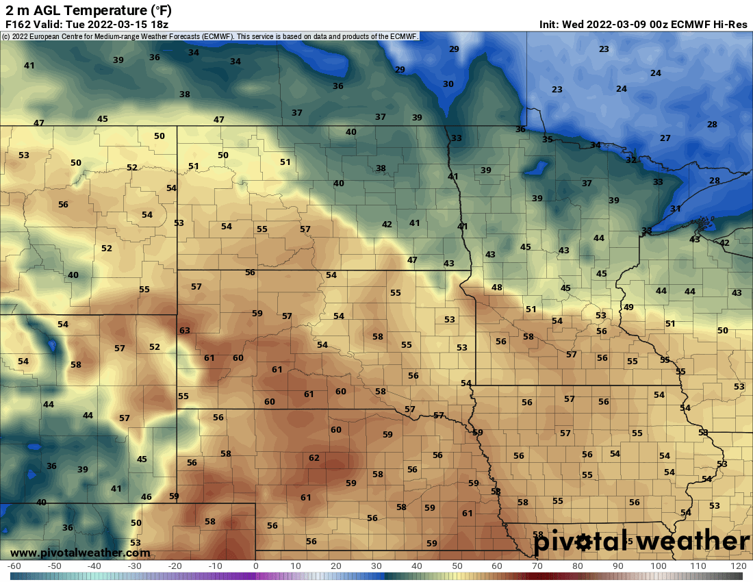
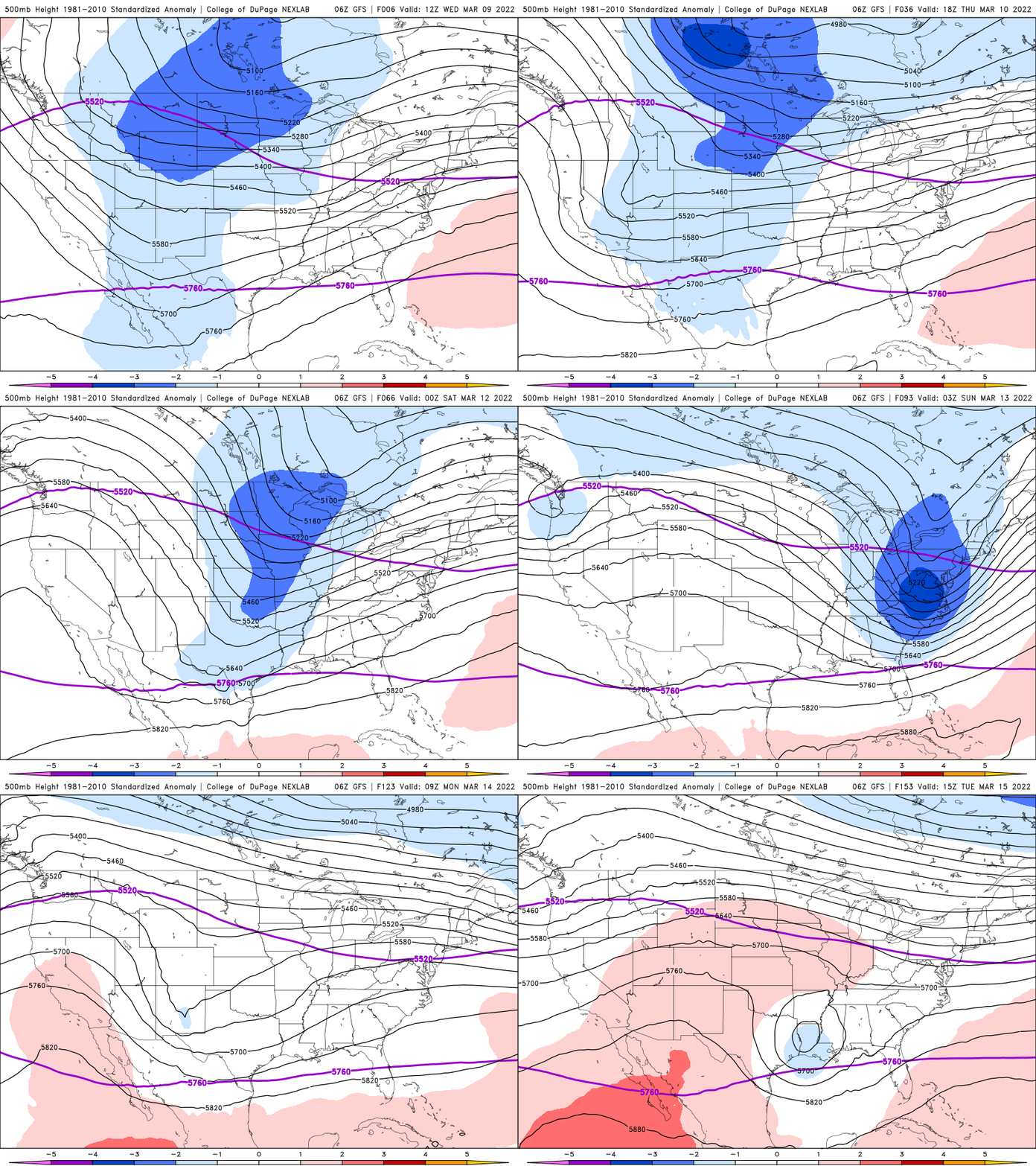
Highs then soar into the 40s Sunday, the start of a big warmup as the upper-level air pattern switches from a cold one for the upper Midwest to a much milder one.
Cold, colder, coldest
Normal low temperatures range from 10 degrees to the low 20s for this time of year. We were back below that early Wednesday and even colder readings are ahead. High temperatures Wednesday will be a good 15 to 20 degrees below normal through Saturday.
Wind chills will stay in the single digits Wednesday in the south and below zero north as a northwest breeze continues to blow at 10 to 20 mph.
Turn Up Your Support
MPR News helps you turn down the noise and build shared understanding. Turn up your support for this public resource and keep trusted journalism accessible to all.
Lows Wednesday night into early Thursday will be even colder with single digits in the south and well below zero for most of northern Minnesota.
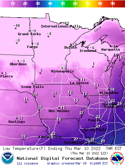
Wind chill temperatures early Thursday will be mostly subzero statewide, much more reminiscent of February.
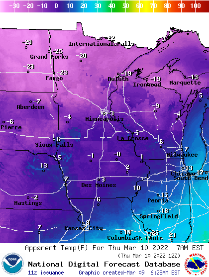
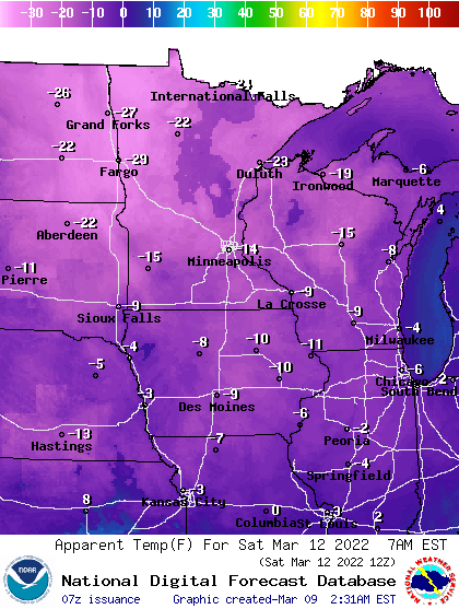
High temperatures will hover just around 20 Thursday and Friday also, but our coldest temperatures are likely to come late Friday night into early Saturday morning. Temperatures will plummet to subzero territory for most of the state, including the Twin Cities.
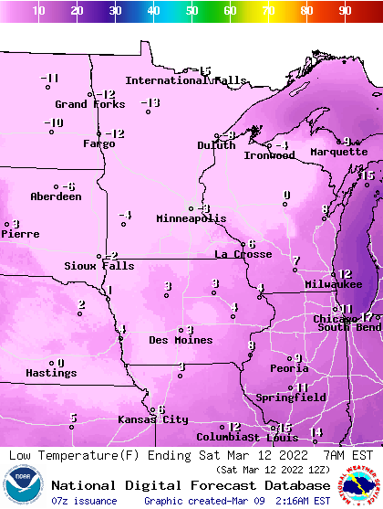
If the thermometer does dip below zero in the Twin Cities early Saturday, that would be the latest subzero in a season since 2009. The normal last subzero in the Twin Cities is Feb. 18.
Even when we look at the full historical record the average is Feb. 28, so this is late on all accounts but not unheard of. Since 2000, we’ve had a subzero reading in March 7 a few different times.
Wind chills will be even more brutal early Saturday as winds pick up late Friday.
Getting warmer
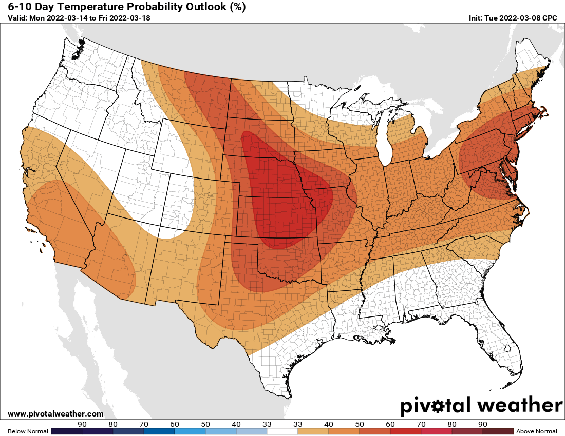
All this cold talk might be bumming you out, but a rapid and significant turn around is in store. Highs will soar already into the 40s Sunday and a significant change in our pattern is happening for next week.
The upper level pattern switches from a cold one for the upper Midwest to a much milder one.
We are very likely (odds are about 77 percent based on the slew of computer models) of seeing our first 50 next week. That does come later than the normal (March 5).
It appears we’re going to make up for lost time however, as we could hit 50 more than once and we even have a decent shot at our first 60-degree temperature. The normal first 60 comes around March 23.