Cold grips Minnesota through Saturday; big warmup starts Sunday
Coldest temps yet to come but also the warmest
Go Deeper.
Create an account or log in to save stories.
Like this?
Thanks for liking this story! We have added it to a list of your favorite stories.


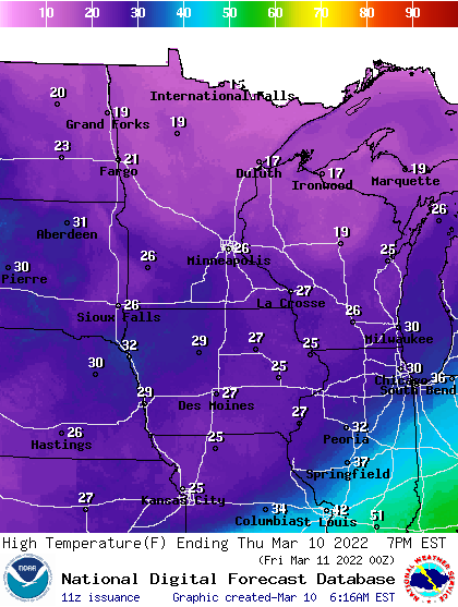
It will be a little warmer Thursday following Wednesday’s cold blast and a second, colder one moving in Thursday night. Expect highs in the mid to upper 20s in the south and teens north with sunshine most of the day. Temperatures will be colder Friday.
Highs by Sunday, though, will be well into the 40s. Next week will likely bring our first 50-degree temperatures.
Once more into the deep freeze
It was a frigid start to the day Thursday across northern Minnesota with widespread subzero readings. Hibbing bottomed out at 23 below zero, the latest temperature that cold since 2009.
While still below the normal high temperatures (which range from 30 in the north to 40 south), today will be slightly warmer. Highs on Wednesday afternoon reached only 19 degrees in the Twin Cities.
Turn Up Your Support
MPR News helps you turn down the noise and build shared understanding. Turn up your support for this public resource and keep trusted journalism accessible to all.
Thursday should be in the mid to upper 20s in the south; upper teens north.
A second blast of even colder air moves in Thursday night, dropping temperatures Friday into early Saturday morning to the coldest readings yet of this cold snap.
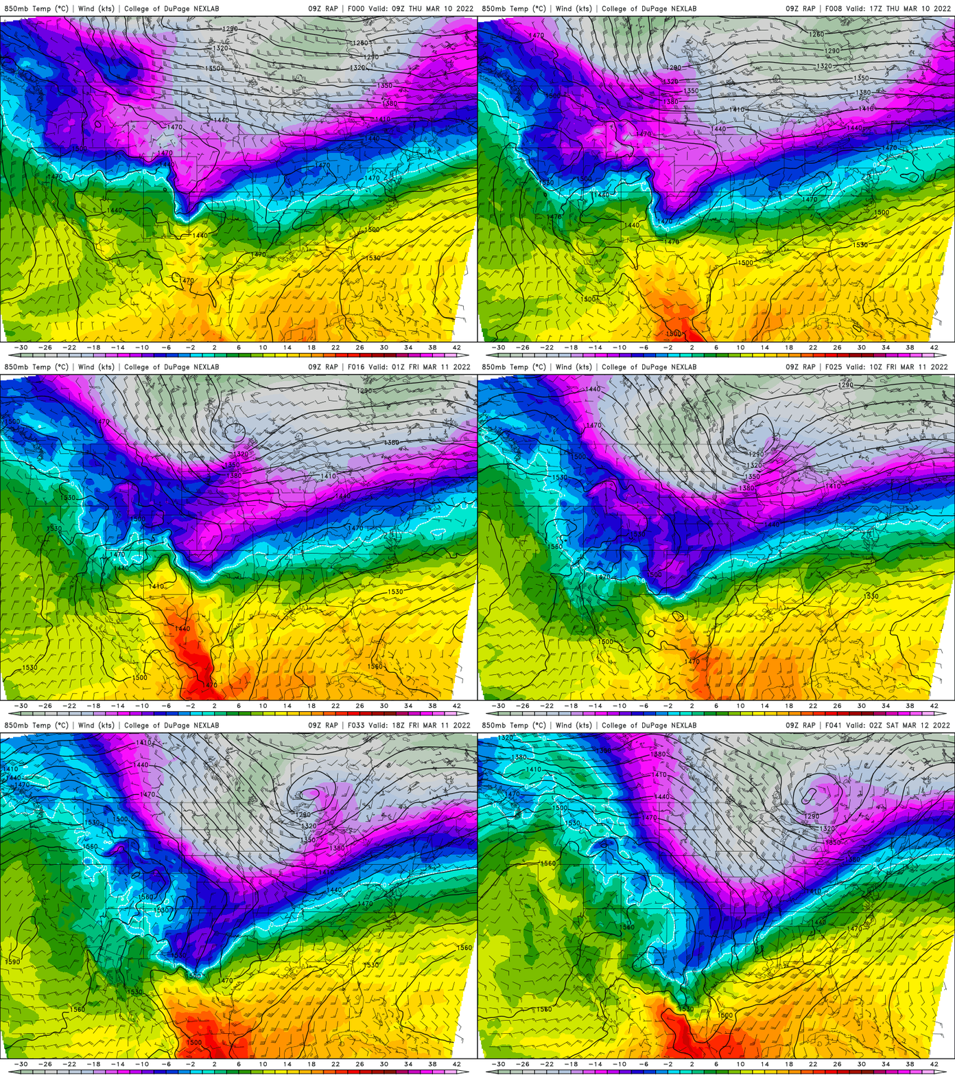
The reinforcing shot of cold is keeping the significant storm track south. Portions of northern Kansas will see 6 to 8 inches of snow Thursday.
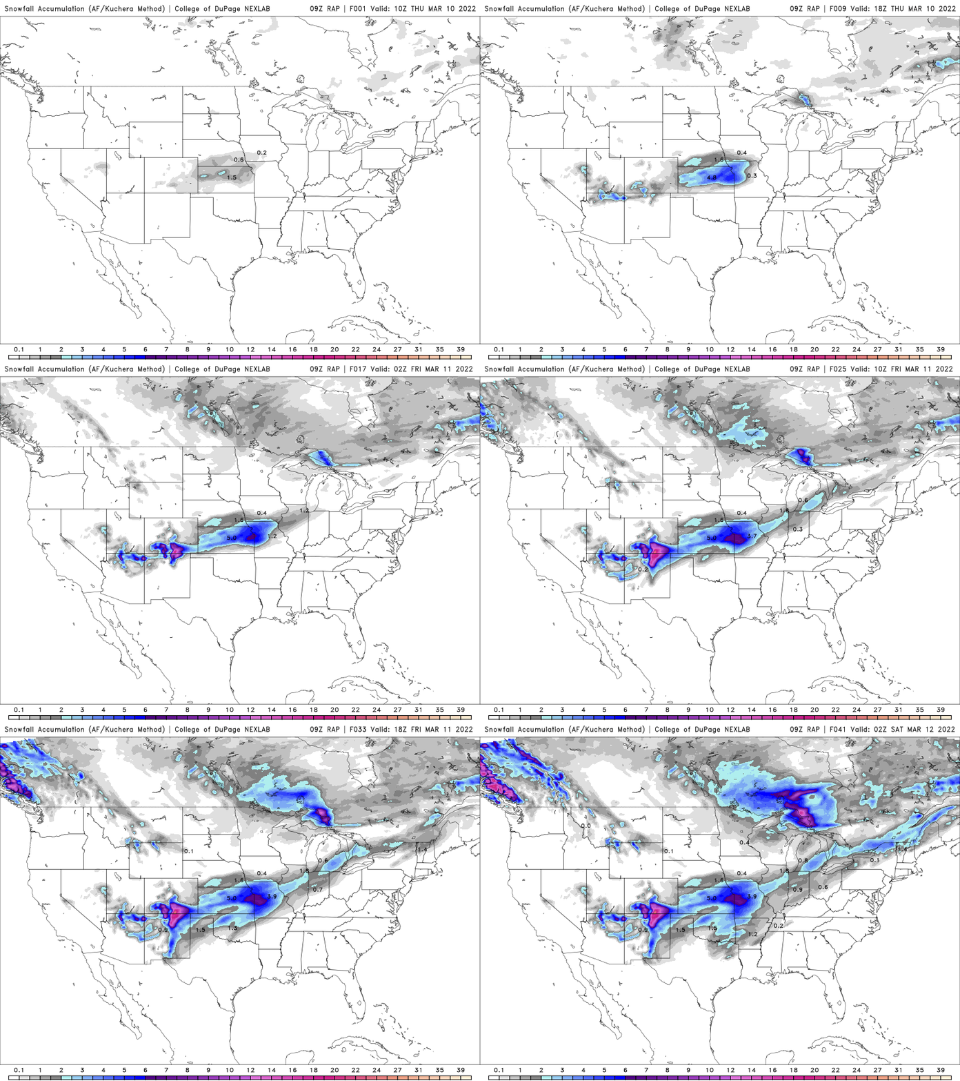
Note also in the snowfall loop above that we could see some flurries or light snow showers Friday with this second cold front. The second cold front will also increase the winds Thursday night into Friday keeping wind chills frigid.
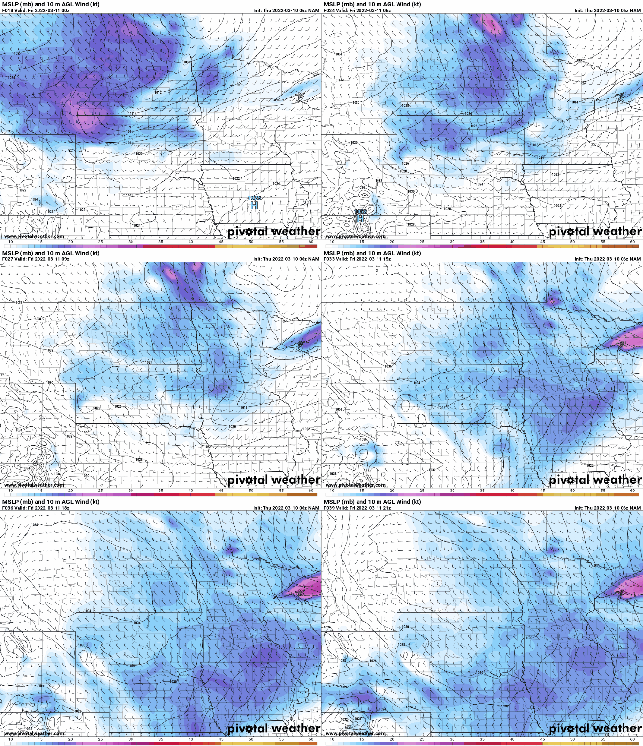
High temperatures Friday won’t reach 20 for most of Minnesota. In fact, much of northern Minnesota won’t get out of the single digits.
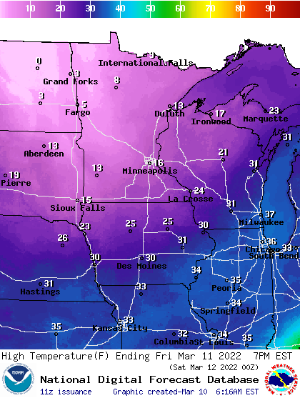
That chilly Friday, with temperatures nearly 25 degrees colder than normal, will set us up for a very frigid night Friday night into early Saturday. As discussed this week, it will be the latest subzero low temperature in the Twin Cities since 2009.
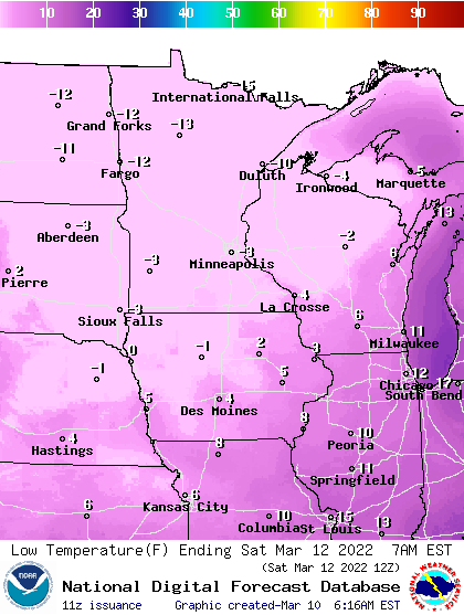
In nearly a blink of an eye, the pattern will be shifting abruptly to a much warmer one over the weekend into next week.
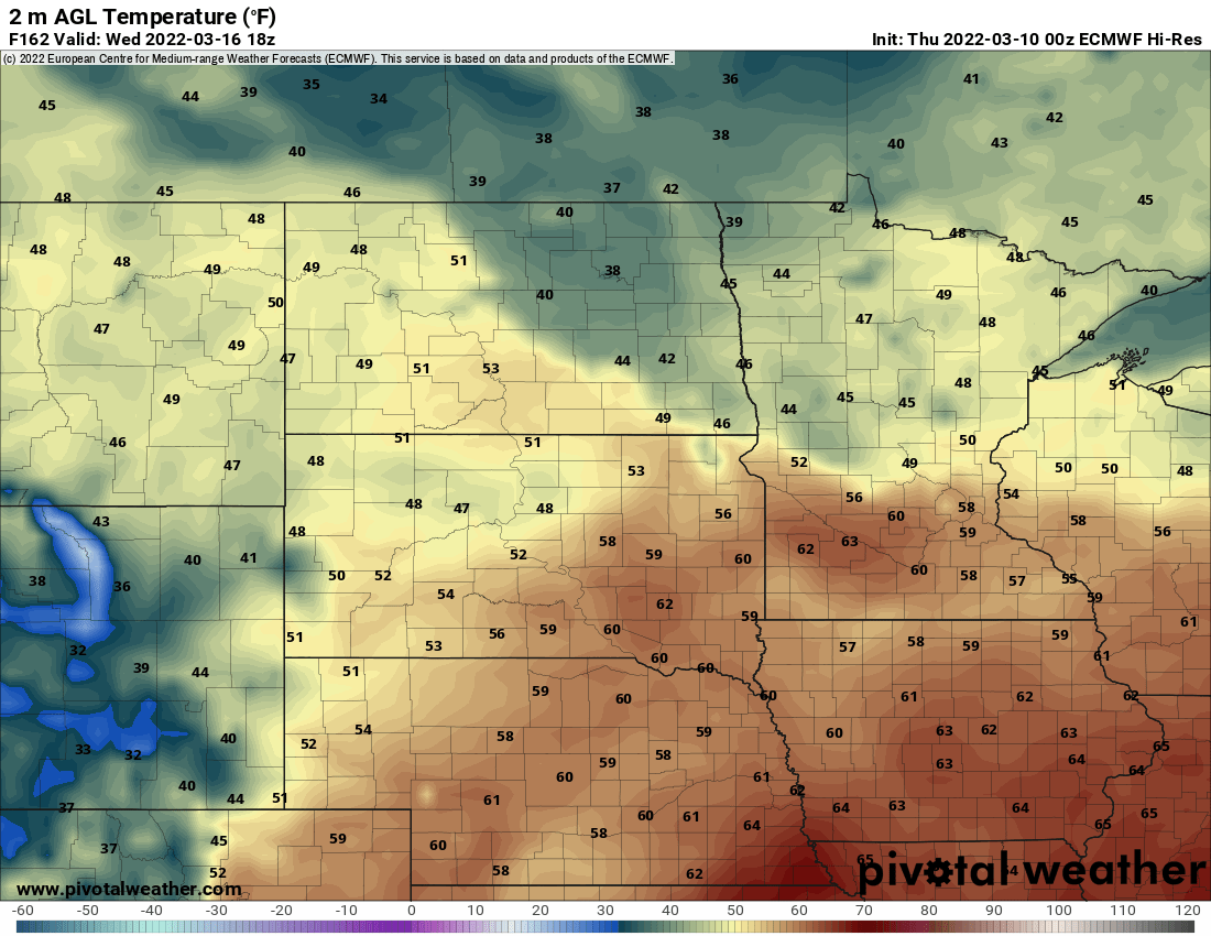
Highs by Sunday will be well into the 40s and next week will bring our first 50s likely. The coldest air retreats toward the north pole and even pushes into the other side of the northern hemisphere, allowing us to warm up significantly.
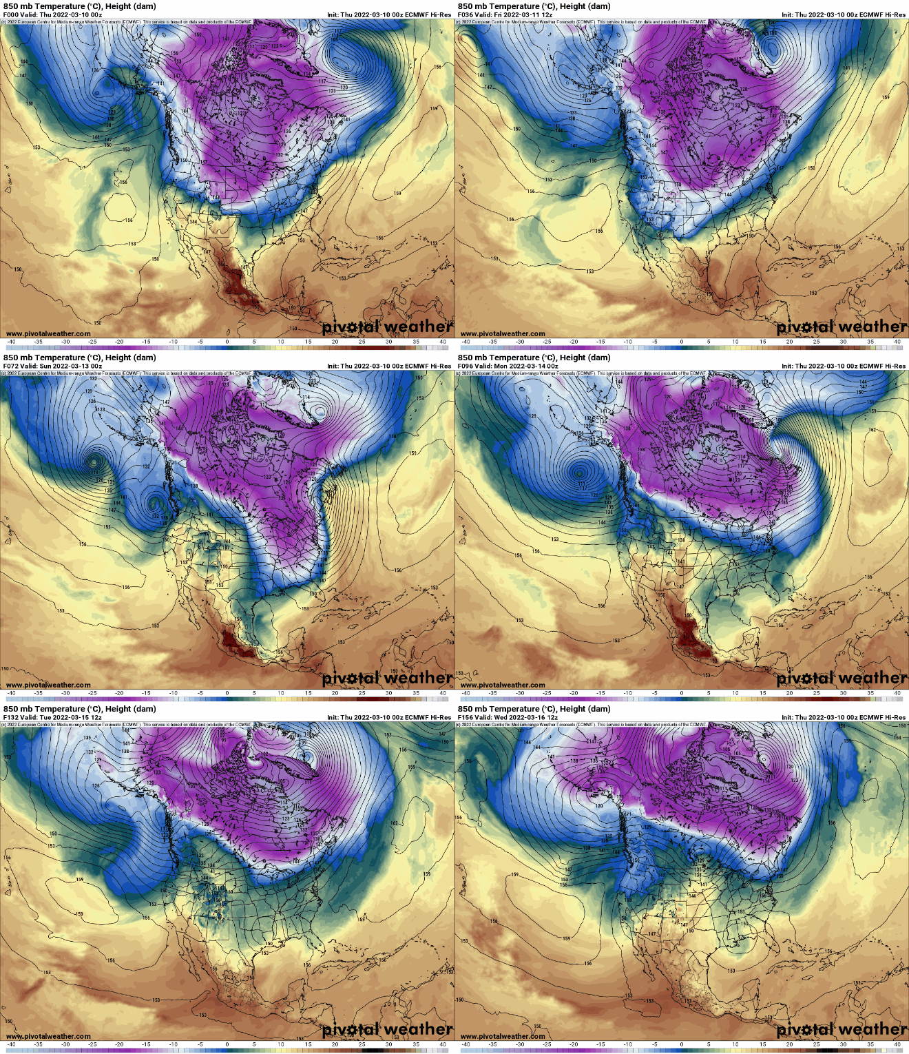
Based on the various computer models at this point, the odds of our first 50 next week is about 85 percent and the odds of our first 60 are at least 25 percent.