
Coldest night of March Friday night; big warm up starts Sunday
Subzero nearly statewide Friday night; 50s next week
Go Deeper.
Create an account or log in to save stories.
Like this?
Thanks for liking this story! We have added it to a list of your favorite stories.


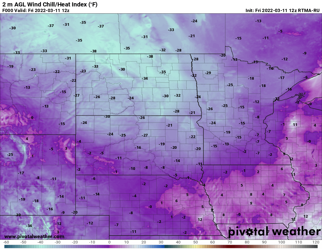
The wind is adding a bite to those chilly late-season temperatures early Friday. Wind chills range from the single digits to 30 below zero in northwest Minnesota. Temperatures are in the single digits for most with many areas subzero in north-central and northwest Minnesota.
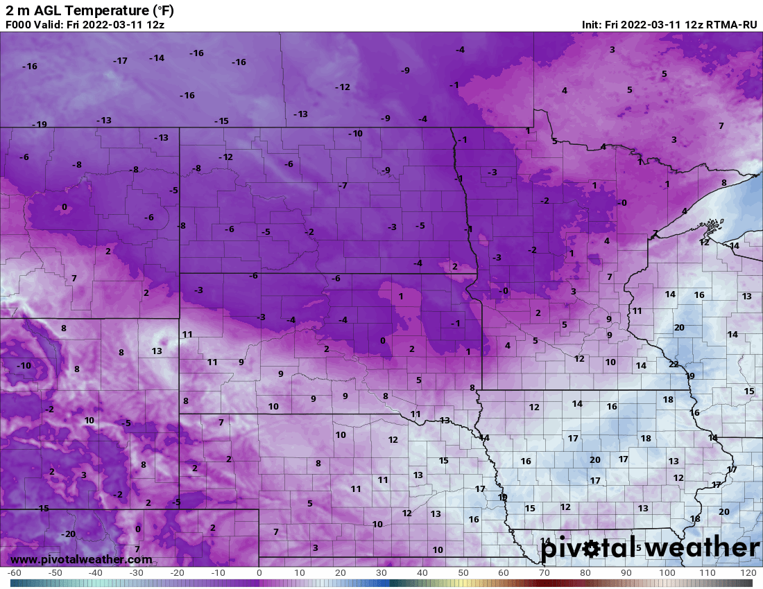
Winds will remain sustained at 10 to 20 mph through the day with gusts up to 30 to 35 mph in the east and even over 40 mph in the northwest. Those winds will create blowing snow combined with snow showers in the northwest where there’s a winter weather advisory posted.
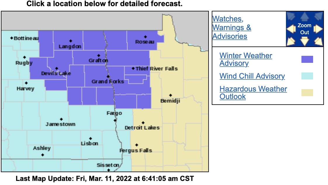
High temperatures Friday will be about 25 degrees below normal; only in the teens south and single digits north.
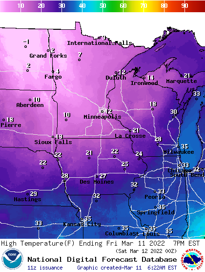
Friday night into early Saturday will bring the coldest temperatures of the month for many, and almost certainly, the last subzero reading for the Twin Cities and southern Minnesota.

We then begin a rapid warm up; 40s Sunday and our first 50s, perhaps even 60 next week as the overall pattern changes drastically.
Turn Up Your Support
MPR News helps you turn down the noise and build shared understanding. Turn up your support for this public resource and keep trusted journalism accessible to all.

