
Last bitter cold night of winter? First 60 possible next week
Snow showers, cold sweep across Minnesota Friday; big warm up ahead

Go Deeper.
Create an account or log in to save stories.
Like this?
Thanks for liking this story! We have added it to a list of your favorite stories.


Wind chills will be frigid through the day Friday as high temperatures won’t get past the low to mid teens in southern Minnesota and barely reach zero in some places up north. Temps drop to subzero statewide overnight into Saturday.
A rapid warm up starts Sunday. The entire upper level pattern shifts to an overall warmer one all of next week.
Cold, howling wind
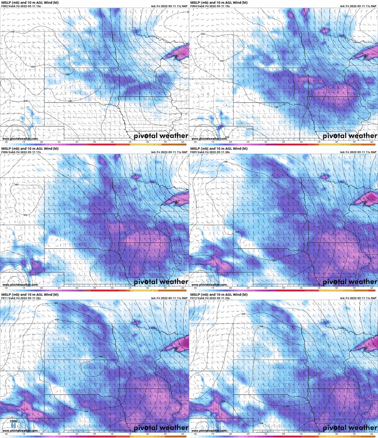
We’ve added the ingredient of wind to our cold temperatures Friday and that’s been creating wind chills already near 30 below zero at times in northwest Minnesota. Winds will howl through the day Friday from the west-northwest at 10-20 mph with gusts of 30 mph to 40 mph in the northwest.
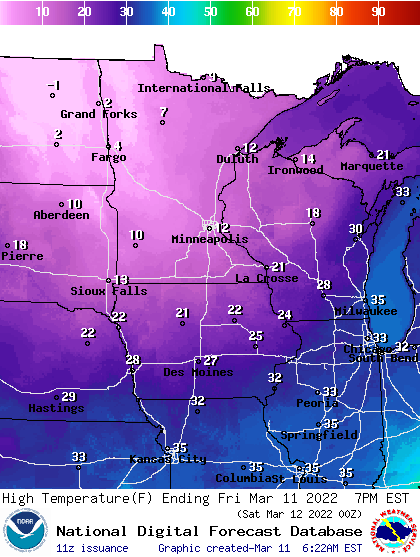
High temperatures Friday will be a good 25 degrees colder than normal with some very late season cold air.
Turn Up Your Support
MPR News helps you turn down the noise and build shared understanding. Turn up your support for this public resource and keep trusted journalism accessible to all.
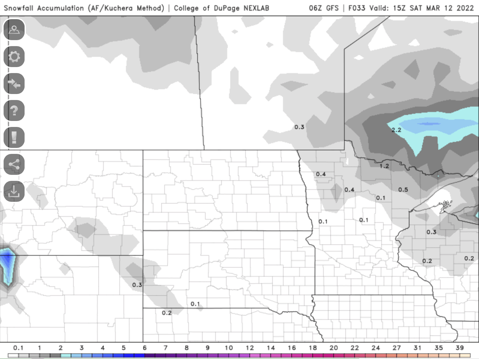
The sharp cold front will create conditions conducive for potential snow squalls in northeastern Minnesota. These snow showers are convective in nature. Like a thunderstorm, they develop with instability and rapidly cooling aloft.

In northwestern Minnesota, the light snow will blow with 40 mph gusts as well. Totals will generally be light, but in some of those snow squalls a quick one-half inch is possible.
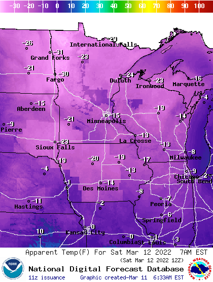
Overnight Friday night into early Saturday we’ll see subzero temperatures for most of Minnesota. It’s the latest we’ve dropped below zero in a season in the Twin Cities since March 12, 2009.
The breeze will be enough to create wind chills in the teens below zero to near 30 below zero early Saturday morning.
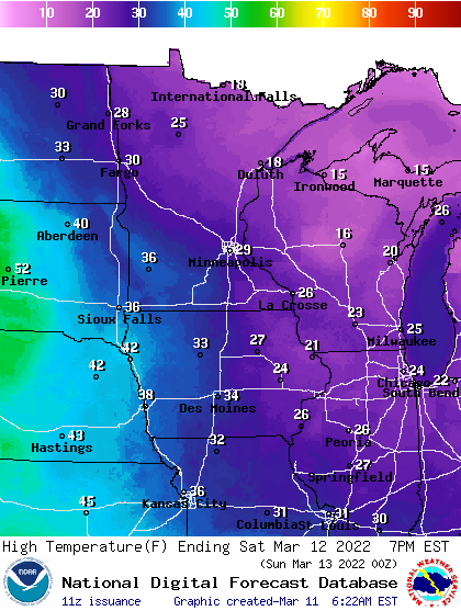
High temperatures Saturday afternoon will already be near 30 in the south and 20 north, with increasing clouds in northern Minnesota.
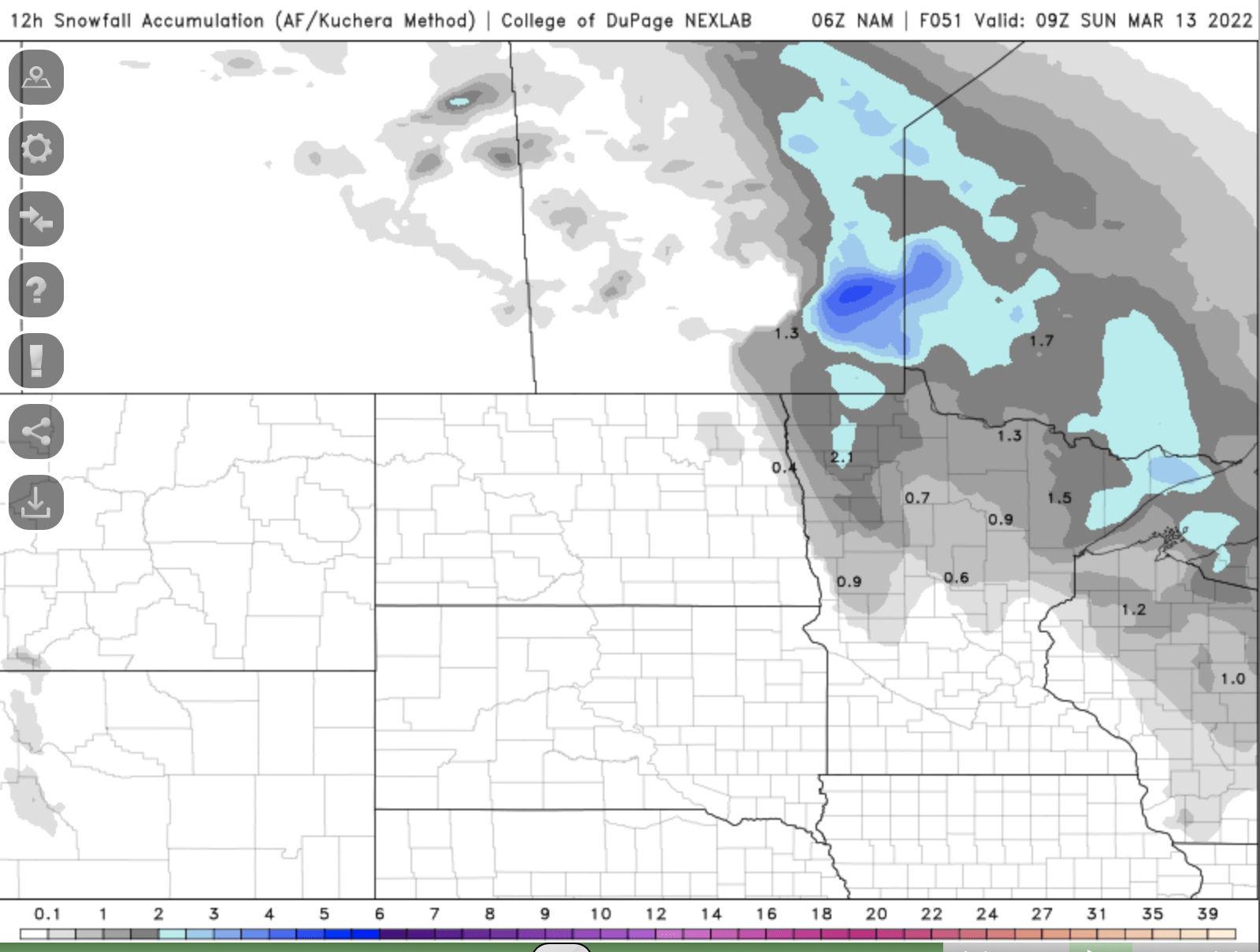
Another clipper system moves in late Saturday bringing snowfall mainly to northern Minnesota by Saturday evening and overnight. Some places could see up to 1 or 2 inches of snow.
Warmup is near
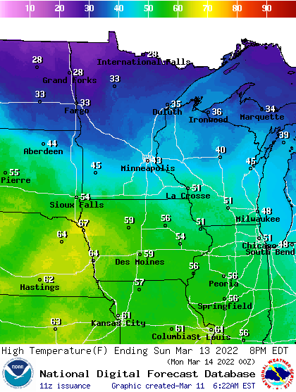
Things really start to improve Sunday already. We’ll see highs in the 40s south and 30s north.
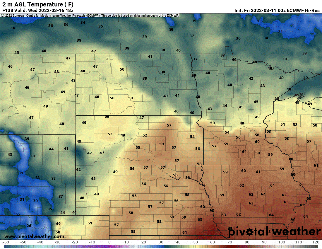
We don’t stop there, however. The entire upper-level pattern shifts to an overall warmer one all of next week, with our first 50 degree reading likely in the Twin Cities Tuesday and even a chance at 60 Wednesday afternoon.
Other than a possibility of rain-snow slush early Monday, most of next week looks fairly quiet as well.

