
Snow at times Sunday night and Monday AM; warmest temps on Wednesday
Updated snow forecasts
Go Deeper.
Create an account or log in to save stories.
Like this?
Thanks for liking this story! We have added it to a list of your favorite stories.


Sunday’s warmer temps brought smiles to many faces and turned our thoughts to spring activities.
The Sunday high temp of 43 degrees at Minneapolis-St. Paul International Airport marked our first 40s in the Twin Cities since March 1. We have even warmer weather in the forecast for Tuesday and Wednesday.
Sunday night snow lingers into Monday morning
It’s March and it can still snow.
Turn Up Your Support
MPR News helps you turn down the noise and build shared understanding. Turn up your support for this public resource and keep trusted journalism accessible to all.
A band of snow is expected to spread across central Minnesota Sunday evening and expand into parts of western Wisconsin overnight Sunday night. Snow lingers into Monday morning in many areas.
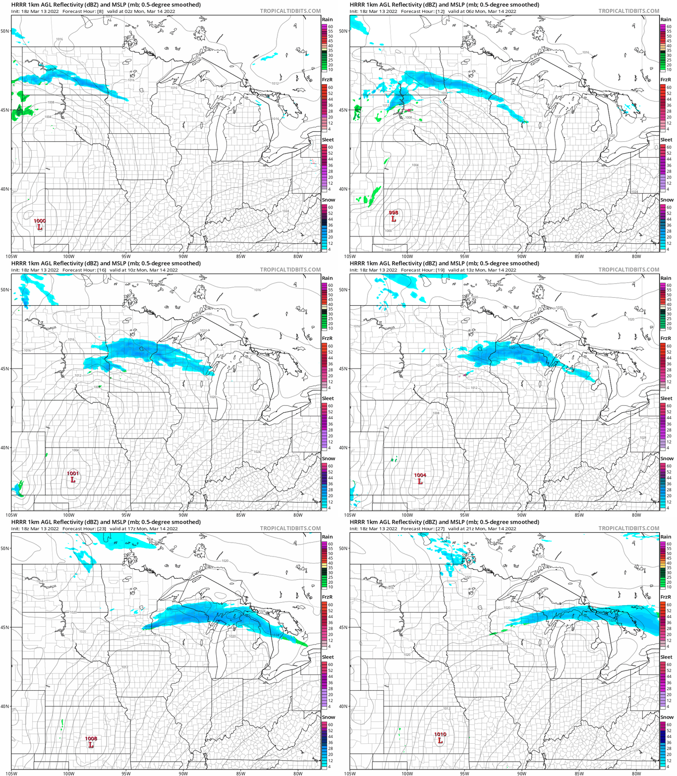
The National Oceanic and Atmospheric Administration’s High-Resolution Rapid-Refresh (HRRR) model shows the potential precipitation pattern from 9 p.m. Sunday to 4 p.m. on Monday:
NOAA’s North American Mesoscale (NAM) forecast model shows the snow spreading a bit deeper into the Twin Cities metro area Monday morning:
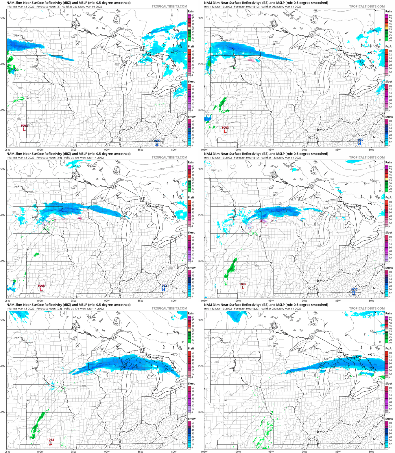
In either scenario, the highest snow accumulations are expected to be from central Minnesota into portions of western Wisconsin.
Here’s the Duluth NWS snow forecast for Sunday night through Monday morning:
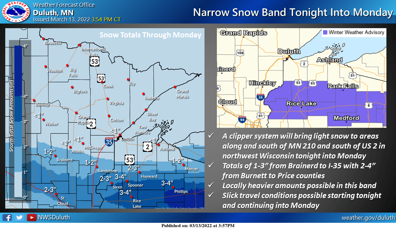
Notice the 2 to 3 inch amounts from St. Cloud eastward, with 3 to 4 inches in parts of west-central and northwestern Wisconsin.
Winter weather advisories (shaded blue on the right-side graphic) run from 3 a.m. to noon Monday in Polk, Barron and Rusk counties of Wisconsin and from 2 a.m. to 2 p.m. Monday for Burnett, Washburn and Sawyer counties of Wisconsin.
The far northern part of the Twin Cities metro area could see a couple inches of slushy snow Monday morning, with an inch or less of snow across most of the metro area. Here are NWS odds of snow accumulation in central/southern Minnesota and parts of Wisconsin, with “tonight” referring to Sunday night:
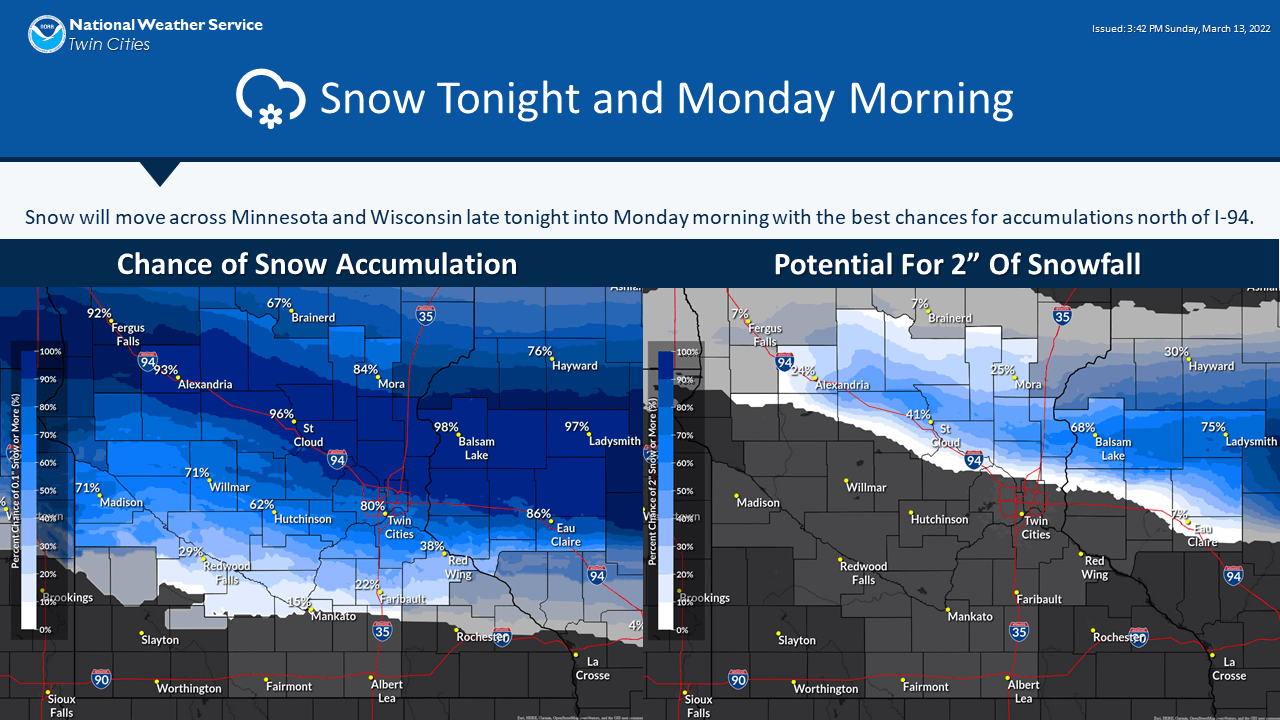
The flakes could be mixed with a bit of drizzle or light rain on Monday, with patchy freezing drizzle and light freezing rain also possible Monday morning.
You can hear updated weather information for Minnesota and western Wisconsin on the Minnesota Public Radio News network, and you can see updated weather info on the MPR News live weather blog.
Updated Minnesota road conditions can be found here. Wisconsin road conditions can be found here.
Temperature trends
Monday highs will be mainly in the 30s, with 40s in southeastern Minnesota:
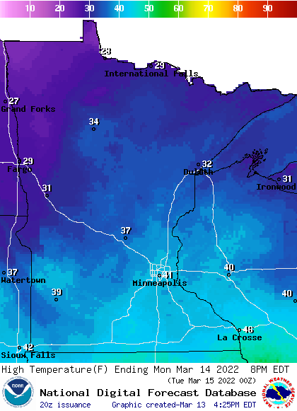
Some spots in the Twin Cities metro area could top 40.
Tuesday highs reach the 50s in southern Minnesota, with mainly 40s elsewhere:
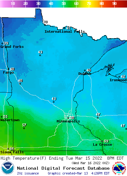
We’ll probably touch 50 degrees Tuesday afternoon in the metro area, and a few spots in the metro could reach the lower 50s. I wouldn’t be surprised to see a 60 degree reading Tuesday afternoon in southwestern Minnesota.
Twin Cities metro area highs are projected to reach the upper 50s on Wednesday, followed by upper 40s Thursday and around 50 on Friday. We could even see a 60 somewhere in the metro area Wednesday afternoon, since our snow cover will be rapidly shrinking this week.
Think spring!

Programming note
You can hear my live weather updates on MPR News at 7:35 a.m., 9:35 a.m. and 4:39 p.m. each Saturday and Sunday.

