
Very mild Tuesday and Wednesday; slightly cooler Thursday
Dense morning fog burns off in southeast Minnesota

Go Deeper.
Create an account or log in to save stories.
Like this?
Thanks for liking this story! We have added it to a list of your favorite stories.


The combination of Monday moisture and clearing skies just before sunset led to dense fog across portions of southeast Minnesota and frosty conditions for all. Strong mid March sunshine will burn off that fog and warm up temperatures quickly back above freezing.

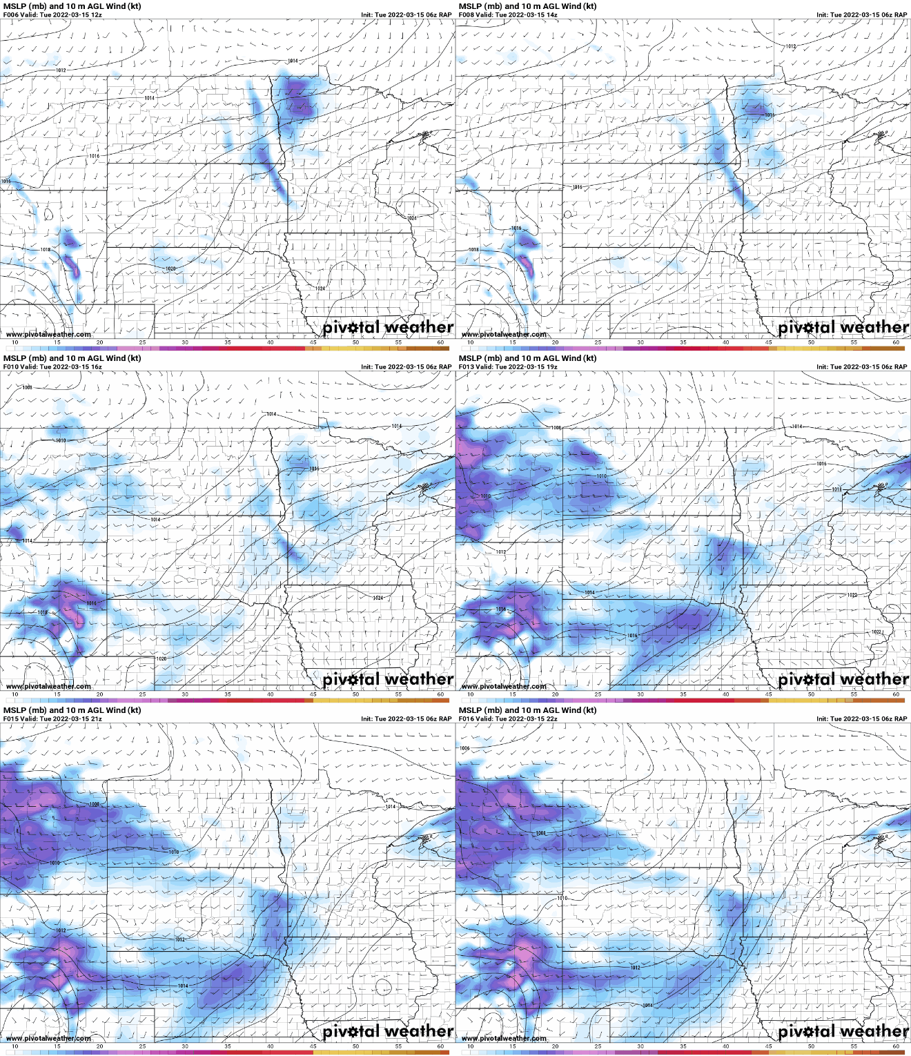
High temperatures Tuesday will be well above normal; near 50 in the Twin Cities with near 60 degrees in southwest Minnesota and 40s in northern Minnesota.
We’ll have a south breeze blowing at 10-15 mph across most of the state with some higher speeds in southwest Minnesota near 20 mph.
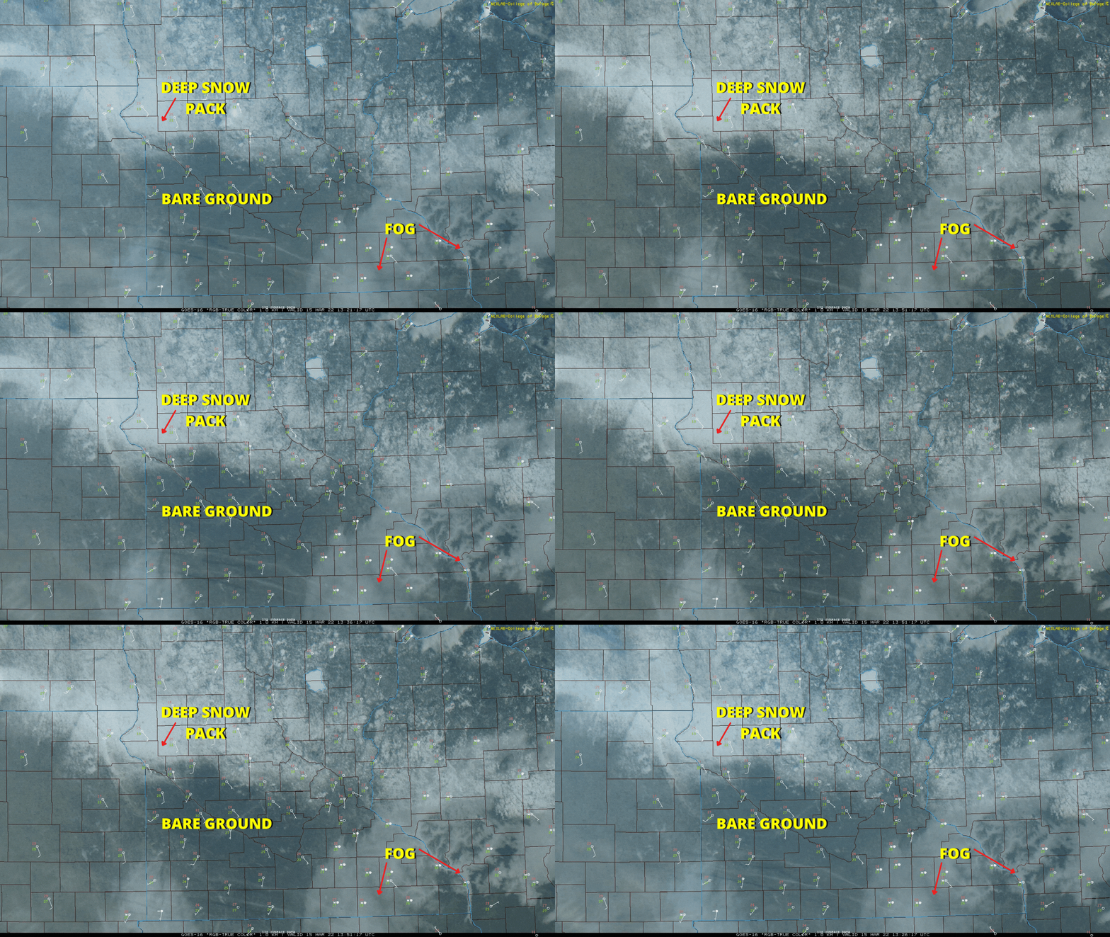
Both Tuesday and Wednesday we’ll see remarkable differences in high temperatures based on snow pack. With clear skies, we have a nice view of some features from space via satellite imagery. Areas with bare ground (or low snow depth, such as the Twin Cities area) have the best chance at 50 Tuesday afternoon. We can also see the fog in southeast Minnesota. Notice how the fog really sits in the deep, rugged valleys of southeast Minnesota and southwest Wisconsin.
Turn Up Your Support
MPR News helps you turn down the noise and build shared understanding. Turn up your support for this public resource and keep trusted journalism accessible to all.
Below is a look at snow cover and depth across the region from Monday.
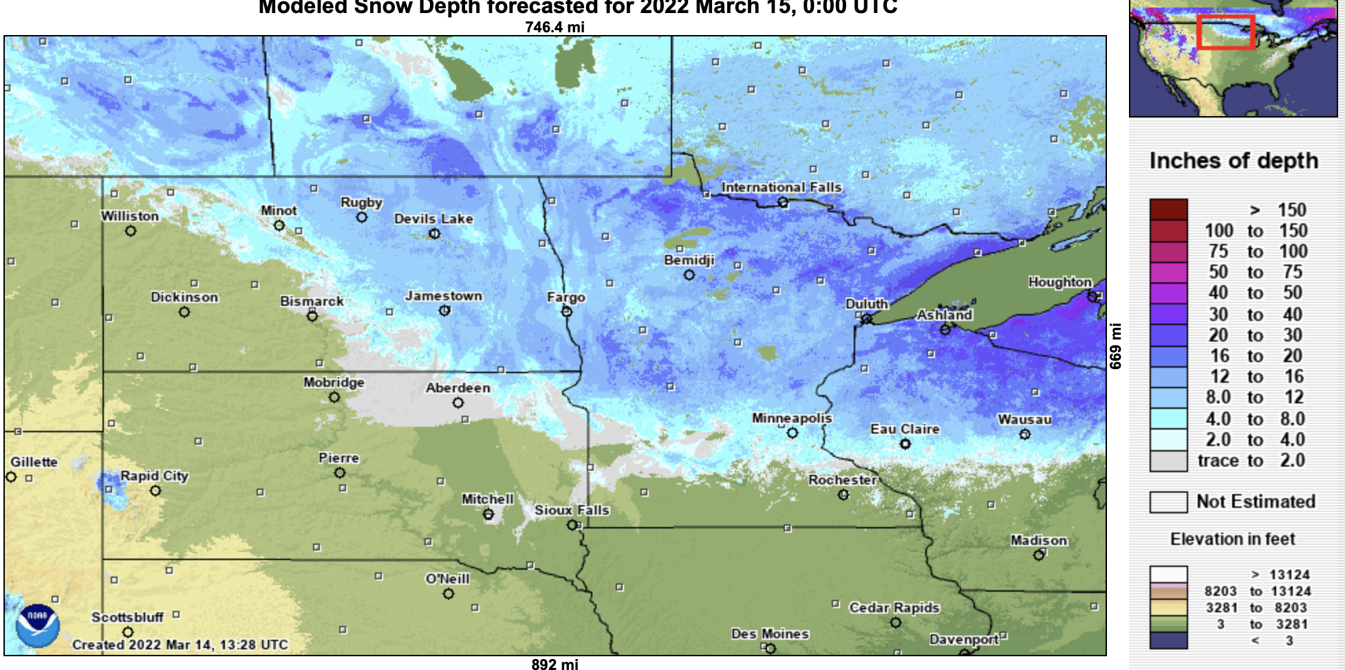
Snow not only reflects back sunlight but, when it’s deep, it acts like a freezer pack, keeping temperatures lower. You can see how the warmest temperatures track right up to the edge of the deeper snow pack.
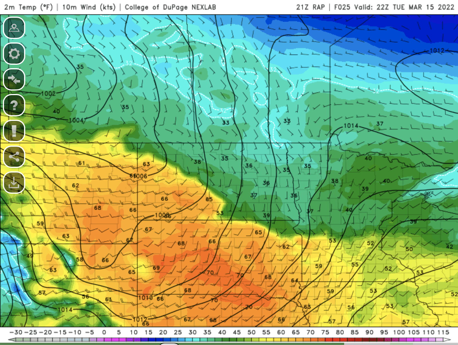
This is why southern Minnesota will see 50s and 60s both Tuesday and Wednesday while northern Minnesota stays in the 40s.
It will be a mild night Tuesday night with those south winds and a warm air mass. Even northern Minnesota will drop to just near freezing by early Wednesday morning.

High temperatures Wednesday will be even warmer. We still have a shot at 60 in the Twin Cities but the most likely areas will be across southern Minnesota.

A cool front will sweep across Minnesota Wednesday into Wednesday night, touching off some light rain in northern Minnesota. By the time the front reaches southern Minnesota, it will be mainly dry with just a sprinkle or two.
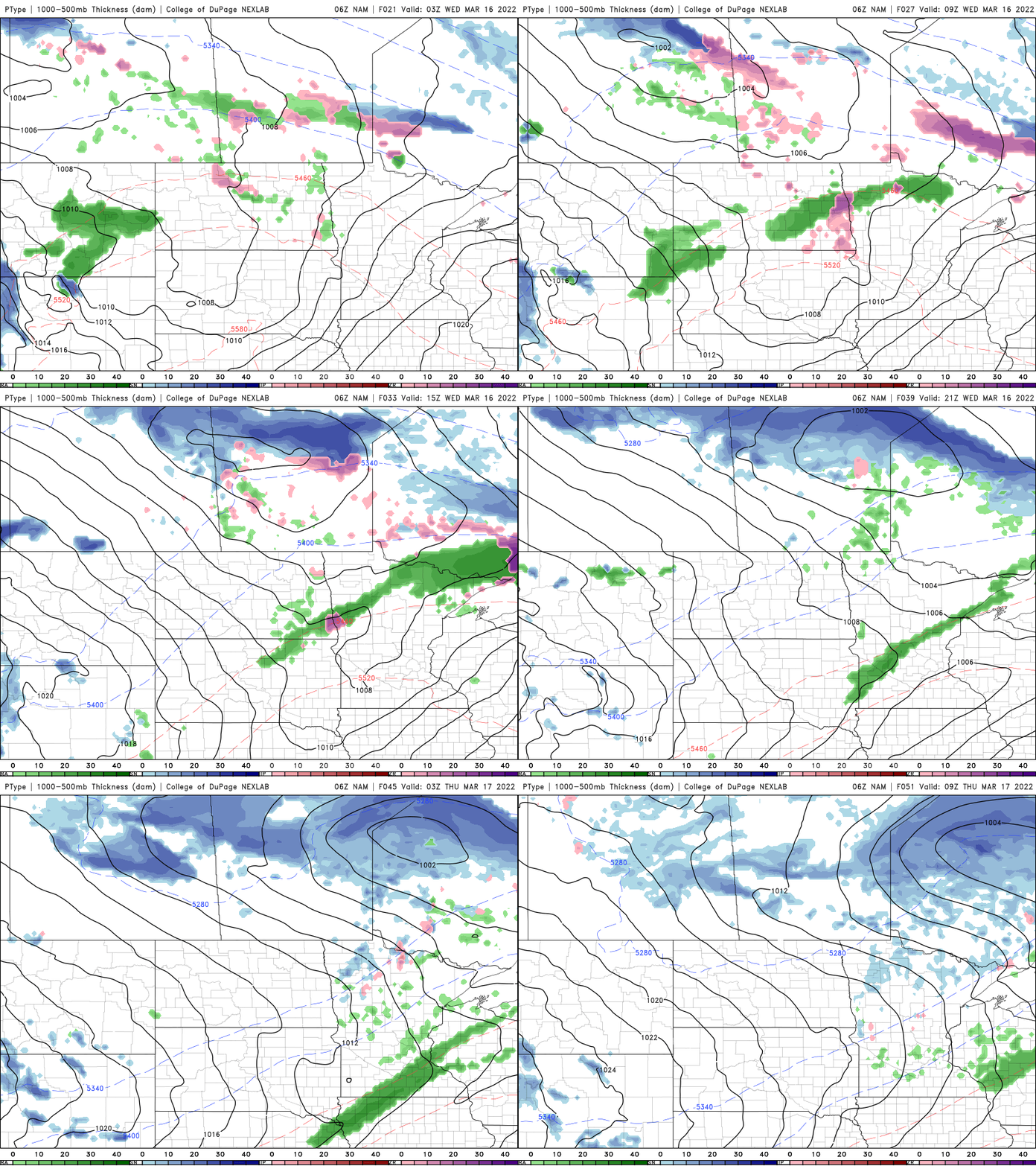
While it will be relatively cooler Thursday and Friday, we’ll still see highs in the 40s and 50s in central and southern Minnesota with 30s in northern Minnesota. We’ll be back in the 50s and 60s by the weekend for southern Minnesota.

