
A warm Wednesday; cooler air moves in Thursday
A cool front will push warm air, clouds, and a couple sprinkles ahead of it Wednesday
Go Deeper.
Create an account or log in to save stories.
Like this?
Thanks for liking this story! We have added it to a list of your favorite stories.


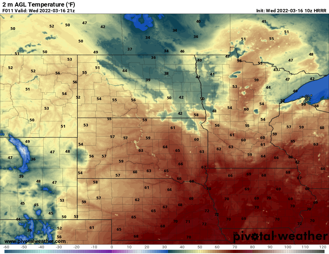
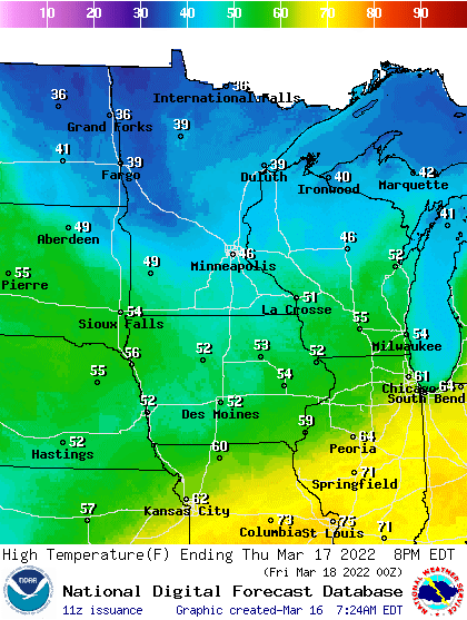
Wednesday will bring our warmest temperatures yet this year for many. Highs will range from the 50s and 60s in the south to the 40s north.
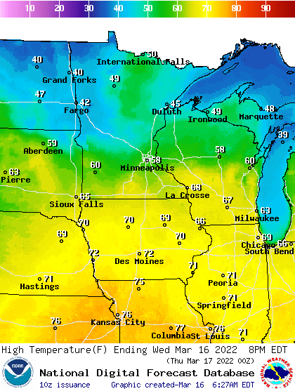
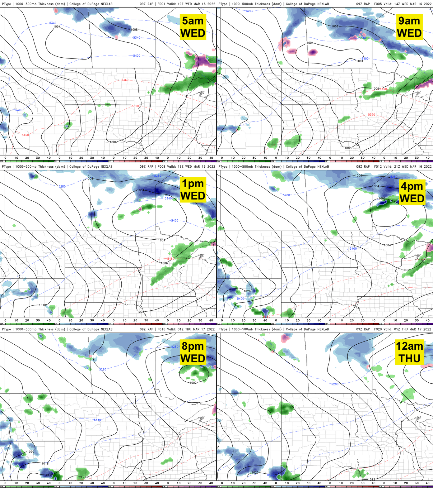
In the Twin Cities, we have a decent chance of hitting our first 60-degree reading. It will be close and depend on the precise timing of a cool front sweeping across Minnesota later Wednesday. That front will increase cloud cover this afternoon and touch off a few light rain showers in northern Minnesota.
Temperatures Wednesday night will be lower in northern Minnesota, back below freezing while southern Minnesota again remains mild.
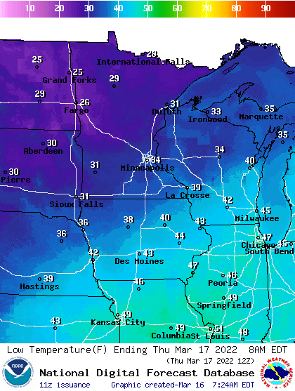
While cooler Thursday, temperatures will still be above normal with 40s and 50s in the south and 30s north.
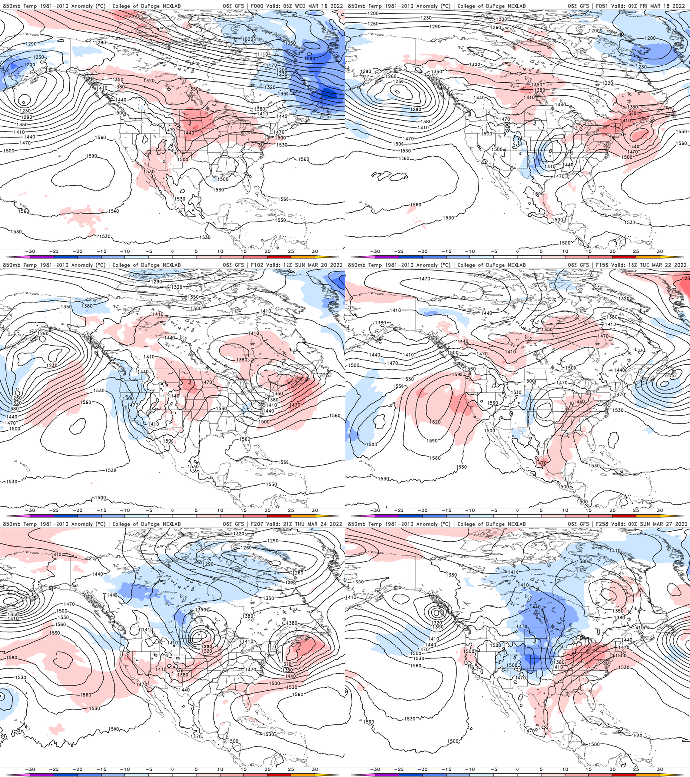
Temperatures will be warming back up for the weekend with southern Minnesota seeing more 50s and even 60s Sunday. The overall pattern remains mild until perhaps late next week when the upper-level pattern will turn toward a cooler one for at least a few days.
No more turning the clocks back?
The United States Senate passed a bill that would make Daylight Saving Time permanent on Tuesday. If the bill became law, what would Minnesota’s sunrise and sunset times look like?
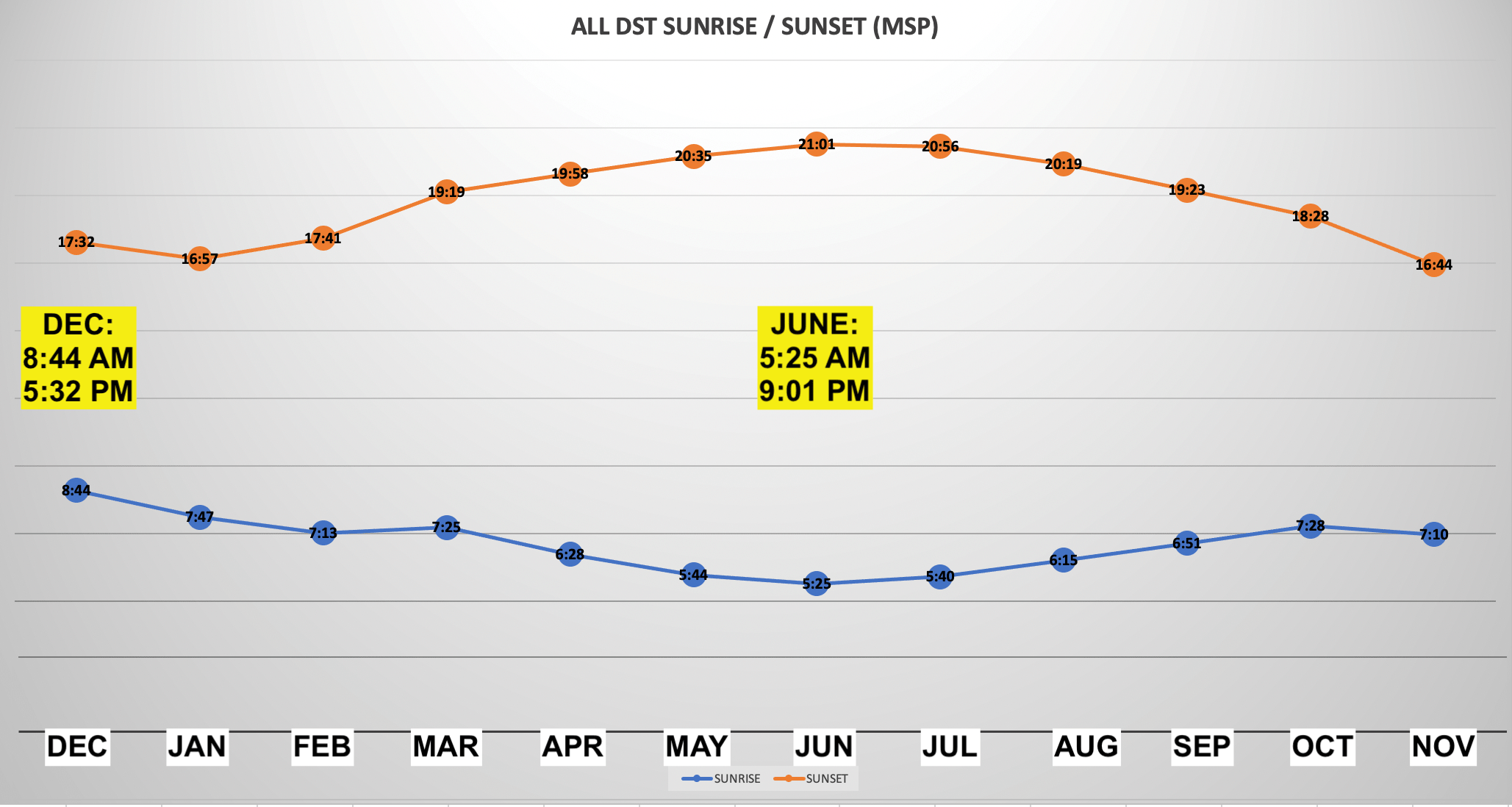
The chart above winter sunrise and sunset times would change. While we could get more evening light in December with a 5:32 p.m. sunset, the sunrise wouldn’t be until 8:44 a.m. in mid-December.
Turn Up Your Support
MPR News helps you turn down the noise and build shared understanding. Turn up your support for this public resource and keep trusted journalism accessible to all.

