
A cool Friday; brighter and warmer Spring weekend
Clouds give way to sunshine Saturday with warmer temperatures
Go Deeper.
Create an account or log in to save stories.
Like this?
Thanks for liking this story! We have added it to a list of your favorite stories.


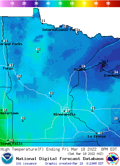
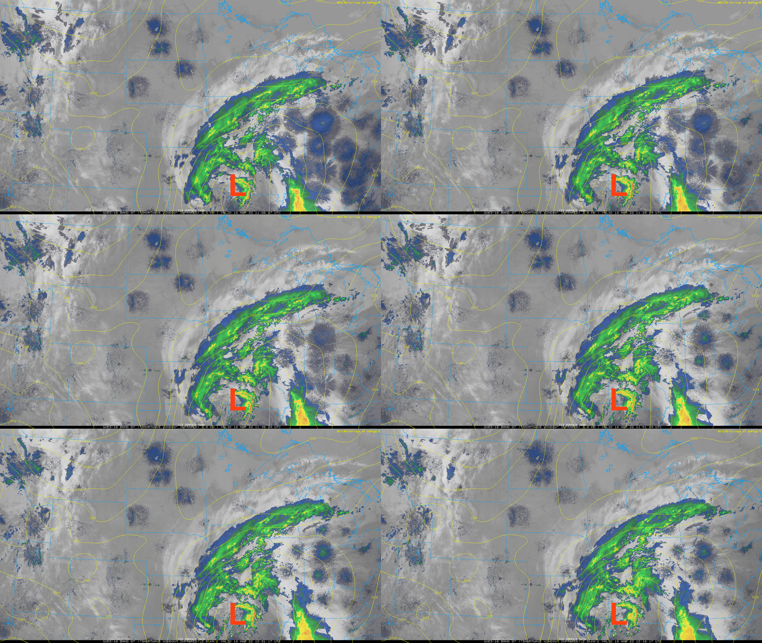
We have another somewhat cooler (though still warmer than normal) day Friday, very similar to Thursday. Expect a mix of clouds and sunshine as we’ll be affected by a storm system moving primarily across Iowa, Illinois and southern Wisconsin Friday.
The far southeastern corner of the state will be clipped by this storm system.
Rain showers mixing with snow is possible Friday into Friday night in those southeastern most counties of Minnesota.
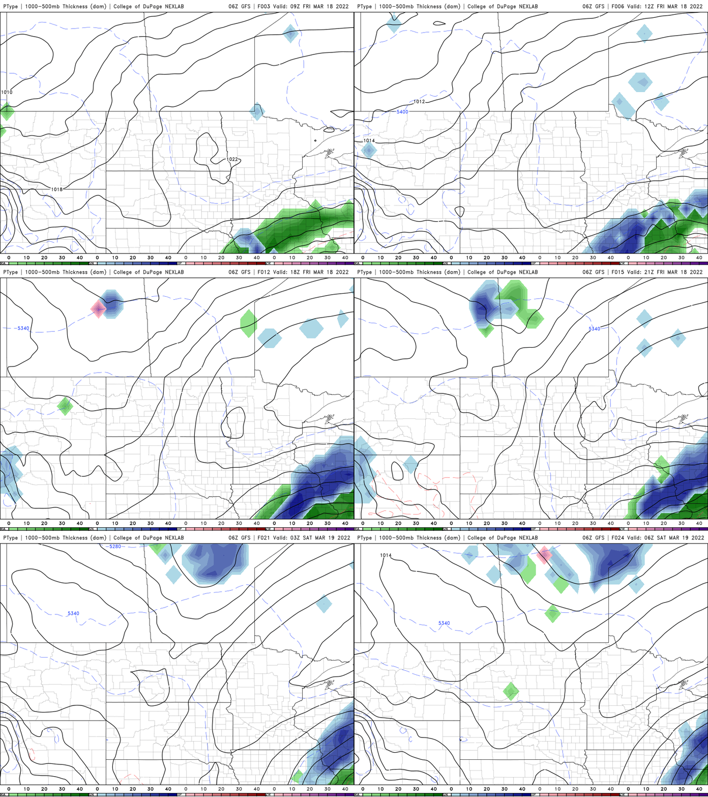
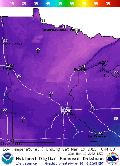
Skies will clear overnight Friday night, leading to cooler temperatures early Saturday morning. Watch out for wet surfaces refreezing.
Turn Up Your Support
MPR News helps you turn down the noise and build shared understanding. Turn up your support for this public resource and keep trusted journalism accessible to all.
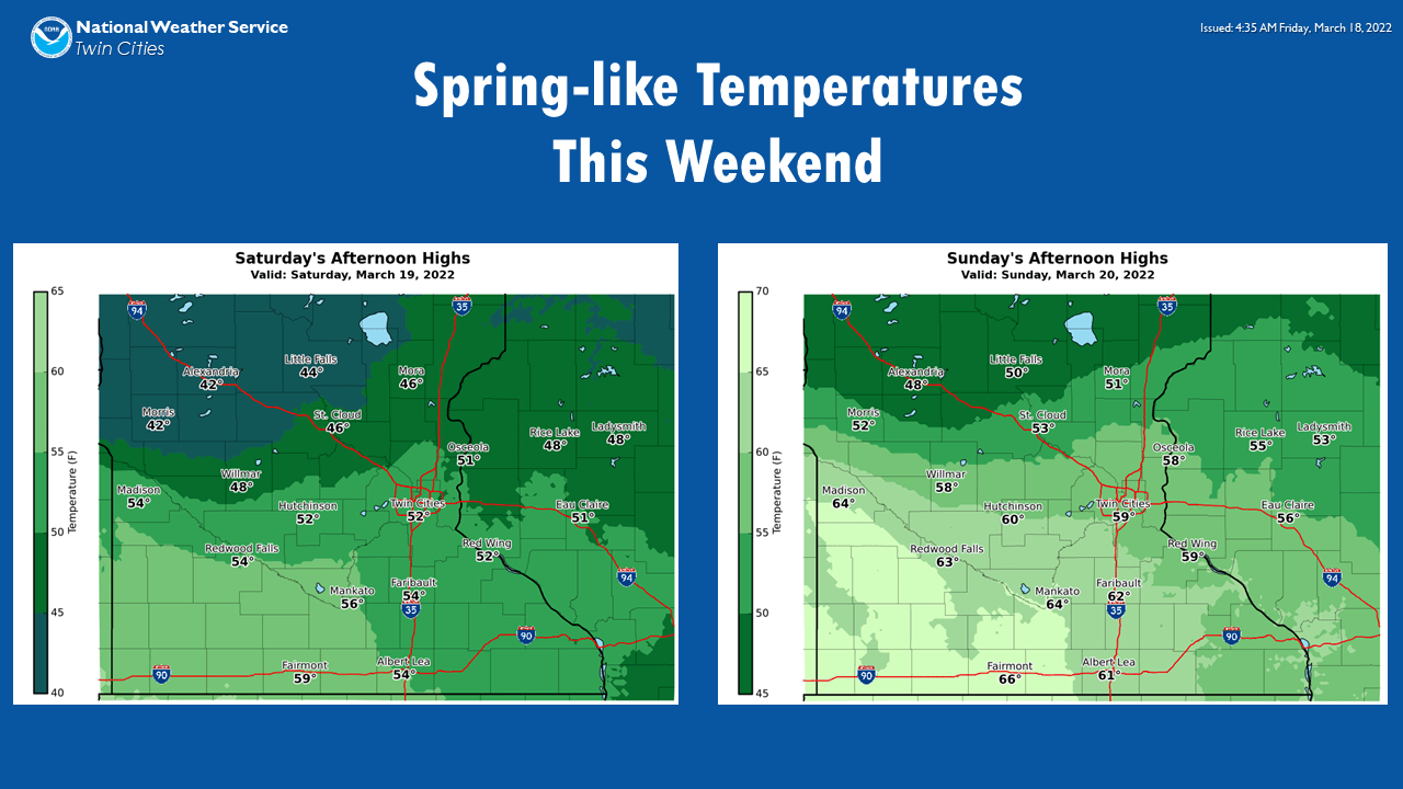
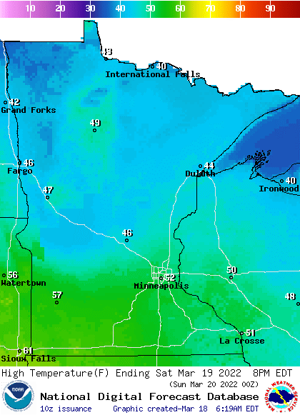
Saturday brings a return to sunshine and warmer temperatures. Expect highs in the 50s south and 40s north.
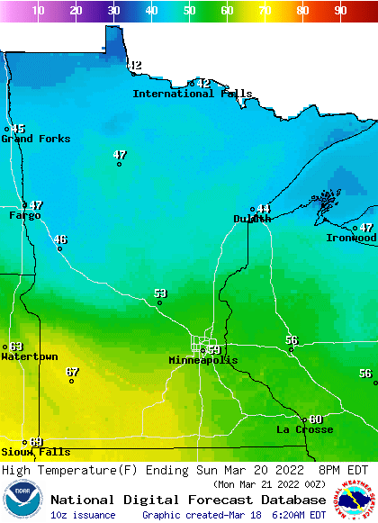
Sunday brings even warmer temperatures and more sunshine. Highs will be well into the 50s and even 60s for portions of southern Minnesota.
Spring begins Sunday morning
Sunday is also the vernal or spring equinox. What does this mean precisely? The sun’s direct, or strongest rays — which are 90 degrees perpendicular to Earth’s surface — cross the equator. Those direct rays have been in the southern hemisphere for the last six months, now they’ll be in the northern hemisphere the next six months. Those most intense beams of light will reach the Tropic of Cancer, approximately 23 degrees latitude, by the summer solstice in June.
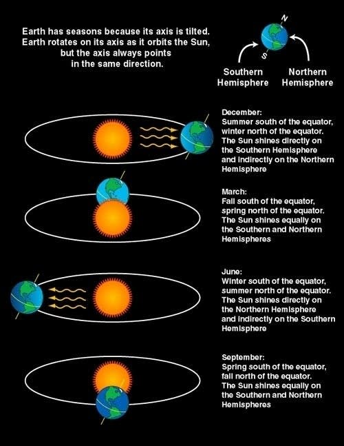
Equinox is Latin for ‘equal night’ but actually we all have a little more daylight than night on the equinox because the sun is a disk — not a point of light — and Earth’s atmosphere refracts or bends sunlight. Friday is actually the first day we have more day than night — by four minutes — for the first time since Sept. 24.
More active next week with rain and snow?
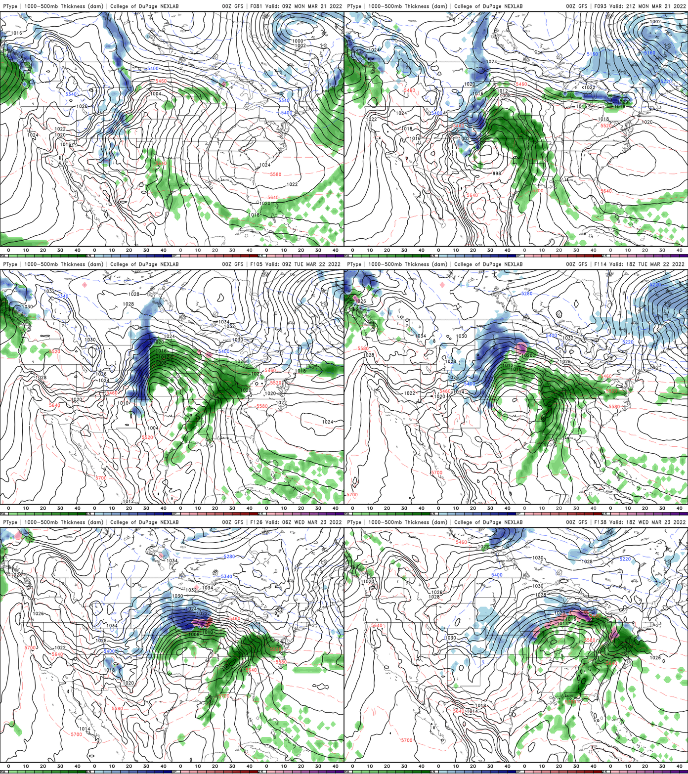
Monday will be yet another mild day; well into the 50s, if not near 60. Things then get more active as a storm system develops rain showers Tuesday. It’s possible we could see some snow Tuesday night into early Wednesday as well. Something to keep our eye on the next several days.
Another hot summer?
I know we’re just talking about spring starting, but the Climate Prediction Center has released its early look at the summer outlook. The odds are favorable at this point for a hotter than normal summer for almost all of the country.

Sahara dust blankets parts of Europe
Dust storms are common in northern Africa’s Sahara desert, and sometimes that dust reaches Europe if the weather patterns are just right. Recently, however, an unusual amount of dust has blanketed much of Spain in an orange/brown layer. Satellite imagery showed this dramatic display. You can make out southern France, Spain and Portugal. At least we don’t have that to contend with.


