
Warmer on Sunday; 60s in parts of southern Minnesota
Snow chances up north on Tuesday

Go Deeper.
Create an account or log in to save stories.
Like this?
Thanks for liking this story! We have added it to a list of your favorite stories.


Saturday was a gorgeous March day!
The Saturday high temperature at Minneapolis-St. Paul International Airport was 54 degrees, which is 11 degrees warmer than our average March 19 high temp.
Much warmer ten years ago
Imagine how 79 degrees would feel this time of year. The Twin Cities high temp was 79 degrees on March 19, 2012. That completed a four-day stretch of highs that were 79 or warmer:
Turn Up Your Support
MPR News helps you turn down the noise and build shared understanding. Turn up your support for this public resource and keep trusted journalism accessible to all.
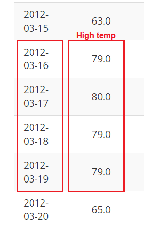
The 80 degree high temp on March 17, 2012 set a new record for the earliest in the year that the official Twin Cities temp had ever reached 80 degrees, based on weather records going back to 1872.
Temperature trends
Highs will reach the 60s in southwestern and south-central Minnesota on Sunday, with mainly 50s elsewhere in Minnesota and western Wisconsin:
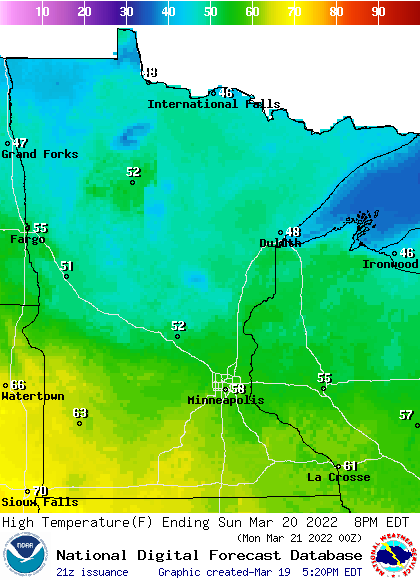
Parts of the Twin Cities metro area could touch 60. There will be some 40s in north-central and northeastern Minnesota.
Winds will start out fairly light on Sunday, with gusty winds developing in western Minnesota Sunday afternoon as a low pressure system approaches. Here are forecast wind gusts for 4 p.m. CDT Sunday:
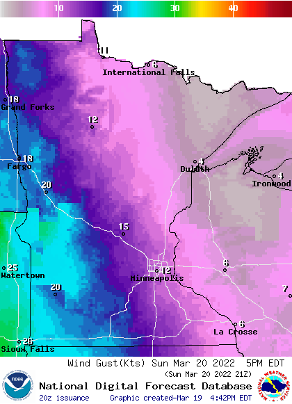
Forecast wind gusts are in knots, with 20 knots equal to 23 mph.
Back to temperatures, Monday highs will range from 60s in southern Minnesota to 40s and a few 30s in the north :
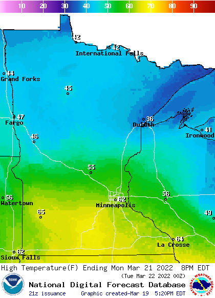
Parts of the Twin Cities metro area could reach the lower 60s. Metro metro area highs are projected to be in the mid 40s on Tuesday, followed by lower 40s Wednesday, upper 40s Thursday and lower 50s on Friday.
Rain and snow for Minnesota Tuesday
A low pressure system will spread rain across much of Minnesota Monday night and Tuesday. In the colder air over northern Minnesota, there could be a wintry mix that changes to mainly snow.
NOAA’s Global Forecast System (GFS) model shows the potential precipitation pattern Tuesday and Tuesday evening:
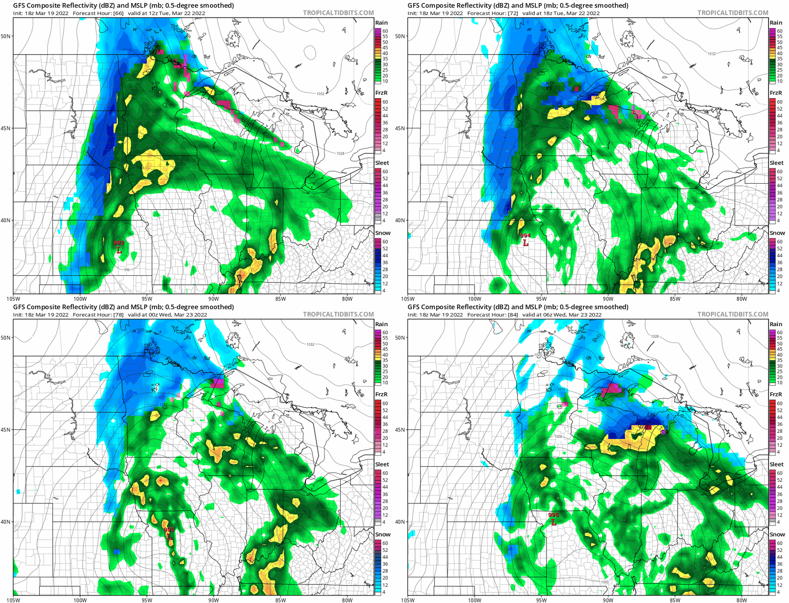
There are 6 hour gaps between images, so think of it as a rough sketch of the weather pattern Tuesday and Tuesday evening. Parts of northern Minnesota could see several inches of snow Tuesday into early Wednesday, so check forecast updates. The Twin Cities metro area is expected to see mainly rain Monday night and Tuesday, with a rain/snow mix possible Tuesday night into early Wednesday.
You can hear updated weather information for Minnesota and western Wisconsin on the Minnesota Public Radio News network, and you can see updated weather info on the MPR News live weather blog.
Spring!
Meteorological spring began on March 1, now it’s time to talk about astronomical spring, which begins on Sunday.
The vernal equinox occurs at 10:33 a.m. this Sunday, March 20. According to earthsky.org:
The March equinox – also called the vernal equinox – marks the beginning of the spring season in the Northern Hemisphere and the autumn season in the Southern Hemisphere
Day and night are not exactly the same length on the date of the equinox because we use the top of the rising or setting sun to define sunrise and sunset, rather than the center of the sun. There’s also some refraction or bending of the sun’s rays as they travel through the atmosphere, which adds to our minutes of daylight. More details on those two factors can be found here.
Programming note
You can hear my live weather updates on MPR News at 7:35 a.m., 9:35 a.m. and 4:39 p.m. each Saturday and Sunday.

