
A warm Monday; rain arrives Tuesday
The warmest temps we’ve seen yet move in Monday afternoon
Go Deeper.
Create an account or log in to save stories.
Like this?
Thanks for liking this story! We have added it to a list of your favorite stories.


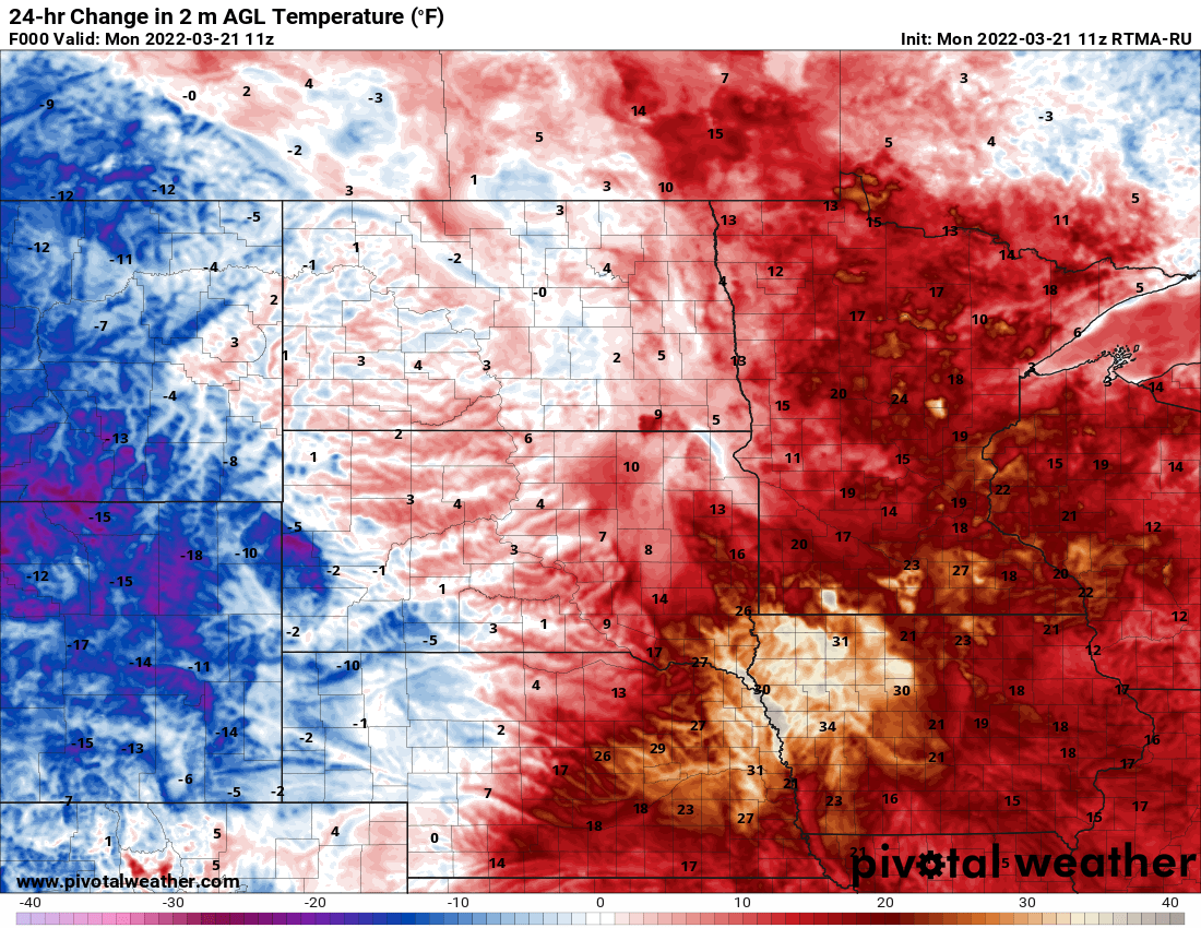
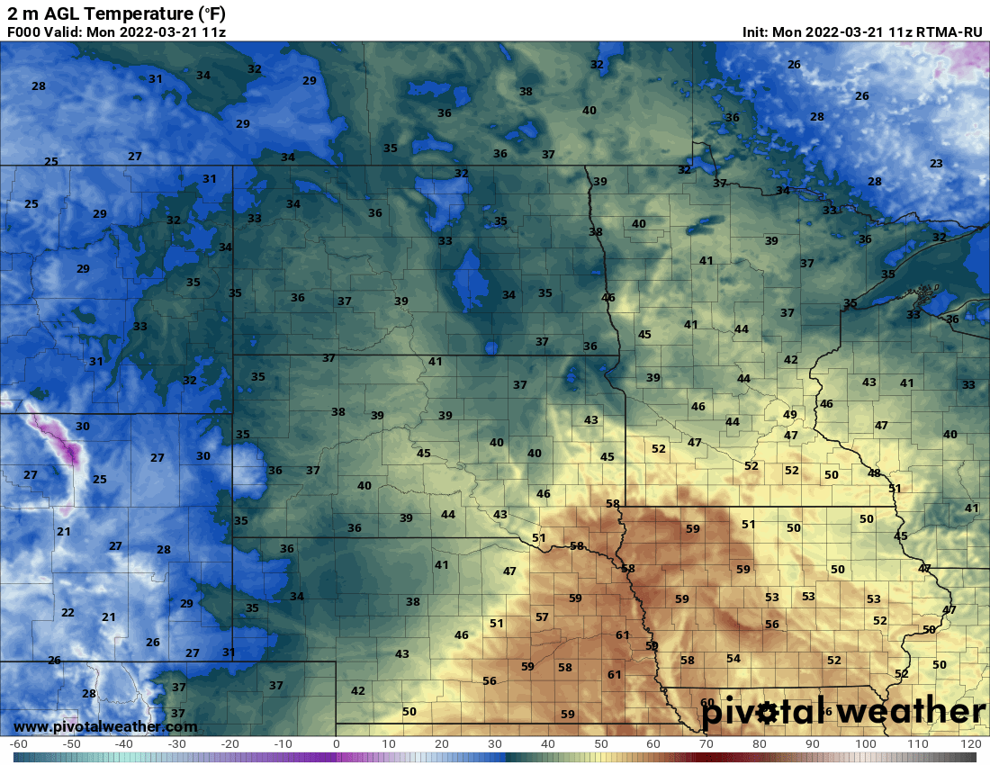
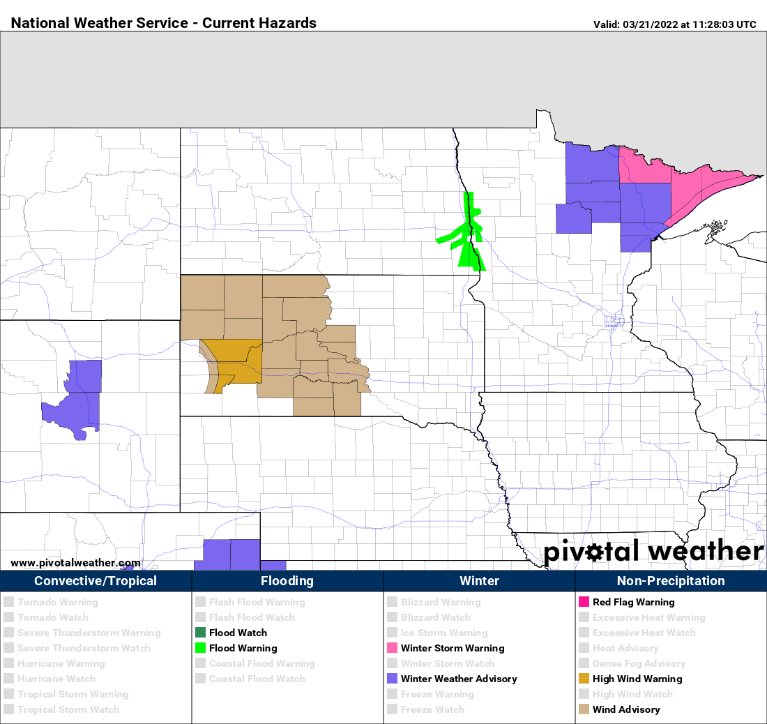
A warm front divides Minnesota between spring-like warmth in the south and colder conditions north. While temperatures are in the 30s north, parts of southern Minnesota are starting the day in the 50s.
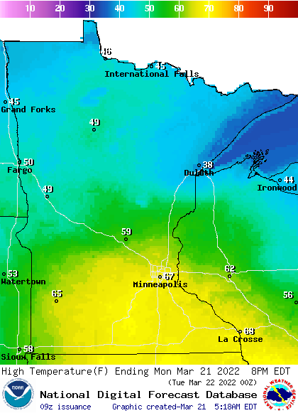
High temperatures Monday will be widespread 60s in the south and even low 70s. Northern Minnesota will remain significantly cooler, in the 40s and even just 30s closer to Lake Superior. Winds will be from the east ahead of the warm front blowing cold air off Lake Superior inland. The southern half of the state will see south winds.
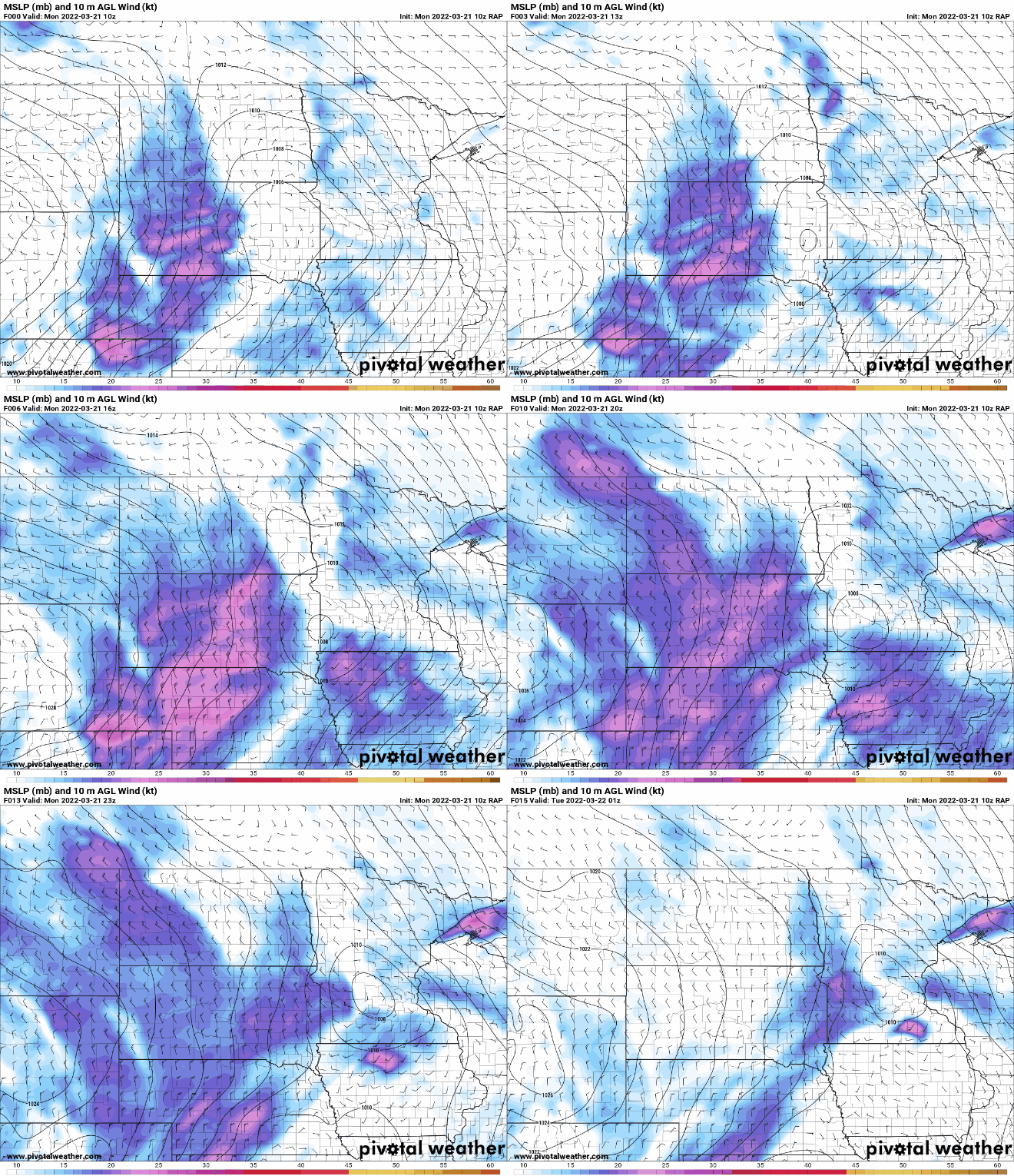
There are some showers ahead of the warm front early Monday morning across portions of central Minnesota. Most of us will remain dry during the day.
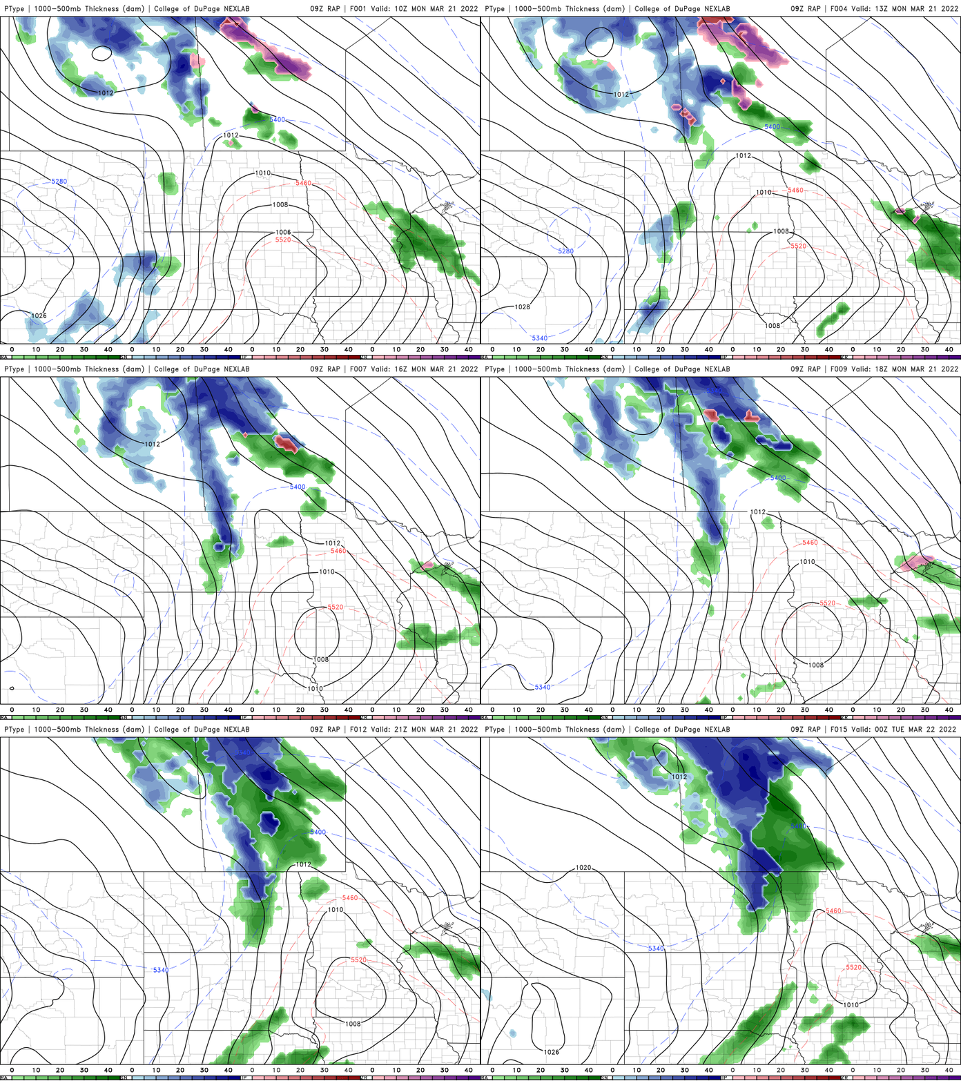
The most significant weather of the week arrives Monday night into Tuesday and Wednesday as a big spring storm pumps moisture north.
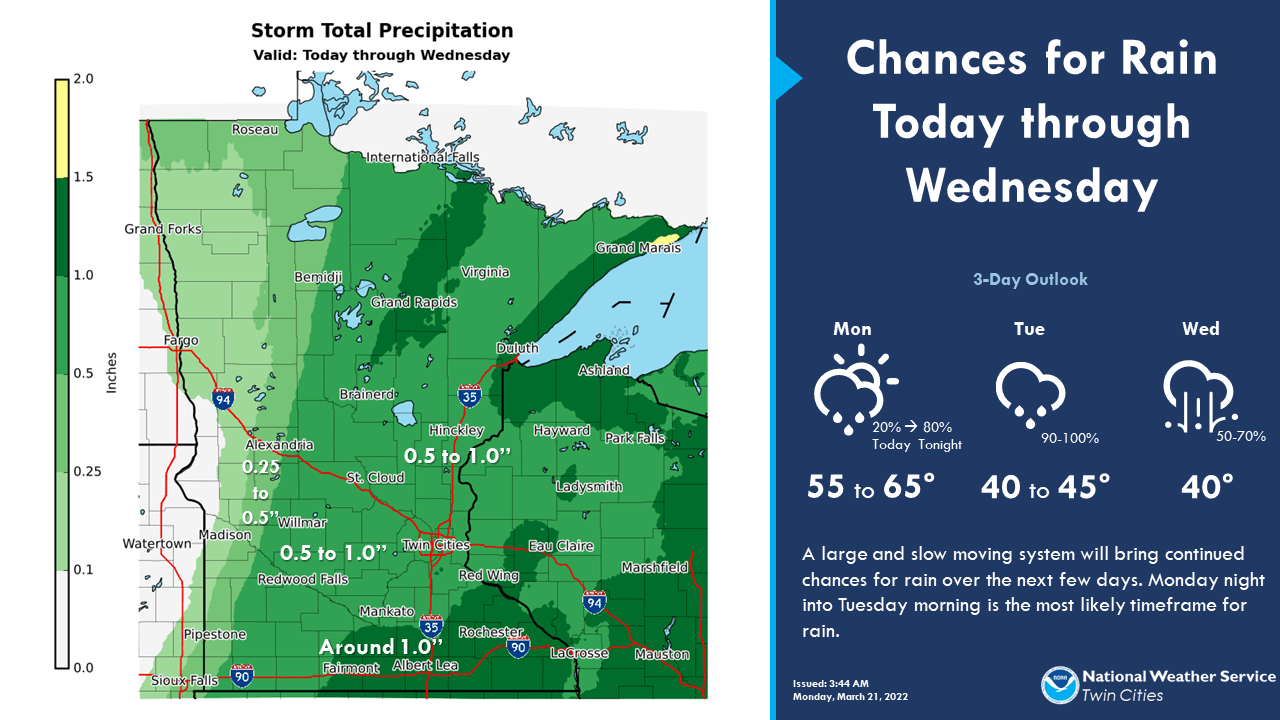
Southern Minnesota will see mainly rain; potentially up to one inch or more in some places.
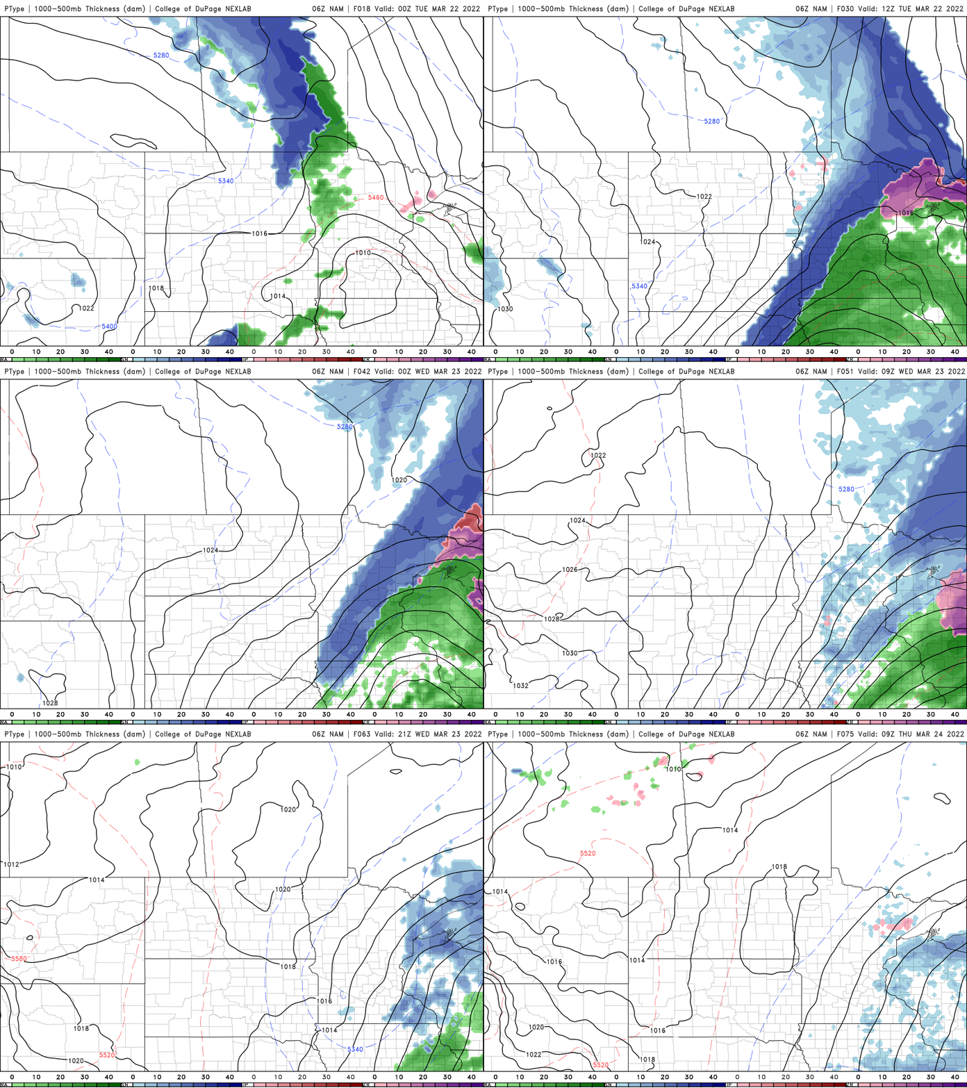
Rain will mix with snow with possible accumulations for all, though the best chance of significant snowfall is north.
Turn Up Your Support
MPR News helps you turn down the noise and build shared understanding. Turn up your support for this public resource and keep trusted journalism accessible to all.

