
Warm Monday, soggy Tuesday
Well into the 60s Monday; spring storm arrives Monday night
Go Deeper.
Create an account or log in to save stories.
Like this?
Thanks for liking this story! We have added it to a list of your favorite stories.


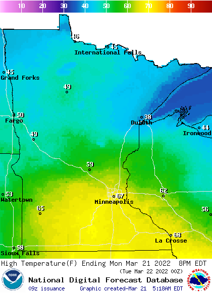
Monday will be very mild, with highs well into the 60s in southern Minnesota and near 70 for some. Temperatures will be in the 40s north.
Rain arrives Monday night with ice potential in northeastern Minnesota. Expect a soggy Tuesday with persistent rain.
Signs of spring
The mild weather continues Monday following a Sunday that brought the season’s first 60-degree temperature to the Twin Cities.
Migrating birds, another sign of spring, were visible in full display on radars across the region. The round clusters, when the air is clear of precipitation, are birds:
Turn Up Your Support
MPR News helps you turn down the noise and build shared understanding. Turn up your support for this public resource and keep trusted journalism accessible to all.
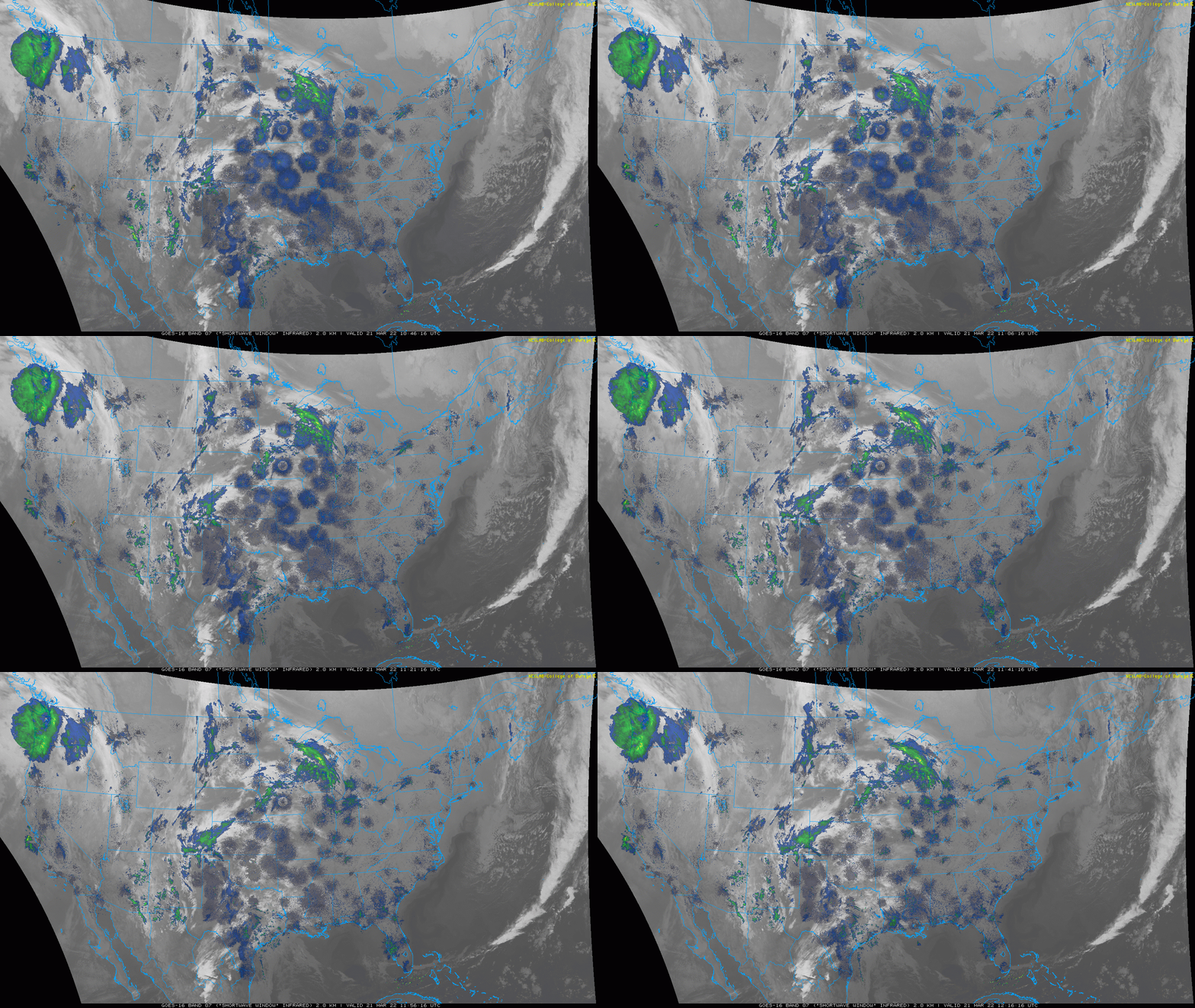
Many song birds migrate at night to avoid hawks and other predatory birds.
A warm Monday
After a balmy start early Monday morning with temps in the 40s and 50s, we’ll see highs Monday afternoon well into the 60s with a few low 70s in southern Minnesota.
If it were sunny, we’d see 70 even in the Twin Cities but we will see filtered sun through high and mid-level cloud cover.
Storm brings sloppy Tuesday
A major spring storm will create weather from the Gulf of Mexico into Minnesota the next couple of days. A large upper-level low is pulling moisture ahead of it already early Monday.
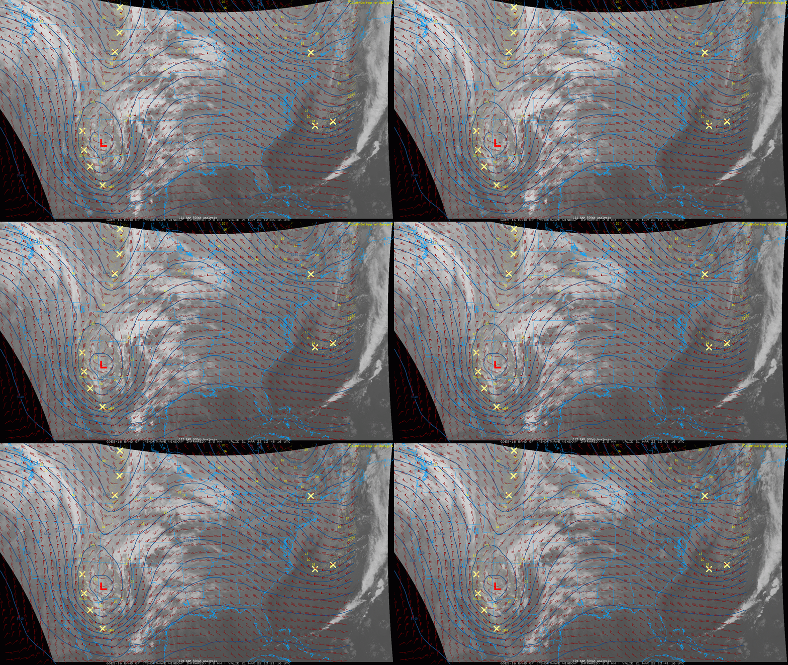
Rain showers will develop and move in overnight Monday night. Expect a soggy Tuesday with persistent rain.
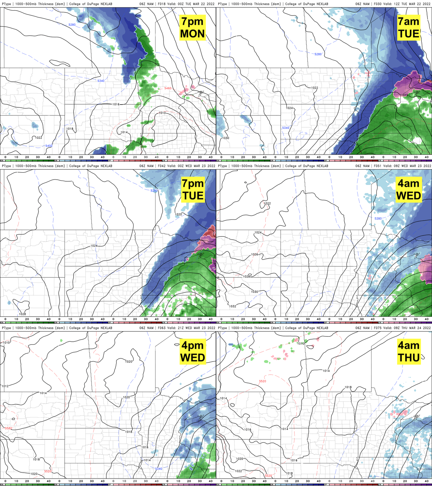
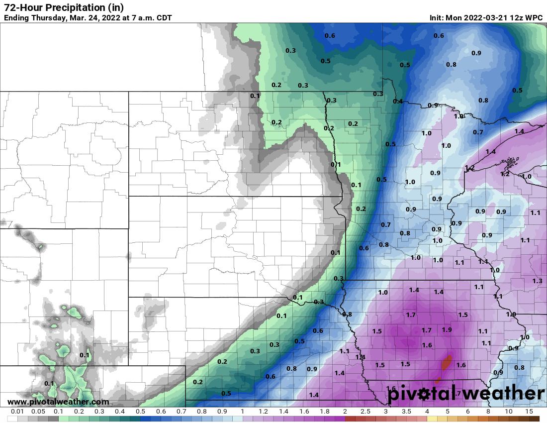
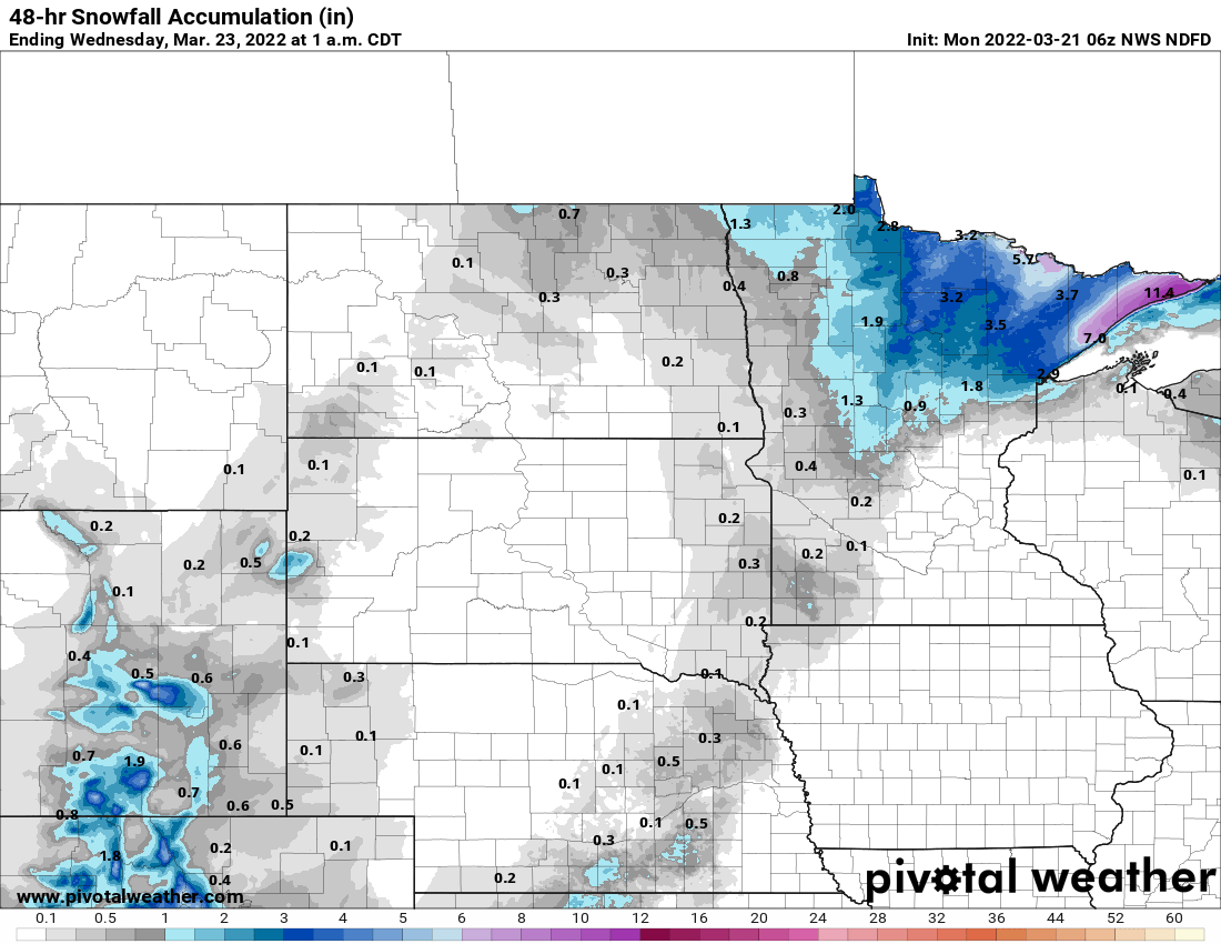
While southern Minnesota will see up to 1 inch of rainfall, northeastern Minnesota will see a wintry mess.
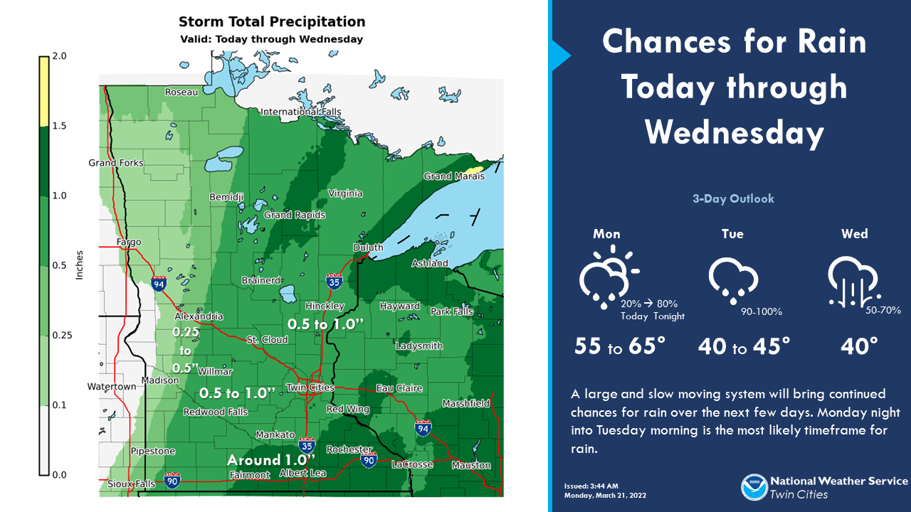
Ice accumulation is possible Monday night into early Tuesday, especially north of Duluth.
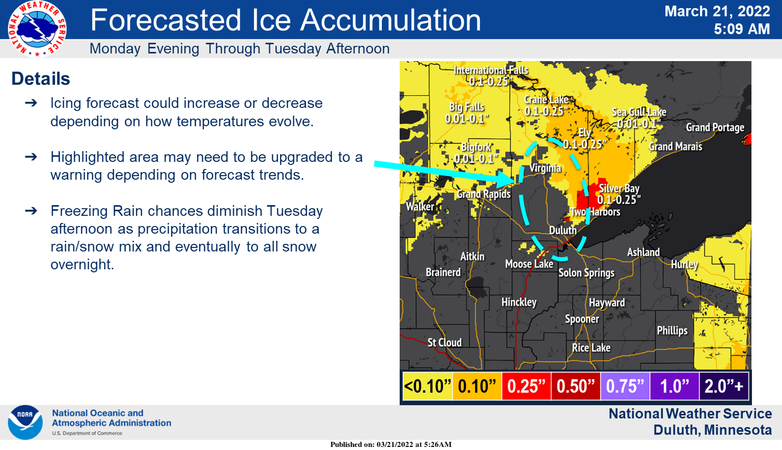
Freezing precipitation will turn to snow gradually Tuesday with significant snowfall up the North Shore from Silver Bay to Grand Portage.
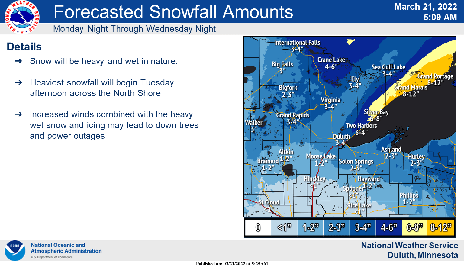
In southern Minnesota we too could see some slushy accumulation Tuesday night into early Wednesday.
While Minnesota sees rain, ice and snow, it’s severe weather in the deep south Tuesday that will be cause for concern.
The storm prediction center issued a rare moderate risk already three days in advance on Sunday for Tuesday. There is a high risk for tornadoes and damaging hail in eastern Louisiana and western Mississippi.


