Spring storm continues: Rain and snowfall reports so far
Soakings rains, ice and significant snowfall still occurring. Storm continues into Wednesday.
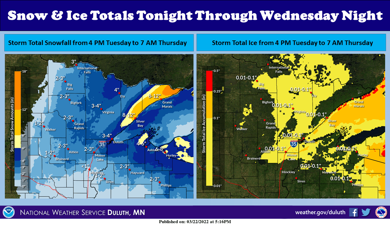
Go Deeper.
Create an account or log in to save stories.
Like this?
Thanks for liking this story! We have added it to a list of your favorite stories.
Our sloppy spring storm continues to deliver a wintry edge to big parts of Minnesota into Wednesday.

Rain, ice and snow cover various parts of our state with this system. NOAA’s afternoon (18Z) NAM 3 km model run shows mixed precipitation swirling around the low-pressure system between 6 p.m. Tuesday and noon Wednesday.

In this scenario, the Twin Cities will pick up some slushy snowflakes Wednesday, but accumulations will be insignificant.
The heaviest snowfall will occur in northeast Minnesota, where a foot could fall along the upper North Shore. Winter storm warnings, gale warnings and winter weather advisories continue for northeast Minnesota into Wednesday.
Turn Up Your Support
MPR News helps you turn down the noise and build shared understanding. Turn up your support for this public resource and keep trusted journalism accessible to all.
Snowfall reports so far
Here are some preliminary snowfall reports as of about 5 p.m.
International Falls 5.3”
Longville 4.5”
Cohasset 3.0”
Jenkins 3.0”
Ice reports
Several locations in northeast Minnesota have reported glaze ice.
Rainfall reports
The Twin Cities and southern Minnesota have received a steady soaking rainfall.
Here are some select preliminary rainfall reports.
Victoria .90”
MSP Airport .69”
St. Cloud .65”
Maple Plain .50”
Chanhassen .36”
Precipitation intensity will gradually ease across southern Minnesota overnight.