
More rain, snow on Friday; weekend looks chilly
Seasonable temperatures Thursday with showers late Thursday night
Go Deeper.
Create an account or log in to save stories.
Like this?
Thanks for liking this story! We have added it to a list of your favorite stories.


Clouds will decrease from north to south Thursday with temperatures near normal — 40s south, 30s north. A clipper brings more precipitation late Thursday night into Friday with a cold weekend behind it. March may be heading out like a lion.
Dry Thursday
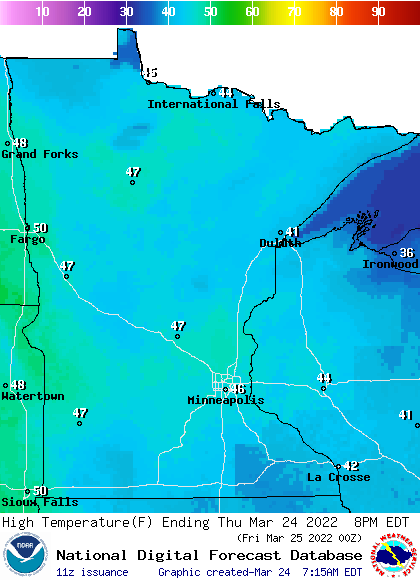
Temperatures Thursday afternoon will be warmer than Wednesday with drier weather. Normal highs for this date range from the mid 40s in the south to 40 in the north. Highs will be right near those readings.
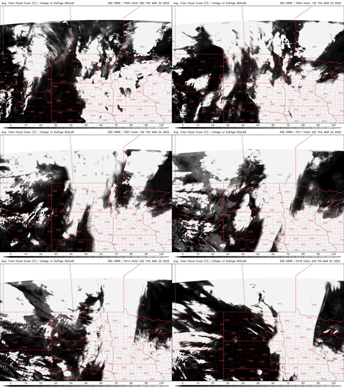
Thursday will be mainly dry with just an early, isolated shower or two left over. Clouds will decrease from north to south as our midweek storm system moves farther east.
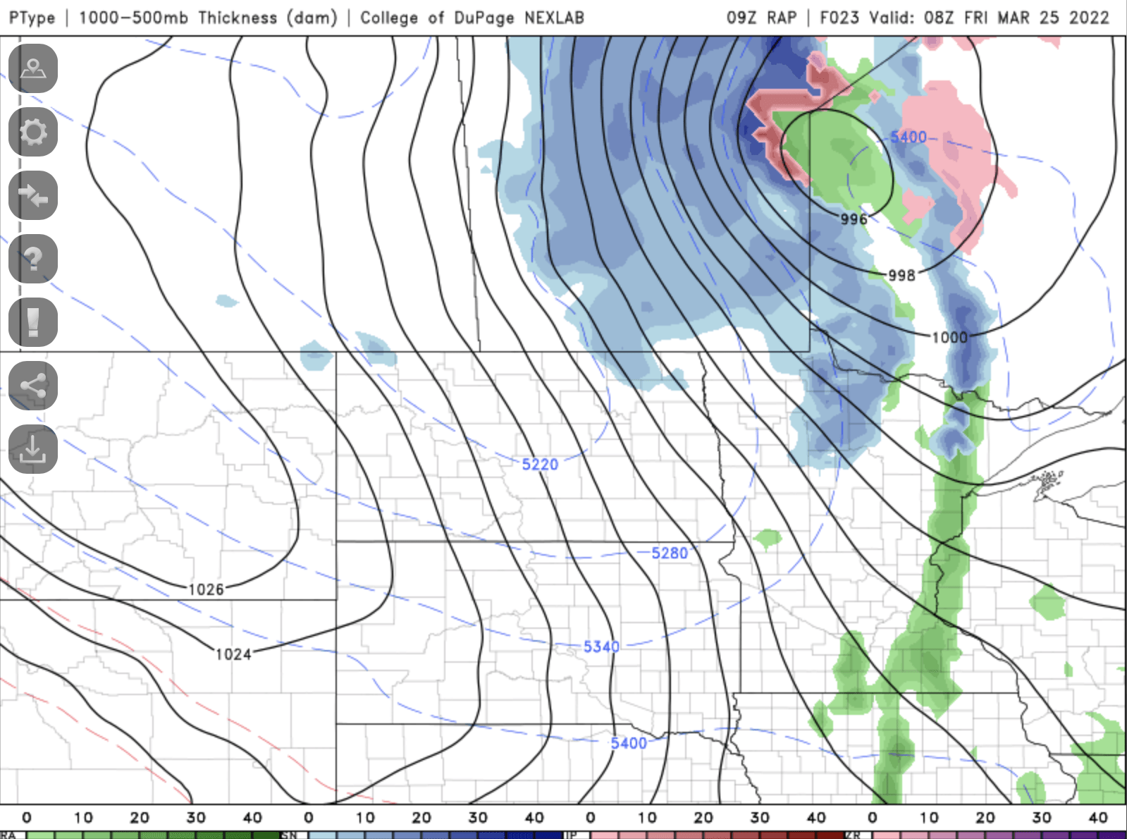
We have another possibility of precipitation Thursday night into Friday — a fast moving clipper, not a large storm system.
Turn Up Your Support
MPR News helps you turn down the noise and build shared understanding. Turn up your support for this public resource and keep trusted journalism accessible to all.
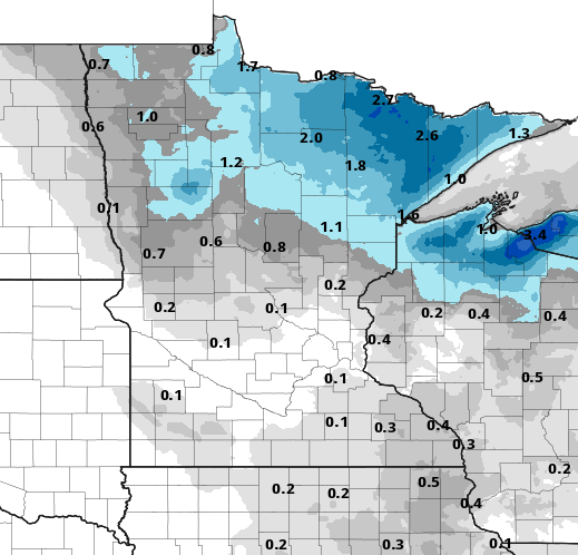
On the warm side of the system we’ll see some light rain showers possible after midnight Thursday night then snow showers Friday as colder air moves in. Amounts will be light for most, with northern Minnesota most likely to see accumulations.
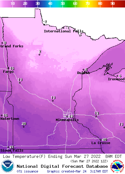
It will be a cold weekend with temperatures below normal by about 10 degrees for most. Highs will range from the 30s south to just 20s north and some early morning lows in the teens and single digits in northern Minnesota.
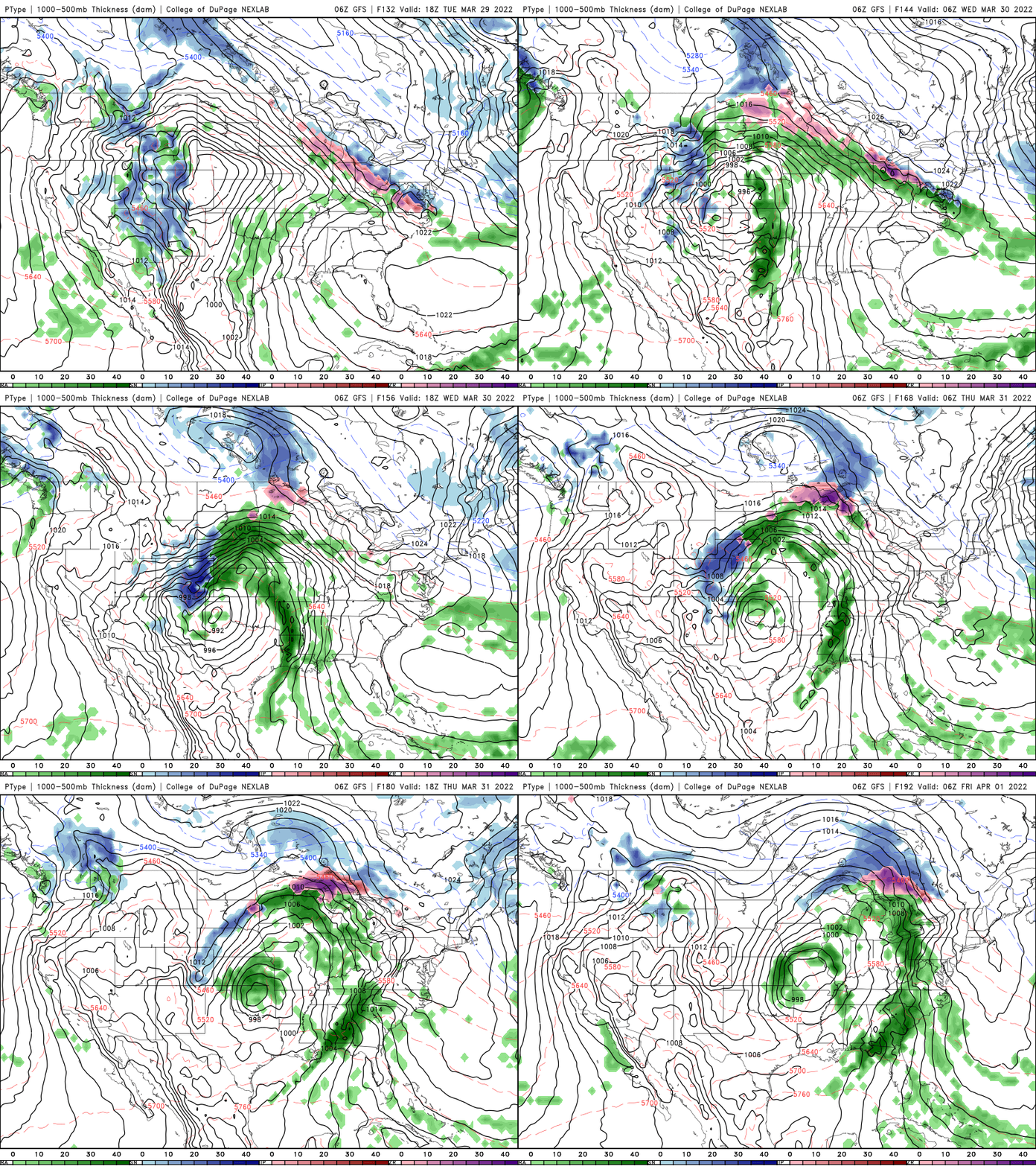
March may be heading out like a lion. Another large storm is shaping up for next Tuesday into Thursday. It could bring another round of rain, ice and snow to Minnesota to close out what’s been a wet month.
Wet March
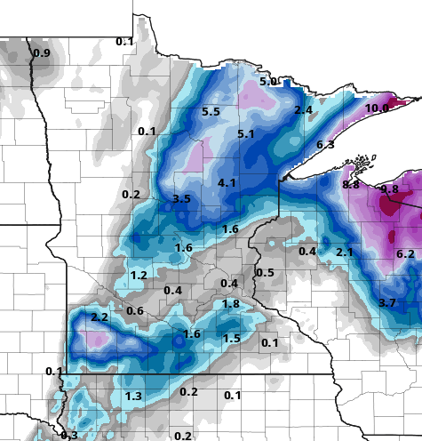
It has been a wet month for a rare change. This latest storm system really put us over the top. Of course, quite a bit of snow fell in northern Minnesota with over a foot around International Falls and into the Arrowhead region.
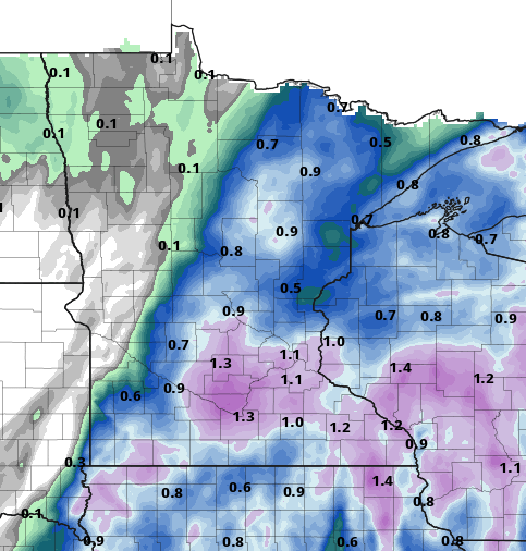
The liquid equivalent was very impressive as well. Many areas saw over 1 inch of precipitation.
March precipitation in the Twin Cities is up to 2.18 inches. That’s nearly double the normal amount to date (1.13 inches). This came from primarily two rainfall events this month. A lot of people have asked me how this impacts the drought and the deficit we had in 2021.
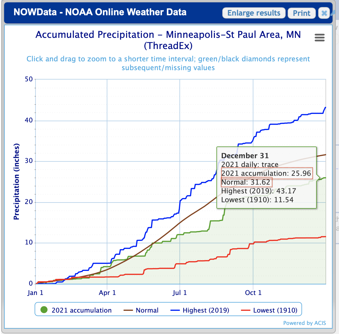
We ended 2021 a whopping 5.66 inches below normal, nearly one-fifth of our normal precipitation below the normal; 2022 has mainly been running below normal too until this month.
This latest storm finally pushed not just March but our annual precipitation to date above normal.
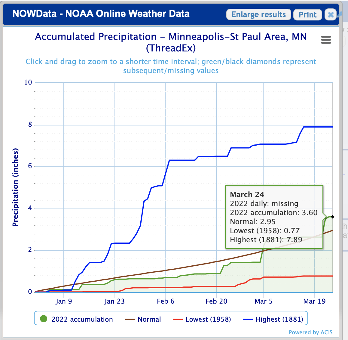
Our surplus of 0.65 inches is enough to cut more than a tenth of the deficit from last year. We need to remain consistent with moisture this year and have several wet months to really make more significant progress.

