
Sunday sunshine; rain and wintry mix may begin Tuesday PM
Update on river levels
Go Deeper.
Create an account or log in to save stories.
Like this?
Thanks for liking this story! We have added it to a list of your favorite stories.


This Sunday is much cooler than last Sunday, when we hit 60 degrees in the Twin Cities. Metro area highs are forecast to reach the low to mid 30s this Sunday. Our average Twin Cities high temp is 47 degrees this time of year.
Most of Minnesota and parts of western Wisconsin will have Sunday highs in the 30s, with mainly 20s in the northern third of Minnesota.
Temperature trends
Monday highs will reach the 40s in much of southern and central Minnesota, with mainly 30s to the north:
Turn Up Your Support
MPR News helps you turn down the noise and build shared understanding. Turn up your support for this public resource and keep trusted journalism accessible to all.
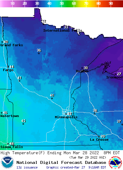
There may be a few 20s up along the North Shore of Lake Superior.
Monday afternoon wind gusts will be highest in western Minnesota:
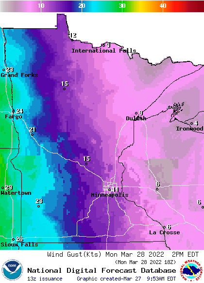
Forecast wind gusts are in knots, with 20 knots equal to 23 mph.
Back to temperatures, Twin Cities metro area highs are projected to reach the lower 40s Monday and Tuesday, then around 40 Wednesday followed by mid 30s Thursday and upper 30s on Friday.
Wintry mess Tuesday PM into Thursday
A low pressure system will move out of the Rockies and spread precipitation across much of Minnesota and western Wisconsin from Tuesday afternoon into Thursday.
The Twin Cities metro will have a chance of rain showers Tuesday afternoon. Periods of rain are likely Tuesday night and Wednesday, possibly mixed with some snow and sleet and light freezing rain at times. A wintry mix Wednesday evening probably changes to all snow later Wednesday night in the metro area, then the snow continues into Thursday. Metro snow amounts depend on the timing of the changeover to snow. The track of the storm system will become clearer by late Monday, so check forecast updates.
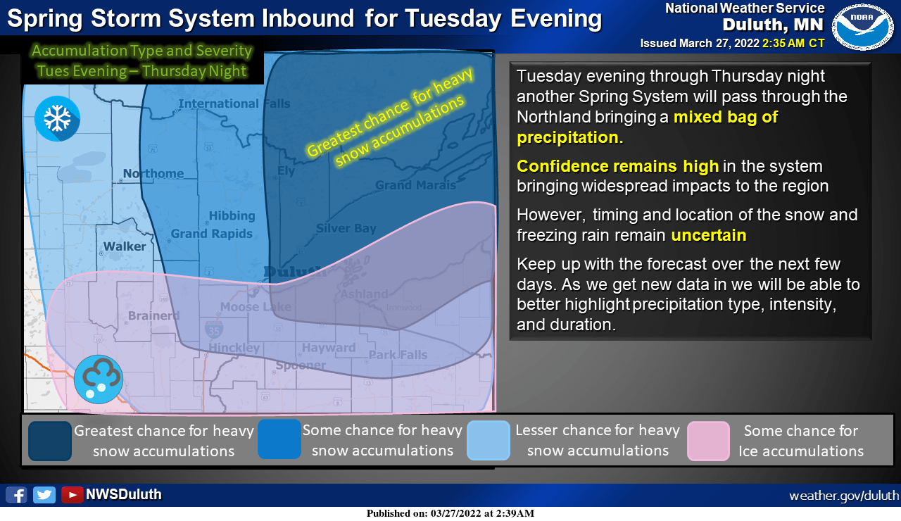
The heaviest snow this week may be from central Minnesota to just north of the metro area and on into northeastern Minnesota and northwestern Wisconsin.
Here’s the NWS depiction of heavy snow and ice chances in northern Minnesota and northwestern Wisconsin:
I should mention that one forecast model shows several inches of snow Tuesday evening into Wednesday in parts of northwestern Minnesota.
You can hear updated weather information for Minnesota and western Wisconsin on the Minnesota Public Radio News network, and you can see updated weather info on the MPR News live weather blog.
River flooding

The Mississippi River is still 8 feet below flood stage at St. Paul, with no flooding expected this week.
Spring snowmelt has caused the Red River to rise above flood stage in parts of northwestern Minnesota. Flood warnings (shaded green) with various start and end times have been issued for several locations along the Red River:
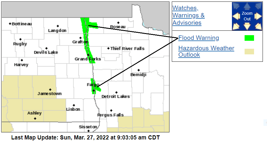
You can get details of flood warning start and end times at the Grand Forks NWS site.
NOAA’s Advanced Hydrologic Prediction Service has a map of river gauges throughout the region:
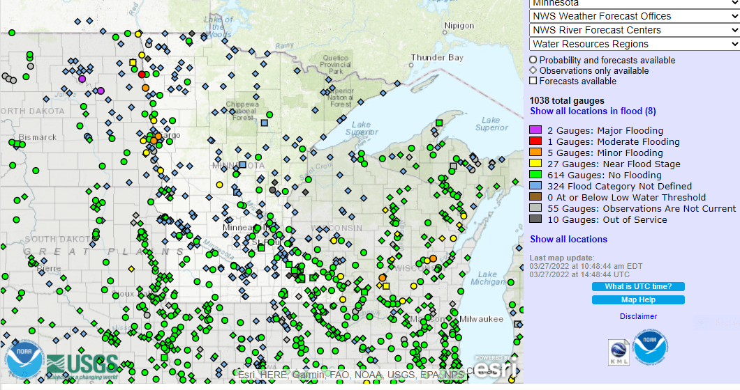
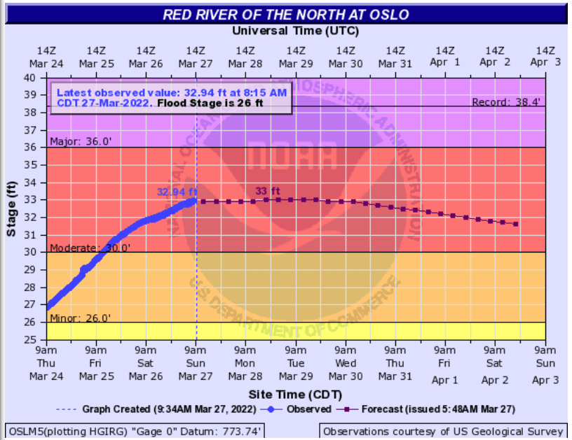
You can click on any gauge at the linked site to see a hydrograph of recent and forecast river levels for that location. Here’s the hydrograph of the Red River at Oslo, Minnesota, which is still at moderate flood stage:
Programming note
You can hear my live weather updates on MPR News at 7:35 a.m., 9:35 a.m. and 4:39 p.m. each Saturday and Sunday.

