Milder Monday; rain, snow arrive late Tuesday

Another spring storm brings a wintry mix late Tuesday into Thursday

precip snapshot
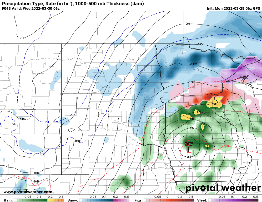
A wintry mix arrives in Minnesota Tuesday night with the next spring storm system
National Oceanic and Atmospheric Administratin, via Pivotal Weather

After another cold morning early Monday, Minnesota should see temperatures inch closer to normal Monday afternoon with highs in the low 40s south, 30s north. Rain and snow arrives late Tuesday into Tuesday night. Next week, 50 degrees should return again for many.

Frigid Monday morning, then near normal

Temperatures were frigid again early Monday morning with subzero lows in northeast Minnesota.

lows Monday
Temperatures early Monday at 7 a.m.
National Oceanic and Atmospheric Administration, via Pivotal Weather

We’ll see highs closer to normal Monday and Tuesday; mainly 40s south and 30s north.

highs MON
High temperatures Monday afternoon
National Weather Service

Spring storm heads toward Minnesota

The big story is the next spring storm moving into Minnesota already late Tuesday. The best chance for significant snow out of this system will be in the arrowhead where a winter storm watch is already posted.

Create a More Connected Minnesota

MPR News is your trusted resource for the news you need. With your support, MPR News brings accessible, courageous journalism and authentic conversation to everyone - free of paywalls and barriers. Your gift makes a difference.

hazards
A winter storm watch for the arrowhead where significant snowfall of more than 3 to 6 inches could fall
NOAA, via Pivotal Weather
NE MN snow
More significant snow impacts in northeastern Minnesota
National Weather Service

Rain showers arrive late Tuesday afternoon with a wintry mix for the northern half of the state turning to snow.

precip loop MON 2
Rain, freezing rain and snow move into Minnesota late Tuesday into Wednesday night
College of DuPage Weather

There’s a chance of icy accumulation across east central Minnesota late Tuesday night as surface temperatures drop below freezing with rain falling.

ice accuml
Potential ice accumulation Tuesday night
NOAA, via Pivotal Weather

The precipitation eventually changes to snow even in southern Minnesota by late Wednesday into Wednesday night but by that time the more significant moisture will have moved on.

Some slushy accumulation cannot be ruled out for the southern half of Minnesota too with the best chances Wednesday night.

snowfall totals
Potential snowfall through early Thursday
NOAA, via Pivotal Weather

If you’re looking for the return of spring temperatures it does look like by later in the weekend and next week we should see 50 degrees return again for many.

Sun highs
High temperatures by Sunday should reach 50 again
NOAA via pivotal weather

Wintry weather to greet Norwegian home guard

It may be fitting that we have some cold and wintry weather to welcome about 100 Norwegian home guard members this week. They are at the Minnesota guard’s Camp Ripley for the annual U.S.-Norwegian Reciprocal Troop Exchange (NOREX).

It’s the 49th year it’s occurred making it the longest running troop exchange. Members of the Minnesota national guard are also training in Norway. The Norwegian base is north of Trondheim, Norway, where it’s definitely still cold and snowy in late March as well.

Norwegian home guard
Minnesota national guard soldiers and Norwegian home guard soldiers at Camp Ripley, Minnesota
Minnesota National Guard photo by Sgt. Mahsima Alkamooneh