
Spring storm brings rain, ice and snow Tuesday night
Milder Tuesday with rain showers arriving late afternoon
Go Deeper.
Create an account or log in to save stories.
Like this?
Thanks for liking this story! We have added it to a list of your favorite stories.


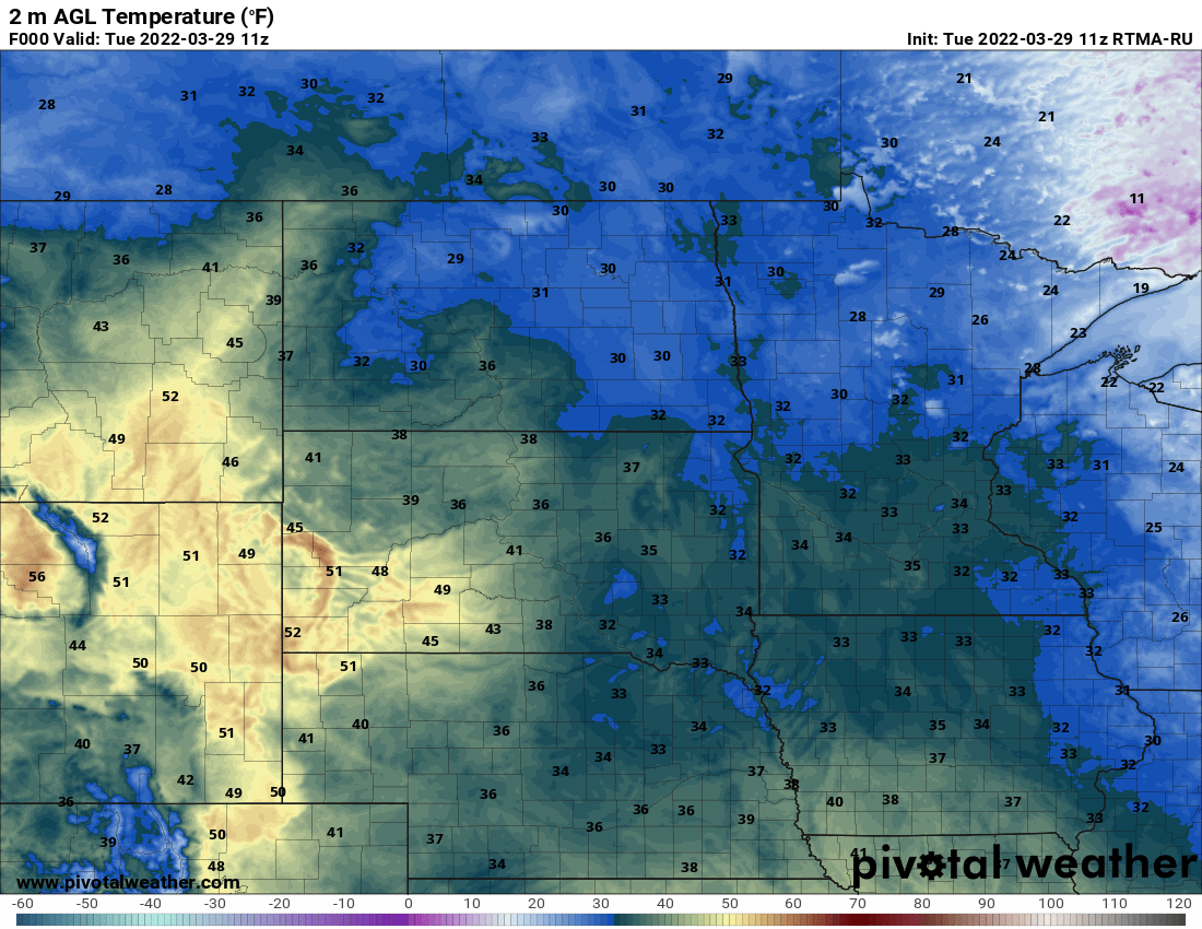
A warmer air mass moving in and cloud cover is making a big difference on early morning temperatures Tuesday.

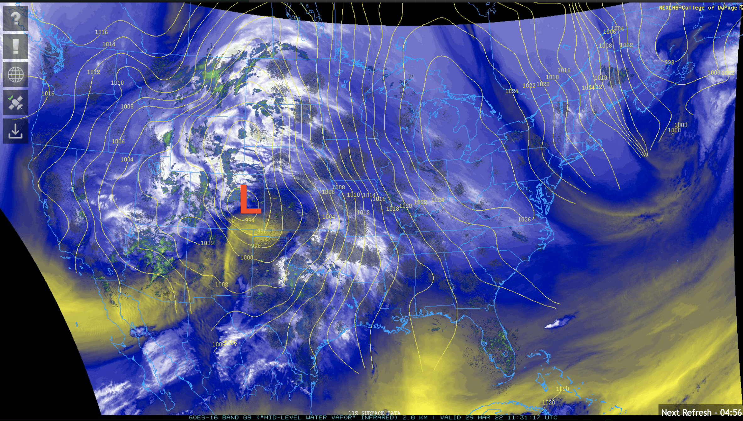
The big story of course is the incoming storm system. It will bring initially rain showers to southern Minnesota gradually late Tuesday and snow in the northwest parts of the state.
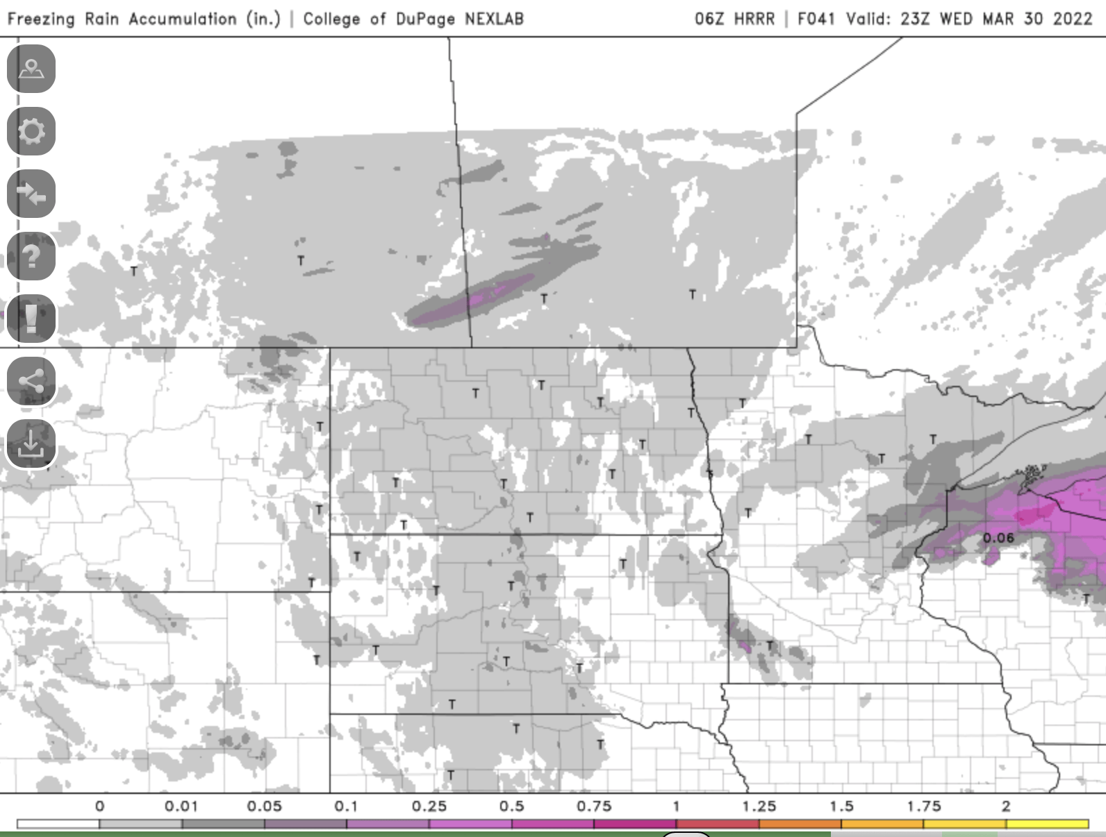
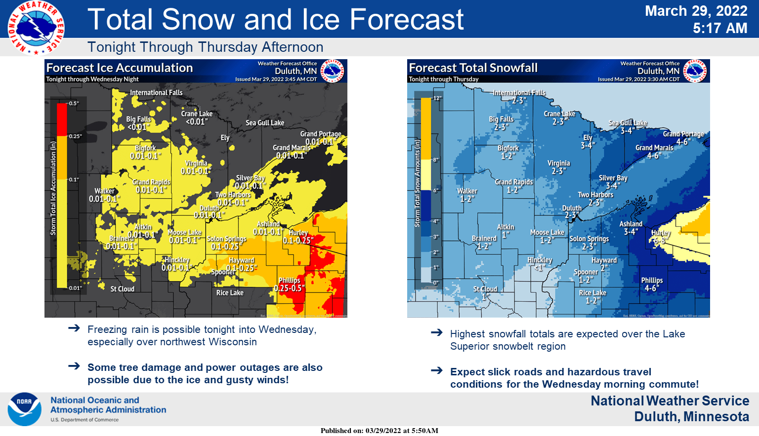
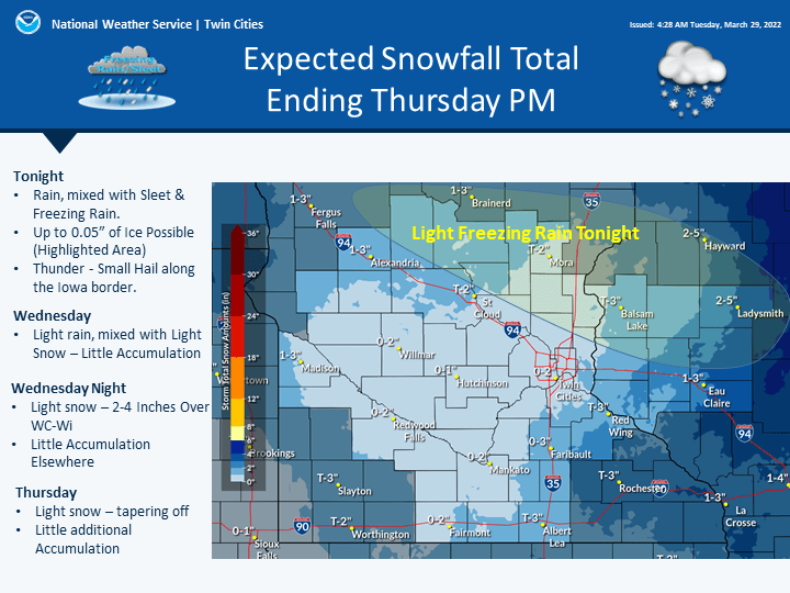
We’ll need to watch central and east central Minnesota Tuesday night for possible ice. Where temperatures drop below freezing, the rain will become freezing rain potentially.
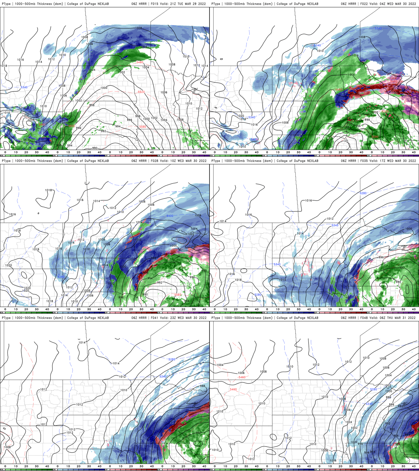
Impacts from this spring storm will differ in each part of the state. Northwest Minnesota will be the first to experience the winter punch.
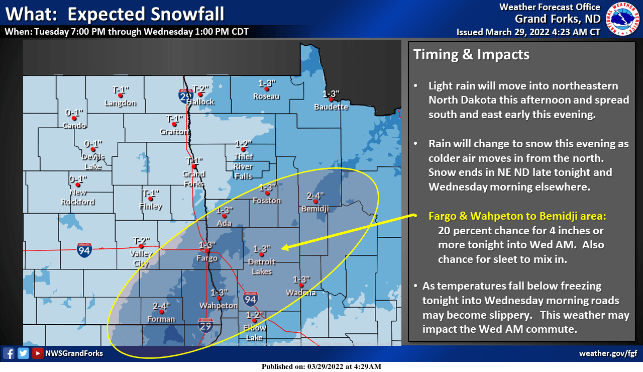
Northeastern Minnesota stands to see the highest possible snowfall amounts.
In southern Minnesota, we’ll see the potential for a secondary area of snow to develop late Wednesday into early Thursday that will create a narrow snowfall from southeast Minnesota into western Wisconsin.
Turn Up Your Support
MPR News helps you turn down the noise and build shared understanding. Turn up your support for this public resource and keep trusted journalism accessible to all.

