
Wet three days ahead; snow north
Rain develops Tuesday and winds increase
Go Deeper.
Create an account or log in to save stories.
Like this?
Thanks for liking this story! We have added it to a list of your favorite stories.


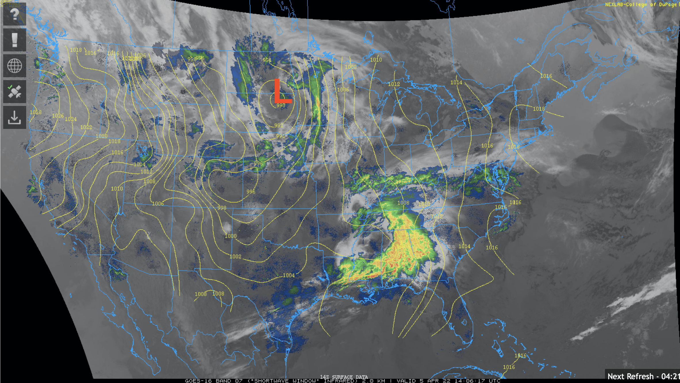
Periods of rain will dominate the midday and afternoon Tuesday in southern Minnesota with rain and snow in northern Minnesota where some places will see accumulations. Heavier snow develops overnight north.
Soggy few days ahead
Ready, set, wet. I sure hope you soaked up a little sun Monday afternoon because we won’t see it again until sometime Friday afternoon. Rain moves across the state with rain mixing with snow Tuesday.
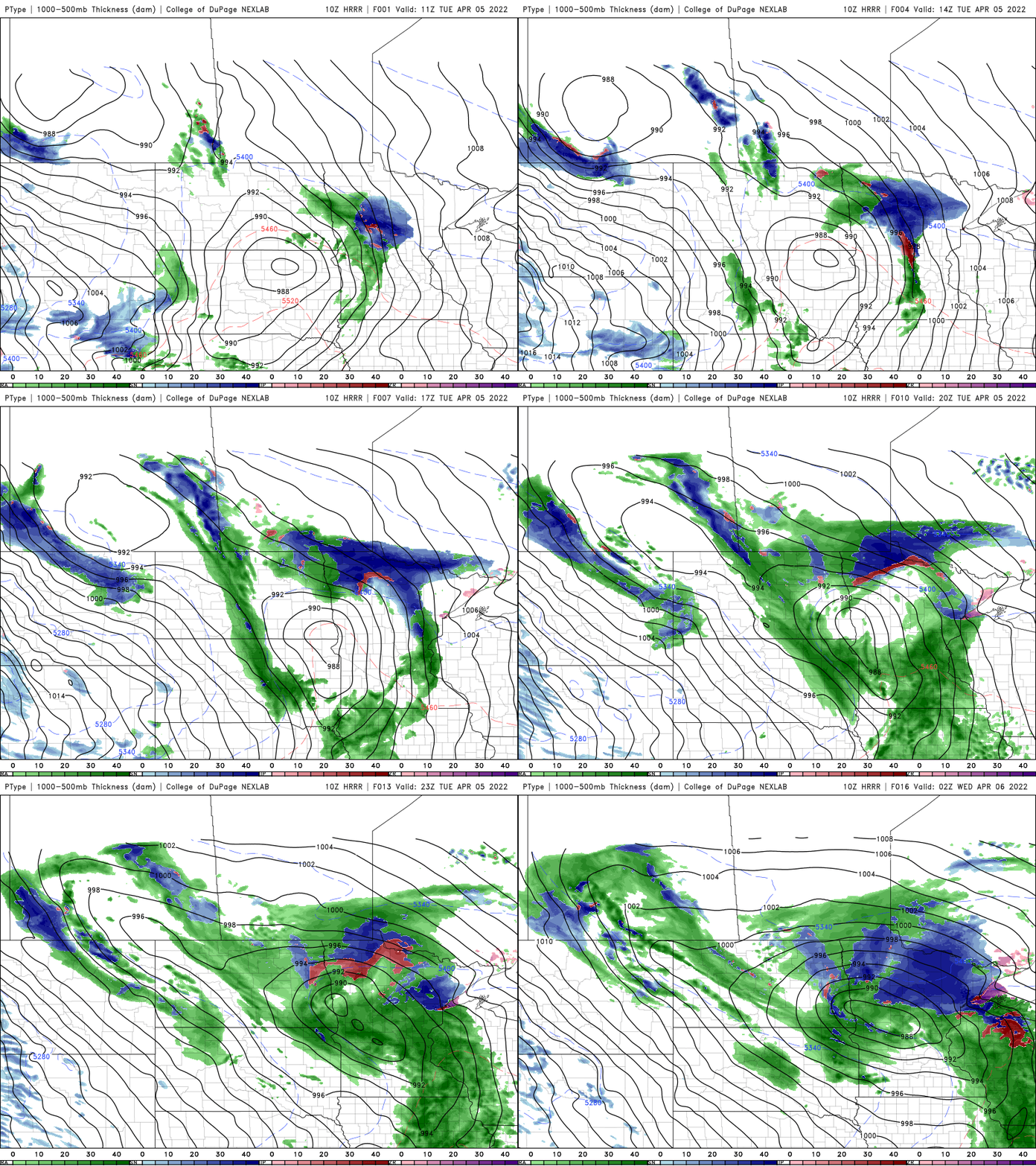
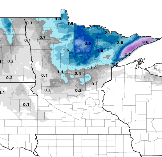
Portions of north central Minnesota will see up to 2 to 4 inches of snow through the evening Tuesday then the snow shifts more into northeast Minnesota and the north shore where up to 3 to 5 inches could fall into early Wednesday.
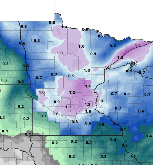
This system will dump quite a bit of water (many of us still have a deficit from last year). Up to one inch or more of liquid equivalent precipitation will fall over the next couple of days.
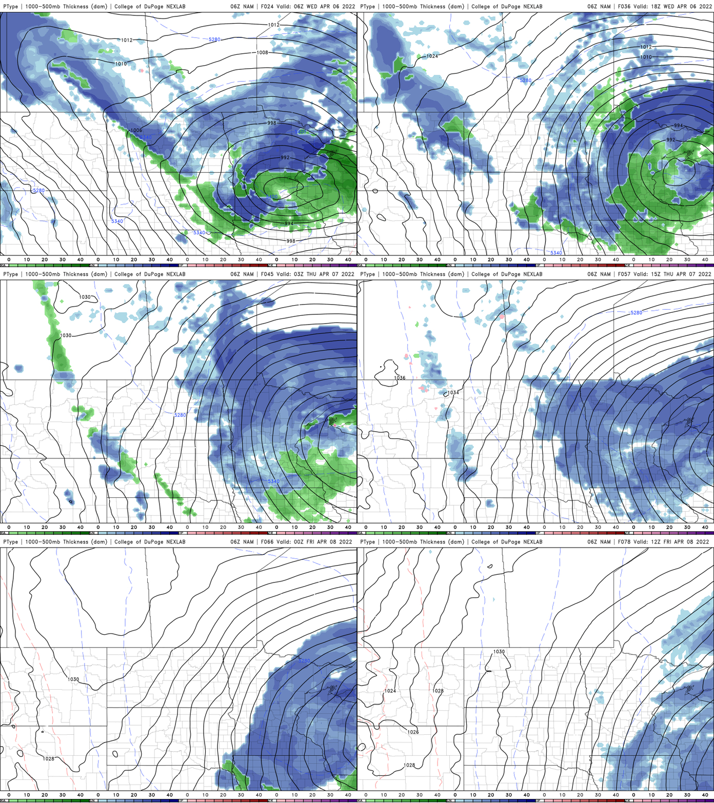
The surface low passes to our east overnight Tuesday night putting us on the colder side of the system and that means rain mixed with snow showers for all on Wednesday into Thursday.
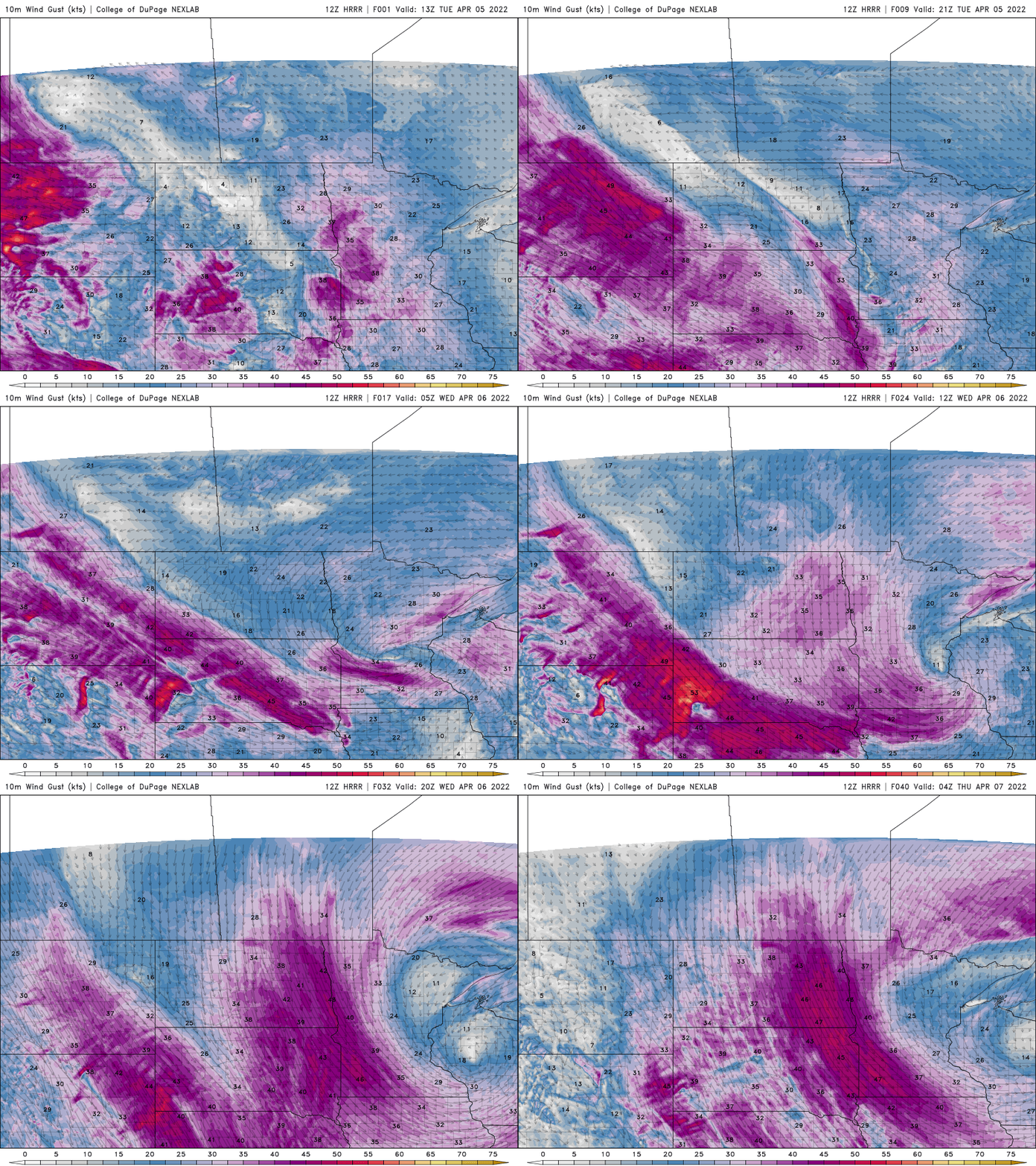
In addition to wet, snowy weather we’ll see a lot of wind for quite a stretch. Winds will remain high; likely sustained at 15 to 20 mph through early Saturday until this upper level low is far enough to our east.
Signs of warmer conditions
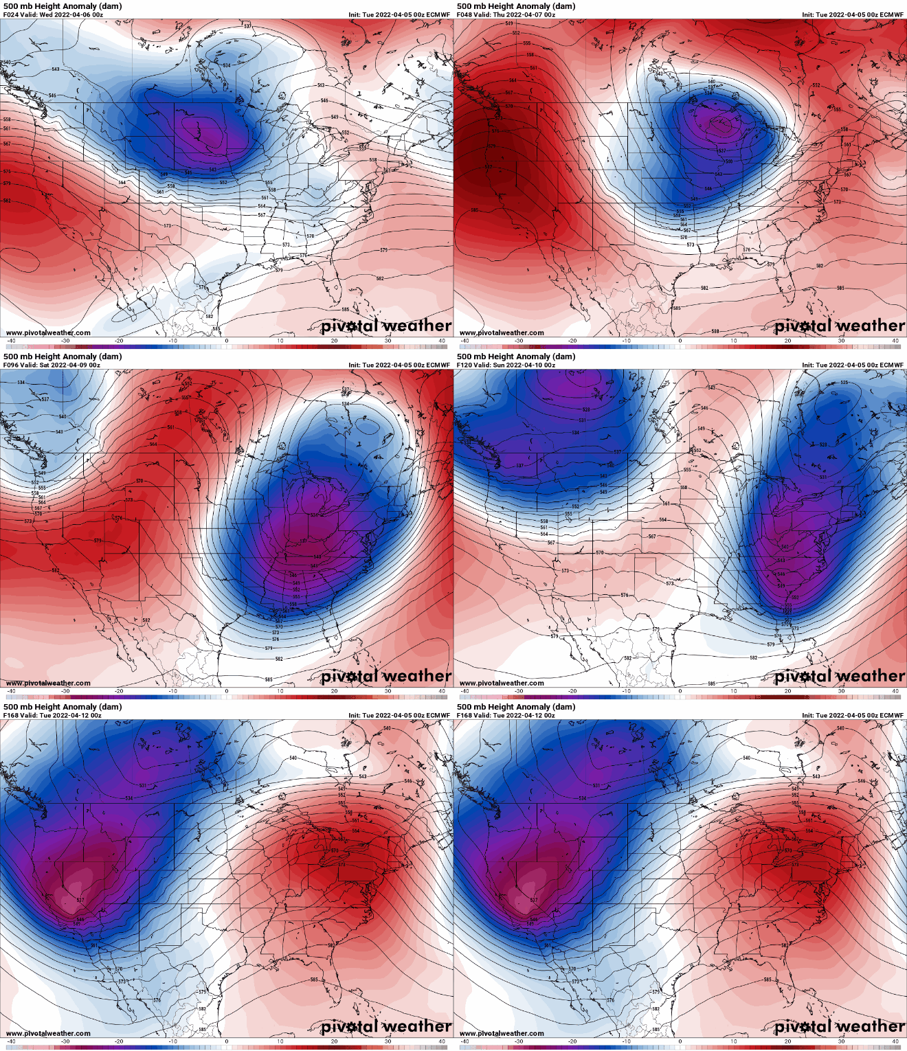
You may be screaming for some nicer spring weather and it looks like we should see some of that this weekend. Sunshine returns Saturday (with some even Friday afternoon). We’ll be in the 50s Saturday and low 60s by Sunday and Monday. The upper level pattern will shift allowing a big upper level ridge (warmer weather) to move in by later in the weekend and next week.
Turn Up Your Support
MPR News helps you turn down the noise and build shared understanding. Turn up your support for this public resource and keep trusted journalism accessible to all.

