
What spring? Twin Cities sees more chilly rain; heavy snowfall up north
More than a foot of snow likely on higher terrain above the North Shore
Go Deeper.
Create an account or log in to save stories.
Like this?
Thanks for liking this story! We have added it to a list of your favorite stories.


Call it the Reluctant Spring of 2022.
Another Wednesday means another potent midweek storm for Minnesota.
Our latest storm system is dumping heavy snow up north, and more soaking rains in southern and central Minnesota.
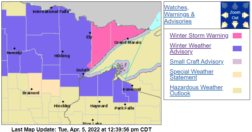
Winter storm warnings are posted for northeastern Minnesota. Winter weather advisories cover most of northern Minnesota.
Turn Up Your Support
MPR News helps you turn down the noise and build shared understanding. Turn up your support for this public resource and keep trusted journalism accessible to all.
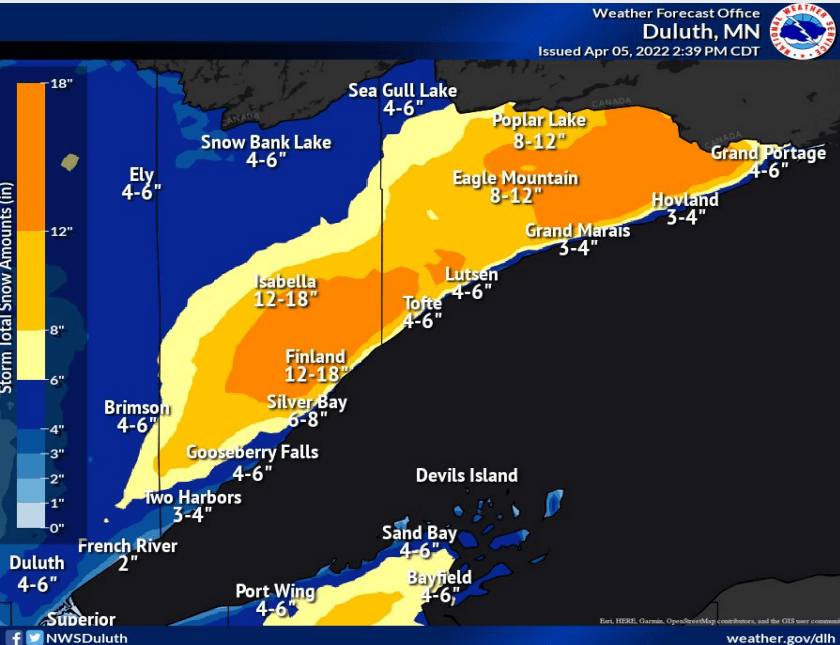
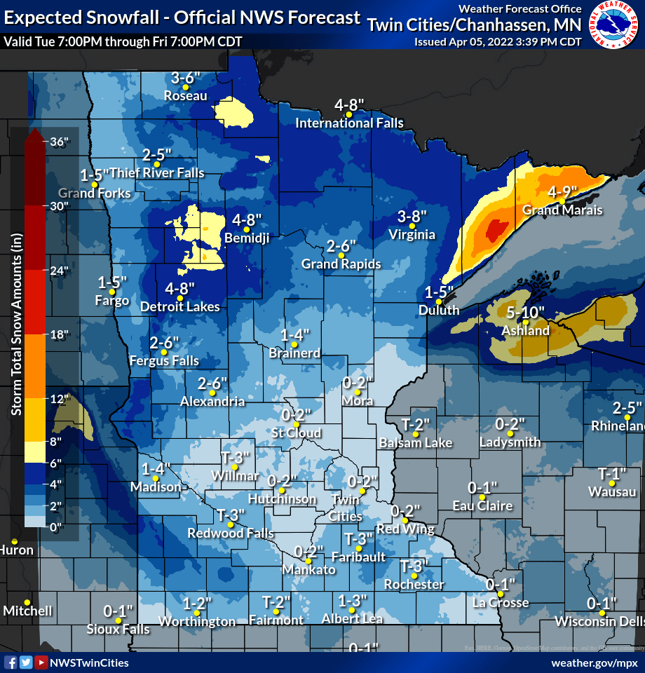
Snow and rain across northern Minnesota will change to heavy wet snow on Wednesday morning. The heaviest snow favors the higher terrain of the Sawtooth Mountains above the North Shore. Snowfall rates of 2 inches per hour will pile up into more than a foot of snow.
The National Oceanic and Atmospheric Administration’s Global Forecast System model shows the swirling low-pressure system, and the heavy snowfall bursts in northeast Minnesota.

Some totals could reach 18 inches by Friday. I wouldn’t be shocked to see a 20-inch snowfall total, but probably on the hill where few measurements are taken.
Including the cities of Isabella, Two Harbors, Silver Bay, and Grand Marais
255 PM CDT Tue Apr 5 2022
...WINTER STORM WARNING REMAINS IN EFFECT FROM 7 PM THIS EVENING TO 7 AM CDT FRIDAY...
* WHAT...Heavy snow expected. Total snow accumulations of 3 to 6 inches for lower elevations near Lake Superior, and 10 to 15 inches with a few locations near 18 inches in the higher terrain of the North Shore. Winds gusting as high as 35 mph tonight.
* WHERE...Northern Cook and Lake, Southern Cook and Southern Lake Counties. This includes the Tribal Lands of the Grand Portage Reservation.
* WHEN...From 7 PM this evening to 7 AM CDT Friday.
* IMPACTS...Travel could be very difficult to impossible. Patchy blowing snow could significantly reduce visibility. The hazardous conditions could impact the morning or evening commute.
Much of the rest of northern Minnesota and areas along the North Shore (warmer) will also see several inches of snow.
Twin Cities: Mostly rain; snowy coating possible
It’s barely warm enough for mostly rain with this system for the Twin Cities and southern Minnesota.
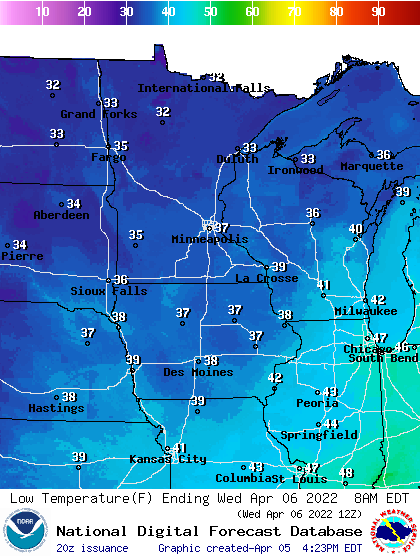
Rainfall totals will reach an inch in some locations, and it will be cold enough for snow showers to mix in again later Wednesday through Thursday.
Yes Twin Cities, another snowy April coating is possible here.
Warmer weekend ahead
The silver lining in this forecast? A warmer weekend ahead. Saturday brings bright sunshine and highs in the 50s again for southern Minnesota.

Sunday brings a mix of sun and clouds with a spotty shower possible. Highs should push the 60-degree mark in the Twin Cities and southern Minnesota Sunday.
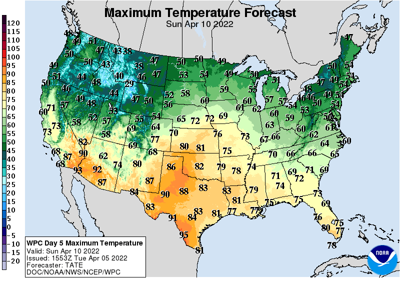
Hang in there.

