Rain, snow pinwheel through Minnesota; weekend's looking nice
Expect more wind driven rain, snow showers through Thursday night
Go Deeper.
Create an account or log in to save stories.
Like this?
Thanks for liking this story! We have added it to a list of your favorite stories.


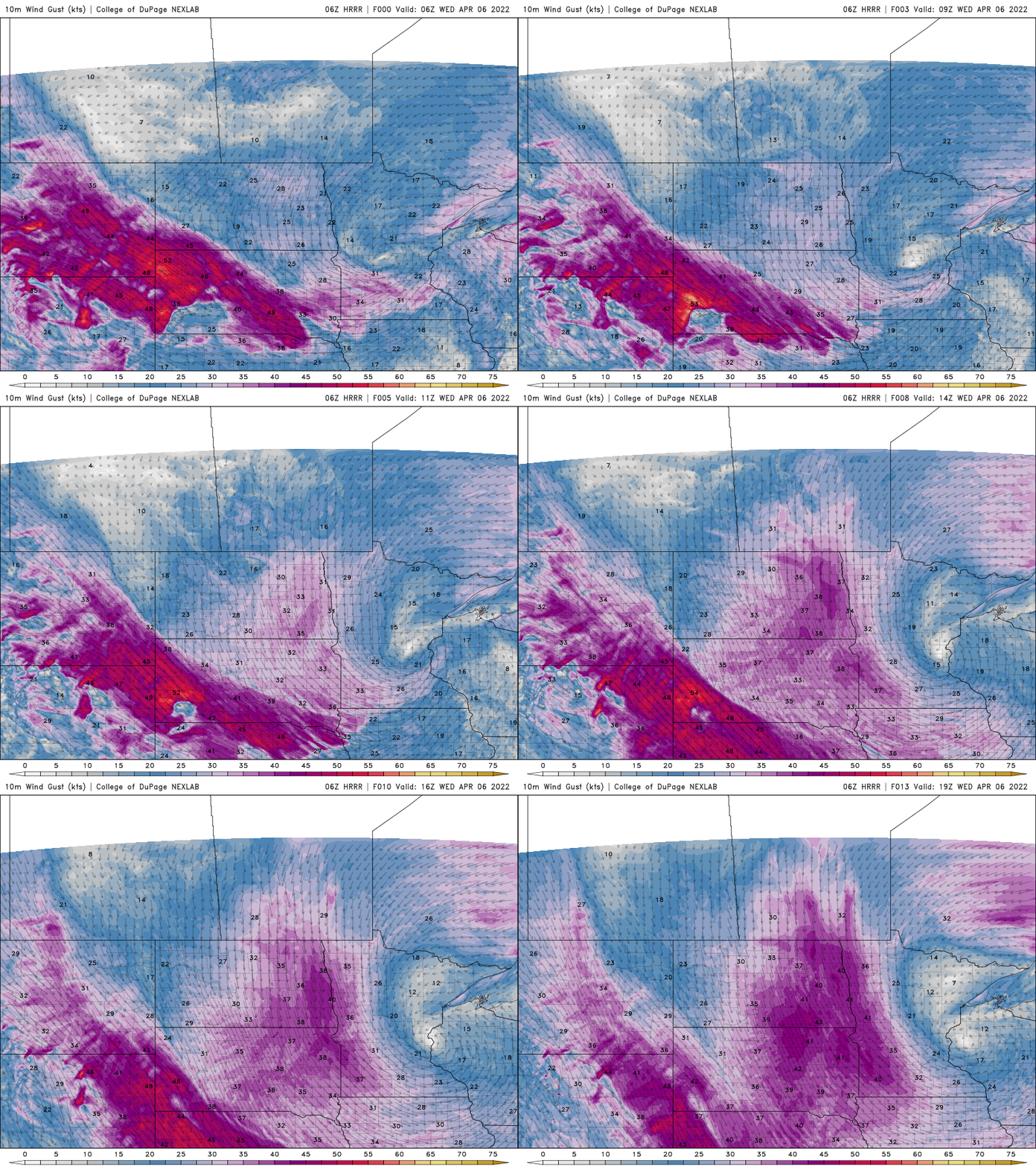
Northern Minnesota will continue to see snowfall Wednesday with rain and snow showers in southern Minnesota. Winds will continue to be high at 10-25 mph, gusts as high as 50 mph in western Minnesota.
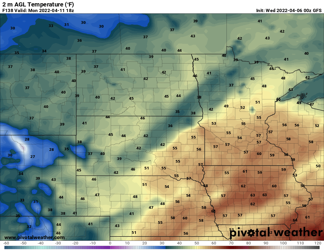
Sunshine returns Saturday with highs in the low 50s in the Twin Cities and the 40s in much of the rest of the state.
Continued wet, windy
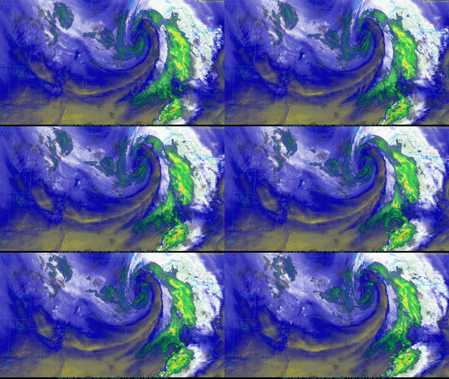
You’d be forgiven for looking at the satellite and radar imagery Wednesday morning and thinking a hurricane were sitting over Minnesota. We have a classic mid latitude cyclone (large, low-pressure storm system). Around it, bands of rain and snow are pinwheeling counter clockwise.
With a rather low-pressure center such as this one, winds also howl around and toward the center. We’ll continue to see high winds Wednesday into Friday, rotating around the system as it slowly moves east.
Turn Up Your Support
MPR News helps you turn down the noise and build shared understanding. Turn up your support for this public resource and keep trusted journalism accessible to all.
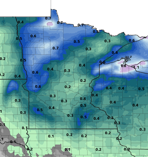
Rain and snow bands will continue Wednesday into Wednesday night.

Northern Minnesota will see more snow than rain, where several inches of additional snow could fall in some spots in northwestern Minnesota and deep into the Arrowhead.
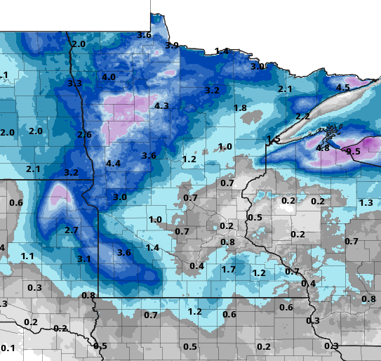
Have Wednesdays seemed wet?
You’re not imagining it. It’s our third wet midweek. We’ve had three consecutive significant mid-latitude cyclones; the meteorological term for large, low-pressure storm systems we see often autumn through winter and spring.
To have them this frequently in a three week period, however, is a little unusual.
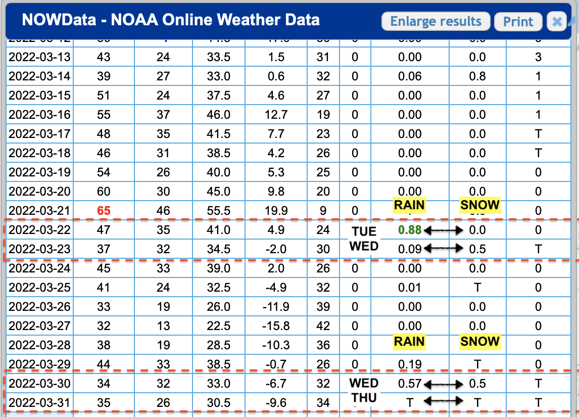
They’ve brought some very beneficial moisture. The three storm systems combined, thus far, have dumped 2.25 inches of liquid equivalent precipitation in the Twin Cities. That’s one-third more than the normal value for all of March and 78 percent of the normal April amount.
Nice weekend shaping up
It may be some consolation that a pretty decent weekend is still shaping up. We’ll have the return of sunshine Saturday with highs into the low 50s.
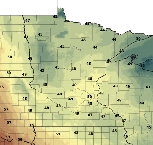
We’ll be near 60 by Sunday and Monday. Sunday will, however, bring a few more clouds.