
Another day, another blasting of rain and snow; brighter and warmer weekend
Yet another wet day with wind but sun returns Saturday

Go Deeper.
Create an account or log in to save stories.
Like this?
Thanks for liking this story! We have added it to a list of your favorite stories.


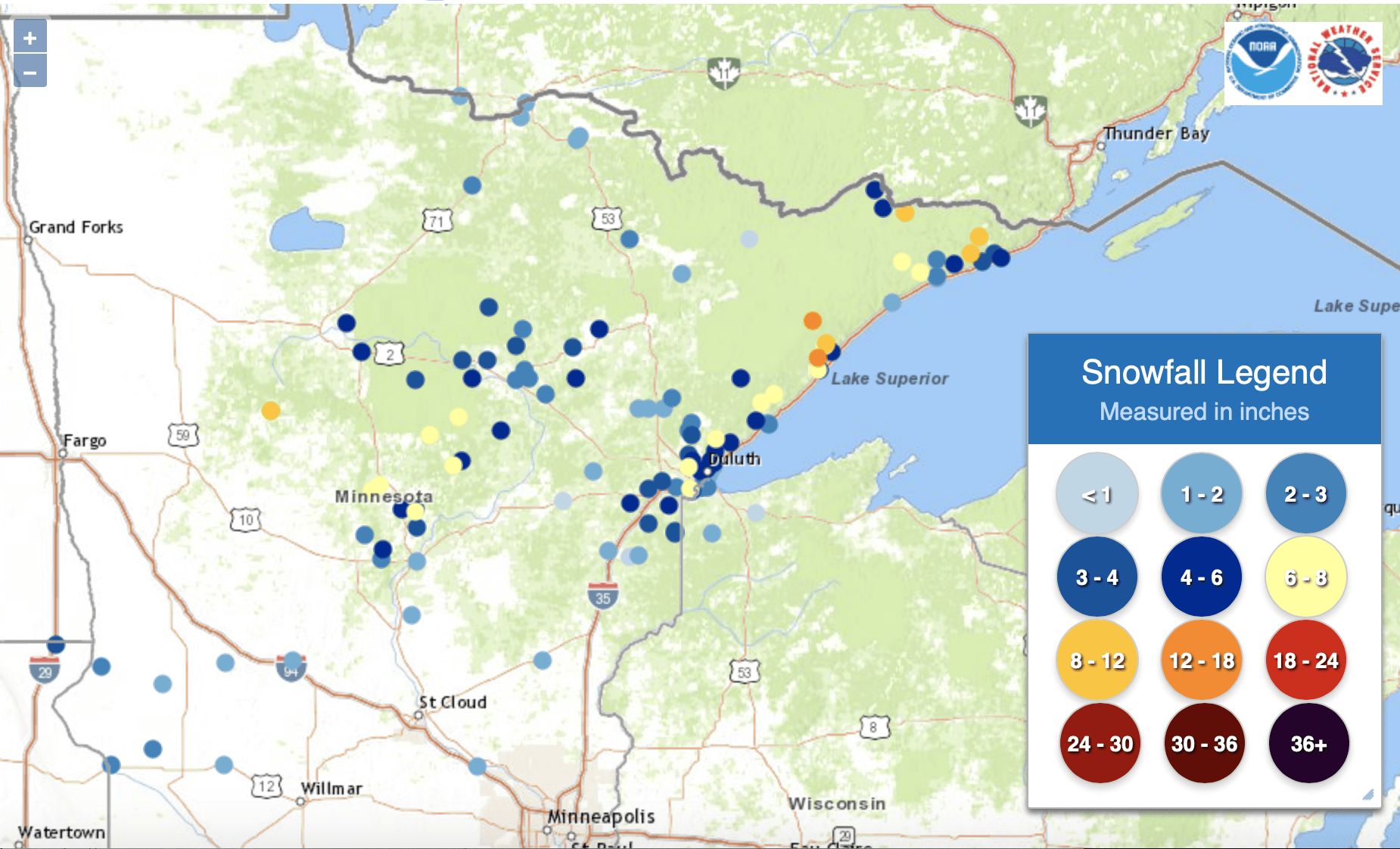
The latest storm system continues to dump rain and snow on much of Minnesota. Here’s a look at how much additional snow fell within the last 24 hours. Snow totals now are closing in at over a foot for some places along the north shore. 13 inches is reported so far in Silver Bay and 9 inches in Grand Marais.
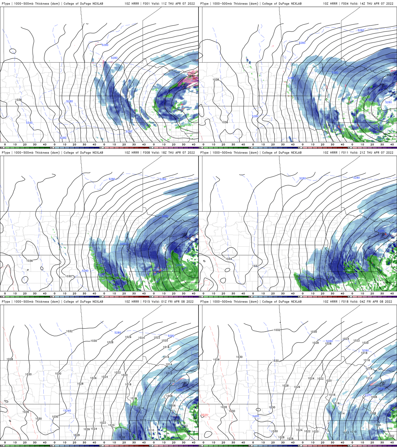
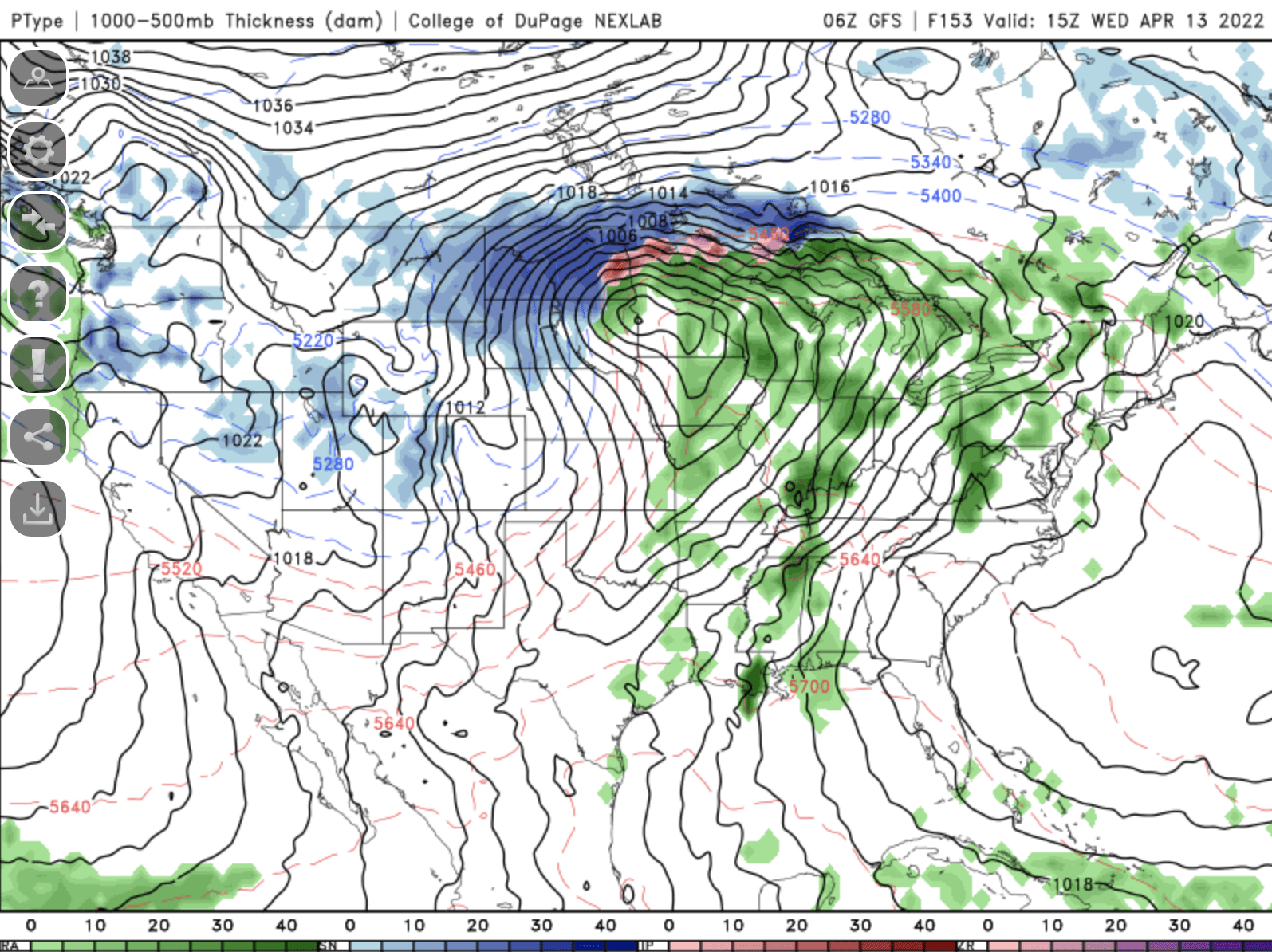
Our precipitation total is up to 0.61 inches in the Twin Cities. The storm is slowly progressing east and until it does we can expect more wind with gusts over 20-30 mph Thursday again.
With the low pressure center now well into northeast Wisconsin we are solidly on the cold side of this storm system meaning we can expect more snow showers rather than rain showers Thursday but temperatures will generally be too warm for accumulations for most of us.
Friday will be still mainly cloudy for eastern Minnesota with sunshine breaking out in the north and west. Highs will still be below normal, mainly in the 40s.

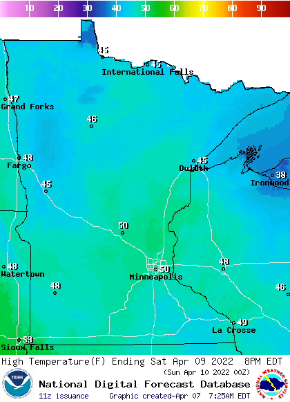
Saturday brings much more improvement with SUNSHINE and seasonable temperatures in the 40s and 50s.
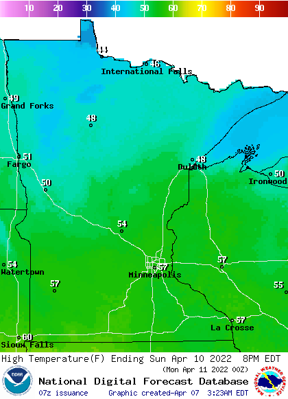
We continue the upward climb closer to 60 in southern Minnesota and 50s more widespread north on Sunday and Monday, though with increased cloud cover.
We need to watch next week carefully as — wait for it — another storm system takes shape. This one could bring severe weather farther north, closer to Minnesota.
Turn Up Your Support
MPR News helps you turn down the noise and build shared understanding. Turn up your support for this public resource and keep trusted journalism accessible to all.

