
Sunshine returns but another storm is brewing for next week
Decreasing clouds Friday but still cool, warmer Saturday
Go Deeper.
Create an account or log in to save stories.
Like this?
Thanks for liking this story! We have added it to a list of your favorite stories.


Finally we’ll see some sunshine Friday. Temperatures will remain cooler than normal Friday but near normal Saturday afternoon.
Sun returns for a day and a half
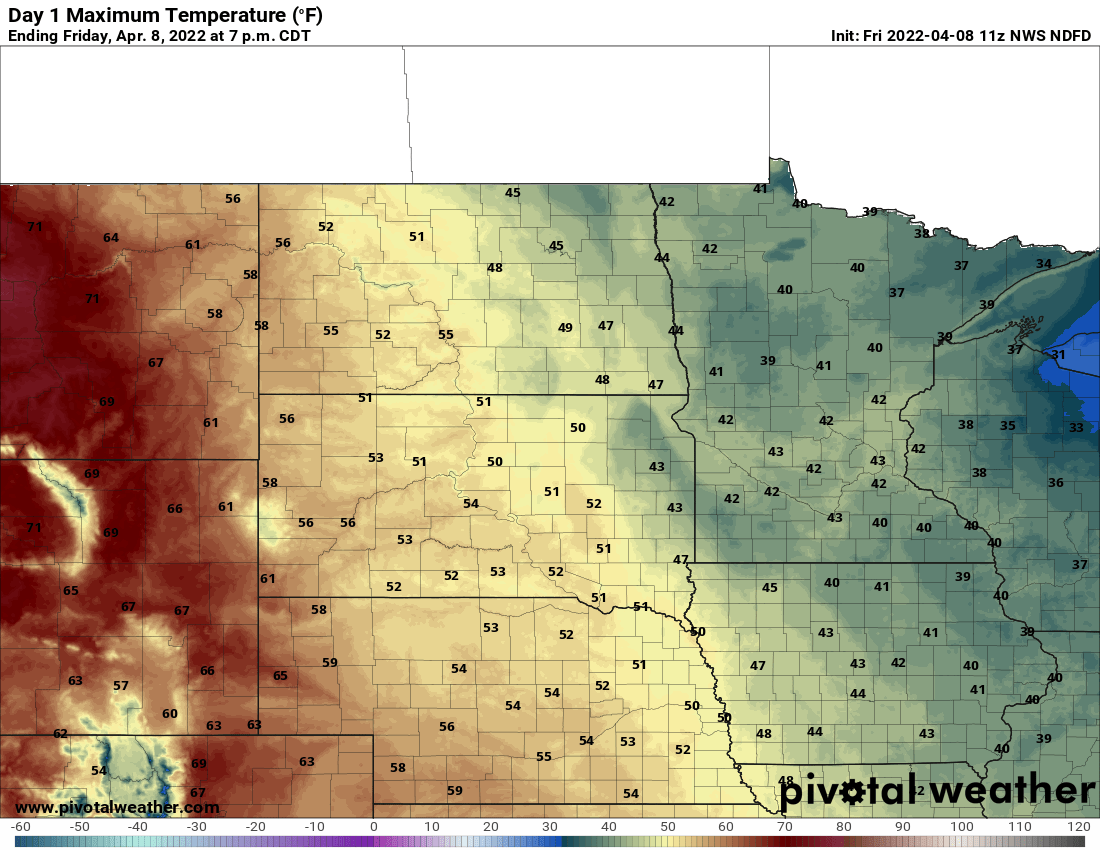
Clouds are moving out quicker than expected, which is a good thing after this gloomy stretch. Look for clearing to continue through the day Friday.
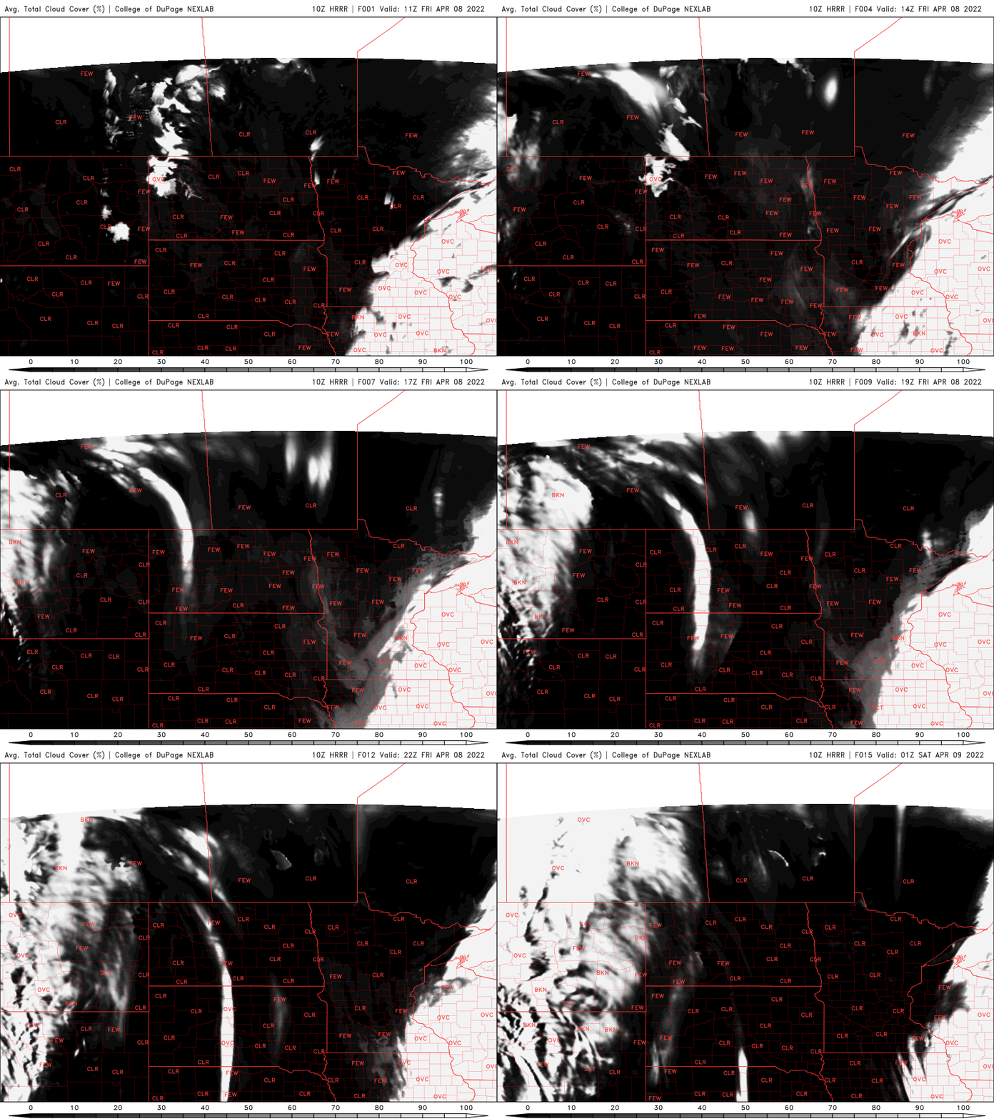
Temperatures will remain on the cool side, however — primarily 40s, with 30s in parts of the north.
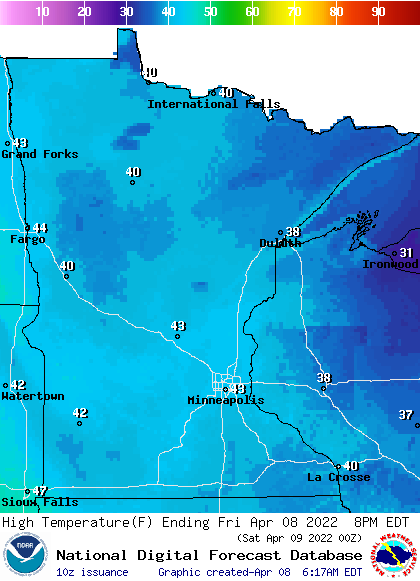
Winds will start blustery but will be light by the end of Friday. They’ll stay below 10 mph Saturday.
Turn Up Your Support
MPR News helps you turn down the noise and build shared understanding. Turn up your support for this public resource and keep trusted journalism accessible to all.
With the clear skies and light winds overnight Friday night it will be chilly. Early morning temperatures Saturday will be in the 20s, with teens north.
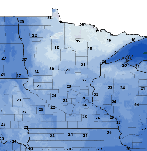
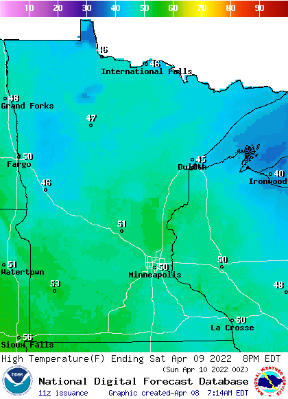
We will warm up quickly with the sunshine however, into the low 50s across southern Minnesota and 40s north.
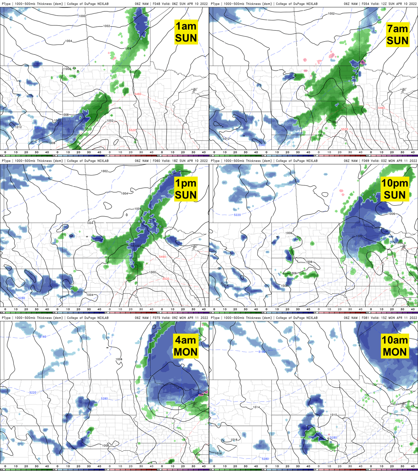
A fast-moving clipper system (as opposed to this big, slow moving upper low we just got rid of) will bring increased clouds Sunday with rain and snow showers primarily across northwestern or northern Minnesota.
Parts of northern Minnesota could see slushy accumulation Sunday night.
Another storm next week
Brace yourselves. Next week brings yet another big storm system for the middle of the week. The models are still figuring out the track, which will make a big difference on what we see.
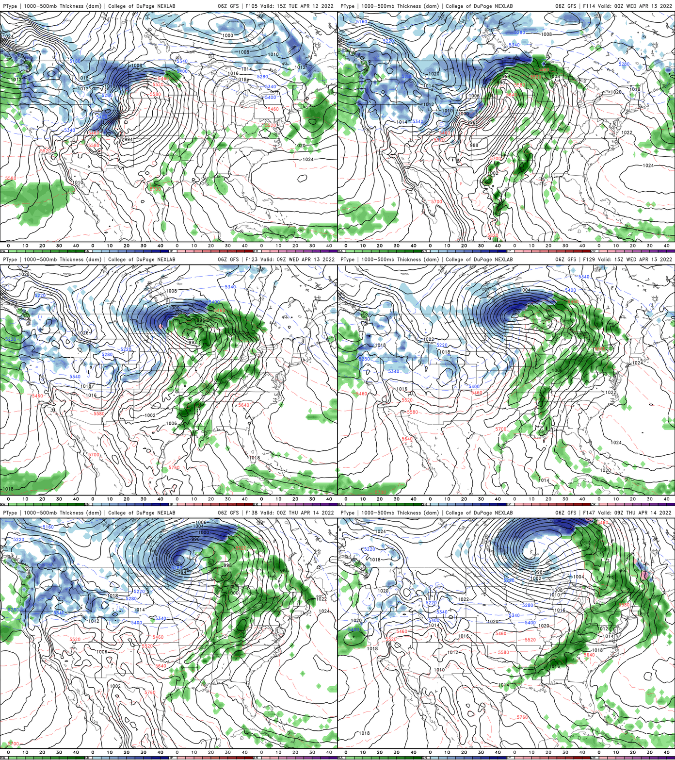
We’re either in for lots of rain and even thunderstorms, or parts of the state could see very heavy wet snow, or everything in between. Stay tuned.
A wet stretch so far
It was yet another impressive week for precipitation. Widespread pockets of the state saw 1 inch or more of liquid.
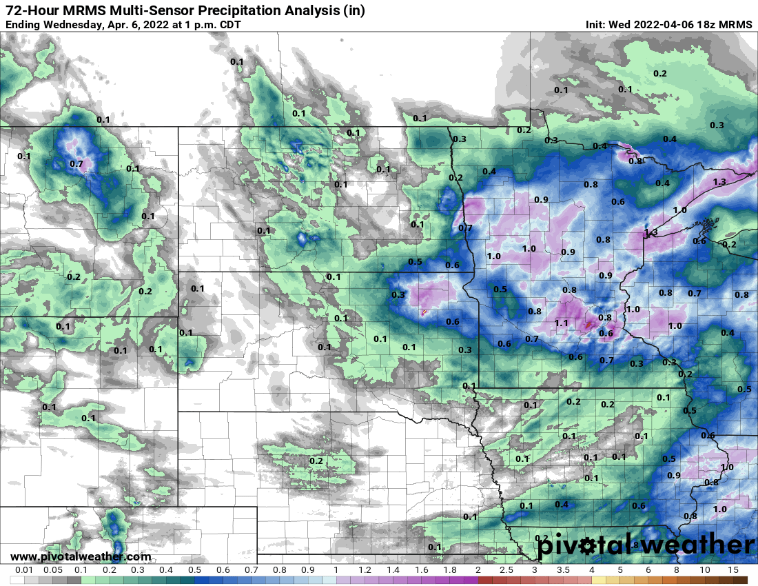
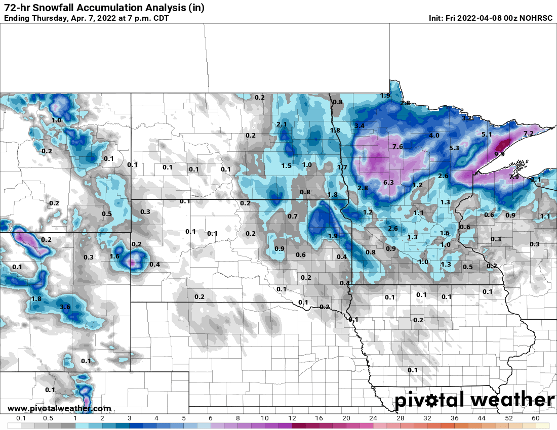
Of course in many areas to the north it fell as very heavy, wet snow.
Year to date, precipitation is running 34 percent higher than normal for the Twin Cities so far in 2022. That’s a big amount considering we’re 27 percent into the year.
There are three main pockets of precipitation surplus: northwestern Minnesota, the Twin Cities area, and Duluth up the North Shore. While miserable, this wet spring is putting a big dent into the deficit we carried over from 2021.

