Another midweek mess on the way: Thunderstorms, rain, snow
Above normal temperatures Monday; thunderstorms develop Tuesday
Go Deeper.
Create an account or log in to save stories.
Like this?
Thanks for liking this story! We have added it to a list of your favorite stories.


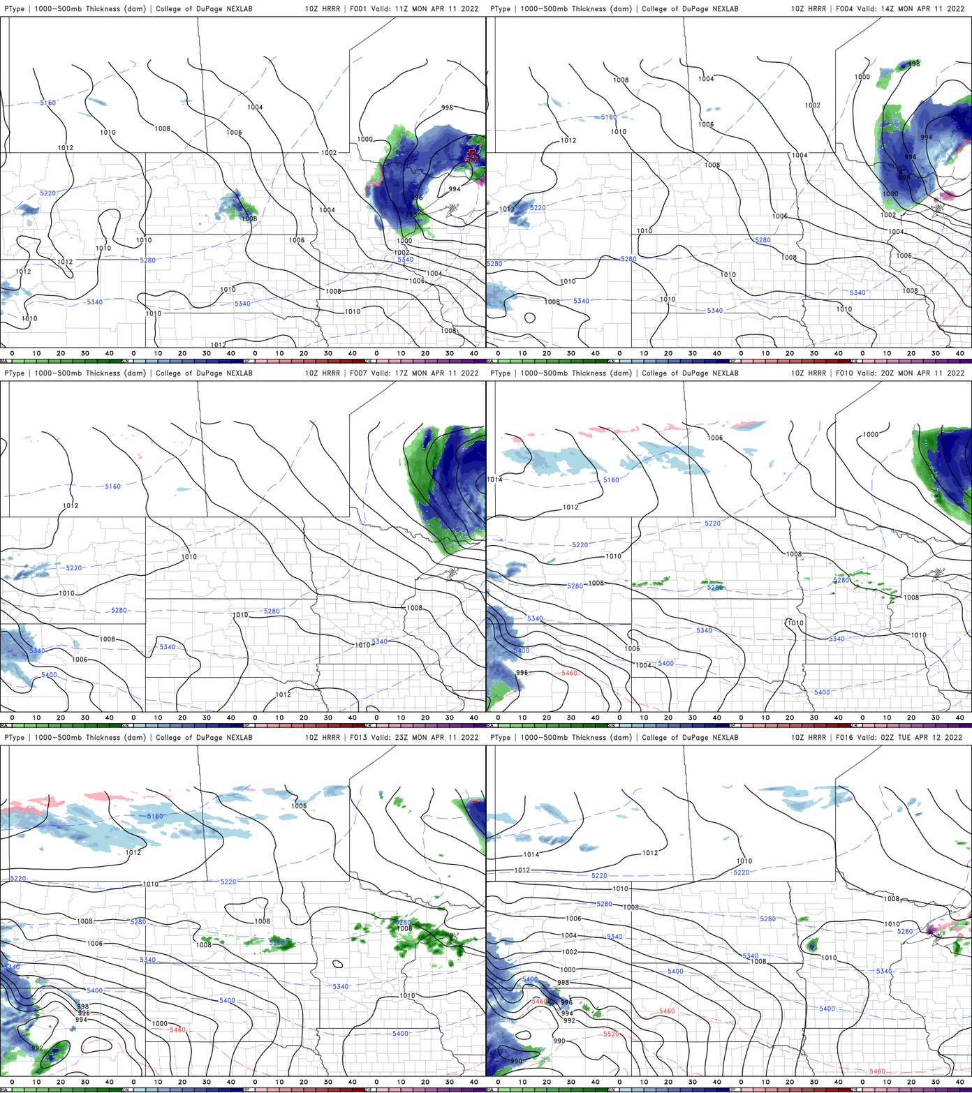
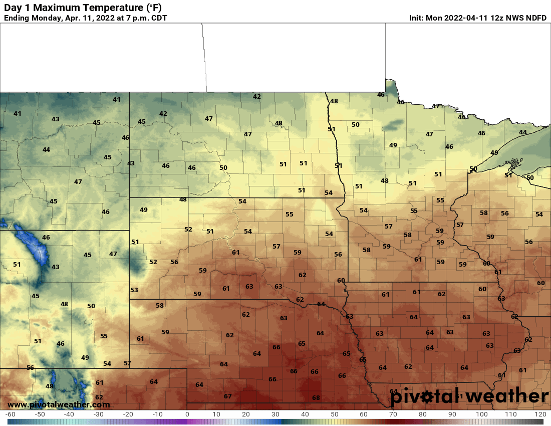
Monday will yield another day of above normal temperatures and some sunshine, although portions of central Minnesota will see a few showers.
The weather becomes more wild Tuesday with thunderstorms. Southern Minnesota can expect some snow Thursday.
Mild Monday; midweek mess
Other than a few showers in the northern half of Minnesota, Monday will be a relatively quiet and mild day considering what’s ahead.
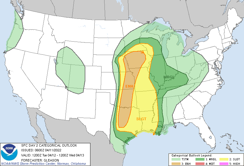
This next midweek spring storm system will bring even more of a variety of weather. This time we’re adding thunderstorms, potentially even severe ones to the mix.
Turn Up Your Support
MPR News helps you turn down the noise and build shared understanding. Turn up your support for this public resource and keep trusted journalism accessible to all.

Far southern Minnesota will be the northern extent of a warm front that will bring very warm temperatures and dew points for this time of year deep into Nebraska and Iowa.
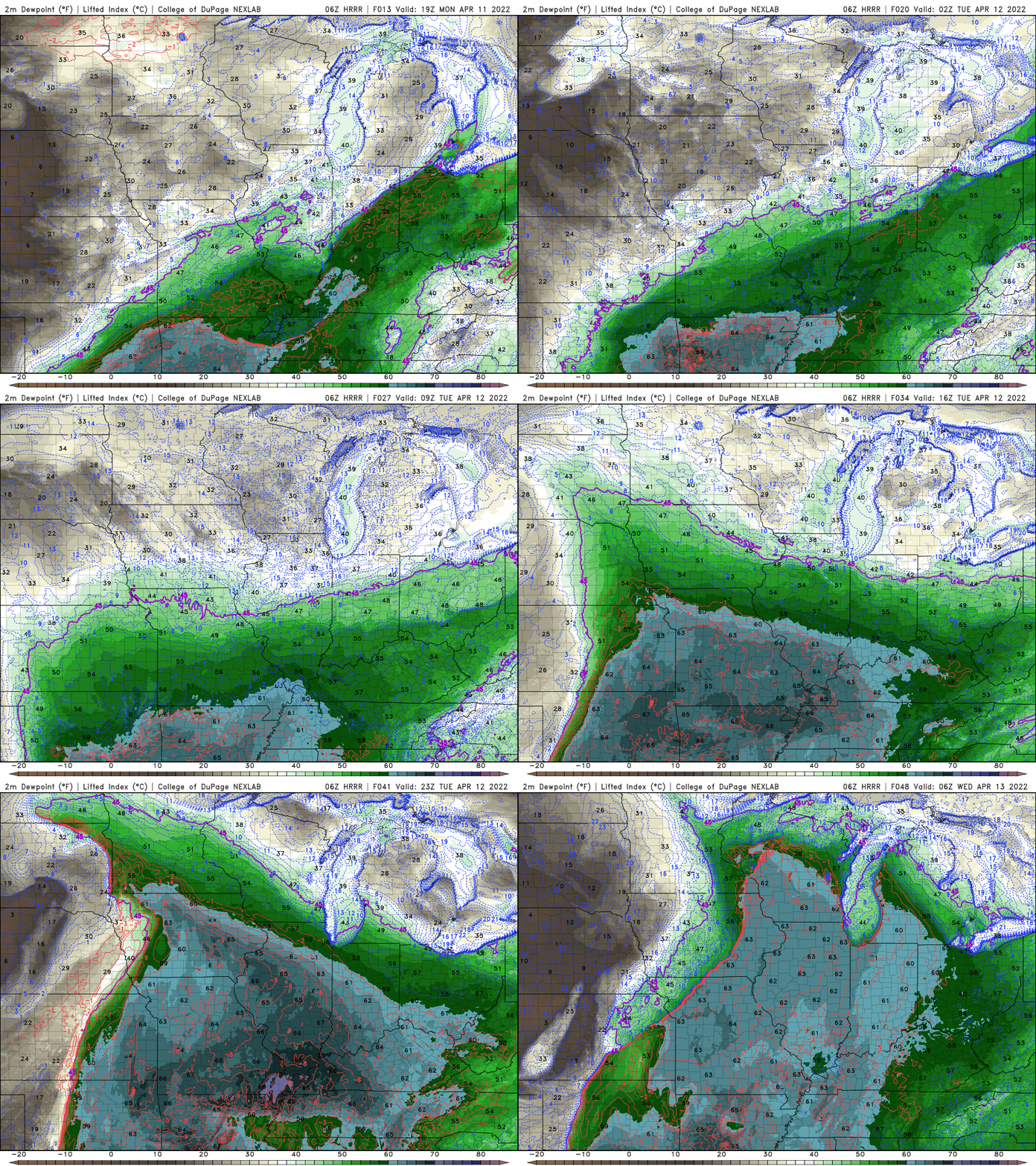
Thunderstorms will develop late Tuesday and there will likely be more storms overnight Tuesday into Wednesday.
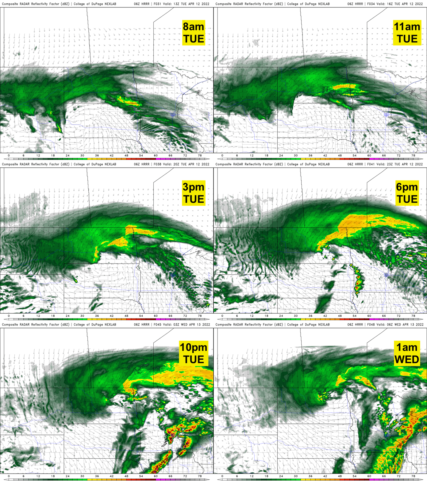
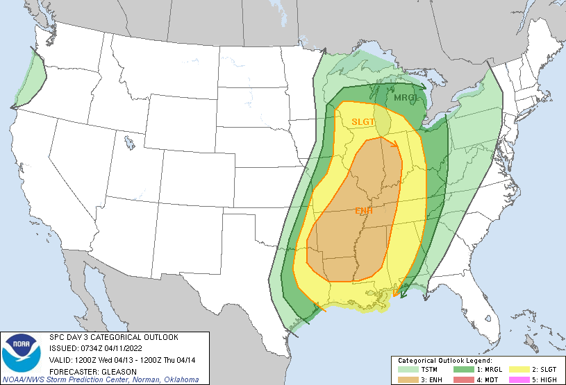
Wednesday could very well bring another round of thunderstorms. That round looks to develop mainly in far southeastern Minnesota into southern Wisconsin and eastern Iowa.
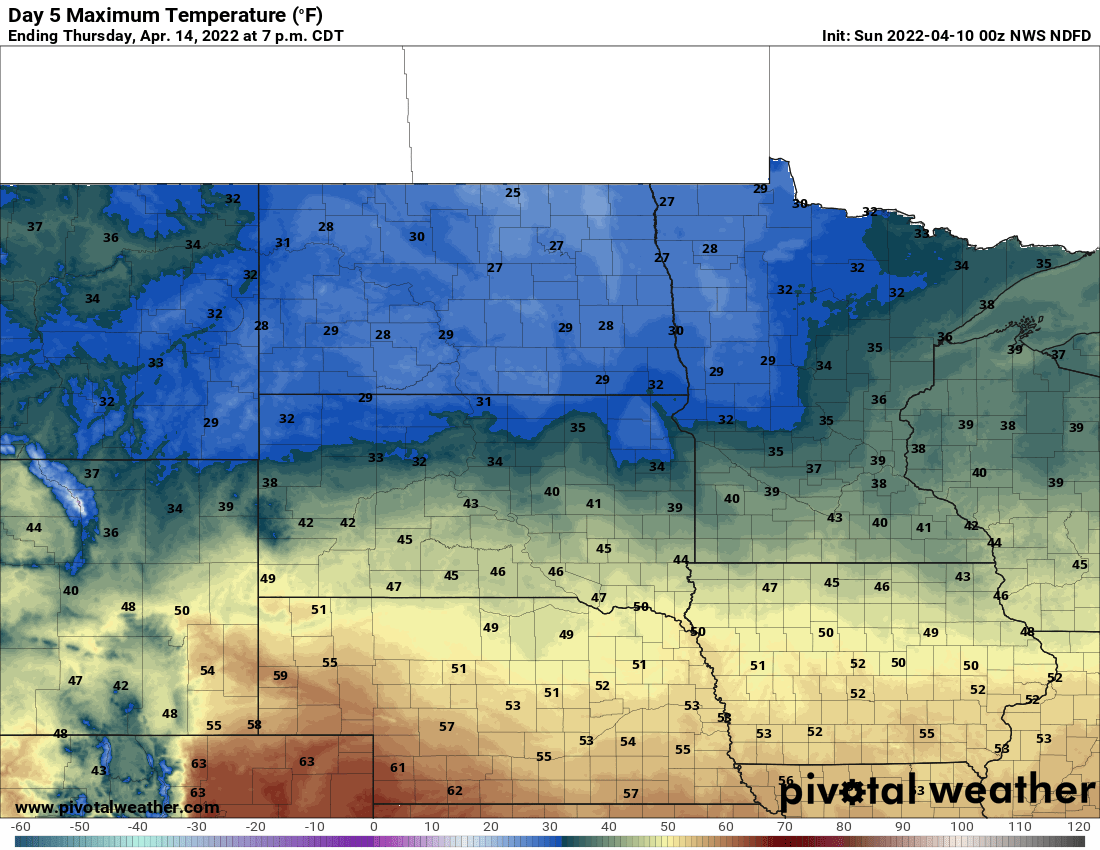
Rain will turn to snow in northern Minnesota Wednesday and in southern Minnesota we can expect some snow Thursday.
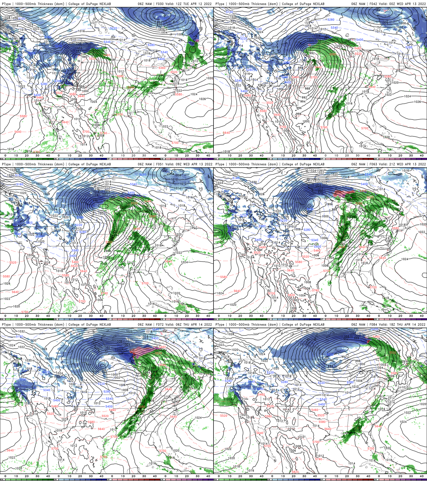
It will also be much cooler late in the week. Highs will be in the 40s and 30s Thursday and Friday.