
Spring storm brings thunderstorms, snow this week
Monday will be mild with partly cloudy skies but storms develop Tuesday
Go Deeper.
Create an account or log in to save stories.
Like this?
Thanks for liking this story! We have added it to a list of your favorite stories.


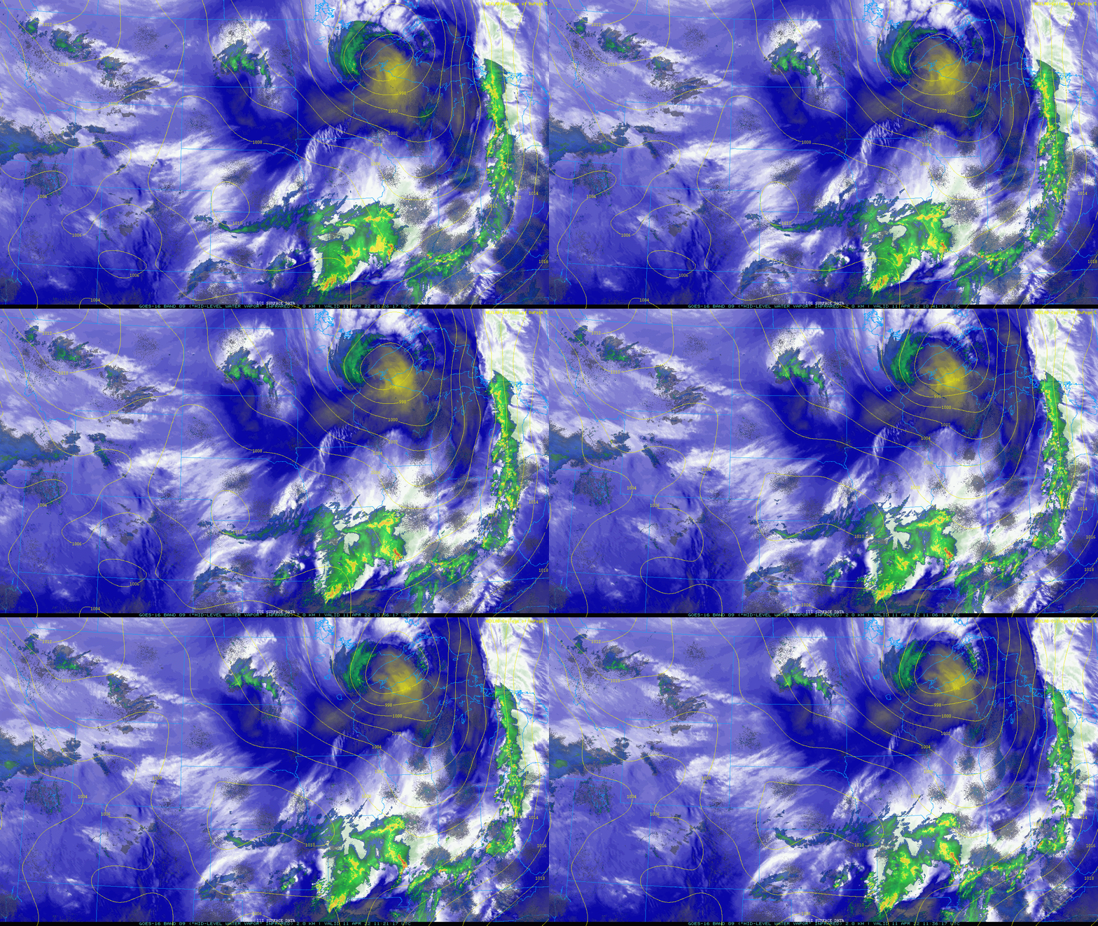
Snow is winding down early Monday morning across northeast Minnesota.
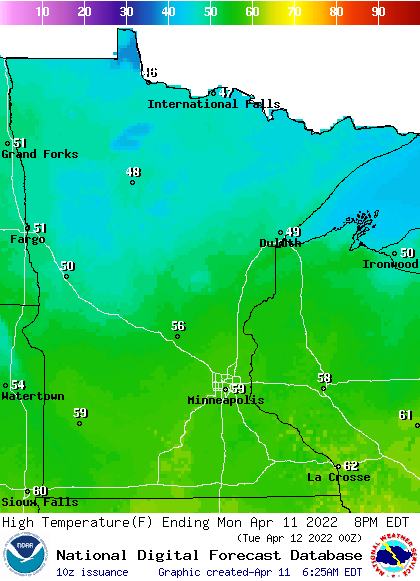
Most of Minnesota will see partly cloudy skies and mild temperatures yet Monday. High temperatures will range from 60 in the south to 40s in northern Minnesota.
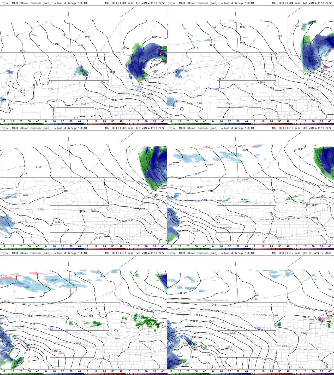
A few sprinkles are possible across portions of central Minnesota along with a few more clouds as a weak upper level wave moves out of the Dakotas across the northern half of Minnesota.
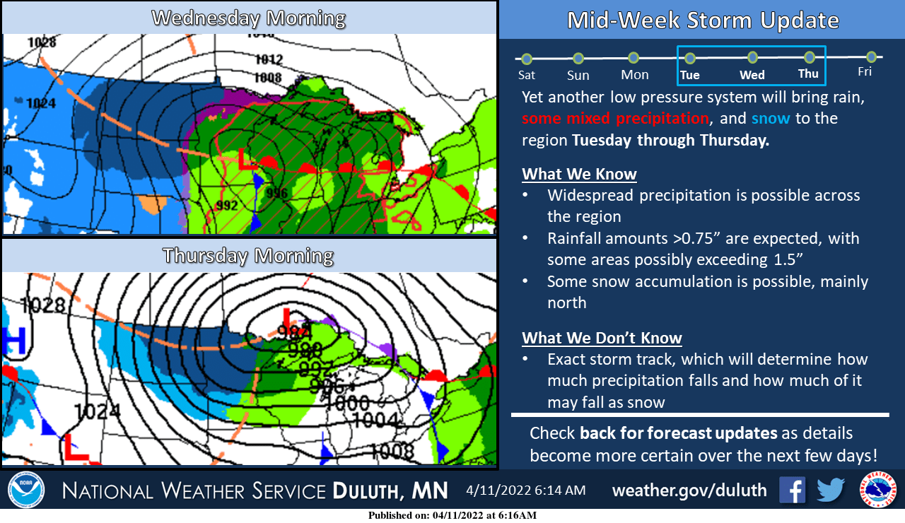
The big news this week: yet another midweek spring storm system. This time it will be a little warmer and with sufficient energy to generate severe weather farther north than we’ve yet seen this season. A surge of warmth and moisture will be on our doorstep creating potential available energy to generate thunderstorms.
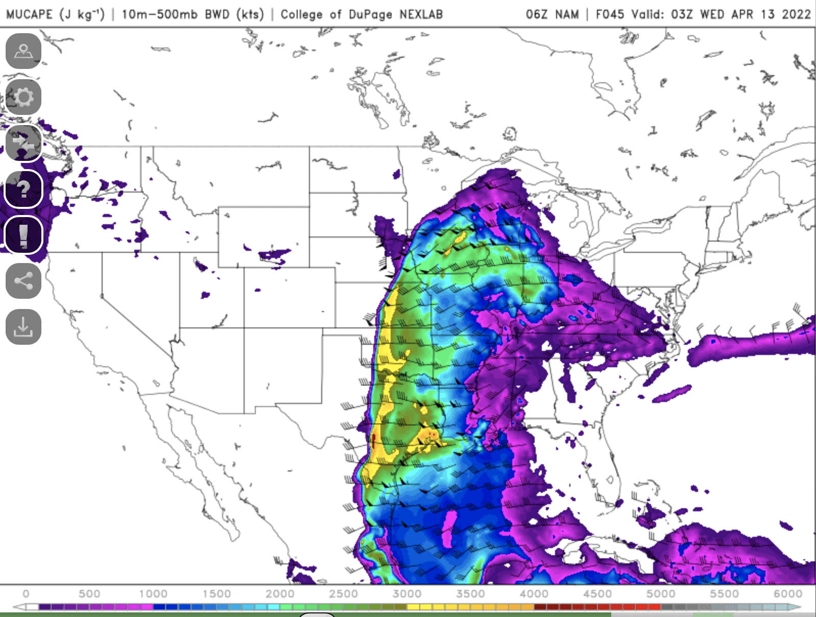
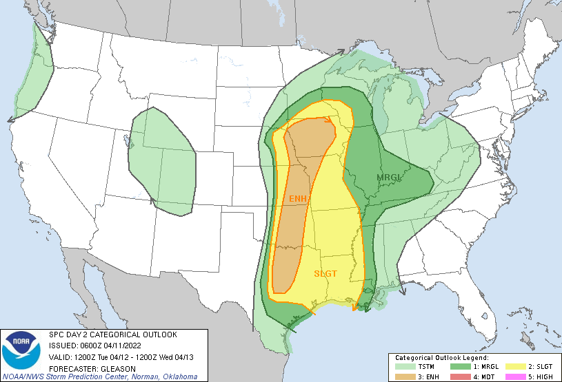
The storm prediction center has a slight risk of severe storms late Tuesday up into the southernmost portions of Minnesota.
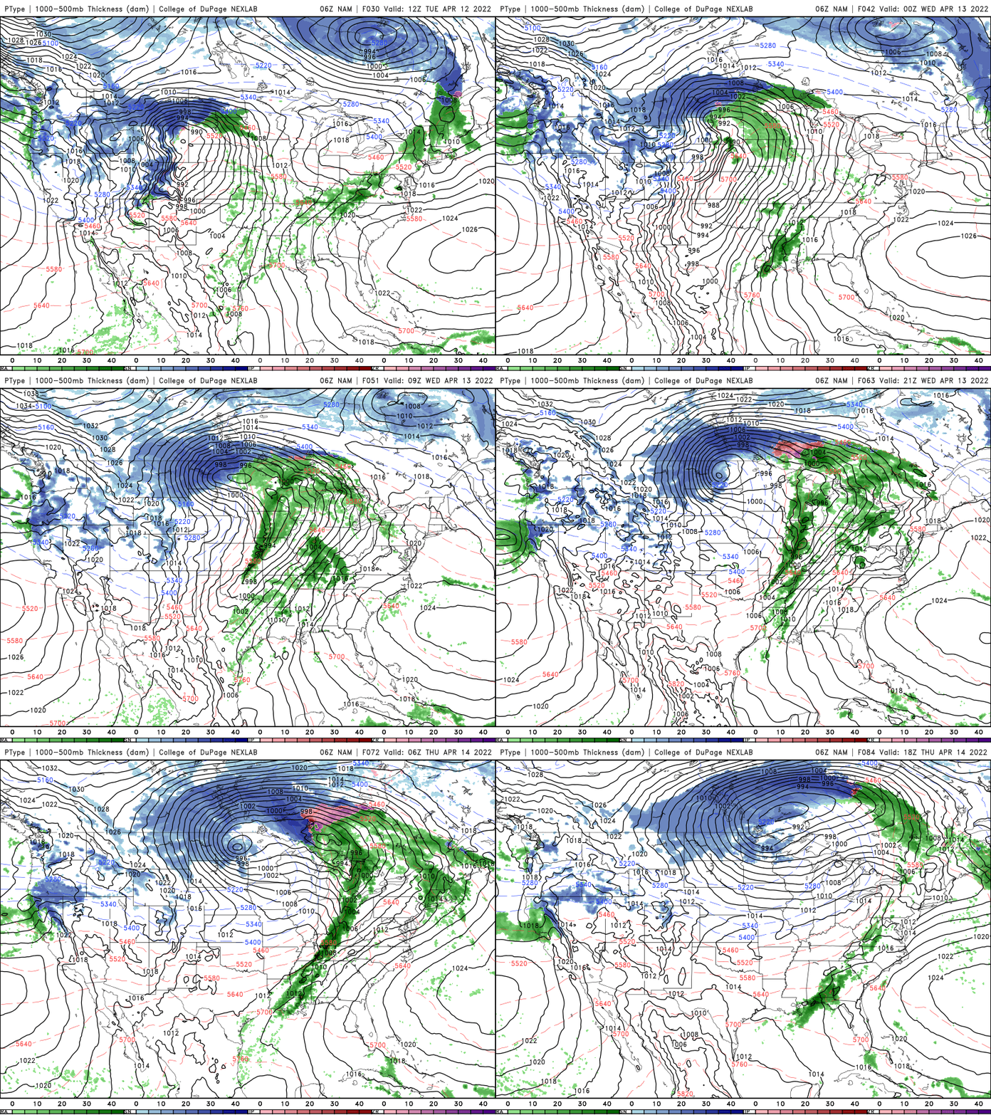
Precipitation will turn to snow Wednesday across northern Minnesota and eventually in southern Minnesota Thursday. The most likely areas to receive significant snowfall accumulation will be northern Minnesota into North Dakota.
Turn Up Your Support
MPR News helps you turn down the noise and build shared understanding. Turn up your support for this public resource and keep trusted journalism accessible to all.

