
Severe storms possible late Tuesday; rain, snow late Wednesday
Severe risk Tuesday followed by colder conditions with snow Thursday

Go Deeper.
Create an account or log in to save stories.
Like this?
Thanks for liking this story! We have added it to a list of your favorite stories.


Moisture surges north Tuesday, developing afternoon showers and evening storms. Some could be strong to severe in southern Minnesota. It will be mild and windy as well.
Potential severe set up
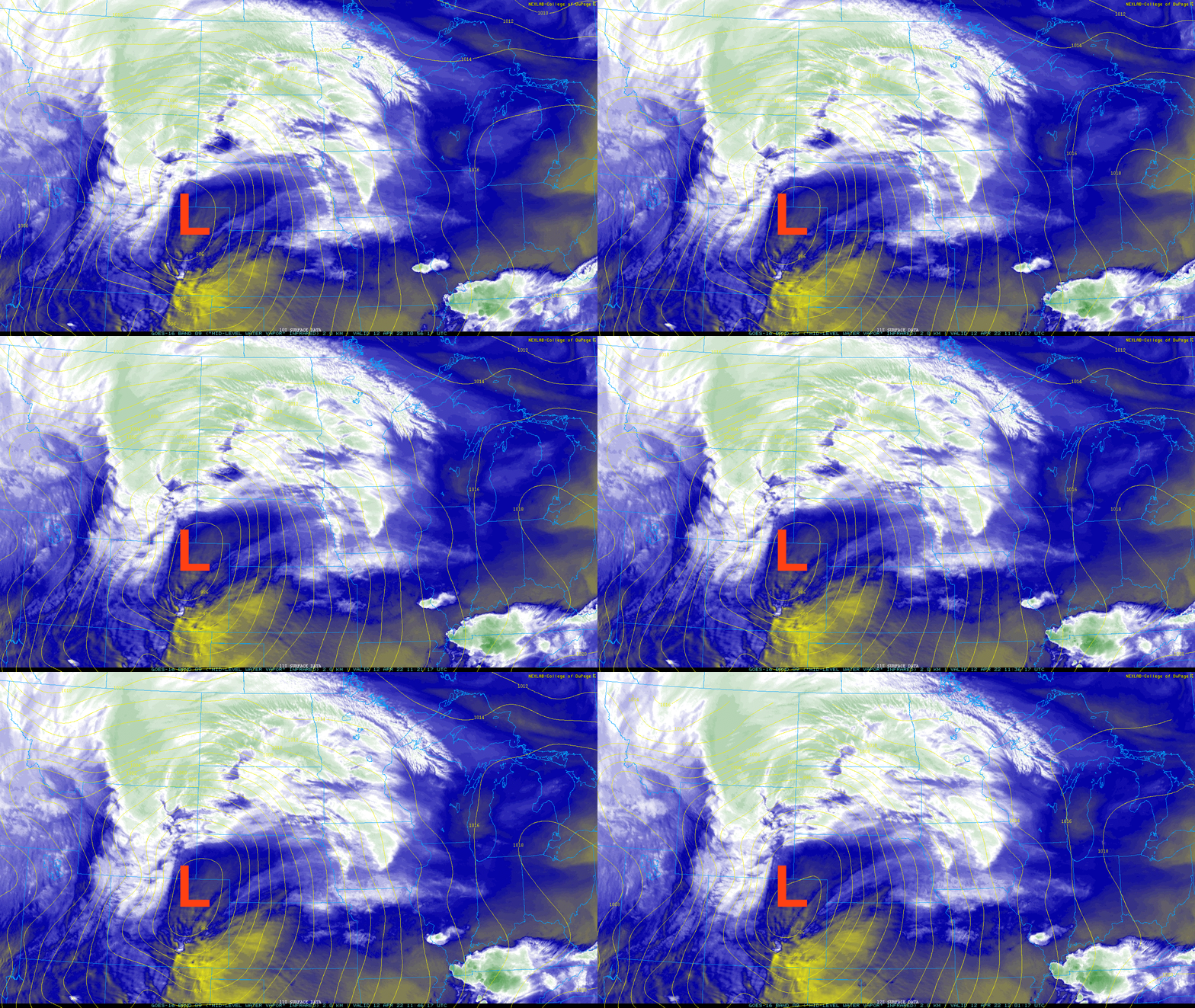
The stage is being set for stormy weather across the Upper Midwest Tuesday. An area of low pressure has exited the Rockies and airflow ahead of it will be increasing rapidly from the south on Tuesday.
The National Weather Service office in Boise, Idaho, saw a record low 500 mb pressure height in its 7 p.m. weather balloon launch Monday. We measure the height of that mid level pressure to determine cold or warm air aloft.
This incoming upper-level low is going to continue to be near record levels for the date. That helps to plow up heat and moisture ahead of it and generate instability necessary to create strong storms.
Turn Up Your Support
MPR News helps you turn down the noise and build shared understanding. Turn up your support for this public resource and keep trusted journalism accessible to all.

Moisture will surge north on those strong winds at the surface and aloft. Dew points in far southern Minnesota could reach the low 60s by evening. This would equate to moisture levels at nearly triple the normal value for this time of year.
There’s still a question how far north the warm front (moisture) can get as this area is still hundreds of miles south of Minnesota early Tuesday.
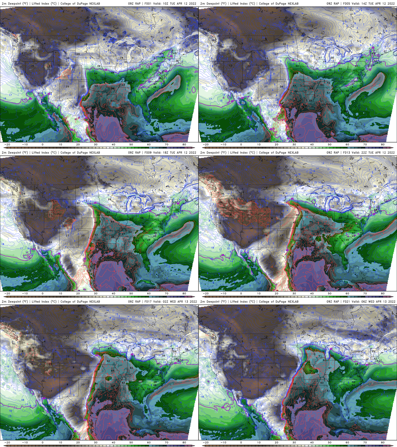
Temperatures will feel summerlike south of a warm front across eastern Nebraska into Iowa.

That combination of heat and moisture will set Iowa up for the highest chance of severe weather Tuesday evening.
The latest severe weather outlook from the National Oceanic and Atmospheric Administration’s Storm Prediction Center now has a moderate risk of severe storms, which is very high this far north for April.
An enhanced risk spreads into south-central Minnesota. The Twin Cities is included in a slight risk for evening severe storms.
The highest risk of tornadoes stretches from Iowa south toward the Gulf of Mexico. One such parameter we can look at is the super cell index, which combines shear, instability and potential energy. This gives us an idea of where storms can be organized.

Southern Minnesota could be on the northern end of some severe weather. Look for some scattered afternoon showers with evening storms developing and filling in and pushing east.

After the storms, a dry break will develop Wednesday across much of Minnesota south to north as we’re in the dry slot of the storm system. Don’t get too comfortable. Rain and snow moves in Wednesday night in northwestern Minnesota into early Friday.

Portions of far northern and northwestern Minnesota could see up to 6-12 inches of wet snow.

Cold weather settles in
Temperatures will also drop well below normal from Thursday into much of next week. Expect highs mainly in the 30s and 40s from Thursday into the middle of next week. That’s 10 to 20 degrees below the normals.


