
Colder conditions on the backside of the latest spring storm system
Colder temperatures means rain and snow for the north and falling temperatures south
Go Deeper.
Create an account or log in to save stories.
Like this?
Thanks for liking this story! We have added it to a list of your favorite stories.


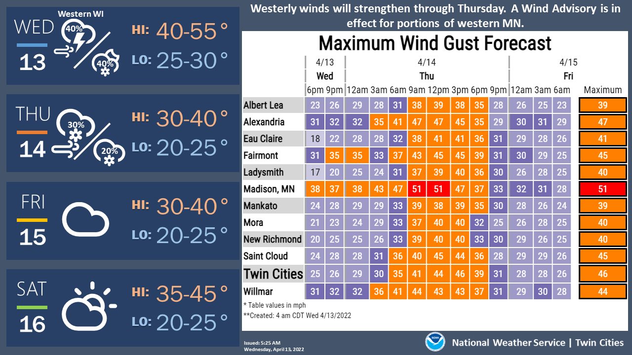
Wednesday will become mainly dry in southern Minnesota while northern Minnesota sees rain and snow showers. Temperatures will also fall across central and southern Minnesota, with blustery west winds.
From severe weather to blizzards
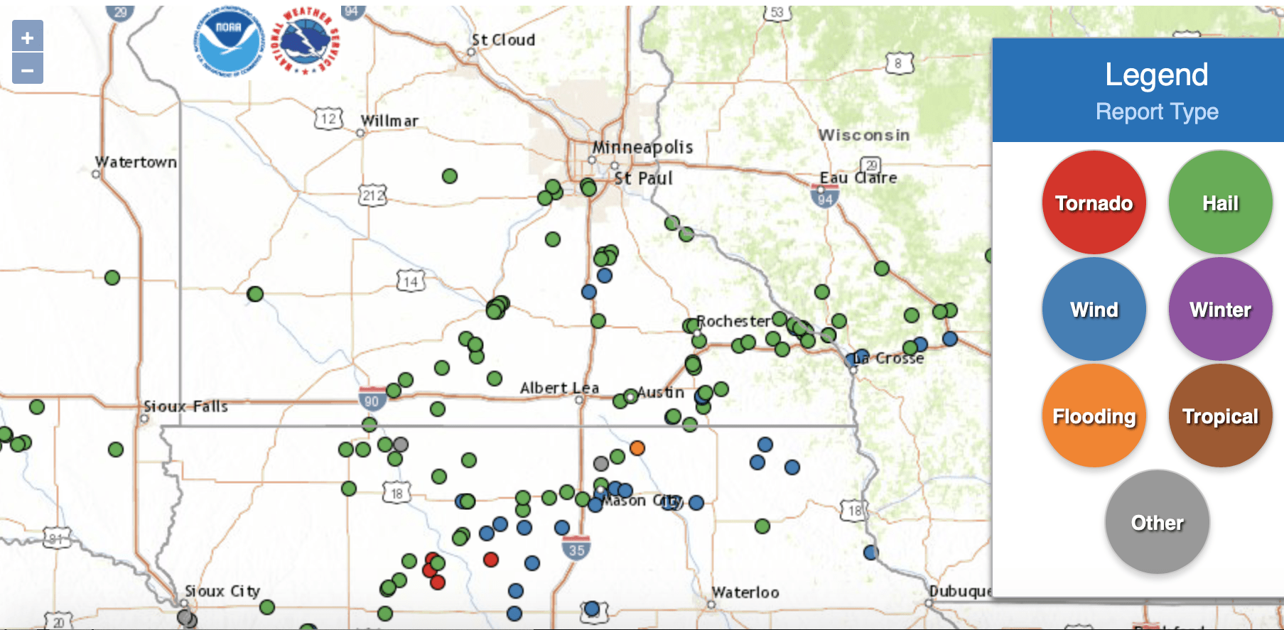
It was an active evening of severe weather across much of Iowa into southern Minnesota Tuesday. Southern Minnesota saw mainly hail reports, although there was significant damage in Spring Valley and Taopi, just north of the Iowa border.
This was the same storm cell that dropped a tornado near Gilmore City, Iowa, earlier in the evening. The same storm was producing straight-line winds at the time.
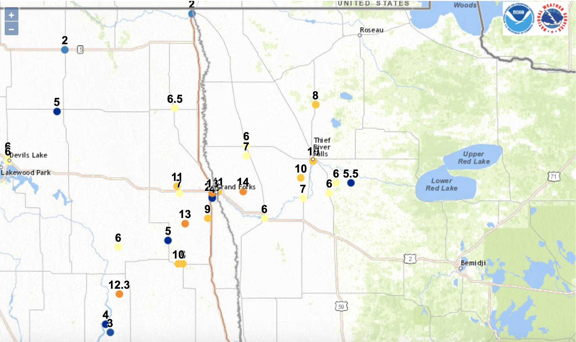
The snow has been piling up in northwestern Minnesota — up to 14 inches in Key West, Minn., east of Grand Forks, N.D., with 10 inches so far in Thief River Falls, Minn.
Turn Up Your Support
MPR News helps you turn down the noise and build shared understanding. Turn up your support for this public resource and keep trusted journalism accessible to all.
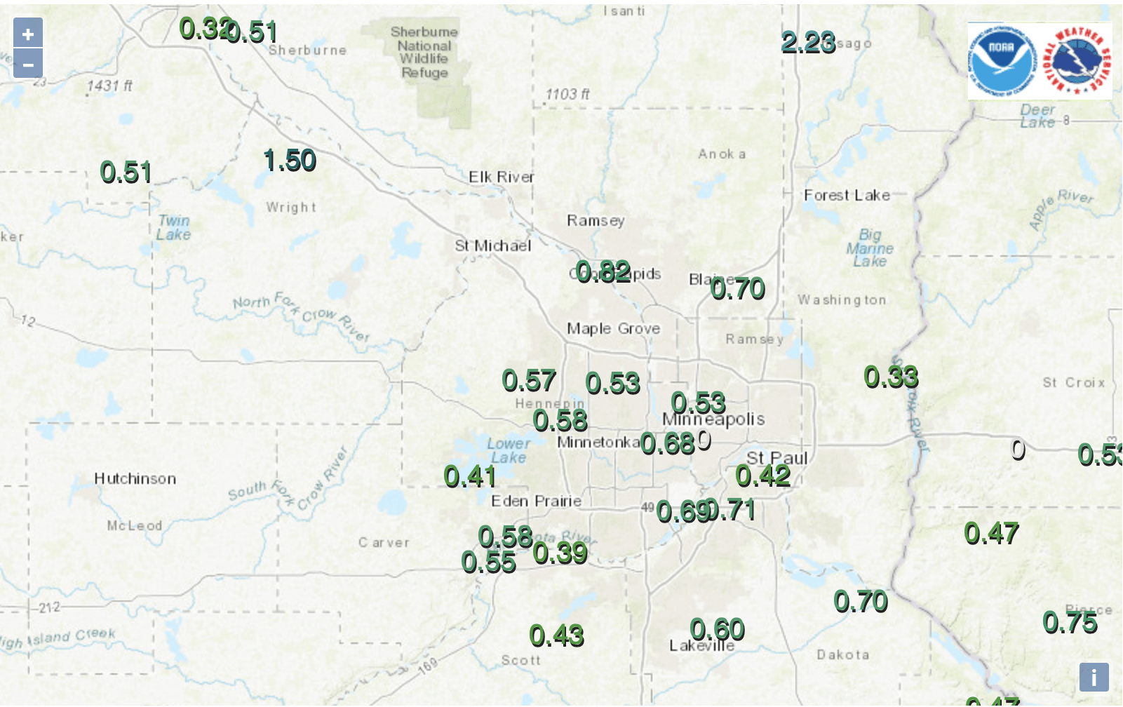
We picked up 0.69 of an inch of rain in the Twin Cities, officially. North Branch, north of St. Paul in Chisago County, tallied 2.23 inches of rainfall.
This has been a classic spring storm with blizzard conditions in North Dakota into northwestern Minnesota and tornadoes on the warm side in Iowa.
We’ll be largely in the dry slot of the system Wednesday across central and southern Minnesota.
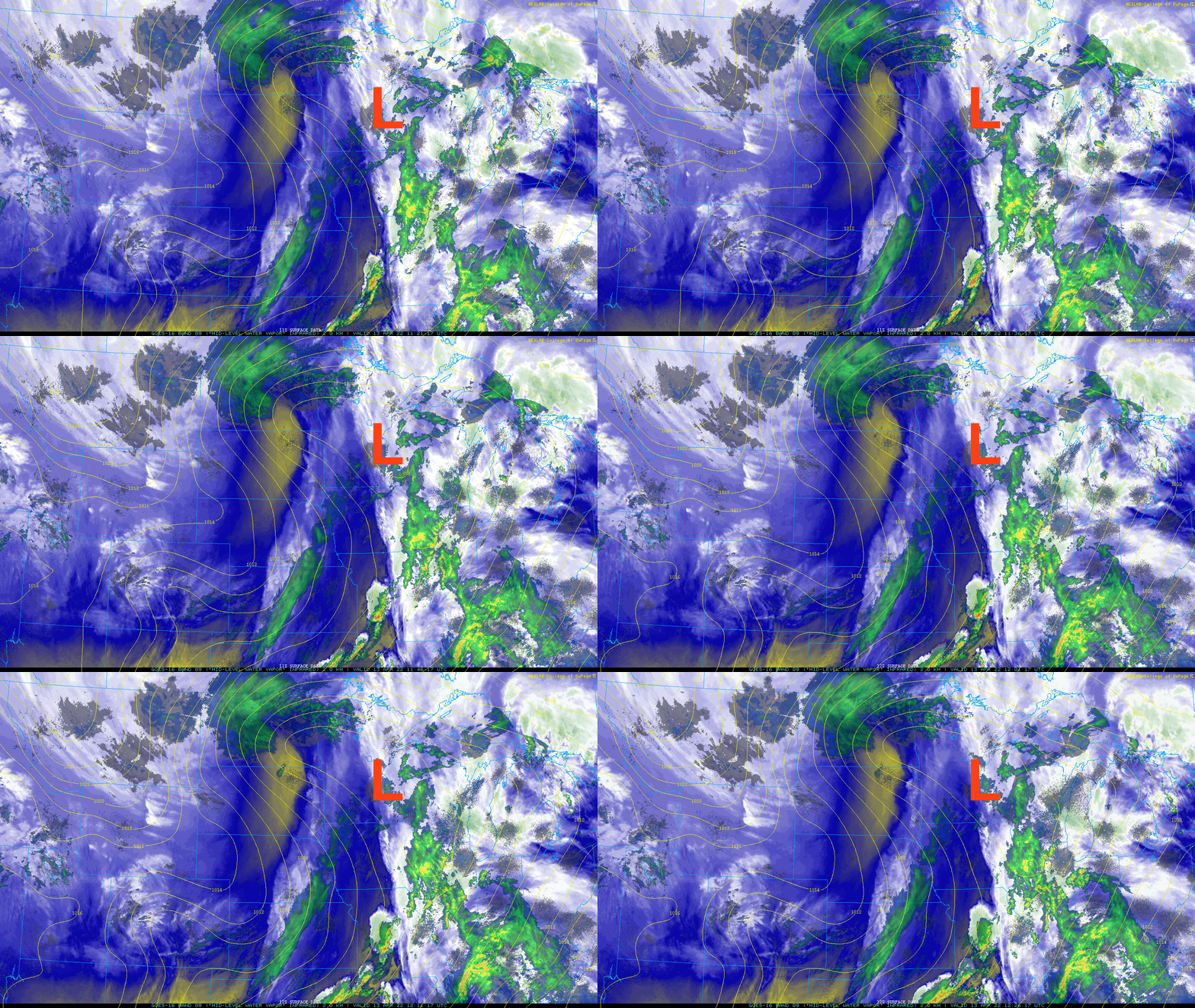
Rain and snow showers will continue to loop through northern Minnesota during the day Wednesday but we’ll see an increase in those showers overnight Wednesday night with snow showers spreading farther south Thursday into early Friday.
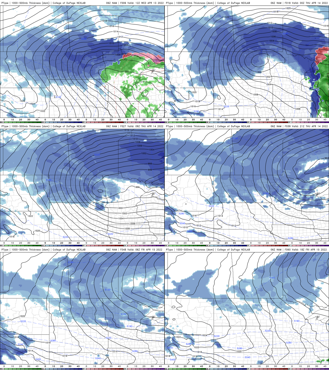
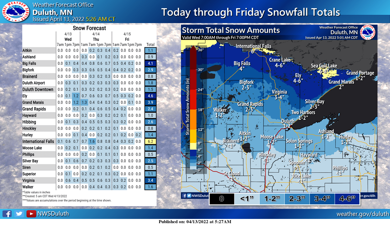
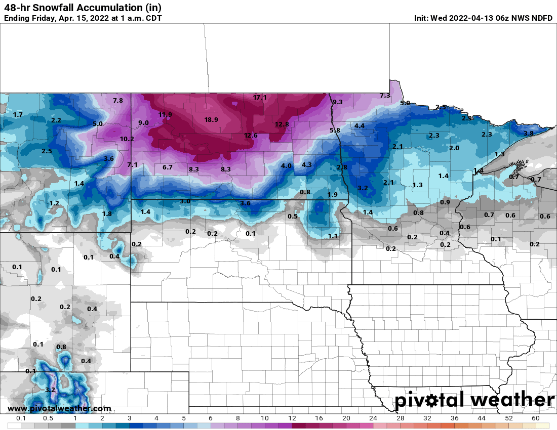
Accumulations in central and southern Minnesota will be relatively minor with some scattered slush overnight Thursday into Friday. But northwestern Minnesota can anticipate several more inches. In the northeast, the Arrowhead will see the snow kick in as well with 4 to 8 inches possible there through early Friday.
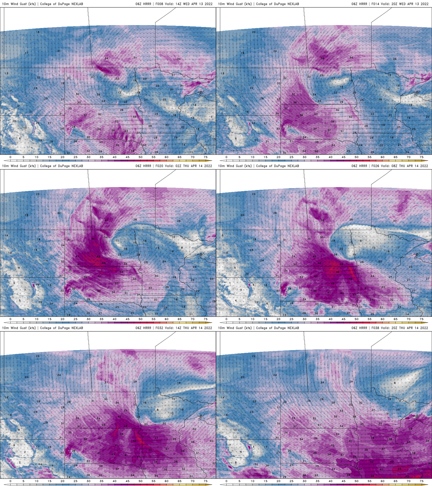
Expect yet more wind Wednesday, but the winds pick up even more Thursday with gusts of up to and over 50 mph for some places.
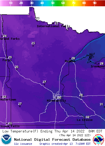
We’ll also need to watch for some slick areas and refreeze early Thursday as temps drop below freezing late Wednesday night for most areas.
High temperatures Thursday will not get out of the 30s for most Minnesota either, far below the normal range of the 40s and 50s.
Stuck in a spring ‘rut’
What seemed like a hopeful start to spring, right around the equinox slumped fast. Temperatures have been averaging several degrees cooler than normal since March 20.
We saw temperatures get back up to normal and above levels this past weekend and start to the week but now we’re in for a good seven-day stretch of pretty chilly temperatures.
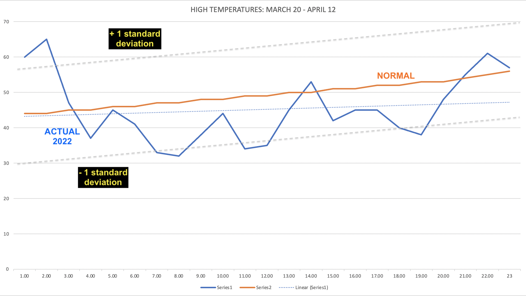
You’ll note however, we’re largely within the normal range. The standard deviation for this time of year is pretty large; in other words big swings are totally normal. We happen to be on the lower end of the range of course this spring fairly consistently.
There are signs of a big pattern change by late next week toward seasonable and above normal temperatures.

